Northfield, Maine

Last updated

Northfield, Maine
USA Maine location map.svg
Red pog.svg
Northfield, Maine
Location within the state of Maine
Coordinates: 44°49′54″N67°36′30″W / 44.83167°N 67.60833°W / 44.83167; -67.60833
Country United States
State Maine
County Washington
Area
[1]
  Total45.84 sq mi (118.73 km2)
  Land43.58 sq mi (112.87 km2)
  Water2.26 sq mi (5.85 km2)
Elevation
210 ft (64 m)
Population
 (2020)
  Total178
  Density4/sq mi (1.6/km2)
Time zone UTC-5 (Eastern (EST))
  Summer (DST) UTC-4 (EDT)
Area code 207
FIPS code 23-51375
GNIS feature ID0582631

Northfield is a town in Washington County, Maine, United States. The population was 178 at the 2020 census. [2]

Contents

Geography

According to the United States Census Bureau, the town has a total area of 45.84 square miles (118.73 km2), of which 43.58 square miles (112.87 km2) is land and 2.26 square miles (5.85 km2) is water. [1]

Demographics

Historical population
CensusPop.Note
1840 232
1850 2466.0%
1860 2626.5%
1870 190−27.5%
1880 1931.6%
1890 143−25.9%
1900 126−11.9%
1910 81−35.7%
1920 832.5%
1930 73−12.0%
1940 57−21.9%
1950 7531.6%
1960 795.3%
1970 57−27.8%
1980 8854.4%
1990 9912.5%
2000 13132.3%
2010 14813.0%
2020 17820.3%
U.S. Decennial Census [3]

2010 census

As of the census [4] of 2010, there were 148 people, 74 households, and 47 families living in the town. The population density was 3.4 inhabitants per square mile (1.3/km2). There were 258 housing units at an average density of 5.9 per square mile (2.3/km2). The racial makeup of the town was 98.6% White and 1.4% African American.

There were 74 households, of which 24.3% had children under the age of 18 living with them, 48.6% were married couples living together, 6.8% had a female householder with no husband present, 8.1% had a male householder with no wife present, and 36.5% were non-families. 32.4% of all households were made up of individuals, and 9.5% had someone living alone who was 65 years of age or older. The average household size was 2.00 and the average family size was 2.34.

The median age in the town was 55.2 years. 16.2% of residents were under the age of 18; 1.4% were between the ages of 18 and 24; 21% were from 25 to 44; 41.8% were from 45 to 64; and 19.6% were 65 years of age or older. The gender makeup of the town was 50.7% male and 49.3% female.

2000 census

As of the census [5] of 2000, there were 131 people, 61 households, and 32 families living in the town. The population density was 3.0 people per square mile (1.2/km2). There were 224 housing units at an average density of 5.1 per square mile (2.0/km2). The racial makeup of the town was 99.24% White, and 0.76% from two or more races. Hispanic or Latino of any race were 0.76% of the population.

There were 61 households, out of which 23.0% had children under the age of 18 living with them, 42.6% were married couples living together, 8.2% had a female householder with no husband present, and 47.5% were non-families. 36.1% of all households were made up of individuals, and 13.1% had someone living alone who was 65 years of age or older. The average household size was 2.15 and the average family size was 2.88.

In the town, the population was spread out, with 21.4% under the age of 18, 9.9% from 18 to 24, 26.7% from 25 to 44, 29.0% from 45 to 64, and 13.0% who were 65 years of age or older. The median age was 42 years. For every 100 females, there were 98.5 males. For every 100 females age 18 and over, there were 98.1 males.

The median income for a household in the town was $36,250, and the median income for a family was $51,875. Males had a median income of $28,750 versus $33,625 for females. The per capita income for the town was $23,048. There were no families and 7.1% of the population living below the poverty line, including no under eighteens and 9.5% of those over 64.

Related Research Articles

<span class="mw-page-title-main">Crossgate, Kentucky</span> City in Kentucky, United States

Crossgate is a home rule-class city in Jefferson County, Kentucky, United States. The population was 225 at the 2010 census.
<span class="mw-page-title-main">Thornhill, Kentucky</span> City in Kentucky, United States

Thornhill is a home rule-class city in Jefferson County, Kentucky, United States. The population was 178 at the 2010 census.

<span class="mw-page-title-main">Hammond, Maine</span> Town in the state of Maine, United States

Hammond is a town in Aroostook County, Maine, United States. The population was 91 at the 2020 census.

<span class="mw-page-title-main">Westfield, Maine</span> Town in the state of Maine, United States

Westfield is a town in Aroostook County, Maine, United States. The population was 455 at the 2020 census.
<span class="mw-page-title-main">Chesterville, Maine</span> Town in Maine, United States

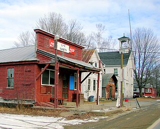
Chesterville is a town in Franklin County, Maine, United States. The population was 1,328 at the 2020 census.
<span class="mw-page-title-main">Benton, Maine</span> Town in the state of Maine, United States

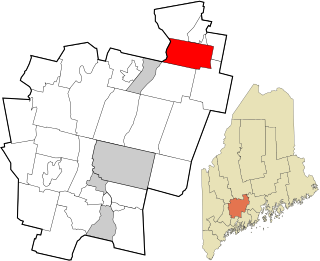
Benton is a town in Kennebec County, Maine, United States. It was formed in 1842, as a subdivision of the town of Clinton. The population was 2,715 at the 2020 census. The town was named for Missouri Senator Thomas Hart Benton.

<span class="mw-page-title-main">Vienna, Maine</span> Town in the state of Maine, United States

Vienna is a town in Kennebec County, Maine, United States. The population was 578 at the 2020 census.

Stoneham is a town in Oxford County, Maine, United States. The population was 261 at the 2020 census.

<span class="mw-page-title-main">Stow, Maine</span> Town in the state of Maine, United States

Stow is a town in Oxford County, Maine, United States. The population was 393 at the 2020 census.

<span class="mw-page-title-main">Upton, Maine</span> Town in the state of Maine, United States

Upton is a town in Oxford County, Maine, United States. The population was 69 at the 2020 census.

<span class="mw-page-title-main">Clifton, Maine</span> Town in the state of Maine, United States

Clifton is a town in Penobscot County, Maine, United States. The population was 840 at the 2020 census. It is part of the Bangor Metropolitan Statistical Area.

Detroit is a town in Somerset County, Maine, United States. The population was 885 at the 2020 census.

<span class="mw-page-title-main">Dundas, Minnesota</span> City in Minnesota, United States

Dundas is a city in Rice County, Minnesota, United States. The population was 1,712 at the 2020 census. Dundas is bordered by the city of Northfield.
<span class="mw-page-title-main">Garretson, South Dakota</span> City in South Dakota, United States

Garretson is a city in Minnehaha County, South Dakota, United States. The city had a population of 1,228 at the 2020 census.

<span class="mw-page-title-main">Ingleside on the Bay, Texas</span> City in Texas, United States

Ingleside on the Bay is a city in San Patricio County, Texas, United States. The population was 615 at the 2010 census.

Fairlawn is a census-designated place (CDP) in Pulaski County, Virginia, United States. The population was 2,419 at the 2020 census up from 2,367 at the 2010 census. It is served by the Radford, Virginia post office and is located on the opposite side of the New River from Radford.

<span class="mw-page-title-main">Garfield, Jackson County, Wisconsin</span> Town in Wisconsin, United States

Garfield is a town in Jackson County, Wisconsin, United States. The population was 638 at the 2010 census. The unincorporated communities of Levis, Price and Requa are located in the town.

<span class="mw-page-title-main">Northfield, Wisconsin</span> Town in Wisconsin, United States

Northfield is a town in Jackson County, Wisconsin, United States. The population was 586 at the 2000 census. The unincorporated communities of Northfield and York are located in the town.

<span class="mw-page-title-main">Corinth (village), New York</span> Village in New York, United States

Corinth is a village in Saratoga County, New York, United States. The population was 2,562 at the 2020 census. The village takes its name from the Greek city of Corinth.

<span class="mw-page-title-main">Northfield (village), Vermont</span> Former Village in Vermont, United States

Northfield is a former village in the town of Northfield in Washington County, Vermont, United States. The population was 3,757 at the 2020 census. In 2014, the village and surrounding town of Northfield merged to form a single municipal government; the village and its neighbors Northfield Center and South Northfield are now included in the Northfield census-designated place for population statistics purposes.

References

  1. 1 2 "US Gazetteer files 2010". United States Census Bureau . Retrieved December 16, 2012.
  2. "Census - Geography Profile: Northfield town, Washington County, Maine". United States Census Bureau . Retrieved March 13, 2022.
  3. "Census of Population and Housing". Census.gov. Retrieved June 4, 2015.
  4. "U.S. Census website". United States Census Bureau . Retrieved December 16, 2012.
  5. "U.S. Census website". United States Census Bureau . Retrieved January 31, 2008.

44°49′44″N67°34′14″W / 44.82889°N 67.57056°W / 44.82889; -67.57056