Pembroke, Maine

Last updated

Pembroke, Maine
Union Square, Pembroke, Maine 2012.jpg
Union Square in 2012
USA Maine location map.svg
Red pog.svg
Pembroke, Maine
Location within the state of Maine
Coordinates: 44°56′55″N67°10′35″W / 44.94861°N 67.17639°W / 44.94861; -67.17639
Country United States
State Maine
County Washington
Incorporated 1832
Area
[1]
  Total35.26 sq mi (91.32 km2)
  Land27.36 sq mi (70.86 km2)
  Water7.90 sq mi (20.46 km2)
Elevation
23 ft (7 m)
Population
 (2020)
  Total788
  Density29/sq mi (11.1/km2)
Time zone UTC-5 (Eastern (EST))
  Summer (DST) UTC-4 (EDT)
ZIP code
04666
Area code 207
FIPS code 23-57780
GNIS feature ID0582667
Website www.pembrokemaine.org

Pembroke is a town in Washington County, Maine, United States. The population was 788 at the 2020 census. [2] The town is home to a reversing falls on Mahar's Point.

Contents

History

Called Pennamaquan by the Passamaquoddy Indians, the area was settled about 1774 as part of Dennysville. [3] It was set off and incorporated on February 4, 1832, by the legislature, which named it after Pembroke in Wales, a community with a history of wooden shipbuilding stretching back to the Middle Ages. With one of the finest harbors in Maine, Pembroke too became a shipbuilding center. Vessels were constructed here as early as 1825. By 1859, when the population was 1,712, there were seven shipyards operating. Most schooners constructed here were used either by the coasting trade or fisheries. [4]

Pembroke also had a stone factory, three sawmills, one gristmill, four shingle mills and four lath machines. Near the head of tide stood the Pembroke Iron Company, established in 1832 and by 1856 producing almost 5,000 tons of iron spikes, rivets and nails a year. Another occupation was agriculture. [4] In 1880, the town's population was 2,324. [5]

Geography

According to the United States Census Bureau, the town has a total area of 35.26 square miles (91.32 km2), of which 27.36 square miles (70.86 km2) is land and 7.90 square miles (20.46 km2) is water. [1] Drained by the Pennamaquan River, Pembroke is on Cobscook Bay.

The town is crossed by U.S. Route 1 and Maine State Route 214.

Union Square c. 1908 The Corner, Pembroke, ME.jpg
Union Square c.1908

Demographics

Historical population
CensusPop.Note
1840 1,050
1850 1,71263.0%
1860 2,29934.3%
1870 2,55111.0%
1880 2,324−8.9%
1890 1,514−34.9%
1900 1,6529.1%
1910 1,378−16.6%
1920 1,168−15.2%
1930 965−17.4%
1940 1,0296.6%
1950 998−3.0%
1960 871−12.7%
1970 700−19.6%
1980 92031.4%
1990 852−7.4%
2000 8793.2%
2010 840−4.4%
2020 788−6.2%
U.S. Decennial Census [6]

2010 census

As of the census [7] of 2010, there were 840 people, 358 households, and 236 families living in the town. The population density was 30.7 inhabitants per square mile (11.9/km2). There were 531 housing units at an average density of 19.4 per square mile (7.5/km2). The racial makeup of the town was 94.9% White, 0.1% African American, 1.3% Native American, 0.4% Asian, 0.2% from other races, and 3.1% from two or more races. Hispanic or Latino of any race were 1.0% of the population.

There were 358 households, of which 28.2% had children under the age of 18 living with them, 49.7% were married couples living together, 10.1% had a female householder with no husband present, 6.1% had a male householder with no wife present, and 34.1% were non-families. 27.4% of all households were made up of individuals, and 12% had someone living alone who was 65 years of age or older. The average household size was 2.30 and the average family size was 2.68.

The median age in the town was 48.5 years. 20.2% of residents were under the age of 18; 4.3% were between the ages of 18 and 24; 20.2% were from 25 to 44; 33% were from 45 to 64; and 22.3% were 65 years of age or older. The gender makeup of the town was 48.7% male and 51.3% female.

2000 census

The old IOOF hall PembrokeME IOOFHall.jpg
The old IOOF hall

As of the census [8] of 2000, there were 879 people, 376 households, and 263 families living in the town. The population density was 32.1 inhabitants per square mile (12.4/km2). There were 539 housing units at an average density of 19.7 per square mile (7.6/km2). The racial makeup of the town was 96.93% White, 0.11% African American, 0.91% Native American, 0.46% Asian, and 1.59% from two or more races. Hispanic or Latino of any race were 0.46% of the population.

There were 376 households, out of which 27.9% had children under the age of 18 living with them, 57.4% were married couples living together, 8.8% had a female householder with no husband present, and 29.8% were non-families. 26.1% of all households were made up of individuals, and 13.3% had someone living alone who was 65 years of age or older. The average household size was 2.34 and the average family size was 2.75.

In the town, the population was spread out, with 22.6% under the age of 18, 4.9% from 18 to 24, 26.5% from 25 to 44, 26.3% from 45 to 64, and 19.7% who were 65 years of age or older. The median age was 42 years. For every 100 females, there were 89.4 males. For every 100 females age 18 and over, there were 89.4 males.

The median income for a household in the town was $23,365, and the median income for a family was $27,875. Males had a median income of $35,972 versus $21,544 for females. The per capita income for the town was $12,382. About 14.6% of families and 20.7% of the population were below the poverty line, including 24.2% of those under age 18 and 30.1% of those age 65 or over.

Notable people

Related Research Articles

<span class="mw-page-title-main">St. Francis, Maine</span> Town in the state of Maine, United States

St. Francis is a town in Aroostook County, Maine, United States on the Canada–United States border at the junction of the St. Francis River and the Saint John River. The population was 438 at the 2020 census. First settled by English speakers from southern Maine, the original population has been supplanted by French-speaking Acadians.

<span class="mw-page-title-main">Baldwin, Maine</span> Town in the state of Maine, United States

Baldwin is a town in Cumberland County, Maine, United States. The population was 1,520 at the 2020 census. It is part of the Portland–South Portland–Biddeford, Maine, metropolitan statistical area.

<span class="mw-page-title-main">Carthage, Maine</span> Town in the state of Maine, United States

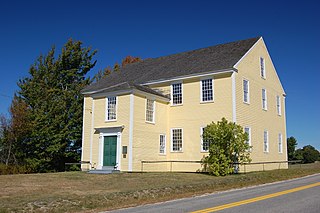
Carthage is a town in Franklin County, Maine, United States. The population was 509 at the 2020 census.

<span class="mw-page-title-main">Union, Maine</span> Town in the state of Maine, United States

Union is a town in Knox County, Maine, United States. The population was 2,383 at the 2020 census. It is home to the Matthews Museum of Maine Heritage and annual Union Fair.

<span class="mw-page-title-main">Alna, Maine</span> Town in the state of Maine, United States

Alna is a town in Lincoln County, Maine, United States. The population was 710 at the 2020 census. Alna is home to the Wiscasset, Waterville and Farmington Railway Museum and is noted for its historic architecture, including the early mill village of Head Tide.

<span class="mw-page-title-main">Bremen, Maine</span> Town in the state of Maine, United States

Bremen is a small town in Lincoln County, Maine, United States. The population was 823 at the 2020 census. Located on Muscongus Bay and the Gulf of Maine, it includes the villages of Broad Cove, Turners Corner, Bremen, Medomak and Muscongus. Hog Island is a center and camp for the Maine chapter of the National Audubon Society.

Otisfield is a town in Oxford County, Maine, United States. Otisfield is included in the Lewiston-Auburn, Maine metropolitan New England city and town area. The population was 1,853 at the 2020 census. Otisfield is a summer recreation area and home to Seeds of Peace Camp and Camp Arcadia.

<span class="mw-page-title-main">Roxbury, Maine</span> Town in the state of Maine, United States

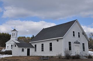
Roxbury is a town in Oxford County, Maine, United States. The population was 361 at the 2020 census. Ellis Pond is popular with recreational fishermen.

Sweden is a town in Oxford County, Maine, United States. The population was 406 at the 2020 census. Set among hills, forests and ponds, Sweden includes the village of East Sweden.

<span class="mw-page-title-main">Corinna, Maine</span> Town in the state of Maine, United States

Corinna is a town in Penobscot County, Maine, United States. The population was 2,221 at the 2020 census. It is part of the Bangor metropolitan statistical area. The village of Corinna is in the southern part of the town.

<span class="mw-page-title-main">Bowdoin, Maine</span> Town in the state of Maine, United States

Bowdoin is a town in Sagadahoc County, Maine, United States. Bowdoin is included in the Lewiston-Auburn, Maine metropolitan New England city and town area. The population was 3,136 at the 2020 census. Bowdoin is 31 land miles north of Portland, and 21 land miles south of Augusta.

<span class="mw-page-title-main">West Bath, Maine</span> Town in the state of Maine, United States

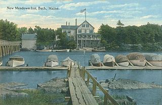
West Bath is a town in Sagadahoc County, Maine, United States. The population was 1,910 at the 2020 census. A sub-locality of West Bath is Winnegance. West Bath is part of the Portland–South Portland–Biddeford, Maine metropolitan statistical area.

<span class="mw-page-title-main">Smithfield, Maine</span> Town in the state of Maine, United States

Smithfield is a town in Somerset County, Maine, United States. The population was 925 at the 2020 census. The town was incorporated on February 29, 1840, making it the only town in Maine incorporated on Leap Day. The town was named after the Rev. Henry Smith, an early settler.

<span class="mw-page-title-main">Solon, Maine</span> Town in the state of Maine, United States

Solon is a town in Somerset County, Maine, United States. The population was 978 at the 2020 census.

<span class="mw-page-title-main">Freedom, Maine</span> Town in the state of Maine, United States

Freedom is a town in Waldo County, Maine, United States. The population was 711 at the 2020 census. Freedom is a residential and recreational area.

<span class="mw-page-title-main">Prospect, Maine</span> Town in the state of Maine, United States

Prospect is a town in Waldo County, Maine, United States. The population was 698 at the 2020 census.

<span class="mw-page-title-main">Waldo, Maine</span> Town in the state of Maine, United States

Waldo is a town in Waldo County, Maine, United States. The population was 795 at the 2020 census. It is the home town of Heather Hemmens, who is known for her role on Hellcats.

<span class="mw-page-title-main">Machiasport, Maine</span> Town in the state of Maine, United States

Machiasport is a town in Washington County, Maine, United States. The population was 962 at the 2020 census. Machiasport is a historic seaport and tourist destination.

<span class="mw-page-title-main">Epsom, New Hampshire</span> Town in New Hampshire, United States

Epsom is a town in Merrimack County, New Hampshire, United States. The population was 4,834 at the 2020 census.

Topsham is a census-designated place (CDP) in the town of Topsham in Sagadahoc County, Maine, United States. The population was 6,271 at the 2000 census. It is part of the Portland–South Portland–Biddeford, Maine Metropolitan Statistical Area.

References

  1. 1 2 "US Gazetteer files 2010". United States Census Bureau . Retrieved December 16, 2012.
  2. "Census - Geography Profile: Pembroke town, Washington County, Maine". United States Census Bureau . Retrieved January 23, 2022.
  3. Maine League of Historical Societies and Museums (1970). Doris A. Isaacson (ed.). Maine: A Guide 'Down East'. Rockland, Me: Courier-Gazette, Inc. pp. 284–285.
  4. 1 2 Coolidge, Austin J.; John B. Mansfield (1859). A History and Description of New England. Boston, Massachusetts: A.J. Coolidge. pp.  253–254. coolidge mansfield history description new england 1859.
  5. Varney, George J. (1886). Gazetteer of the state of Maine. Pembroke. Boston: Russell.
  6. "Census of Population and Housing". Census.gov. Retrieved June 4, 2015.
  7. "U.S. Census website". United States Census Bureau . Retrieved December 16, 2012.
  8. "U.S. Census website". United States Census Bureau . Retrieved January 31, 2008.
  9. Best, Henry B. M. (June 2003). Margaret and Charley: The Personal Story of Dr. Charles Best, the Co-Discoverer of Insulin. Dundurn. ISBN   9781550029864.

44°57′13″N67°09′43″W / 44.95361°N 67.16194°W / 44.95361; -67.16194