Vanceboro is a town in Washington County, Maine, United States. The town was named after landowner William Vance. The main village in town is located at the eastern terminus of Maine State Route 6. Vanceboro is across the St. Croix River from St. Croix, New Brunswick, Canada, to which it is connected by the Saint Croix–Vanceboro Bridge. Vanceboro is also connected to St. Croix by the Saint Croix–Vanceboro Railway Bridge, which is used by the New Brunswick Southern Railway.

The St. Croix River is a river in northeastern North America, 71 miles (114 km) in length, that forms part of the Canada–United States border between Maine (U.S.) and New Brunswick (Canada). The river rises in the Chiputneticook Lakes and flows south and southeast, between Calais and St. Stephen. It discharges into Passamaquoddy Bay, in the Bay of Fundy.

The Canada–United States border is the longest international border in the world. The boundary is 8,891 km (5,525 mi) long. The land border has two sections: Canada's border with the contiguous United States to its south, and with the U.S. state of Alaska to its west. The bi-national International Boundary Commission deals with matters relating to marking and maintaining the boundary, and the International Joint Commission deals with issues concerning boundary waters. The agencies responsible for facilitating legal passage through the international boundary are the Canada Border Services Agency (CBSA) and U.S. Customs and Border Protection (CBP).

Machias Seal Island is an island in disputed water between the Gulf of Maine and the Bay of Fundy, about 16 km (10 mi) southeast from Cutler, Maine, and 19 km (12 mi) southwest of Grand Manan Island, New Brunswick. Sovereignty of the island is disputed by the United States and Canada. The Canadian Coast Guard continues to staff a lighthouse on the island; the first lighthouse was constructed there in 1832.

Passamaquoddy Bay is an inlet of the Bay of Fundy, between the U.S. state of Maine and the Canadian province of New Brunswick, at the mouth of the St. Croix River. Most of the bay lies within Canada, with its western shore bounded by Washington County, Maine. The southernmost point is formed by West Quoddy Head on the U.S. mainland in Lubec, Maine; and runs northeasterly through Campobello Island, New Brunswick, engulfing Deer Island, New Brunswick, to the New Brunswick mainland head at L'Etete, New Brunswick in Charlotte County, New Brunswick.
The Meduxnekeag River is a tributary of the Saint John River. It is about 35 miles (56 km) long. The North Branch Meduxnekeag River rises from the outlet of a small pond in Maine and runs to its confluence with the Meduxnekeag in Wakefield, New Brunswick. The South Branch Meduxnekeag River rises from the outflow of Johnson Pond in Linneus, and runs to its confluence with the Meduxnekeag River two miles upstream from Houlton, Maine. The Meduxnekeag joins the Saint John in Woodstock, New Brunswick.
Forest City is a rural community in York County, New Brunswick, Canada.
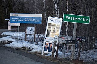
Fosterville is a rural community located in western York County, New Brunswick, Canada, mainly on Route 122
Pemberton Ridge is a rural community in North Lake Parish, York County, New Brunswick, Canada.
The Chiputneticook Lakes are a group of several lakes along the international boundary between Maine and New Brunswick.
Carlingford is a Canadian rural community in Victoria County, New Brunswick, on the Canada–United States border between Maine and New Brunswick. Carlingford is midway between Perth-Andover and Fort Fairfield on Route 190, also known as the Fort Road, which ends at the Canada Border Services Agency inspection station.

The Anchorage Provincial Park is a public park located on the south-east coast of Grand Manan Island, New Brunswick, Canada. The island, the largest in the Bay of Fundy, is also the primary island in the Grand Manan Archipelago, sitting at the boundary between the Bay of Fundy and the Gulf of Maine.
The Tinker Dam is a hydroelectric dam built in Tinker on the Aroostook River in the Canadian province of New Brunswick, and operated jointly by WPS Energy and NB Power. Its power house has a capacity of 34 megawatts.
St. Croix is a rural community in York County, New Brunswick, Canada.

The Saint Leonard–Van Buren Bridge is an international bridge, which connects the communities of St. Leonard, New Brunswick in Canada and Van Buren, Maine in the United States, across the Saint John River.
Stetson Mountain is a small mountain located in Washington County, Maine; a 8-mile (13 km) long ridge running roughly north–south. The summit elevation is between 1,080 ft (330 m) and 1,090 ft (330 m). Stetson is approximately 10 miles (16 km) from the Canada–United States border with New Brunswick.
The North Branch Meduxnekeag River is a river in Aroostook County, Maine and Carleton County, New Brunswick. From the outlet of a small pond in Maine Township 8, Range 3, WELS, the river runs about 20 miles (30 km) northeast, south, and east to the Canada–United States border, crossing into Canada at 46°16′40″N67°46′56″W. It runs about 4 miles (6 km) southeast to its confluence with the Meduxnekeag River in Wakefield, NB.
The River de Chute is a river in Maine and New Brunswick. From the outflow of Lindsay Lake in Easton, Maine, the river runs about 5 miles (8 km) south, about half a mile west of the Canada–United States border. The river turns east and crosses into Canada at 46°36′04″N67°47′18″W. It runs about 3 miles (5 km) to its confluence with the Saint John River. This section of the river forms the border between Carleton County, New Brunswick and Victoria County, New Brunswick.
Hancock Barracks was a 19th-century fortification near Houlton, Maine. It was an active United States Army post from 1828 to 1847.

