Demographics
The Peria statistical area covers 199.63 km2 (77.08 sq mi) [3] and had an estimated population of 1,280 as of June 2023, [4] with a population density of 6.4 people per km2.
Historical population| Year | Pop. | ±% p.a. |
|---|
| 2006 | 1,011 | — |
|---|
| 2013 | 951 | −0.87% |
|---|
| 2018 | 1,107 | +3.08% |
|---|
| Source: [5] |
Peria had a population of 1,107 at the 2018 New Zealand census, an increase of 156 people (16.4%) since the 2013 census, and an increase of 96 people (9.5%) since the 2006 census. There were 423 households, comprising 585 males and 522 females, giving a sex ratio of 1.12 males per female. The median age was 46.4 years (compared with 37.4 years nationally), with 228 people (20.6%) aged under 15 years, 159 (14.4%) aged 15 to 29, 540 (48.8%) aged 30 to 64, and 177 (16.0%) aged 65 or older.
Ethnicities were 74.3% European/Pākehā, 40.1% Māori, 3.0% Pacific peoples, 2.7% Asian, and 2.7% other ethnicities. People may identify with more than one ethnicity.
The percentage of people born overseas was 14.4, compared with 27.1% nationally.
Of those people who chose to answer the census's question about religious affiliation, 52.3% had no religion, 30.4% were Christian, 4.3% had Māori religious beliefs, 0.5% were Muslim, 1.4% were Buddhist and 2.4% had other religions.
Of those at least 15 years old, 108 (12.3%) people had a bachelor's or higher degree, and 183 (20.8%) people had no formal qualifications. The median income was $19,600, compared with $31,800 nationally. 45 people (5.1%) earned over $70,000 compared to 17.2% nationally. The employment status of those at least 15 was that 324 (36.9%) people were employed full-time, 126 (14.3%) were part-time, and 60 (6.8%) were unemployed. [5]
Thames is a town at the southwestern end of the Coromandel Peninsula in New Zealand's North Island. It is located on the Firth of Thames close to the mouth of the Waihou River. The town is the seat of the Thames-Coromandel District Council. The Māori iwi are Ngāti Maru, who are descendants of Marutuahu's son Te Ngako. Ngāti Maru is part of the Ngati Marutuahu confederation of tribes or better known as Hauraki Iwi.

Ōpunake is a small town on the southwest coast of Taranaki in New Zealand's North Island. It is located 45 kilometres southwest of New Plymouth. Rahotu is 16 km to the northwest. Manaia is 29 km to the southeast. State Highway 45 passes through the town. The town has a population of 1,440.
Taipa-Mangonui or Taipa Bay-Mangonui is a string of small resort settlements – Taipa, Cable Bay, Coopers Beach, and Mangōnui – that lie along the coast of Doubtless Bay and are so close together that they have run together to form one larger settlement.
Waharoa is a rural community in the Waikato region of New Zealand's North Island. It is located 7 km north of Matamata, and is part of the Matamata-Piako District. It is located at the junction of the Kinleith Branch railway and the East Coast Main Trunk Railway. State Highway 27 runs through the town, which is serviced by several shops and cafes and by a petrol station. Matamata Airport is just over 3 km (1.9 mi) north of Waharoa.

Maketu is a small town on the Western Bay of Plenty coast in New Zealand.

Matauri Bay is a bay in New Zealand, situated 30 km north of Kerikeri, in Whangaroa county, just north of the Bay of Islands. It has over a kilometre of white sand and crystal clear water, making it a popular summer destinations for surfers, divers, fishers and holidaymakers.
Kaeo is a township in the Far North District of New Zealand, located some 22 km (14 mi) northwest of Kerikeri. The town's name comes from the Māori-language name of the New Zealand freshwater mussel, which is found in nearby rivers.

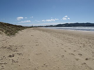
Te Araroa is a town in the Gisborne Region of the North Island of New Zealand. It is situated 175 km north of Gisborne city, along State Highway 35 between Tokata and Awatere. Te Araroa is the birthplace of noted Māori politician Sir Āpirana Ngata. Māori in the area are generally associated with the Ngāti Porou iwi. It is 100 metres from its local beach.
Pakaraka is a settlement in Northland, New Zealand, at the junction of State Highway 1 and 10, in the district the Ngāpuhi tribe called Tai-a-mai.
Whatuwhiwhi is a settlement at the northern end of Tokerau Beach, on the Karikari Peninsula of Northland, New Zealand. To the south is Doubtless Bay.

The Karikari Peninsula on the east coast of the far north of Northland, New Zealand, is between Rangaunu Harbour to the west, and Doubtless Bay to the southeast. It is a right-angled land mass of two relatively distinct parts. The rocky northern part, which has an east–west orientation and is approximately 17 km long, was originally an island but is now connected to the mainland by a low sandy tombolo approximately 11 km long, which has a north–south orientation. The spiritually significant Puwheke sits high above the north-facing beaches.

Long Bay is one of the northernmost suburbs of the North Shore, part of the contiguous Auckland metropolitan area located in New Zealand.
Wiremu Hoani Taua was a New Zealand tribal leader and school principal. Of Māori descent, he identified with the Ngati Kahu iwi. He was born in Kareponia, Northland, New Zealand in 1862.
Hihi or Hihi Beach is a village and rural community in the Far North District and Northland Region of New Zealand's North Island.

Putiki is a settlement in the Whanganui District and Manawatū-Whanganui region of New Zealand's North Island, located across the Whanganui River from Whanganui city. It includes the intersection of State Highway 3 and State Highway 4.
Ngapuna is a suburb in eastern Rotorua in the Bay of Plenty Region of New Zealand's North Island.
Pokuru is a rural community in the Waipa District and Waikato region of New Zealand's North Island.
Waitahanui is a village in the Taupō District, Waikato region, New Zealand. The village is on the eastern shore of Lake Taupō, 14 km (9 mi) south of the district seat of Taupō.
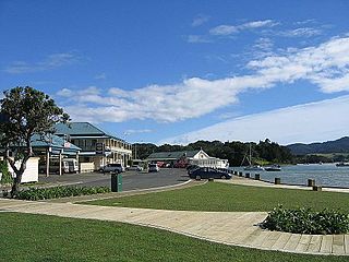
Mangōnui is a settlement on the west side of Mangōnui Harbour in Northland, New Zealand. State Highway 10 runs through it. It is the easternmost of the Taipa-Mangonui string of settlements, separated from Coopers Beach to the northwest by Mill Bay Road.

Schnapper Rock is a western suburb on the North Shore of Auckland, New Zealand. The suburb is currently under local governance of Auckland Council. The area was known for a gum digging hut used by early European settlers in the mid-19th century. North Shore Memorial Park was opened area in 1974, and the area developed into suburban housing in the early 2000s.
This page is based on this
Wikipedia article Text is available under the
CC BY-SA 4.0 license; additional terms may apply.
Images, videos and audio are available under their respective licenses.

