North Pekin is a village in Tazewell County, Illinois, United States. The population was 1,574 at the 2000 census. North Pekin is a suburb of Peoria and is part of the Peoria, Illinois Metropolitan Statistical Area.

Perrygrove Railway runs through farmland and woods on the edge of the Forest of Dean. Passengers can ride on the train to use activities including a Treetop Adventure, a covered picnic and play area at Foxy Hollow, an Indoor Village with secret passages, and a den-building area in the woods.
The École Nationale Supérieure de Chimie et de Physique de Bordeaux or ENSCPB - which can be translated as Graduate School of Chemistry and Physics of Bordeaux - is one of the French "grandes écoles ", whose main purpose is to form chemical and physical engineers. It is located on the campus of the University of Bordeaux 1, in the town of Pessac, close to the famous city of Bordeaux.
La Peca District is a district in the Bagua Province, Amazonas Region, Peru.
La Peca is a place in La Peca District in the Bagua Province, Amazonas Region, Peru. The town's population is approximately 22,400.

Southern National Motorsports Park is a 4/10-mile auto racing track in Lucama, North Carolina.
Helena is a hamlet in the Town of Brasher in St. Lawrence County, New York, United States.
Faulder is a railway point located in British Columbia, Canada, situated in a large valley ten kilometers west of the town of Summerland. This is also the end point of the Kettle Valley Steam Railway. Named after Evelyn Robert Faulder, it consists of many large acreages and agricultural farms.

Plumtree is a former settlement in Yolo County, California. It was located on the Southern Pacific Railroad 4.25 miles (6.8 km) west of West Sacramento, at an elevation of 26 feet. It still appeared on maps as of 1916.

Dovşanlı is a village in the Kalbajar Rayon of Azerbaijan.

Załęże is a village in the administrative district of Gmina Koczała, within Człuchów County, Pomeranian Voivodeship, in northern Poland. It lies approximately 6 kilometres (4 mi) north-east of Koczała, 34 km (21 mi) north-west of Człuchów, and 109 km (68 mi) south-west of the regional capital Gdańsk.

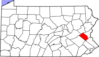
Walbert, Pennsylvania is a small village that hosts the municipal offices of South Whitehall Township, Lehigh County, Pennsylvania. It is located on Route 309 and has easy access to 22, 78, and 476. It is split between the Allentown zip code of 18104 and the Orefield zip code of 18069. It is drained by the Jordan Creek into the Lehigh River.

Eastwood, is a ghost town in San Diego County, California. It was located a mile northwest of Julian, near Eastwood Creek.
Reindalspasset is a mountain pass in Nordenskiöld Land at Spitsbergen, Svalbard. It separates the 38 kilometer long valley of Reindalen from the 14 kilometer long valley Lundströmdalen.
WULK 94.7 FM is a radio station licensed to Crawfordville, Georgia. The station broadcasts a Country music format and is owned by Paul and Suzanne Stone's Southern Broadcasting, through licensee Wyche Services Corporation.
Lock is an unincorporated community in Knox and Licking counties in the U.S. state of Ohio.

Gu Oidak is a census-designated place (CDP) located within the Tohono O'odham Nation Division in Pima County, Arizona, United States. The population was 188 at the 2010 census. The name "Gu Oidak" is the O'odham term for "big field".
Miguel Barrera is a census-designated place (CDP) in Starr County, Texas, United States. It is a new CDP formed from part of the La Rosita CDP prior to the 2010 census with a population of 128.
Prescott is an unincorporated community in northern Texas County, in the U.S. state of Missouri. The community lies approximately 4.5 miles southwest of Licking and the Big Piney River flows about 1.5 miles to the west of the location. The Prescott Church and cemetery lie one-half mile south.
Elephant Butte is a summit in Hidalgo County, New Mexico. It lies at an elevation of 6,361 feet / 1,939 meters, on the Cowboy Rim of the Animas Mountains.


