References
- ↑ Garnett P. Williams and Harold P. Guy. Erosional and Depositional Aspects of Hurricane Camille in Virginia, 1969. United States Government Printing Office, 1973, pp. 1.
Municipalities and communities of Nelson County, Virginia, United States | ||
|---|---|---|
| CDPs | 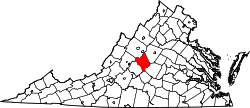 | |
| Other communities |
| |
| Footnotes | ‡This populated place also has portions in an adjacent county or counties | |
37°48′04″N78°57′23″W / 37.80111°N 78.95639°W
| | This Nelson County, Virginia state location article is a stub. You can help Wikipedia by expanding it. |