Lodebar, Virginia

Last updated

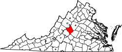
Lodebar is an unincorporated community in Nelson County, Virginia, United States.

Nelson County, Virginia County in the United States

Nelson County is a county located in the Commonwealth of Virginia. As of the 2010 census, the population was 15,020. Its county seat is Lovingston.

Virginia State of the United States of America

Virginia, officially the Commonwealth of Virginia, is a state in the Southeastern and Mid-Atlantic regions of the United States located between the Atlantic Coast and the Appalachian Mountains. Virginia is nicknamed the "Old Dominion" due to its status as the first English colonial possession established in mainland North America and "Mother of Presidents" because eight U.S. presidents were born there, more than any other state. The geography and climate of the Commonwealth are shaped by the Blue Ridge Mountains and the Chesapeake Bay, which provide habitat for much of its flora and fauna. The capital of the Commonwealth is Richmond; Virginia Beach is the most populous city, and Fairfax County is the most populous political subdivision. The Commonwealth's estimated population as of 2018 is over 8.5 million.

United States Federal republic in North America

The United States of America (USA), commonly known as the United States or America, is a country comprising 50 states, a federal district, five major self-governing territories, and various possessions. At 3.8 million square miles, the United States is the world's third or fourth largest country by total area and is slightly smaller than the entire continent of Europe's 3.9 million square miles. With a population of over 327 million people, the U.S. is the third most populous country. The capital is Washington, D.C., and the largest city by population is New York City. Forty-eight states and the capital's federal district are contiguous in North America between Canada and Mexico. The State of Alaska is in the northwest corner of North America, bordered by Canada to the east and across the Bering Strait from Russia to the west. The State of Hawaii is an archipelago in the mid-Pacific Ocean. The U.S. territories are scattered about the Pacific Ocean and the Caribbean Sea, stretching across nine official time zones. The extremely diverse geography, climate, and wildlife of the United States make it one of the world's 17 megadiverse countries.

Related Research Articles

House, New Mexico Village in New Mexico, United States

House is a village in Quay County, New Mexico, United States. The population was 72 at the 2000 census. The town has been rapidly losing population.

Dale, Pennsylvania Borough in Pennsylvania, United States

Dale is a borough in Cambria County, Pennsylvania, United States. It is part of the Johnstown, Pennsylvania Metropolitan Statistical Area. The population was 1,234 at the 2010 census, down from 1,503 at the 2000 census.

JJY is the call sign of a low frequency time signal radio station located in Japan.

There are several lakes named Mud Lake within the U.S. state of Illinois.

Renews-Cappahayden Town in Newfoundland and Labrador, Canada

Renews–Cappahayden is a small fishing town on the southern shore of Newfoundland, 83 kilometres south of St. John's.

Waties Island, South Carolina island in the United States of America

Waties Island is an undeveloped barrier island in the eastern coast of South Carolina. It is under the jurisdiction of Coastal Carolina University and is used primarily as an educational research facility.

Ponte de Rubiães

The Ponte de Rubiães is a Roman bridge in the civil parish of Rubiães, Paredes de Coura municipality, northern Portugal. It crosses the small river Coura. It is part of the Portuguese Way of St. James. The bridge was constructed in the 2nd century.

Monterrubio is a municipality located in the province of Segovia, Castile and León, Spain. According to the 2004 census (INE), the municipality has a population of 80.

Cwmdu, Powys village in United Kingdom

Cwmdu or Llanfihangel Cwmdu is a small village and community situated in the heart of the Black Mountains in Powys, Wales. Its name is derived from the Welsh language "Cwm Du", which means 'Black Valley'. It is located on the A479 Talgarth to Tretower road. Nearby towns include Crickhowell and Abergavenny. The population of the community, Llanfihangel Cwmdu with Bwlch and Cathedine, which includes Cwmdu and nearby villages Bwlch, Tretower and Cathedine, as of the 2011 UK Census was 1026. It is in the historic county of Brecknockshire.

Winduga, Łódź Voivodeship Settlement in Łódź, Poland

Winduga is a settlement in the administrative district of Gmina Sulejów, within Piotrków County, Łódź Voivodeship, in central Poland. It lies approximately 9 kilometres (6 mi) south of Sulejów, 21 km (13 mi) south-east of Piotrków Trybunalski, and 64 km (40 mi) south-east of the regional capital Łódź.

Rzeplin, Lublin Voivodeship Village in Lublin, Poland

Rzeplin is a village in the administrative district of Gmina Ulhówek, within Tomaszów Lubelski County, Lublin Voivodeship, in eastern Poland, close to the border with Ukraine. It lies approximately 6 kilometres (4 mi) east of Ulhówek, 31 km (19 mi) east of Tomaszów Lubelski, and 125 km (78 mi) south-east of the regional capital Lublin.

Wola Zofiowska Village in Świętokrzyskie, Poland

Wola Zofiowska is a village in the administrative district of Gmina Gnojno, within Busko County, Świętokrzyskie Voivodeship, in south-central Poland. It lies approximately 5 kilometres (3 mi) east of Gnojno, 20 km (12 mi) north-east of Busko-Zdrój, and 38 km (24 mi) south-east of the regional capital Kielce.

Dodge Place, California Unincorporated community in California, United States

Dodge Place is an unincorporated community in Butte County, California. It lies at an elevation of 1873 feet.

Forks is a hamlet in the town of Cheektowaga in Erie County, New York, United States.<rts> surrounded by George Urban Blvd, Dick Rd, Union Rd and Broadway St.

Cheeca Rocks is a shallow coral reef located within the Florida Keys National Marine Sanctuary. It lies approximately one mile to the southeast of Upper Matecumbe Key. This reef lies within a Sanctuary Preservation Area (SPA).

Perris Auto Speedway, also known as The PAS, is a 1/2 mile clay oval track located at 18700 Lake Perris Drive on the Lake Perris Fairgrounds in Perris, California. The track features a raised backstretch offering fans a better view over the infield of the oval. The track hosts USAC/CRA sprint cars, street stocks, dirt modifieds, and many others. It hosted the Turkey Night Grand Prix midget car race in 1996, 2012 and 2013. The track has also hosted the World of Outlaws and the Traxxas TORC Series.

Hickory Run is an unincorporated community located in Brunswick County, in the U.S. state of Virginia.

Icelandic Meteorological Office is Iceland's national weather service.

WIMC is a radio station broadcasting a classic rock format. Licensed to Crawfordsville, Indiana, the station serves West-Central Indiana, and is owned by Forcht Broadcasting.

Michael Mountain is a summit in West Virginia, in the United States. With an elevation of 3,678 feet (1,121 m), Michael Mountain is the 164th highest summit in the state of West Virginia.

References

Coordinates: 37°54′14″N78°50′56″W / 37.90389°N 78.84889°W / 37.90389; -78.84889

Geographic coordinate system Coordinate system

A geographic coordinate system is a coordinate system that enables every location on Earth to be specified by a set of numbers, letters or symbols. The coordinates are often chosen such that one of the numbers represents a vertical position and two or three of the numbers represent a horizontal position; alternatively, a geographic position may be expressed in a combined three-dimensional Cartesian vector. A common choice of coordinates is latitude, longitude and elevation. To specify a location on a plane requires a map projection.