White Rock, Virginia

Last updated

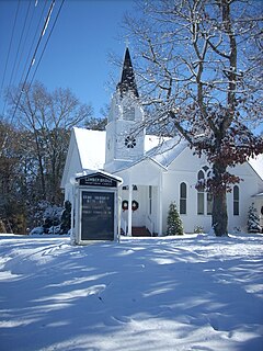
White Rock is an unincorporated community in Nelson County, Virginia, United States.

Nelson County, Virginia County in the United States

Nelson County is a county located in the Commonwealth of Virginia. As of the 2010 census, the population was 15,020. Its county seat is Lovingston.

Virginia State of the United States of America

Virginia, officially the Commonwealth of Virginia, is a state in the Southeastern and Mid-Atlantic regions of the United States located between the Atlantic Coast and the Appalachian Mountains. Virginia is nicknamed the "Old Dominion" due to its status as the first English colonial possession established in mainland North America and "Mother of Presidents" because eight U.S. presidents were born there, more than any other state. The geography and climate of the Commonwealth are shaped by the Blue Ridge Mountains and the Chesapeake Bay, which provide habitat for much of its flora and fauna. The capital of the Commonwealth is Richmond; Virginia Beach is the most populous city, and Fairfax County is the most populous political subdivision. The Commonwealth's estimated population as of 2018 is over 8.5 million.

United States Federal republic in North America

The United States of America (USA), commonly known as the United States or America, is a country comprising 50 states, a federal district, five major self-governing territories, and various possessions. At 3.8 million square miles, the United States is the world's third or fourth largest country by total area and is slightly smaller than the entire continent of Europe's 3.9 million square miles. With a population of over 327 million people, the U.S. is the third most populous country. The capital is Washington, D.C., and the largest city by population is New York City. Forty-eight states and the capital's federal district are contiguous in North America between Canada and Mexico. The State of Alaska is in the northwest corner of North America, bordered by Canada to the east and across the Bering Strait from Russia to the west. The State of Hawaii is an archipelago in the mid-Pacific Ocean. The U.S. territories are scattered about the Pacific Ocean and the Caribbean Sea, stretching across nine official time zones. The extremely diverse geography, climate, and wildlife of the United States make it one of the world's 17 megadiverse countries.
Related Research Articles

Lumber Bridge, North Carolina Town in North Carolina, United States

Lumber Bridge is a town in Robeson County, North Carolina, United States. The population was 94 at the 2010 census.

Beaver Township, Jefferson County, Pennsylvania Township in Pennsylvania, United States

Beaver Township is a township in Jefferson County, Pennsylvania, United States. The population was 498 at the 2010 census. It was named for Beaver Run, a stream which traverses the township from east to west.

Twilight, Pennsylvania Borough in Pennsylvania, United States

Twilight is a borough in Washington County, Pennsylvania, United States. The population was 241 at the 2000 census.

Lynchburg, South Carolina Town in South Carolina, United States

Lynchburg is a town in Lee County, South Carolina, United States. The population was 350 at the 2016 census.

Adjala–Tosorontio Township in Ontario, Canada

Adjala–Tosorontio is a township in south-central Ontario, Canada, in the County of Simcoe.

Arratzua-Ubarrundia municipality of Spain

Arratzua-Ubarrundia is a valley and municipality located in the province of Álava, in the Basque Country, northern Spain. It is located just a few kilometers north of the provincial capital, Vitoria-Gasteiz.

Treherneville is an unincorporated community in Northampton County, Virginia, United States.

Liśnik Mały is a village in the administrative district of Gmina Trzydnik Duży, within Kraśnik County, Lublin Voivodeship, in eastern Poland.

Estadio Jose Ramon Flores is a multi-use sports complex located in Santa Rosa de Lima, El Salvador. The sports complex is mainly used for its soccer facility. The soccer field is the home field of C.D. Municipal Limeño, a first division soccer team with a capacity of 5,000.

Downings Corner is an unincorporated community in Northumberland County, in the U.S. state of Virginia.

Boucaid Commune and town in Tissemsilt Province, Algeria

Boucaid is a town and commune in Tissemsilt Province in northern Algeria.

Scotts Fork is an unincorporated community located in Amelia County, in the U.S. state of Virginia.

Hivehchi-ye Markazi is a village in Bagheli-ye Marama Rural District, in the Central District of Gonbad-e Qabus County, Golestan Province, Iran. At the 2006 census, its population was 979, in 202 families.

Black Brook is a stream in Mille Lacs County, in the U.S. state of Minnesota. It is a tributary of the Rum River.

Briggs is an extinct town in Washington County, in the U.S. state of Ohio. The GNIS classifies it as a populated place.

Paisaje, Colorado human settlement in Colorado, United States of America

Paisaje is an unincorporated community in Conejos County, in the U.S. state of Colorado.

Castle Butte Township is a township in Perkins County, in the U.S. state of South Dakota. Its population was 19 as of the 2010 census.

Clarks, Indiana Unincorporated community in Indiana, United States

Clarks is an unincorporated community in Cass Township, Pulaski County, in the U.S. state of Indiana.

Zahns Corners is an unincorporated community in Pike County, in the U.S. state of Ohio.

Tobar is an extinct town in Elko County, in the U.S. state of Nevada.

References

Coordinates: 37°53′25″N79°03′38″W / 37.89028°N 79.06056°W / 37.89028; -79.06056

Geographic coordinate system Coordinate system

A geographic coordinate system is a coordinate system that enables every location on Earth to be specified by a set of numbers, letters or symbols. The coordinates are often chosen such that one of the numbers represents a vertical position and two or three of the numbers represent a horizontal position; alternatively, a geographic position may be expressed in a combined three-dimensional Cartesian vector. A common choice of coordinates is latitude, longitude and elevation. To specify a location on a plane requires a map projection.