
Roseland is an unincorporated community in Nelson County, Virginia, United States. It was among the communities severely affected by flash flooding from Hurricane Camille in 1969. [1]
Roseland is home to the Devils Backbone Brewing Company.
Roseland is an unincorporated community in Nelson County, Virginia, United States. It was among the communities severely affected by flash flooding from Hurricane Camille in 1969. [1]
Roseland is home to the Devils Backbone Brewing Company.
Municipalities and communities of Nelson County, Virginia, United States | ||
|---|---|---|
| CDPs | 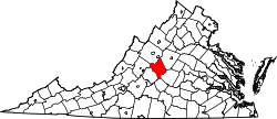 | |
| Other communities |
| |
| Footnotes | ‡This populated place also has portions in an adjacent county or counties | |
37°44′52″N78°58′33″W / 37.74778°N 78.97583°W
| International | |
|---|---|
| National | |
| | This Nelson County, Virginia state location article is a stub. You can help Wikipedia by expanding it. |