
Flintshire is a county in the north-east of Wales. It borders the English ceremonial counties of Merseyside and Cheshire, across the Dee Estuary to the north and by land to the east respectively, Wrexham County Borough to the south, and Denbighshire to the west. Connah's Quay is the largest town, while Flintshire County Council is based in Mold.
Until 1974, Flintshire, also known as the County of Flint, was an administrative county in the north-east of Wales, later classed as one of the thirteen historic counties of Wales.

The River Dee is a river flowing through North Wales, and through Cheshire, England, in Great Britain. The length of the main section from Bala to Chester is 113 km and it is largely located in Wales. The stretch between Aldford and Chester is within England, and two other sections form the border between the two countries.

Alyn and Deeside was one of six local government districts in the county of Clwyd, north-east Wales from 1974 to 1996. There is still a parliamentary constituency of the same name.

Alyn and Deeside is a parliamentary constituency represented in the House of Commons of the Parliament of the United Kingdom. The constituency was created in 1983, and it elects one Member of Parliament (MP) by the first-past-the-post method of election.

Delyn was a local government district with borough status from 1974 to 1996, being one of six districts in the county of Clwyd, north-east Wales.

Abermorddu is a village in the county of Flintshire, Wales, in the community of Hope. Approximately 5 miles north of Wrexham along the A541 road, it is contiguous with the main village of Caergwrle and closely related to the village of Hope. In the 19th century there was a turnpike road known as Abermorddu Branch running from the tollhouse at King's Ferry to Abermorddu.

Mynydd Isa is a village in Flintshire, in north-east Wales. It lies between the county town of Mold, and Buckley in the community of Argoed which had a population of 5837 according to the 2011 census. Mynydd Isa was originally a small hamlet on the north side of the Mold to Buckley road just downhill from the now demolished Calvinist chapel. It did not appear on Ordnance Survey maps until 1912.

The River Alyn is a tributary of the River Dee in north-east Wales. It rises at the southern end of the Clwydian hills and the Alyn Valley forms part of the Clwydian Range and Dee Valley Area of Outstanding Natural Beauty. The main town on the river is Mold, the county town of Flintshire. It lends its name to the constitutencies of Alyn and Deeside in the UK Parliament and the Senedd.

Hope is a small village and community in Flintshire, north-east Wales. The village is located approximately 3 miles / 4.5 km from the Wales-England border, on the course of the River Alyn, and less than 5 miles from Wrexham.

The River Cegidog is a river in north-east Wales. It flows mainly through Flintshire but towards the end of its course it forms the border between Flintshire and Wrexham County Borough.
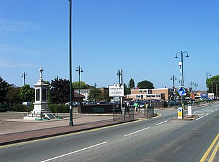
Connah's Quay, known locally as "The Quay" and formerly known as Wepre, is a town and community in Flintshire, on the River Dee and next to the border with England. With a population of 16,771, it is the largest town in Flintshire. The town is also part of the wider Deeside conurbation and is contiguous with Shotton, Flint and Buckley.

North Wales was a European Parliament constituency which roughly covered the geographic region of North Wales, from 1979 until 1999. It was held by the Conservative Party from 1979 until 1989, during which time it was their only seat in Wales.

Rhydymwyn is a village in Flintshire, Wales, located in the upper Alyn valley. Once a district of Mold, it was recognised as a separate parish from 1865. It is now part of the community of Cilcain.

The Afon Dwyfor is a river in Gwynedd, north-west Wales, in total the river is 12+1⁄2 miles (20.1 km) in length. It rises in Cwm Dwyfor at the head of Cwm Pennant, gathers to itself numerous streams which drain the surrounding mountains from Mynydd Graig Goch in the west to Moel Hebog in the east, then flows southwest towards Dolbenmaen and out of the Snowdonia National Park.

Rhydtalog is a small, isolated village in Flintshire, Wales. It lies in hilly country on the border with Denbighshire in the community of Treuddyn.
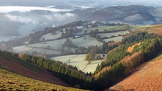
The Clwydian Range and Dee Valley is a designated Area of Outstanding Natural Beauty located in north-east Wales, covering the Clwydian Range, and the valley of the River Dee.


