
Flintshire, also known as the County of Flint, is one of Wales' thirteen historic counties, and a former administrative county. It mostly lies on the north-east coast of Wales.

The River Dee is a river in the United Kingdom. It flows through parts of both Wales and England, forming part of the border between the two countries.

Afon Mellte or the River Mellte is a river in south Wales. It is formed by the confluence of the Afon Llia and the Afon Dringarth. It then flows south through the village of Ystradfellte to Pontneddfechan where it joins with the Nedd Fechan to become the River Neath. The river derives its name from 'mellt' - the Welsh word for 'lightning' - after its tendency to rise and fall rapidly in response to heavy rainfall.

The Minera Limeworks were extensive lime quarries and kilns at Minera in Wrexham, Wales. It was located at grid reference SJ253520, near the villages of Gwynfryn, Minera, and Coedpoeth and was locally referred to as The Calch.

Dinas Rock is a high promontory of Carboniferous Limestone which rises between the Afon Mellte and its left-bank tributary, the Afon Sychryd on the border between the county of Powys and the county borough of Neath Port Talbot in south Wales. It can be found near the village of Pontneddfechan near Glyn Neath at the head of the Vale of Neath. It derives its name from the presence of Iron Age earthworks on its summit, dinas in Welsh signifying a defensive site or "city".

Ogof Hesp Alyn was discovered by North Wales Caving Club in 1973 in the Alyn Gorge near Cilcain, Flintshire, Wales. Reaching the end of the cave is a serious commitment involving 24 pitches and the draining of two sumps. The proliferation of short, awkward and muddy pitches appear best suited to be tackled by wire ladders, but in the 1980s a team of divers from the Wessex Caving Club who passed the sumps, concluded that single rope technique was preferable, avoiding the need for excessive numbers of people to carry the equipment. A perpetual siphon has since been used at the first sump which does a good job of keeping the water level relatively low, when working properly.
Ogof Hen Ffynhonnau lies in the Alyn Gorge in Flintshire, Wales close to Ogof Hesp Alyn. It was discovered in 1978 after excavation allowed access to Dyer's Adit. Being below a dry river bed, the cave can be prone to flooding in wet weather. There is a short ladder pitch just inside the entrance, and it makes a short trip suitable for novice cavers.

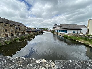
The River Alyn is a tributary of the River Dee. The River Alyn rises at the southern end of the Clwydian hills and the Alyn Valley forms part of the Clwydian Range and Dee Valley Area of Outstanding Natural Beauty. The main town on the river Alyn is Mold, the county town of Flintshire. It lends its name to the constituencies of Alyn and Deeside in the UK Parliament and the Senedd.

Ogof Nadolig is a cave in the Alyn Gorge near Cilcain, Flintshire, Wales. It is mostly crawling, 300 metres (980 ft) long, and ends with a shaft up to the surface and a locked manhole cover.
The River Cleddau consists of the Eastern and Western Cleddau rivers in Pembrokeshire, west Wales. They unite to form the Daugleddau estuary and the important harbour of Milford Haven.

The River Nidd is a tributary of the River Ouse in the English county of North Yorkshire. In its first few miles it is dammed three times to create Angram Reservoir, Scar House Reservoir and Gouthwaite Reservoir, which attract a total of around 150,000 visitors a year. The Nidd can overflow the reservoirs, flooding the caves in the valley. In such cases the river overflows into the normally dry river bed past Lofthouse through to Gouthwaite Reservoir. The Yorkshire Dales Rivers Trust YDRT has a remit to conserve the ecological condition of the River Nidd from its headwaters to the Humber estuary.

Bryn Alyn is a hill and Site of Special Scientific Interest in Denbighshire, North Wales, and forms part of the Clwydian Range and Dee Valley Area of Outstanding Natural Beauty. Bryn Alyn lies in the community of Llanarmon-yn-Iâl, to the east of the River Alyn, with the valley of Dyffryn Alyn separating it from the main range of the Clwydian hills. At just 408m, Bryn Alyn's significance is not in its height, but in the dramatic west-facing limestone cliffs, which can be seen from the nearby A494 trunk road and from many of the walking routes in the southern Clwydian hills. Areas of natural limestone pavement can be found throughout the upper parts of the hill. The main points of access to Bryn Alyn are from the nearby villages of Llanferres and Eryrys. A nature information board for Bryn Alyn can be found in the layby on the A494 just south of Llanferres, at grid reference SJ188600.
Mynydd Llangynidr is a mountain in the Brecon Beacons National Park largely in the county of Powys, south Wales. Its southern slopes extend into the northernmost parts of the county borough of Blaenau Gwent. It is named from the village of Llangynidr which sits in the valley of the River Usk to the north of it. It is essentially an undulating plateau rising in the west to a height of 557m at Garn Fawr at OS grid ref SO 123151. A secondary high point is achieved at a point marked by a trig point at SO 147159. To the north the hill overlooks the valleys of Dyffryn Crawnon and Cwm Claisfer, themselves tributary valleys of the Usk. The shallow upper valley of the Ebbw River reaches into the plateau in the southeast whilst the upper reaches of the Sirhowy Valley and its tributary the Nant Trefil define its western margins. A further tributary, the Nant Milgatw, reaches in from the south whilst the sharp edge of Rassau Industrial Estate also defines a part of its southern margin. Passing east across the B4560, the hill merges with Mynydd Llangatwg which has a similar character.
Esclusham Mountain is an area in Wrexham County Borough, Wales, United Kingdom, and is part of the Ruabon Moors. It rises to a height of 460 m, with the nearby spur of Cyrn-y-Brain, to the west, reaching 473 m. It lies mostly within the community of Esclusham. A smaller spur to the north, known as Minera Mountain, is within the neighbouring community of Minera.
The Nant Glais Caves are a collection of six caves located near Vaynor in Merthyr Tydfil County Borough, South Wales. The largest cave, Ogof Rhyd Sych, measures around 2000m long. The site has been designated a Site of Special Scientific Interest.

Alyn Valley Woods and Alyn Gorge Caves is a Site of Special Scientific Interest on the border of Flintshire and Denbighshire in north Wales. Most of the site is also designated as the Alyn Valley Woods Special Area of Conservation and the southern part includes Loggerheads Country Park. The SSSI has an area of 190.3 hectares while the SAC covers 168.3 hectares.

Upper Wye Gorge is a Site of Special Scientific Interest (SSSI), noted for its biological and geological characteristics, around Symonds Yat in the Upper Wye Valley on the Wales–England border. The site is listed in the 'Forest of Dean Local Plan Review' as a Key Wildlife Site (KWS).
This article describes the geology of the Brecon Beacons National Park in mid/south Wales. The area gained national park status in 1957 with the designated area of 1,344 km2 (519 sq mi) including mountain massifs to both the east and west of the Brecon Beacons proper. The geology of the national park consists of a thick succession of sedimentary rocks laid down from the late Ordovician through the Silurian and Devonian to the late Carboniferous period. The rock sequence most closely associated with the park is the Old Red Sandstone from which most of its mountains are formed. The older parts of the succession, in the northwest, were folded and faulted during the Caledonian orogeny. Further faulting and folding, particularly in the south of the park is associated with the Variscan orogeny.

Llyn Traffwll is a 91 acre natural lake located, in Anglesey, Wales. Located midway between the villages of Rhosneigr and Valley it lies less than a kilometre south of the A55 North Wales Expressway. It is the largest natural lake on the island with Llyn Alaw and Llyn Cefni both being reservoirs. Along with the surrounding smaller lakes it is a Site of Special Scientific Interest and is adjacent to the Valley Wetlands RSPB site. Formerly the lake was used to supply water to Holyhead by the Holyhead Water Company, and to aid water management a small dam was built which still exists.

The Clwydian Range and Dee Valley is a designated Area of Outstanding Natural Beauty (AONB) and proposed national park, located in north-east Wales, covering the Clwydian Range, and the valley of the River Dee. Designated in 1985 as the Clwydian Range AONB, and expanded to its current form in 2011, the Area of Outstanding Natural Beauty includes: medieval field systems, open heather moorland, prehistoric hillforts, limestone crags, broad leaved woodland, wooded valleys, and farmland. In 2018, an estimated 1.1 million people visited six key sites across the AONB, generating approximately £24.1 million to the Welsh economy, according to Natural Resources Wales. The AONB falls within the jurisdiction of the local authorities of Denbighshire, Flintshire, and Wrexham County Borough, with the majority, 80% of the AONB in Denbighshire, and the remaining 20% split evenly between the other two authorities. The AONB is the largest of only five AONBs in Wales, and one of the 46 in the United Kingdom. Additionally, it is one of only 8 protected areas of Wales. Long-distance footpaths; Offa's Dyke Path, and the Clwydian Way pass through the AONB. The area of the Clwydian Range and Dee Valley AONB is 390 km2 (150 sq mi), and has been proposed by the Welsh Government to become Wales' fourth national park.

