Walton County is a county located on the Emerald Coast in the northwestern part of the U.S. state of Florida, with its southern border on the Gulf of Mexico. As of the 2020 census, the population was 75,305. Its county seat is DeFuniak Springs. The county is home to the highest natural point in Florida: Britton Hill, at 345 feet (105 m). Walton County is included in the Crestview–Fort Walton Beach–Destin Metropolitan Statistical Area.

Seaside, formerly East Monterey, is a city in Monterey County, California, United States, with a population of 32,366 as of the 2020 census. It is located 2.25 miles (3.6 km) east-northeast of Monterey, at an elevation of 33 feet (10 m), and is the home of California State University, Monterey Bay (CSUMB), UC MBEST Center, and the Monterey College of Law, which are located on the site of the former military base Fort Ord. Also on the site are the Bayonet and Black Horse golf courses, now open to the public and host to PGA Tour events, including the 2012 PGA Professional National Championship. Seaside is the gateway to Fort Ord National Monument, created on April 20, 2012.

Seaside Heights is a borough situated on the Jersey Shore, within Ocean County, in the U.S. state of New Jersey. As of the 2020 United States census, the borough's population was 2,440, a decrease of 447 (−15.5%) from the 2010 census count of 2,887, which in turn had reflected a decline of 268 (−8.5%) from the 3,155 counted in the 2000 census. Seaside Heights is located on the Barnegat Peninsula, a long, narrow barrier peninsula that separates the Barnegat Bay from the Atlantic Ocean. During the summer, the borough attracts a crowd largely under the age of 21, mainly highschoolers and young adults, drawn to a community with boardwalk entertainment and one of the few shore communities with sizable numbers of apartments, attracting as many as 65,000 people who are often out until early morning visiting bars and restaurants.

Seaside is a city in Clatsop County, Oregon, United States, on the coast of the Pacific Ocean. The name Seaside is derived from Seaside House, a historic summer resort built in the 1870s by railroad magnate Ben Holladay. The city's population was 6,457 at the 2010 census.

Bultfontein is a town in the Free State province of South Africa with a total population of about 23,400 people. It is situated in the Tswelopele Local Municipality, about 100 kilometres (60 mi) north of Bloemfontein. The town site was laid out in 1873; it had been delayed because of a location dispute which also led to the establishment of Hoopstad 55 kilometres (35 mi) to the north-west. The township of Phahameng was established on the outskirts of Bultfontein in the 1970s.

Hyams Beach is a seaside village in the City of Shoalhaven, New South Wales, Australia, on the shores of Jervis Bay. At the 2016 census, it had a population of 112. The village, 180 km south of Sydney, is bordered by two beaches, Chinaman's Beach to the north and Seaman's Beach to the south, with Hyams Beach being in the centre. A seaside resort, its beach is known for having turquoise/aqua-coloured waters and fine, squeaky, brilliantly white sand composed of pure quartz.
The Vhembe District Municipality is one of the 5 districts of the Limpopo province of South Africa. It is the northernmost district of the country and shares its northern border with the Beitbridge District in Zimbabwe and on the east with the Gaza Province in Mozambique. Vhembe consists of all the territories that were part of the former Venda Bantustan; however, two large densely populated districts of the former Tsonga homeland of Gazankulu, in particular, Hlanganani and Malamulele, were also incorporated into the municipality, hence the ethnic diversity of the district. The seat is Thohoyandou, the capital of the former Venda Bantustan. According to the 2011 census, the majority of the municipality's 800,000 inhabitants spoke TshiVenda as their mother language, while 400,000 spoke Xitsonga as their home language. However, the Tsonga people form the majority south of the Levubu River, while the Venda are the minority south of Levubu at 15%. The Sepedi speakers number 27,000. The district code is DC34.
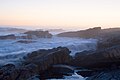
Scarborough is a seaside town situated within the City of Cape Town on the Cape Peninsula in the Western Cape province of South Africa, situated at the edge of the Cape Point Nature Reserve. The town's boundary includes Scarborough Beach, which is popular with surfers.
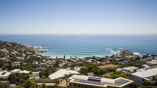
Llandudno is a seaside suburb of Cape Town on the Atlantic seaboard of the Cape Peninsula in the Western Cape, South Africa. There are no street lights, shops or commercial activities, and the town has some of the most expensive residential property in South Africa.

Rosebank is one of the Southern Suburbs of Cape Town, South Africa, located between the suburbs of Mowbray and Rondebosch.

Burgersdorp is a medium-sized town in Walter Sisulu in the Joe Gqabi District Municipality of the Eastern Cape province of South Africa.
Chinderah is a town in the Tweed Shire. It is located south of Tweed Heads and next to the seaside township of Kingscliff. An industrial estate, golf course and small shopping precinct are located within the area.
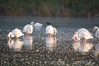
Vermont is a seaside town in the Western Cape province of South Africa. Located near Cape Town, the town adjoins the settlement of Onrusrivier and is also close to the town of Hermanus. Vermont is nestled between the mountains and the ocean, and has abundant birdlife. There is a salt pan which fills after rains, and is frequented by flamingos. There is also a rock pool, green areas and coastal pathway in Vermont.

Rondebosch East is a residential suburb of Cape Town, South Africa, about 7 kilometres (4.3 mi) south-east of the city centre. As the name suggests, it is located to the east of the neighbouring suburb of Rondebosch. As of 2001 it had a population of approximately 4,600 people in an area of just over 1 square kilometre (0.4 sq mi). A large common, similar to but smaller than Rondebosch Common, is located in the center of the suburb.
Maitland is a suburb of Cape Town, South Africa.

Pearston is a small town in the eastern Karoo, in the Eastern Cape province of South Africa. It lies between Graaff-Reinet and Somerset East at the foot of the Coetzeesberge, about 160 kilometres (100 mi) north of Port Elizabeth. It falls within the Blue Crane Route Local Municipality and has a population of approximately 4,500 people.

Ritchie is a small town situated 40 kilometres (20 mi) south of Kimberley on the north bank of the Riet River in the Northern Cape province of South Africa. The town, with a population of approximately 15,000, is in the Sol Plaatje Local Municipality, which forms part of the Frances Baard District Municipality.
Bishop Lavis is a suburb of Cape Town, located 15 kilometres (9 mi) east of the city centre near Cape Town International Airport. It had, as of 2001, a population of 44,419 people, of whom 97% described themselves as Coloured, and 90% spoke Afrikaans while 9% spoke English. The official 2011 census gave the population figure as 26,482.
Lotus River is a suburb of Cape Town in South Africa. Lotus River is found at an elevation of 11 metres above sea level.

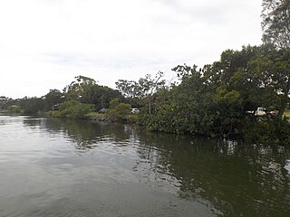
Brooklyn is a suburb of Cape Town, Western Cape with a population of 10,941 people. It lies to the north of Maitland, east of the Atlantic Ocean and Paarden Eiland, and west of Air Force Base Ysterplaat. The Black River flows through a section of Brooklyn.