The Cape Colony, also known as the Cape of Good Hope, was a British colony in present-day South Africa named after the Cape of Good Hope. It existed from 1795 to 1802, and again from 1806 to 1910, when it united with three other colonies to form the Union of South Africa, then became the Cape Province, which existed even after 1961, when South Africa had become a republic, albeit, temporarily outside the Commonwealth of Nations (1961–94).

Paarl is a town with 285,574 inhabitants in the Western Cape province of South Africa. It is the largest town in the Cape Winelands. Due to the growth of the Mbekweni township, it is now a de facto urban unit with Wellington. It is situated about 60 kilometres (37 mi) northeast of Cape Town in the Western Cape Province and is known for its scenic environment and viticulture and fruit-growing heritage.

The Trekboers were nomadic pastoralists descended from European colonists on the frontiers of the Dutch Cape Colony in Southern Africa. The Trekboers began migrating into the interior from the areas surrounding what is now Cape Town, such as Paarl, Stellenbosch, and Franschhoek, during the late 17th century and throughout the 18th century.

Theewaterskloof Municipality is a local municipality located within the Overberg District Municipality, in the Western Cape province of South Africa. As of 2007, the population was 108,790. Its municipality code is WC031. The enormous Theewaterskloof Dam, which provides water for Cape Town and the surrounding areas, is located in this municipality.

Swellendam is the third oldest town in South Africa, a town with 17,537 inhabitants situated in the Western Cape province. The town has over 50 provincial heritage sites, most of them buildings of Cape Dutch architecture. Swellendam is situated on the N2, approximately 220 km from both Cape Town and George.
Jan van Riebeeck landed at the Cape on 6 April 1652, setting up a supply station and fortifications for the Dutch East India Company. The decade saw the beginning of European settlement, marked by the introduction of crops from Europe and the New World and culminating in war with the Khoikhoi in 1659.

The Castle of Good Hope is a bastion fort built in the 17th century in Cape Town, South Africa. Originally located on the coastline of Table Bay, following land reclamation the fort is now located inland. In 1936 the Castle was declared a historical monument and following restorations in the 1980s it is considered the best preserved example of a Dutch East India Company fort.

Durbanville, previously called Pampoenkraal, is a town in the Western Cape province of South Africa, part of the greater Cape Town metropolitan area. It is a semi-rural residential suburb on the north-eastern outskirts of the metropolis surrounded by farms producing wine and wheat.
The area known today as Cape Town has no written history before it was first mentioned by Portuguese explorer Bartholomeu Dias in 1488. The German anthropologist Theophilus Hahn recorded that the original name of the area was '||Hui !Gais' – a toponym in the indigenous Khoi language meaning "where clouds gather."

Helderberg refers to a planning district of the City of Cape Town metropolitan municipality, the mountain after which it is named, a wine-producing area in the Western Cape province of South Africa, or a small census area in Somerset West.
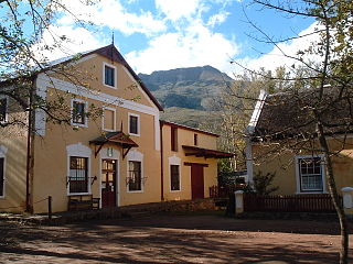
Genadendal is a town in the Western Cape province of South Africa, built on the site of the oldest mission station in the country. It was originally known as Baviaanskloof, but was renamed Genadendal in 1806. Genadendal was the place of the first Teachers' Training College in South Africa, founded in 1838.

Caledon, originally named Swartberg, is a town in the Overberg region in the Western Cape province of South Africa, located about 100 kilometres (62 mi) east of Cape Town next to mineral-rich hot springs. As of 2011 it had a population of 13,020. It is located in, and the seat of, the Theewaterskloof Local Municipality.
Fisherhaven is a suburb of the whale watching town of Hermanus in the Western Cape, South Africa. It is situated next to the Bot River Lagoon, about 14 km from Hermanus center and about 14 km from Arabella Country Estate and Golf course. There is an abundance of indigenous fauna and flora.
Plumstead is a residential suburb situated in the Southern Suburbs of Cape Town in the Western Cape Province of South Africa.

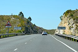
Sir Lowry's Pass is a mountain pass on the N2 national road in the Western Cape province of South Africa. It crosses the Hottentots Holland Mountains between Somerset West and the Elgin valley, on the main route between Cape Town and the Garden Route. A railway line also crosses the mountain range near this point.

The Overberg branch line is a railway line in the Western Cape, South Africa. It runs from Cape Town through Somerset West and Caledon to Bredasdorp.
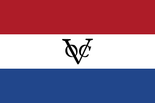
The Dutch Cape Colony was a Dutch United East India Company (VOC) colony in Southern Africa, centered on the Cape of Good Hope, from where it derived its name. The original colony and the successive states that the colony was incorporated into occupied much of modern South Africa. Between 1652 and 1691, it was a Commandment, and between 1691 and 1795, a Governorate of the VOC. Jan van Riebeeck established the colony as a re-supply and layover port for vessels of the VOC trading with Asia. The Cape came under VOC rule from 1652 to 1795 and from 1803 to 1806 was ruled by the Batavian Republic. Much to the dismay of the shareholders of the VOC, who focused primarily on making profits from the Asian trade, the colony rapidly expanded into a settler colony in the years after its founding.
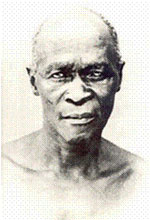
Jongumsobomvu Maqoma was a Xhosa chief and a commander of the Xhosa forces during the Cape Frontier Wars. Born in the Right Hand House of the Xhosa Kingdom, he was the older brother of Chief Sandile kaNgqika and nephew to King Hintsa. In 1818, he commanded the forces of his father, Ngqika, who seemingly was trying to overthrow the government and become the king of the Xhosa nation. In 1822, he moved to the so-called neutral zone to take land but was expelled by the British troops.

Free Burghers were early European settlers in the 18th century who had been released of their service contracts to the Dutch East India Company (VOC) and had become full citizens (burghers). The introduction of Free Burghers to the Dutch Cape Colony is regarded as the beginning of a permanent settlement of Europeans in South Africa. The Free Burgher population eventually devolved into two distinct segments separated by social status, wealth, and education: the Cape Dutch and the Boers.
Tesselaarsdal is a dispersed rural settlement in the Theewaterskloof Municipality, Western Cape, South Africa. It is situated on the northern side of the Kleinrivier Mountains, 20 kilometres (12 mi) south of the town of Caledon. The 2011 census recorded a population of 1,395 people in 428 households in Tesselaarsdal and on the surrounding farms.