Nova Scotia is one of the thirteen provinces and territories of Canada. It is one of the three Maritime provinces and one of the four Atlantic provinces. Nova Scotia is Latin for "New Scotland".

Shelburne County is a county in the Canadian province of Nova Scotia.
Canadian Forces Station Debert was a Canadian Forces station located in Debert, Nova Scotia. It was most recently used during the Cold War as a communications facility and was home to a "Regional Emergency Government Headquarters" (REGH) complex, more commonly known by their nickname "Diefenbunker."
Debert is an unincorporated farming community in Nova Scotia, Canada. Located in the central-western part of Colchester County, it is approximately 20 km (12 mi) west of Truro.

A Canadian Forces base or CFB is a military installation of the Canadian Armed Forces. For a facility to qualify as a Canadian Forces base, it must station one or more major units.

Eastern Passage is an unincorporated suburban community in Halifax Regional Municipality Nova Scotia, Canada.
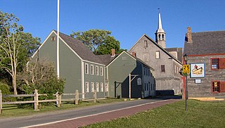
Shelburne is a town located in southwestern Nova Scotia, Canada.
Barrington, officially named the Municipality of the District of Barrington, is a district municipality in western Shelburne County, Nova Scotia, Canada. Statistics Canada classifies the district municipality as a municipal district.
Cape Sable Island, locally referred to as Cape Island, is a small Canadian island at the southernmost point of the Nova Scotia peninsula. It is sometimes confused with Sable Island. Historically, the Argyle, Nova Scotia region was known as Cape Sable and encompassed a much larger area than simply the island it does today. It extended from Cape Negro (Baccaro) through Chebogue.

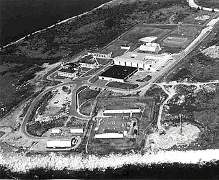
Canadian Forces Station Barrington, also referred to as CFS Barrington, was a Canadian Forces Station located in the unincorporated community of Baccaro, Nova Scotia at Baccaro Point near the southwesternmost point of the province.
Route 330 is a collector road in the Canadian province of Nova Scotia.
Barrington Passage is a community in the Canadian province of Nova Scotia, located in the Municipality of the District of Barrington of Shelburne County. It is named after William Barrington, 2nd Viscount Barrington.
Port La Tour is a community in the Canadian province of Nova Scotia, located in the Municipality of the District of Barrington of Shelburne County.
Cape Negro is a community in the Canadian province of Nova Scotia, located in the Municipality of the District of Barrington of Shelburne County. Cape Sable, Nova Scotia By one account, Cape Negro was first settled by the French who migrated from Port Royal, Nova Scotia in 1720. However other records indicate the habitation and garden of a French Priest at the Hawl Over in Cape Negro as early as 1635, and the 1671 French census records the family of Amand and Elizabeth Lalloue living in Cape Negro.
Villagedale is a community in the Canadian province of Nova Scotia, located in the Municipality of the District of Barrington of Shelburne County.
Canadian Forces Station (CFS) Shelburne is a former Canadian Forces Station that was a shore terminus for the Sound Surveillance System (SOSUS) from 1955 to 1994. It was located in the Municipality of the District of Shelburne, Shelburne County, Nova Scotia.
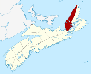
Canadian Forces Station Sydney, also known as CFS Sydney, is a former Canadian Forces Station located in the community of Lingan Road, Nova Scotia.
The NATO Satellite Ground Terminal Folly Lake, also known as SGT Folly Lake, is a now-decommissioned Canadian military satellite communications facility located in Wentworth, Cumberland County, Nova Scotia. At one time it was one of 24 satellite communication facilities for the North Atlantic Treaty Organization (NATO) that were located in NATO countries.

The following outline is provided as an overview of and topical guide to Nova Scotia:
The Municipality of the County of Inverness is a county municipality on Cape Breton Island, Nova Scotia, Canada. It provides local government to about 17,000 residents of the historical county of the same name, except for the incorporated town of Port Hawkesbury and the Whycocomagh 2 Miꞌkmaq reserve, both of which are enclaves. Public services are provided in the areas of recreation, tourism, administration, finance, and public works.