Slieve Gullion

Last updated

Slieve Gullion
Sliabh gCuillinn
Slieve Gullion.jpg
Slieve Gullion from Aughanduff
Highest point
Elevation 573 m (1,880 ft)
Prominence 478 m (1,568 ft) [1]
Listing County top (Armagh), Marilyn
Coordinates 54°08′N6°26′W / 54.133°N 6.433°W / 54.133; -6.433
Naming
English translationmountain of the steep slope
Language of name Irish
Geography
Relief Map of Northern Ireland.png
Red triangle with thick white border.svg
Slieve Gullion
Location in Northern Ireland
Island of Ireland relief location map.png
Red triangle with thick white border.svg
Slieve Gullion
Slieve Gullion (island of Ireland)
United Kingdom relief location map.jpg
Red triangle with thick white border.svg
Slieve Gullion
Slieve Gullion (the United Kingdom)
Location County Armagh, Northern Ireland
Parent range Ring of Gullion
OSI/OSNI grid J024201

Slieve Gullion (from Irish : Sliabh gCuillinn, meaning 'hill of the steep slope' [2] or Sliabh Cuilinn, "Culann's mountain") [3] is a mountain in the south of County Armagh, Northern Ireland. The mountain is the heart of the Ring of Gullion and is the highest point in the county, with an elevation of 573 metres (1,880 ft). At the summit is a small lake and two ancient burial cairns, one of which is the highest surviving passage grave in Ireland. Slieve Gullion appears in Irish mythology, where it is associated with the Cailleach and the heroes Fionn mac Cumhaill and Cú Chulainn. It dominates the countryside around it, offering views as far away as Antrim, Dublin Bay and Wicklow on a clear day. [4] Slieve Gullion Forest Park is on its eastern slope.

Contents

Villages around Slieve Gullion include Meigh, Drumintee, Forkhill, Mullaghbawn and Lislea. The mountain gives its name to the surrounding countryside, and is the name of an electoral area within Newry, Mourne and Down District Council.

Geography

The western slope; the lowlands between Mullaghbane and Lislea and in the background The Ring of Gullion (Slievenacapple) Slieve Gullion, Western Slope - geograph.org.uk - 255264.jpg
The western slope; the lowlands between Mullaghbane and Lislea and in the background The Ring of Gullion (Slievenacapple)

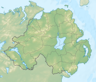
Slieve Gullion is a steep-sided mountain with a flat top and a height of 573 metres (1,880 ft). It is the eroded remains of a Paleocene volcanic complex. It is surrounded by a ring dike known as the Ring of Gullion, a designated Area of Outstanding Natural Beauty (AONB). Slieve Gullion has been shaped by glaciation and exhibits a classic 'crag and tail' glacial feature. The 'tail', made up of glacial deposits, points south, ending at Drumintee. The geological formation was the first ring dike to be mapped, [5] although its significance was not understood until similar structures had been described from Scotland. The rocks of the area are complex and have featured in international geological debate since the 1950s. The site has attracted geologists from all over the world and featured in theories to explain the unusual rock relationships. Some of these theories have now become an accepted part of geological science. [6]

Much of Slieve Gullion is covered with forest, heather, or raw stone, while 612 hectares of dry heath on the mountain has been designated a Special Area of Conservation, [7] an Environmentally Sensitive Area, [8] and an Area of Outstanding Natural Beauty. In July 2006, some areas of gorse were destroyed by a wildfire which may have been started deliberately. [9]

Traces of fields on the mountain's poor soil from farming in earlier times can still be seen. There is also evidence of past quarrying.

History

Burial cairns

The entrance to the passage tomb Chambered Grave on Slieve Gullion - geograph.org.uk - 563997.jpg
The entrance to the passage tomb

There are two burial cairns on top of the hill, on either side of a small lake. The southern one is a large passage tomb, the highest surviving passage tomb in Ireland. [10] In 1961, a team of archaeologists explored the site and set up a 30-person camp near the summit. [11] The tomb's cairn is 30 m (98 ft) wide and 5 m (16 ft) high. The chamber inside is 3.6 m (12 ft) wide, with a corbelled roof up to 4.3 m (14 ft) high. It contained three large blocks of stone seemingly used as basins, and fragments of human bone. Some bits of worked flint and a barbed-end arrowhead were also found, "the meager remnants that survived the centuries of tomb raiding". [12] The entrance is aligned with the setting sun on the winter solstice. [13] Radiocarbon dating suggests it was built c.3500–2900 BCE. [14] The smaller cairn to the north of the lake was built later, perhaps during the Bronze Age. It contains two cist burials, with one containing bits of burnt bone; likely the remains of a single adult. [15]

The two cairns were disturbed by American soldiers training there during World War II. [16] Irish folklore holds that it is bad luck to damage or disrespect such tombs and that doing so could bring a curse. [17] [18] Today they are historic monuments protected by law. In recent years, volunteers have helped to repair the burial cairns under the supervision of an archaeologist. [19]

Slieve Gullion at dusk from the west Carrick.JPG
Slieve Gullion at dusk from the west

Titus Oates Plot

Around 1680, religious persecution of local Irish Catholics heated up in reaction to Titus Oates' claims of a non-existent Catholic conspiracy aimed at assassinating King Charles II of England and massacring the Protestants of the British Isles. As a result, a Catholic priest named Fr. Mac Aidghalle was murdered while saying mass at a mass rock that still stands atop Slieve Gullion. The perpetrators were a company of redcoats under the command of a priest hunter named Turner. Redmond O'Hanlon, the outlawed but de facto Chief of the Name of Clan O'Hanlon and leading local rapparee, is said in local oral tradition to have avenged the murdered priest and in so doing to have sealed his own fate. [20]

Hillwalking

Slieve Gullion is popular with hillwalkers, with about 20,000 people climbing the hill every year. A road leads to a small car park about halfway up the western side of the mountain. From there a trail leads to the summit. There is also a waymarked trail from the northern side of the mountain. As there is no security on the mountainside, cars parked there are often broken into by thieves, and police have asked visitors not to leave valuables in cars. [21] [22]

On the eastern side of the mountain is Slieve Gullion Forest Park, which includes a visitors' centre, café, playground, and the Giant's Lair Story Trail. [23]

Mythology

Slieve Gullion appears in Irish mythology.

Fionn and the Cailleach

In the tale known as The Hunt of Slieve Gullion, Áine and her sister Milucra both seek after the legendary hero Fionn mac Cumhaill (Finn McCool). Knowing that Áine vowed never to marry a man with grey hair, Milucra secretly puts a spell on the lake atop Slieve Gullion, so that anyone who swam in it would become elderly. She tricks Fionn by asking him to fetch her golden ring from the lake, and he emerges as an old man with grey-white hair. His men, the Fianna, force her to give him a restorative potion from her cornucopia. Fionn's youth returns, but his hair does not return to its true colour. [24] This is said to be the origin of his name, Fionn, meaning 'white'. In some versions of the tale, Milucra is revealed to be the Cailleach Bhéara (Calliagh Birra), an ancient goddess. [25]

The names of several features on the mountain refer to the Cailleach Bhéara. The passage grave is known as Calliagh Birra's House and the small lake is called Calliagh Birra's Lough. Lower down, on a hillock called Spellick, is a rock feature called the Calliagh Birra's Chair. Locals would visit it at Lughnasadh and take turns sitting on the chair. [26]

Cú Chulainn

Slieve Gullion is said to be where the legendary hero Cú Chulainn (Cuhullin) received his name and where he spent his childhood as Sétanta.

According to myth, the mountain is named after Culann the metalsmith. Culann invites Conchobhar mac Neasa, king of Ulster, to a feast at his house on the slopes of Slieve Gullion. On his way, Conchobhar stops at the playing field to watch the boys play hurling. He is so impressed by Sétanta's performance that he asks him to join him at the feast. Sétanta promises to join him after he finishes his game. Conchobhar goes ahead, but he forgets about Sétanta, and Culann lets loose his ferocious hound to guard his house. When Sétanta arrives, the hound attacks him, but he kills it; in one version by smashing it against a standing stone, in another by driving a sliotar (hurling ball) down its throat with his hurley. Culann is devastated by the loss of his hound, so Sétanta promises to rear him a replacement, and until it was old enough to do the job, he himself would guard Culann's house. The druid Cathbhadh announces that his name henceforth would be Cú Chulainn, "Culann's Hound".

In the Táin Bó Cuailnge , the nearby Gap of the North is where Cú Chulainn single-handedly fends-off the army of queen Méabh. [27]

360 deg panorama of Ireland over Slieve Gullion Slieve Gullion Panorama.jpg
360 deg panorama of Ireland over Slieve Gullion

See also

Related Research Articles

<span class="mw-page-title-main">County Armagh</span> County in Northern Ireland

County Armagh is one of the six counties of Northern Ireland and one of the traditional thirty-two counties of Ireland. Adjoined to the southern shore of Lough Neagh, the county covers an area of 1,327 km2 (512 sq mi) and has a population of 194,394 as of the 2021 census. County Armagh is known as the "Orchard County" because of its many apple orchards. The county is part of the historic province of Ulster.

<span class="mw-page-title-main">Cailleach</span> Gaelic female hag deity

In Gaelic myth, the Cailleach is a divine hag and ancestor, associated with the creation of the landscape and with the weather, especially storms and winter. The word literally means 'old woman, hag', and is found with this meaning in modern Irish and Scottish Gaelic, and has been applied to numerous mythological and folkloric figures in Ireland, Scotland, and the Isle of Man. In modern Irish folklore studies, she is sometimes known as The Hag of Beara, while in Scotland she is known as Beira, Queen of Winter.

<span class="mw-page-title-main">Cú Chulainn</span> Irish mythological hero

Cú Chulainn, is a warrior hero and demigod in the Ulster Cycle of Irish mythology, as well as in Scottish and Manx folklore. He is believed to be an incarnation of the Irish god Lugh, who is also his father. His mother is the mortal Deichtine, sister of king Conchobar mac Nessa.

<span class="mw-page-title-main">Slieve Croob</span> Mountain in Northern Ireland

Slieve Croob is a mountain with a height of 534 metres (1,752 ft) in the middle of County Down, Northern Ireland. It is the heart of a mountainous area, the Dromara Hills, north of the Mourne Mountains. It is designated an Area of Outstanding Natural Beauty and is the source of the River Lagan. There is a small road to the summit, where there is an ancient burial cairn and several transmitter stations with radio masts. It has wide views over all of County Down and further afield. The Dromara Hills also includes Slievenisky, Cratlieve, Slievegarran and Slievenaboley.

<span class="mw-page-title-main">Loughcrew</span>

Loughcrew or Lough Crew is an area of historical importance near Oldcastle, County Meath, Ireland. It is home to a group of ancient tombs from the 4th millennium BC, some decorated with rare megalithic art, which sit on top of a range of hills. The hills and tombs are together known as Slieve na Calliagh and are the highest point in Meath. It is one of the four main passage tomb cemeteries in Ireland and is a protected National Monument. The area is also home to the Loughcrew Estate, from which it is named.

<span class="mw-page-title-main">Slieve Donard</span> Highest mountain in Northern Ireland

Slieve Donard is the highest mountain in Northern Ireland and the wider province of Ulster, with a height of 850 metres (2,790 ft). The highest of the Mourne Mountains, it is near the town of Newcastle on the eastern coast of County Down, overlooking the Irish Sea. It is also the highest mountain in the northern half of Ireland, and 7th highest on the island.

<span class="mw-page-title-main">Slievenamon</span> Mountain in Tipperary, Ireland

Slievenamon or Slievenaman is a mountain with a height of 721 metres (2,365 ft) in County Tipperary, Ireland. It rises from a plain that includes the towns of Fethard, Clonmel and Carrick-on-Suir. The mountain is steeped in folklore and is associated with Fionn mac Cumhaill. On its summit are the remains of ancient burial cairns, which were seen as portals to the Otherworld. Much of its lower slopes are wooded, and formerly most of the mountain was covered in woodland. A low hill attached to Slievenamon, Carrigmaclear, was the site of a battle during the Irish Rebellion of 1798.

<span class="mw-page-title-main">Ring of Gullion</span> Geological formation and area

The Ring of Gullion is a geological formation and area, officially designated as an Area of Outstanding Natural Beauty, (AONB) located in County Armagh, Northern Ireland. The area centres on Slieve Gullion, the highest peak in County Armagh, measures roughly 42 by 18 kilometres and comprises some 150 km2 defined topographically by the hills of an ancient ring dyke. Parts of the area have also been officially listed as Areas of Special Scientific Interest.

<span class="mw-page-title-main">Cloughmore</span>

<span class="mw-page-title-main">Carn Clonhugh</span> Mountain in Longford, Ireland

<span class="mw-page-title-main">Camlough</span> Village in County Armagh, Northern Ireland

Camlough is a village west of Newry in County Armagh, Northern Ireland. The village is named after a lake, known as the Cam Lough. South of the village is Camlough Mountain, part of the Ring of Gullion and is designated an Area of Outstanding Natural Beauty. Camlough had a population of 1,074 at the 2011 Census.

<span class="mw-page-title-main">Meigh</span> Village in County Armagh, Northern Ireland

Meigh is a small village and townland near Slieve Gullion in County Armagh, Northern Ireland. It had a population of 444 people in the 2001 Census. It lies within the Newry, Mourne and Down District Council area.

<span class="mw-page-title-main">Dromintee</span> Village in County Armagh, Northern Ireland

Dromintee or Drumintee is a small village and townland in County Armagh, Northern Ireland. In the 2001 Census it had a population of 364 people. It lies within the Newry and Mourne District Council area. It sits within the Ring of Gullion AONB.

Jonesborough or Jonesboro is a small village and civil parish in the Ring of Gullion in County Armagh, Northern Ireland. It is about 5 miles (8 km) south of Newry and lies 1,000 yards (1 km) from the border with County Louth in the Republic of Ireland. The Catholic parish includes the neighbouring area of Dromintee and crosses the Irish border into Louth.

<span class="mw-page-title-main">Clermont Carn</span> Mountain in Ireland

Clermont Carn, also known as Black Mountain, is a mountain that rises to 510 metres (1,670 ft) in the Cooley Mountains of County Louth, Ireland. It is at the border with Northern Ireland, and is also the location of the Clermont Carn transmission site. The mountain's name refers to an ancient burial cairn on its summit, and to Lord Clermont of Ravensdale.

<span class="mw-page-title-main">Mullaghbawn</span> Village in County Armagh, Northern Ireland

Mullaghbawn, or Mullaghbane, is a small village and townland near Slieve Gullion in County Armagh, Northern Ireland. In the 2011 Census it had a population of 596.

<span class="mw-page-title-main">Slieve na Calliagh</span> Hilly area, with megalithic tombs, in County Meath, Ireland

Slieve na Calliagh are a range of hills and ancient burial site near Oldcastle, County Meath, Ireland. The summit is 276 metres (906 ft), the highest point in the county. On the hilltops are about twenty passage tombs, some decorated with rare megalithic art, which were built in the 4th millennium BC. Also called the Loughcrew tombs, it is one of the main passage tomb cemeteries in Ireland, along with Brú na Bóinne, Carrowkeel and Carrowmore.

<span class="mw-page-title-main">Caherconree</span> Mountain in Kerry, Ireland

Caherconree at 835 metres (2,740 ft), is the 20th–highest peak in Ireland on the Arderin scale, and the 27th–highest peak on the Vandeleur-Lynam scale. Caherconree is the 2nd-highest mountain in the Slieve Mish Mountains in the Dingle Peninsula in Kerry, Ireland, and one of its southerly spurs is the site of an ancient stone promontory fort, which is a protected National Monument.

<span class="mw-page-title-main">Mullyash Kerbed Cairn</span> Barrow in Ireland

Mullyash Kerbed Cairn is a kerb cairn and National Monument located in County Monaghan, Ireland.

Clanvaraghan is a small village in County Down, in the north-east of Northern Ireland close to the Irish Sea. Clanvaraghan is located approximately 3 miles north of the town of Castlewellan. The village has a population of 186 residents while the number of people living within this rural townland is much greater.

References

  1. "Cooley/Gullion Area - Slieve Gullion". MountainViews. Ordnance Survey Ireland . Retrieved 18 June 2015.
  2. "Slieve Gullion". PlaceNames NI. Retrieved 20 December 2016.
  3. T.S. Ó Máille (1960) "Cuileann in áitainmneacha", in 'Béaloideas', Journal of the Folklore of Ireland Society XXVIII.
  4. Christopher Somerville – 13 June 2009 (13 June 2009). "Walk of the week: Slieve Gullion Co Armagh by Christopher Somerville, Irish Independent, Saturday June 13 2009". Independent.ie. Retrieved 16 January 2014.
  5. "Slieve Gullion Ring - Overview". Habitas.org.uk. Retrieved 16 January 2014.
  6. "Geology within Ring of Gullion AONB". Doeni.gov.uk. 19 January 2010. Archived from the original on 12 November 2013. Retrieved 16 January 2014.
  7. "Slieve Gullion Special Area of Conservation". Jncc.gov.uk. 25 March 2010. Retrieved 16 January 2014.
  8. "Environmentally Sensitive Areas (Slieve Gullion) Designation (Amendment) Order (Northern Ireland) 1997". Opsi.gov.uk. 17 June 2013. Retrieved 16 January 2014.
  9. FireFightingNews.com (21 July 2006). "Arsonists Strike 2,500 Times In Ulster In Last Three Years". Firefightingnews.com. Retrieved 16 January 2014.
  10. "Slieve Gullion, County Armagh". Mythicalireland.com. 16 March 2000. Retrieved 16 January 2014.
  11. Collins, A.E.P., and B.C.S. Wilson. "The Slieve Gullion Cairns" in the Ulster Journal of Archaeology (1963). p.19.
  12. Collins, A.E.P. "The Slieve Gullion Passage-Grave Cairn". Journal of the Armagh Diocesan Historical Society 5.1 (1969). pp.180-182
  13. 'Mystery and magic in megalithic Ireland' Irish Times, December 3rd, 2011
  14. Waddell, John. The Prehistoric Archaeology of Ireland. Wordwell, 2005. p.77
  15. Collins & Wilson, pp.31-33
  16. Collins & Wilson, p.24
  17. Sarah Champion & Gabriel Cooney. "Chapter 13: Naming the Places, Naming the Stones". Archaeology and Folklore. Routledge, 2005. p.193
  18. Doherty, Gillian. The Irish Ordnance Survey: History, Culture and Memory. Four Courts Press, 2004. p.89
  19. "Slieve Gullion: Volunteers help repair ancient cairn". BBC News. 18 May 2015.
  20. Tony Nugent (2013), Were You at the Rock? The History of Mass Rocks in Ireland, The Liffey Press. Pages 80-81.
  21. "Vigilance urged after Slieve Gullion Forest Park robberies". Newry Times. 22 August 2017.
  22. "Slieve Gullion Park theft prompts police investigation". Newry Times. 8 November 2013.
  23. Slieve Gullion Forest Park
  24. Monaghan, Patricia. The Encyclopedia of Celtic Mythology and Folklore. Infobase Publishing, 2004. p.109
  25. Gregory, Isabella Augusta (Persse). Gods and Fighting Men. John Murray, 1904. pp. 306-09
  26. Tempan, Paul. Irish Hill and Mountain Names. MountainViews.ie.
  27. Gribben, Arthur. "Táin Bó Cuailnge: A Place on the Map, A Place in the Mind". Western Folklore (1990). p.285