St Clears railway station

Last updated

St Clears
Level crossing, St Clears - geograph.org.uk - 580502.jpg
The station was right of the level crossing
General information
Location St Clears, Carmarthenshire
Wales
Coordinates 51°49′42″N4°29′32″W / 51.8283°N 4.4923°W / 51.8283; -4.4923
Grid reference SN283173
Platforms2
Other information
StatusDisused
History
Original company South Wales Railway
Pre-grouping Great Western Railway
Post-groupingGreat Western Railway
Key dates
2 January 1854 (1854-01-02)Station opened
15 June 1964 (1964-06-15)Station closed

St Clears railway station served the town of St Clears, Carmarthenshire, Wales between 1854 and 1964. It was on the West Wales Line.

Contents

History

The station opened on 2 January 1854. [1] It was on the section of the South Wales Railway which opened that day between the temporary station near Carmarthen and Haverfordwest, [2] and was situated between Sarnau and Whitland. [3]

The station closed on 15 June 1964. [1] An attempt to reopen the station in 1973 was made by five local authorities and organisations, together with the Department of the Environment, which jointly agreed to fund construction of a new station at a total cost of £5,400 (equivalent to £27,000in 2021 [lower-alpha 1] ). [4] The new station would have consisted of concrete platforms adjoining both tracks and timber waiting shelters provided with electric lighting. [4] It had been hoped that works would be swiftly completed so that the first trains could call at St Clears by the end of Summer 1973, but this did not materialise. [4]

New reopening proposals

There has long been a local campaign for the reopening of the station, supported by Angela Burns AM and William Powell AM. [5] [6]

Locals started a Facebook campaign to reopen the station in 2010 which drew in thousands of supporters. The St Clears Times ran a community poll from 2010 and 95% of people who voted were in favour of opening the station.[ citation needed ]

There have been recent proposals to reopen the station as part of the Welsh Governments Rail infrastructure investment. [7] In 2019 it was shortlisted by Welsh Government for further assessment, along with three other stations (from an original longlist of 12) as part of a national strategy to improve transport links. [8] In 2020, funding was secured to reopen the station by 2024. [9] Some initial activities (groundwork and surveying) were carried out in February and March 2022. [10] Final design work has not been completed and a timetable for construction of the new station has yet to be announced. [11]

Routes

Preceding station Historical railways Following station
Sarnau
Line open, station closed
  Great Western Railway
South Wales Railway
  Whitland
Line and station open
 Future services 
Carmarthen   Transport for Wales
West Wales line
  Whitland

See also

Related Research Articles

<span class="mw-page-title-main">Carmarthenshire</span> County in Wales

Carmarthenshire is a county in the south-west of Wales. The three largest towns are Llanelli, Carmarthen and Ammanford. Carmarthen is the county town and administrative centre. The county is known as the "Garden of Wales" and is also home to the National Botanic Garden of Wales.

<span class="mw-page-title-main">Carmarthen</span> County town of Carmarthenshire, Wales

Carmarthen is the county town of Carmarthenshire and a community in Wales, lying on the River Towy 8 miles (13 km) north of its estuary in Carmarthen Bay. The population was 14,185 in 2011, down from 15,854 in 2001, but gauged at 16,285 in 2019. It has a claim to be the oldest town in Wales – Old Carmarthen and New Carmarthen became one borough in 1546. It was the most populous borough in Wales in the 16th–18th centuries, described by William Camden as "chief citie of the country". Growth stagnated by the mid-19th century as new settlements developed in the South Wales Coalfield.

<span class="mw-page-title-main">Newcastle Emlyn</span> Town in West Wales

Newcastle Emlyn is a town on the River Teifi, straddling the counties of Ceredigion and Carmarthenshire in West Wales. It is also a community entirely within Carmarthenshire, bordered by those of Llangeler and Cenarth, also in Carmarthenshire, and by Llandyfriog in Ceredigion. Adpar is the part of town on the Ceredigion side of the River Teifi. It was formerly called Trefhedyn and was an ancient Welsh borough in its own right. The area including Adpar had a population of 1,883 according to the 2011 census.

<span class="mw-page-title-main">Abergwili</span> Village and community in Carmarthenshire, Wales

Abergwili is a village and community in Carmarthenshire, Wales, near the confluence of the rivers Towy and Gwili, close to the town of Carmarthen. It is also an electoral ward. Named after the village of Abergwili, the community includes the settlements of Peniel, Llanfihangel-uwch-Gwili and White Mill. The grounds of the former Bishop's Palace are listed on the Cadw/ICOMOS Register of Parks and Gardens of Special Historic Interest in Wales.

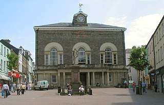
<span class="mw-page-title-main">Tenby</span> Seaside town and community in Wales

Tenby is a seaside town and community in the county of Pembrokeshire, Wales. It lies within Carmarthen Bay.
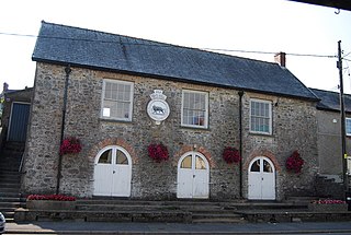
<span class="mw-page-title-main">St Clears</span> Town in Carmarthenshire, Wales

St Clears is a town on the River Taf and a community in Carmarthenshire, Wales. At the 2011 census, the population was 2,995. The community includes the small settlements of Bancyfelin and Pwlltrap. It is bordered by the Carmarthenshire towns and villages of Meidrim, Newchurch and Merthyr, Llangynog, Laugharne Township, Llanddowror, Eglwyscummin, Llanboidy and Llangynin.

<span class="mw-page-title-main">Glanamman</span> Village in Carmarthenshire, Wales

Glanamman is a mining village in the valley of the River Amman in Carmarthenshire, Wales. Glanamman has long been a stronghold of the Welsh language; village life is largely conducted in Welsh. Like the neighbouring village of Garnant it experienced a coal-mining boom in the 19th and early 20th centuries, but the last big colliery closed in 1947 and coal has been extracted fitfully since then.
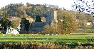
<span class="mw-page-title-main">Llanybydder</span> Market town and community in Carmarthenshire, Wales

Llanybydder is a market town and community straddling the River Teifi in Carmarthenshire, West Wales. At the 2011 Census, the population of the community was 1638, an increase from 1423 at the 2001 Census.

<span class="mw-page-title-main">West Wales lines</span> Railway lines west of Swansea, Wales

The West Wales lines are a group of railway lines from Swansea through Carmarthenshire to Pembrokeshire, West Wales. The main part runs from Swansea to Carmarthen and Whitland, where it becomes three branches to Fishguard, Milford Haven and Pembroke Dock.

<span class="mw-page-title-main">Richmond Park, Carmarthen</span> Sporting stadium in Carmarthen, Wales

Richmond Park is a Welsh Premier League stadium in Carmarthen, Wales. Situated on Priory Street, it is currently used for football matches and is the home ground of Carmarthen Town AFC.

<span class="mw-page-title-main">Llanddowror</span> Village and community in Carmarthenshire, Wales

Llanddowror is a village and community in Carmarthenshire, Wales situated 2 miles (3 km) from St. Clears. Previously on the trunk road to Pembroke Dock, the village is small, historic and relatively unspoilt.
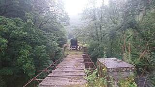
<span class="mw-page-title-main">Carmarthen–Aberystwyth line</span> Former railway line in Wales

The Carmarthen–Aberystwyth line was originally a standard-gauge branch line of the Great Western Railway (GWR) in Wales, connecting Carmarthen and Aberystwyth.

<span class="mw-page-title-main">Llanpumsaint</span> Village and community in Carmarthenshire, Wales

Llanpumsaint is a village and community in Carmarthenshire, Wales. In the 2001 UK Census, Llanpumsaint community had a population of 595. It is not to be confused with Pumsaint, a small village some distance away on the River Cothi. The population increased in 2011 to 734, and thus the percentage of Welsh speakers declined.

The South Wales Railway was a main line railway which opened in stages from 1850, connecting the Great Western Railway from Gloucester to South Wales. It was constructed on the broad gauge. An original aspiration was to reach Fishguard to engender an Irish ferry transit and transatlantic trade, but the latter did not materialise for many years, and never became an important sector of the business. Neyland was the western terminus of the line until 1906.

<span class="mw-page-title-main">Pembroke and Tenby Railway</span>

The Pembroke and Tenby Railway was a locally promoted railway in Pembrokeshire, Wales. It was built by local supporters and opened in 1863. The line, now known as the Pembroke Dock branch line, remains in use at the present day.

Newport West railway station is a proposed station to serve the western suburbs of the city of Newport, Wales.

<span class="mw-page-title-main">Caerleon railway station</span> Disused railway station in Wales

Caerleon railway station is a former station serving Caerleon on the east side of the city of Newport, UK and a proposed future station as part of the South Wales Metro.

Newport West Central railway station is a proposed station on the Ebbw Valley Railway in the city of Newport, Wales.

<span class="mw-page-title-main">Cockett railway station</span> Former railway station in Wales

Cockett railway station was a former station on the West Wales Line from Swansea to Gowerton and onwards to Llanelli.

A North–South Wales railway, also known as Traws Link Cymru is a proposed rail service line that would link North and South Wales via a western rail line from Swansea to Bangor. This includes re-opening the Carmarthen–Aberyswyth and the Bangor–Afon Wen line.

References

  1. 1 2 Butt, R.V.J. (1995). The Directory of Railway Stations. Yeovil: Patrick Stephens Ltd. p. 203. ISBN   1-85260-508-1. R508.
  2. MacDermot, E.T. (1927). History of the Great Western Railway, vol. I: 1833-1863. Paddington: Great Western Railway. pp. 572–3, 865.
  3. Conolly, W. Philip (January 1976). British Railways Pre-Grouping Atlas and Gazetteer (5th ed.). Shepperton: Ian Allan. p. 7, section A1. ISBN   0-7110-0320-3. EX/0176.
  4. 1 2 3 "Topics: St. Clears to reopen". The Railway Magazine . 119 (866): 269. June 1973.
  5. "Station campaign picks up steam". BBC News Online . 4 February 2009. Retrieved 26 November 2010.
  6. "Fresh support for calls to reopen town's rail station". Carmarthen Journal . 25 January 2012. Retrieved 25 January 2012.
  7. "Two New Railway Stations Planned for Wrexham as Part of Welsh Government Rail Infrastructure Improvements".
  8. Mosalski, Ruth (28 August 2019). "The new railway stations which could be built in Wales". walesonline. Retrieved 18 September 2019.
  9. Ruth Davies (3 December 2020). "St Clears' new rail station welcomed by Carmarthenshire County Council". Tivyside Advertiser. Retrieved 7 December 2020.
  10. "Work begins to re-open mainline railway station closed for over 50 years". Western Telegraph. 4 February 2022.
  11. Davies, Ruth (20 January 2023). "New St Clears station at Pembrokeshire gateway is 'long overdue'". Western Telegraph. Retrieved 10 February 2023.
  1. UK Retail Price Index inflation figures are based on data from Clark, Gregory (2017). "The Annual RPI and Average Earnings for Britain, 1209 to Present (New Series)". MeasuringWorth. Retrieved 11 June 2022.