Tornado outbreak sequence of June 20–26, 2023

Last updated
48°59′54″N99°57′37″W / 48.9983°N 99.9603°W / 48.9983; -99.9603 (William Lake Provincial Park (Jun. 20, EF1))
Tornado outbreak sequence of June 20–26, 2023
June 23, 2023, EF3 tornado damage in Granada, Colorado.jpg
A house that was completely destroyed by an EF3 tornado south of Granada, Colorado on June 23.
02:354.0 mi (6.5 km)230 yd (210 m)
Aerial surveys revealed a tornado touched down just south of the Canada–United States border and moved northeast into Canada. Damage was confined to numerous trees that were snapped or uprooted. Only the Canadian portion of the track was surveyed. [32] [33]
EF1NW of Killarney to SE of Ninette MB 49°13′59″N99°44′53″W / 49.2331°N 99.748°W / 49.2331; -99.748 (Killarney (Jun. 20, EF1)) 02:5510.9 mi (17.5 km)1,300 yd (1,200 m)
A large tornado snapped trees and caused roof and siding damage to a couple of homes, one of which was shifted slightly off its foundation. A camper was tipped over, a quonset hut was destroyed, and several grain bins and barns were destroyed as well. [32] [33]
EF1NE of MacGregor MB 49°59′26″N98°41′55″W / 49.9906°N 98.6987°W / 49.9906; -98.6987 (MacGregor (Jun. 20, EF1)) 04:304.2 mi (6.8 km)870 yd (800 m)
Trees were snapped and several grain bins and farm outbuildings were damaged. A farmhouse had minor damage, and some metal storage tanks were dented. [32] [33]

June 21 event

List of confirmed tornadoes – Wednesday, June 21, 2023 [note 1]
EF# LocationCounty / ParishStateStart Coord.Time (UTC)Path lengthMax width
EFUENE of Lorenzo Cheyenne NE 41°03′30″N103°01′24″W / 41.0583°N 103.0234°W / 41.0583; -103.0234 (Lorenzo (Jun. 21, EFU)) 19:330.59 mi (0.95 km)50 yd (46 m)
A local emergency manager observed a brief tornado. No damage occurred. [34]
EFUSSW of Padroni Logan CO 40°42′39″N103°11′56″W / 40.7109°N 103.1988°W / 40.7109; -103.1988 (Padroni (Jun. 21, EFU)) 19:44–19:470.46 mi (0.74 km)
A storm chaser observed a tornado that caused no damage. [35]
EFUSE of Akron Washington CO 40°03′57″N102°59′22″W / 40.0657°N 102.9894°W / 40.0657; -102.9894 (Akron (Jun. 21, EFU)) 21:05–21:100.67 mi (1.08 km)
A storm chaser observed a tornado over open fields. No damage occurred. [36] [35]
EFUNNE of Pawnee Pass Logan CO 40.0657|-102.9894|name=Pawnee Pass (Jun. 21, EFU)}}-->data-sort-value="" style="background: #ececec; color: #2C2C2C; vertical-align: middle; text-align: center; " class="table-na" | —21:35–21:461.5 mi (2.4 km)
Trained storm spotters observed a tornado over open country. No damage occurred. [35]
EFUS of Akron (1st tornado) Washington CO 39°59′57″N103°11′23″W / 39.9991°N 103.1896°W / 39.9991; -103.1896 (Akron (Jun. 21, EFU)) 22:10–22:110.3 mi (0.48 km)25 yd (23 m)
A storm chaser observed a brief rope tornado that moved over open fields and caused no damage. [35]
EFUS of Claude Armstrong TX 34°57′N101°23′W / 34.95°N 101.38°W / 34.95; -101.38 (Claude (Jun. 21, EFU)) 22:18-22:230.97 mi (1.56 km)100 yd (91 m)
A tornado occurred over an open field, causing no damage. [36]
EFUS of Akron (2nd tornado) Washington CO 40°01′15″N103°12′12″W / 40.0207°N 103.2032°W / 40.0207; -103.2032 (Akron (Jun. 21, EFU)) 22:18–22:220.51 mi (0.82 km)200 yd (180 m)
Storm chasers observed a cone tornado. No damage occurred. [35]
EFUS of Akron (3rd tornado) Washington CO 40.0207|-103.2032|name=Elba (Jun. 21, EFU)}}-->data-sort-value="" style="background: #ececec; color: #2C2C2C; vertical-align: middle; text-align: center; " class="table-na" | —22:25–22:261 mi (1.6 km)50 yd (46 m)
Storm chasers observed a tornado that remained over open country and caused no damage. [35]
EFUS of Akron (4th tornado) Washington CO 40°01′12″N103°11′50″W / 40.0200°N 103.1971°W / 40.0200; -103.1971 (Akron (Jun. 21, EFU)) 22:28–22:290.25 mi (0.40 km)50 yd (46 m)
A brief tornado touched down in an open field and caused no damage. [35]
EF2S of Akron (5th tornado) Washington CO 40°01′21″N103°12′31″W / 40.0225°N 103.2085°W / 40.0225; -103.2085 (Akron (Jun. 21, EF2)) 22:28–22:351.5 mi (2.4 km)400 yd (370 m)
Storm chasers observed a large tornado that snapped multiple wooden power poles along SH 63. [35]
EFUS of Akron (6th tornado) Washington CO 40.0200|-103.1971|name=Elba (Jun. 21, EFU)}}-->data-sort-value="" style="background: #ececec; color: #2C2C2C; vertical-align: middle; text-align: center; " class="table-na" | —22:29–22:300.5 mi (0.80 km)50 yd (46 m)
A storm chaser reported a brief satellite tornado in association with the 4th tornado south of Akron. No damage occurred. [35]
EFUS of Akron (7th tornado) Washington CO 40.0200|-103.1971|name=Elba (Jun. 21, EFU)}}-->data-sort-value="" style="background: #ececec; color: #2C2C2C; vertical-align: middle; text-align: center; " class="table-na" | —22:31–22:344 mi (6.4 km)50 yd (46 m)
A storm chaser reported a second, stronger satellite tornado in association with the 4th tornado south of Akron. No damage occurred. [35]
EFUS of Akron (8th tornado) Washington CO 40.0200|-103.1971|name=Elba (Jun. 21, EFU)}}-->data-sort-value="" style="background: #ececec; color: #2C2C2C; vertical-align: middle; text-align: center; " class="table-na" | —22:36–22:370.5 mi (0.80 km)
A storm chaser observed another brief tornado that caused no damage. [35]
EFUS of Akron (9th tornado) Washington CO 40°01′56″N103°14′19″W / 40.0323°N 103.2387°W / 40.0323; -103.2387 (Akron (Jun. 21, EFU)) 22:37–22:380.5 mi (0.80 km)
A storm chaser observed a tornado. No damage occurred. [35]
EFUS of Akron (10th tornado) Washington CO 40°01′58″N103°13′06″W / 40.0329°N 103.2183°W / 40.0329; -103.2183 (Akron (Jun. 21, EFU)) 22:39–22:400.25 mi (0.40 km)
A storm chaser observed a brief tornado that remained over open fields and caused no damage. [35]
EFUS of Akron (11th tornado) Washington CO 40°02′11″N103°13′37″W / 40.0363°N 103.2269°W / 40.0363; -103.2269 (Akron (Jun. 21, EFU)) 22:40–22:410.57 mi (0.92 km)
A storm chaser observed a brief tornado that moved across open fields and caused no damage. [35]
EFUS of Akron (12th tornado) Washington CO 40.0363|-103.2269|name=Akron (Jun. 21, EFU)}}-->data-sort-value="" style="background: #ececec; color: #2C2C2C; vertical-align: middle; text-align: center; " class="table-na" | —22:42–22:430.25 mi (0.40 km)
A storm chaser observed a brief tornado that caused no damage. [35]
EF1S of Akron (13th tornado) Washington CO 40°02′32″N103°14′44″W / 40.0422°N 103.2456°W / 40.0422; -103.2456 (Akron (Jun. 21, EF1)) 22:43–22:450.95 mi (1.53 km)200 yd (180 m)
This tornado caused some damage at a farmstead, but otherwise remained over open fields. [36] [35]
EFUS of Akron (14th tornado) Washington CO 40°02′23″N103°13′13″W / 40.0397°N 103.2202°W / 40.0397; -103.2202 (Akron (Jun. 21, EFU)) 22:43–22:450.5 mi (0.80 km)
A storm chaser observed a large tornado that remained over open country. No damage occurred. [35]
EFUS of Akron (15th tornado) Washington CO 40°02′49″N103°14′24″W / 40.0470°N 103.2400°W / 40.0470; -103.2400 (Akron (Jun. 21, EFU)) 22:45–22:460.5 mi (0.80 km)
A brief tornado touched down and moved across open fields. No damage occurred. [35]
EFUS of Akron (16th tornado) Washington CO 40°02′49″N103°13′30″W / 40.0470°N 103.2249°W / 40.0470; -103.2249 (Akron (Jun. 21, EFU)) 22:45–22:460.25 mi (0.40 km)50 yd (46 m)
A brief tornado touched down in an open field and caused no damage. This tornado occurred simultaneously with the previous one. [35]
EFUS of Akron (17th tornado) Washington CO 40°02′54″N103°14′07″W / 40.0484°N 103.2352°W / 40.0484; -103.2352 (Akron (Jun. 21, EFU)) 22:46–22:470.5 mi (0.80 km)
A storm chaser observed a brief tornado that moved over open fields. No damage occurred. [35]
EFUS of Akron (18th tornado) Washington CO 40.0484|-103.2352|name=Akron (Jun. 21, EFU)}}-->data-sort-value="" style="background: #ececec; color: #2C2C2C; vertical-align: middle; text-align: center; " class="table-na" | —22:47–22:480.5 mi (0.80 km)
A storm chaser observed another tornado. It remained over open country and caused no damage. [35]
EFUS of Akron (19th tornado) Washington CO 40°03′11″N103°14′10″W / 40.0531°N 103.2361°W / 40.0531; -103.2361 (Akron (Jun. 21, EFU)) 22:48–22:490.54 mi (0.87 km)100 yd (91 m)
A storm chaser observed a brief tornado that remained over open fields. No damage occurred. [35]
EFUS of Akron (20th tornado) Washington CO 40.0531|-103.2361|name=Akron (Jun. 21, EFU)}}-->data-sort-value="" style="background: #ececec; color: #2C2C2C; vertical-align: middle; text-align: center; " class="table-na" | —22:49–22:500.5 mi (0.80 km)
A storm chaser observed a large tornado that remained over open country. No damage occurred. [35]
EFUS of Akron (21st tornado) Washington CO 40°03′29″N103°14′56″W / 40.0580°N 103.2490°W / 40.0580; -103.2490 (Akron (Jun. 21, EFU)) 22:50–22:510.5 mi (0.80 km)
A storm chaser observed a brief tornado that remained over open fields and caused no damage. [35]
EFUS of Akron (22nd tornado) Washington CO 40.0580|-103.2490|name=Akron (Jun. 21, EFU)}}-->data-sort-value="" style="background: #ececec; color: #2C2C2C; vertical-align: middle; text-align: center; " class="table-na" | —22:51–22:520.5 mi (0.80 km)
A storm chaser observed another tornado in an open field. No damage occurred. [35]
EFUS of Akron (23rd tornado) Washington CO 40.0580|-103.2490|name=Akron (Jun. 21, EFU)}}-->data-sort-value="" style="background: #ececec; color: #2C2C2C; vertical-align: middle; text-align: center; " class="table-na" | —22:52–22:552 mi (3.2 km)200 yd (180 m)
A storm chaser observed yet another tornado that moved across open fields. No damage occurred. [35]
EFUS of Akron (24th tornado) Washington CO 40.0580|-103.2490|name=Akron (Jun. 21, EFU)}}-->data-sort-value="" style="background: #ececec; color: #2C2C2C; vertical-align: middle; text-align: center; " class="table-na" | —22:53–22:560.5 mi (0.80 km)
A storm chaser observed another tornado that occurred simultaneously with the previous one. No damage occurred. [35]
EFUS of Akron (25th tornado) Washington CO 40°03′48″N103°14′58″W / 40.0632°N 103.2495°W / 40.0632; -103.2495 (Akron (Jun. 21, EFU)) 22:57–23:10400 yd (370 m)
A storm chaser observed a large multi-vortex tornado that remained over open fields. No damage occurred. [35]
EFUS of Akron (26th tornado) Washington CO 40°04′32″N103°14′44″W / 40.0756°N 103.2455°W / 40.0756; -103.2455 (Akron (Jun. 21, EFU)) 23:15–23:191 mi (1.6 km)50 yd (46 m)
A storm chaser observed a brief cone tornado that remained over open fields, causing no damage. [35]
EF2S of Akron (27th tornado) Washington CO 40°05′43″N103°18′29″W / 40.0952°N 103.3080°W / 40.0952; -103.3080 (Akron (Jun. 21, EF2)) 23:20–23:363 mi (4.8 km)400 yd (370 m)
A strong tornado destroyed multiple grain bins and a barn. Wooden power poles were snapped as well. [35]
EF1NE of Willard Logan CO 40°34′25″N103°27′03″W / 40.5737°N 103.4509°W / 40.5737; -103.4509 (Willard (Jun. 21, EF1)) 23:30–23:400.25 mi (0.40 km)15 yd (14 m)
A brief high-end EF1 tornado tore most of the roof off of a farmhouse and caused its chimney to collapse. Tree damage occurred, and an old barn was destroyed as well. [36] [35]
EFUW of Woodward Washington CO 39°59′12″N103°25′58″W / 39.9866°N 103.4327°W / 39.9866; -103.4327 (Woodward (Jun. 21, EFU)) 23:39–23:53
A storm chaser observed a tornado that remained over open country. No damage occurred. [35]
EFUN of Anton (1st tornado) Washington CO 39°50′N103°13′W / 39.83°N 103.21°W / 39.83; -103.21 (Anton (Jun. 21, EFU)) 00:14–00:150.71 mi (1.14 km)50 yd (46 m)
Storm chasers observed a brief anticyclonic tornado that caused no damage. [35]
EF2NW of Anton Washington CO 39°51′55″N103°13′49″W / 39.8654°N 103.2302°W / 39.8654; -103.2302 (Anton (Jun. 21, EF2)) 00:16–00:224.94 mi (7.95 km)800 yd (730 m)
A strong multiple-vortex tornado snapped 15 wooden power poles. [36] [35]
EFUN of Anton (2nd tornado) Washington CO 39°52′16″N103°11′41″W / 39.8711°N 103.1946°W / 39.8711; -103.1946 (Anton (Jun. 21, EFU)) 00:35–00:401 mi (1.6 km)50 yd (46 m)
A trained spotter observed a brief cone tornado that remained over open country, causing no damage. [35]
EFUNNW of Anton Washington CO 39°50′N103°15′W / 39.83°N 103.25°W / 39.83; -103.25 (Anton 36 (Jun. 21, EFU)) 00:45–01:001.02 mi (1.64 km)
A trained spotter observed a tornado over open country. No damage occurred. [35]
EFUNE of Whiteflat Motley TX 34°07′N100°51′W / 34.12°N 100.85°W / 34.12; -100.85 (Whiteflat (Jun. 21, EFU)) 00:50–00:510.18 mi (0.29 km)30 yd (27 m)
Storm chasers reported a brief tornado that remained over open country. It did not cause damage. [37]
EF3NE of Whiteflat to S of Matador Motley TX 34°07′N100°51′W / 34.12°N 100.85°W / 34.12; -100.85 (Matador (Jun. 21, EF3)) 00:51–01:099.14 mi (14.71 km)600 yd (550 m)
4 deaths – See section on this tornado – 15 people were injured.
EF0SE of Lemmon Perkins SD 45°51′29″N102°02′33″W / 45.8581°N 102.0424°W / 45.8581; -102.0424 (Lemmon (Jun. 21, EF0)) 01:19–01:211.76 mi (2.83 km)50 yd (46 m)
A tornado touched down and moved across open fields. No damage was reported. [38]
EFUNE of Afton Dickens TX 33°49′N100°44′W / 33.82°N 100.73°W / 33.82; -100.73 (Afton (Jun. 21, EFU)) 01:36–01:370.06 mi (0.097 km)30 yd (27 m)
An off-duty National Weather Service employee reported a brief tornado over open country. It did not cause damage. [39]
EFUWSW of Matador Motley TX 34°01′N100°53′W / 34.01°N 100.89°W / 34.01; -100.89 (Matador (Jun. 21, EFU)) 01:37–01:402.82 mi (4.54 km)100 yd (91 m)
Local media streamed footage of a tornado. It remained over open country did not cause damage. [40]
EFUSW of Yoder Goshen WY 41°53′10″N104°20′38″W / 41.886°N 104.344°W / 41.886; -104.344 (Yoder (Jun. 21, EFU)) 01:44–01:461.01 mi (1.63 km)50 yd (46 m)
A trained spotter reported a stovepipe tornado before it quickly became rain-wrapped. No damage occurred. [41]
EFUE of Dickens Dickens TX 33°37′N100°43′W / 33.62°N 100.72°W / 33.62; -100.72 (Dickens (Jun. 21, EFU)) 02:18–02:190.35 mi (0.56 km)50 yd (46 m)
A storm chaser reported a brief tornado that touched down in a open field. It did not cause damage. [42]

June 22 event

List of confirmed tornadoes – Thursday, June 22, 2023 [note 1]
EF# LocationCounty / ParishStateStart Coord.Time (UTC)Path lengthMax width
EF1Northern Kinston Lenoir NC 35°17′06″N77°35′10″W / 35.285°N 77.586°W / 35.285; -77.586 (Kinston (Jun. 22, EF1)) 17:04–17:050.7 mi (1.1 km)100 yd (91 m)
This tornado touched down in the northern part of Kinston, where at least six large windows at a furniture store were bowed in or shattered, and a large AC unit on the top of the store was blown off. The exterior wall of a Salvation Army store was bowed out, a box truck parked nearby had a window blown out, and a dumpster was tossed about 100 yards (91 m). Some homes had minor damage to siding and shutters, a garden shed was blown off its foundation, and multiple trees were snapped. The tornado impacted UNC Health Care Lenoir, damaging an entrance sign and causing damage to a large section of a medical building's roof. A wooden power pole was snapped in half about 6 feet (1.8 m) off the ground, and power lines were downed as well. [43]
EF1NW of Allison Hemphill TX 35°42′N100°14′W / 35.7°N 100.23°W / 35.7; -100.23 (Allison (Jun. 22, EF1)) 20:41–20:5510.3 mi (16.6 km)150 yd (140 m)
Many trees were snapped or uprooted and two silos had their lids torn off, causing one of them to collapse. Two sheds and a barn had minor roof damage. [44]
EF1 Highlands Ranch Douglas CO 39°33′21″N105°00′57″W / 39.5559°N 105.0159°W / 39.5559; -105.0159 (Highlands Ranch (Jun. 22, EF1)) 21:24–21:486.3 mi (10.1 km)25 yd (23 m)
A rain-wrapped tornado moved though the Denver suburb of Highlands Ranch, snapping or uprooting many trees and toppling fences. Several houses had roof and window damage, one of which had a section of its roof torn off. Northridge Elementary School sustained considerable roof damage, and a tree was blown over onto the building. Valor Christian High School had windows blown out and also sustained damage to its athletic fields. [45]
EFUS of Chugwater Laramie WY 41°39′11″N104°52′46″W / 41.653°N 104.8794°W / 41.653; -104.8794 (Chugwater (Jun. 22, EFU)) 22:42–22:453.12 mi (5.02 km)50 yd (46 m)
A tornado briefly touched down over open country, causing no known damage. [46]
EF0SSE of Peyton El Paso CO 38°57′N104°25′W / 38.95°N 104.42°W / 38.95; -104.42 (Peyton (Jun. 22, EF0)) 02:08–02:100.85 mi (1.37 km)10 yd (9.1 m)
A cone tornado caused minor damage to structures. [47]

June 23 event

List of confirmed tornadoes – Friday, June 23, 2023 [note 1]
EF# LocationCounty / ParishStateStart Coord.Time (UTC)Path lengthMax width
EF0N of Grace Caribou ID 42°38′33″N111°43′12″W / 42.6424°N 111.72°W / 42.6424; -111.72 (Grace (Jun. 23, EF0)) 18:30–18:400.2 mi (0.32 km)10 yd (9.1 m)
A weak tornado over an open field was photographed. No damage occurred. [48]
EF0NE of Grainger Sweetwater WY 41°40′20″N109°49′09″W / 41.6721°N 109.8193°W / 41.6721; -109.8193 (Grainger (Jun. 23, EF0)) 19:35–19:371.55 mi (2.49 km)30 yd (27 m)
A landspout tornado was caught on video. It remained over open country and caused no damage. [49]
EF0N of Natrona Natrona WY 43°13′57″N106°49′12″W / 43.2326°N 106.82°W / 43.2326; -106.82 (Natrona (Jun. 23, EF0)) 20:37–20:402.21 mi (3.56 km)30 yd (27 m)
A rope tornado remained over open country, causing no damage. [50]
EF0N of Kaycee Johnson WY 43°44′04″N106°39′00″W / 43.7345°N 106.65°W / 43.7345; -106.65 (Kaycee (Jun. 23, EF0)) 20:40–20:410.53 mi (0.85 km)40 yd (37 m)
A rancher reported a brief tornado. It remained over open country and caused no damage. [51]
EF1SSW of Midwest to ESE of Edgerton Natrona WY 43°17′59″N106°20′55″W / 43.2997°N 106.3486°W / 43.2997; -106.3486 (Midwest (Jun. 23, EF1)) 21:15–21:2510.83 mi (17.43 km)100 yd (91 m)
A house had a large section of its roof torn off as result of this high-end EF1 tornado. A trailer was overturned, fuel tanks were blown away, and trees were damaged. [52]
EFUESE of Ross Converse WY 43°26′N105°50′W / 43.43°N 105.84°W / 43.43; -105.84 (Ross (Jun. 23, EFU)) 22:330.25 mi (0.40 km)50 yd (46 m)
A brief tornado touched down in an open field and caused no damage. [53]
EFUENE of Chugwater (1st tornado) Platte WY 41°46′28″N104°44′51″W / 41.7745°N 104.7474°W / 41.7745; -104.7474 (Chugwater (Jun. 23, EFU)) 23:110.01 mi (0.016 km)50 yd (46 m)
A tornado briefly touched down in an open field. No damage occurred. [54]
EFUENE of Chugwater (2nd tornado) Goshen WY 41°47′38″N104°38′46″W / 41.794°N 104.646°W / 41.794; -104.646 (Chugwater (Jun. 23, EFU)) 23:29–23:373 mi (4.8 km)50 yd (46 m)
Numerous photos and videos showed a cone tornado that remained over open country, causing no damage. [55]
EF2 North Antelope Rochelle Mine to WSW of Rochelle Campbell, Weston WY 43°29′55″N105°21′23″W / 43.4986°N 105.3563°W / 43.4986; -105.3563 (North Antelope Rochelle Mine (Jun. 23, EF2)) 23:59–01:209.81 mi (15.79 km)800 yd (730 m)
A strong tornado touched down near the Campbell/Converse County Line, initially snapping wooden power poles. It moved northeast and struck the North Antelope Rochelle Mine, the largest coal mine in the world. The operations area was directly impacted, where some metal buildings were damaged and cars, buses, and shipping containers were flipped or thrown. Twelve cars on an empty train were knocked over as well, and eight employees were injured. The tornado continued into Weston County, downing trees and partially unroofing a house before dissipating. [56] [57]
EFUW of Hawk Springs Goshen WY 41°46′22″N104°24′54″W / 41.7728°N 104.4151°W / 41.7728; -104.4151 (Hawk Springs (Jun. 23, EFU)) 00:03–00:040.5 mi (0.80 km)50 yd (46 m)
Storm spotters photographed and took video of a brief tornado that remained over open country. No damage occurred. [58]
EF2S of Hawk Springs Goshen WY 41°46′34″N104°15′39″W / 41.7762°N 104.2608°W / 41.7762; -104.2608 (Hawk Springs (Jun. 23, EF2)) 00:21–00:374.72 mi (7.60 km)800 yd (730 m)
This strong tornado quickly became rain-wrapped after it touched down. An irrigation pivot was partially ripped from its concrete base, numerous power poles were snapped, and trees were snapped or uprooted. A small shed was swept away and destroyed, a barn was leveled, and a house had a tree branch impaled into its stucco siding. A railroad crossing sign was pulled out of the ground, and an 18-wheeler was flipped on US 85, injuring the driver. [59] [60]
EF1SE of Campo to W of Elkhart, KS Baca CO 37°02′N102°20′W / 37.03°N 102.33°W / 37.03; -102.33 (Campo (Jun. 23, EF1)) 00:33–00:568.43 mi (13.57 km)100 yd (91 m)
A long-lived tornado remained mostly over open county, though two structures at an abandoned farmstead were damaged and some power poles were downed. [61]
EF3SSW of Granada Prowers CO 37°58′32″N102°23′17″W / 37.9756°N 102.388°W / 37.9756; -102.388 (Granada (Jun. 23, EF3)) 00:40–01:2213.12 mi (21.11 km)320 yd (290 m)
This intense and highly-photogenic cone tornado remained mainly over open country, but caused major damage at a farmstead. A house on the property was completely destroyed and had only part of one interior wall still standing. Two barns were completely swept away with very little debris remaining, vehicles and pieces of farm machinery were thrown and destroyed, and trees were denuded and debarked. A metal-framed outbuilding was obliterated with only some mangled beams left behind, and a concrete footing was pulled out of the ground at that location. Eight cattle were killed at the farmstead. The tornado moved southeast from the farm, looped over its own path in an open field, and downed some wooden power poles before it dissipated. This was the strongest tornado to impact Colorado since an EF3 tornado that struck areas near Berthoud on June 4, 2015. [62] [63] [64]
EF1E of Hawk Springs Goshen WY 41°47′N104°08′W / 41.78°N 104.14°W / 41.78; -104.14 (Hawk Springs (Jun. 23, EF1)) 00:44–00:583.9 mi (6.3 km)20 yd (18 m)
This was the third and final tornado near Hawk Springs. An outbuilding collapsed and a few light poles and flag poles were bent. [65]
EFUW of Gering Scotts Bluff NE 41°49′16″N103°56′17″W / 41.821°N 103.938°W / 41.821; -103.938 (Gering (Jun. 23, EFU)) 01:04–01:113.53 mi (5.68 km)50 yd (46 m)
A tornado moved over open fields near Gunsight Pass, causing no damage. [66]
EFUW of Gering Scotts Bluff NE 41°51′N103°51′W / 41.85°N 103.85°W / 41.85; -103.85 (Gering (Jun. 23, EFU)) 01:22–01:273.16 mi (5.09 km)50 yd (46 m)
Storm spotters observed a tornado that became rain-wrapped over open fields near Rifle Sight Pass. No damage occurred. [67]
EFUS of Holly Prowers CO 37°52′N102°08′W / 37.86°N 102.14°W / 37.86; -102.14 (Holly (Jun. 23, EFU)) 01:23unknownunknown
A tornado occurred over open country, causing no damage. [68]
EF2E of Gering to SE of Scottsbluff Scotts Bluff NE 41°49′N103°38′W / 41.82°N 103.63°W / 41.82; -103.63 (Gering (Jun. 23, EF2)) 01:38–01:452.48 mi (3.99 km)700 yd (640 m)
A strong multiple-vortex tornado formed east of Gering and crossed the North Platte River as it moved northeast, prompting a tornado emergency. A house had major structural damage to the southeast of Scottsbluff, sustaining loss of its roof and some exterior walls. Debris was scattered up to 0.5 mi (0.80 km) away from the house, cars on the property were thrown up to 50 feet (15 meters) away, and a small wooden trailer was thrown a quarter-mile. Power poles were snapped and irrigation pivots were overturned elsewhere along the path. The tornado passed over wastewater treatment ponds, sucking water from them before dissipating. A man was injured inside a vehicle that was flipped. [69] [70]
EF0N of Johnson City Stanton KS 37°40′N101°45′W / 37.67°N 101.75°W / 37.67; -101.75 (Johnson City (Jun. 23, EFU)) 01:400.01 mi (0.016 km)1 yd (0.91 m)
A storm chaser reported a tornado. It remained over open country and caused no damage. [71]
EF1SE of Gering Scotts Bluff NE 41°49′N103°37′W / 41.81°N 103.62°W / 41.81; -103.62 (Gering (Jun. 23, EF1)) 01:44–01:471.24 mi (2.00 km)50 yd (46 m)
This tornado was spawned by a secondary circulation just south of the stronger Scottsbluff EF2 tornado. A quonset hut collapsed and several power poles were snapped. [72]
EFUESE of Gering Scotts Bluff NE 41°49′N103°35′W / 41.81°N 103.59°W / 41.81; -103.59 (Gering (Jun. 23, EFU)) 01:500.5 mi (0.80 km)50 yd (46 m)
A trained spotter reported a rain-wrapped tornado over open country. No damage occurred. [73]
EFUW of Minatare Scotts Bluff NE 41°49′N103°32′W / 41.82°N 103.54°W / 41.82; -103.54 (Minatare (Jun. 23, EFU)) 02:050.5 mi (0.80 km)50 yd (46 m)
A trained spotter reported a tornado over open country. No damage occurred. [74]
EF0NE of Johnson City to NW of Ulysses Stanton, Grant KS 37°39′N101°34′W / 37.65°N 101.56°W / 37.65; -101.56 (Johnson City (Jun. 23, EF0)) 02:09–02:124.2 mi (6.8 km)1 yd (0.91 m)
A storm chaser reported a tornado over open country. No damage occurred [75]
EFUENE of Johnson City Stanton KS 37°35′N101°34′W / 37.59°N 101.56°W / 37.59; -101.56 (Johnson City (Jun. 23, EFU)) 02:15–02:171.2 mi (1.9 km)unknown
A cone tornado remained over open country, causing no damage. [76]
EFUE of Lynn Morrill NE 41°49′N102°51′W / 41.81°N 102.85°W / 41.81; -102.85 (Lynn (Jun. 23, EFU)) 03:510.5 mi (0.80 km)50 yd (46 m)
A storm chaser reported a brief tornado that caused no damage. [77]

June 24 event

List of confirmed tornadoes – Saturday, June 24, 2023 [note 1]
EF# LocationCounty / ParishStateStart Coord.Time (UTC)Path lengthMax width
EFUN of Lake Park (1st tornado) Becker MN 46°58′16″N96°05′55″W / 46.9710°N 96.0987°W / 46.9710; -96.0987 (Lake Park (Jun. 24, EFU)) 20:20–20:231.98 mi (3.19 km)
Local broadcast media photographed a tornado. It remained over an open field and caused no damage. [78] [36]
EFUNW of Borup Norman MN 47°14′51″N96°35′53″W / 47.2474°N 96.5981°W / 47.2474; -96.5981 (Borup (Jun. 24, EFU)) 20:25–20:302.35 mi (3.78 km)
A trained spotter observed a tornado over an open field. No damage occurred. [79] [36]
EFUW of Waubun Mahnomen MN 47°11′18″N96°03′35″W / 47.1883°N 96.0597°W / 47.1883; -96.0597 (Waubun (Jun. 24, EFU)) 20:54
A brief tornado touched down in an open field, causing no damage. [36]
EFUS of Waubun Mahnomen MN 47°09′32″N95°56′49″W / 47.1588°N 95.9469°W / 47.1588; -95.9469 (Waubun (Jun. 24, EFU)) 21:03
A brief tornado touched down in an open field, causing no damage. [36]
EFUNE of Shelly Norman, Polk MN 47°29′41″N96°44′02″W / 47.4946°N 96.734°W / 47.4946; -96.734 (Shelly (Jun. 24, EFU)) 21:10–21:161.45 mi (2.33 km)
This tornado remained over open fields. No damage occurred. [36]
EF0SW of Lockhart Norman MN 47°24′22″N96°35′57″W / 47.4061°N 96.5992°W / 47.4061; -96.5992 (Lockhart (Jun. 24, EF0)) 21:12–21:152.03 mi (3.27 km)20 yd (18 m)
A brief tornado damaged trees in a shelterbelt. [36] [80]
EF2E of Mahnomen Mahnomen MN 47°15′15″N95°56′16″W / 47.2542°N 95.9378°W / 47.2542; -95.9378 (Mahnomen (Jun. 24, EF2)) 21:15–21:407 mi (11 km)250 yd (230 m)
An intermittent but strong multiple-vortex tornado damaged several farmsteads. A two-story house had its entire roof torn off, a metal quonset hut was caved in, and a garage was shifted off its foundation and collapsed. Several fuel tanks were thrown over a barn into a shed, knocking it off its foundation. Multiple trees were snapped or uprooted, some power poles were snapped, and crop damage occurred as well. [36] [81]
EFUNW of Lockhart Norman MN 47°32′59″N96°38′21″W / 47.5498°N 96.6392°W / 47.5498; -96.6392 (Lockhart (Jun. 24, EF0)) 21:25
A brief tornado touched down over an open field. No damage occurred. [36]
EFUN of Lake Park (2nd tornado) Becker MN 47°07′45″N96°04′37″W / 47.1293°N 96.0770°W / 47.1293; -96.0770 (Lake Park (Jun. 24, EFU)) 21:36
A brief tornado touched down. No damage occurred. [36]
EFUWNW of Beltrami Polk MN 47°32′59″N96°38′21″W / 47.5498°N 96.6392°W / 47.5498; -96.6392 (Beltrami (Jun. 24, EFU)) 21:44
A brief tornado touched down over open fields and caused no damage. [36]
EFUNW of Beltrami (1st tornado) Polk MN 47°34′33″N96°36′31″W / 47.5757°N 96.6085°W / 47.5757; -96.6085 (Beltrami (Jun. 24, EFU)) 21:49–21:520.99 mi (1.59 km)
A tornado moved through open fields, causing no damage. [36]
EFUWNW of Beltrami (2nd tornado) Polk MN 47°34′06″N96°38′35″W / 47.5683°N 96.6431°W / 47.5683; -96.6431 (Beltrami (Jun. 24, EFU)) 21:52
A brief tornado touched down over an open field and caused no damage. [36]
EF0E of Walcott to Northern Davenport Scott IA 41°36′15″N90°42′41″W / 41.6041°N 90.7113°W / 41.6041; -90.7113 (Davenport (Jun. 24, EF0)) 03:31–03:459.63 mi (15.50 km)20 yd (18 m)
A weak tornado touched down east of Walcott, leaving swirl marks in grassy fields as it moved east. It then moved into the northern outskirts of Davenport, where tree branches were snapped and a gas station canopy sustained minor damage at a Flying J truck stop. It also struck the Davenport Airport, where the Quad City Air Show was being held. Damage to tents, canopies, and equipment occurred at the airport before the tornado continued east, causing some additional minor damage to trees and structures before dissipating. [82]
EF0N of Pocahontas to SW of Rolfe Pocahontas IA 42°46′38″N94°39′17″W / 42.7772°N 94.6547°W / 42.7772; -94.6547 (Pocahontas (Jun. 24, EF0)) 04:02–04:072.77 mi (4.46 km)80 yd (73 m)
A weak tornado moved a grain bin off its foundation and rolled it into a field. [83]

June 25 event

List of confirmed tornadoes – Sunday, June 25, 2023 [note 1]
EF# LocationCounty / ParishStateStart Coord.Time (UTC)Path lengthMax width
EF2Southern Greenwood to W of New Whiteland Johnson IN 39°34′09″N86°13′16″W / 39.5692°N 86.221°W / 39.5692; -86.221 (Bargersville (Jun. 25, EF2)) 20:13–20:235.4 mi (8.7 km)400 yd (370 m)
A low-end EF2 tornado damaged numerous homes as it moved through residential areas in the Indianapolis suburb of Greenwood. Many homes suffered varying degrees of roof damage, and a few had large sections of their roofs torn off. An apartment building that was under construction had its roof torn off, and debris from the building was left impaled into the ground. Other apartment buildings sustained significant roof damage, and a vacant grocery store had roof damage as well. Many trees and power poles were snapped, a camper trailer was thrown 100 feet (15 meters) and destroyed, and a pool shed was destroyed as well. [84] [85]
EF1S of Crane Daviess, Martin IN 38°53′13″N86°57′29″W / 38.887°N 86.958°W / 38.887; -86.958 (Crane (Jun. 25, EF1)) 20:21–20:303.73 mi (6.00 km)100 yd (91 m)
A tornado snapped and uprooted many trees as it moved through areas in and around the Naval Surface Warfare Center Crane Division grounds. [86] [87]
EF1NW of Oolitic Monroe IN 39°01′43″N86°40′28″W / 39.0287°N 86.6745°W / 39.0287; -86.6745 (Oolitic (Jun. 25, EF1)) 20:30–20:374.45 mi (7.16 km)100 yd (91 m)
A couple of homes suffered extensive roof damage, another house had a window blown out, and multiple barns and outbuildings were damaged or destroyed. Many trees were snapped or uprooted, and several fences were knocked over as well. [88]
EF2ENE of Alfordsville to Rusk to W of Hillham Martin, Dubois IN 38°35′06″N86°52′00″W / 38.585°N 86.8666°W / 38.585; -86.8666 (Alfordsville (Jun. 25, EF2)) 20:34–20:469.12 mi (14.68 km)565 yd (517 m)
1 death This strong tornado touched down in a rural area to the east of Alfordsville, where a house suffered major roof damage and had its attached garage destroyed. A car was also flipped at this location. The tornado then moved southeastward and caused some ground scouring in open farm fields before it continued into the Hoosier National Forest, where it snapped and uprooted countless large trees. It reached peak intensity as it moved through the rural community of Rusk, where a two-story cabin was completely destroyed, trees were downed, and some power poles were snapped. One person was killed and another was injured in the cabin. The tornado continued to the southeast through remote wooded areas, snapping and uprooting a large swath of trees and destroying some outbuildings before dissipating. [89] [90]
EF1ENE of Dover Pope AR 35°25′04″N93°04′20″W / 35.4178°N 93.0723°W / 35.4178; -93.0723 (Dover (Jun. 25, EF1)) 21:19–21:200.6 mi (0.97 km)50 yd (46 m)
A brief tornado snapped and uprooted trees along its path. [91]
EFU Camp Robinson Pulaski AR 34°55′12″N92°18′19″W / 34.9199°N 92.3054°W / 34.9199; -92.3054 (Camp Robinson (Jun. 25, EFU)) 22:37–22:380.2 mi (0.32 km)50 yd (46 m)
A tornado was photographed over a heavily forested area of Camp Robinson, however it was non-surveyable due to widespread wind damage in the area. [92]
EF0Western Windsor Essex ON 42°17′25″N83°03′15″W / 42.2903°N 83.0542°W / 42.2903; -83.0542 (Windsor (Jun. 25, EF0)) 22:451.26 mi (2.02 km)200 yd (180 m)
A weak tornado moved through residential areas in the western part of Windsor, downing tree limbs. [32]
EF0Eastern Windsor to Tecumseh Essex ON 42°18′21″N82°54′33″W / 42.3057°N 82.9091°W / 42.3057; -82.9091 (Windsor (Jun. 25, EF0)) 23:002.91 mi (4.69 km)130 yd (120 m)
A narrow tornado caused minor damage as it moved from the east side of Windsor into Tecumseh. Many homes had minor roof and fascia damage, tree branches were downed, and fences were toppled over. A metal building, a business, and the steeple of a church sustained minimal damage as well. [32]
EF2W of Cecilia Hardin KY 37°40′55″N86°00′48″W / 37.682°N 86.0133°W / 37.682; -86.0133 (Cecilia (Jun. 25, EF2)) 02:27–02:321.17 mi (1.88 km)300 yd (270 m)
This strong tornado partially or completely unroofed a few homes near the rural community of Franklin Crossroads. A carport was torn from one house and thrown into a field, and some barns and outbuildings were damaged or destroyed as well. Two vehicles were moved, an RV was knocked over, and a gazebo was thrown. Large trees were snapped or uprooted and some crop damage occurred as well. [93]
EF1Southwestern Jamestown Russell KY 36°58′33″N85°05′10″W / 36.9757°N 85.0861°W / 36.9757; -85.0861 (Jamestown (Jun. 25, EF1)) 04:25–04:260.67 mi (1.08 km)300 yd (270 m)
A brief high-end EF1 tornado touched down in the southwestern part of Jamestown, where an apartment building and a carpet business both sustained considerable roof damage, and two other buildings had their gabled porch roofs torn off. A small automotive museum and an auto parts store had windows blown out, and a cinder block garage was destroyed. Many trees were snapped or uprooted, and a tree branch was speared through the exterior wall of a house. [94]

June 26 event

List of confirmed tornadoes – Monday, June 26, 2023 [note 1]
EF# LocationCounty / ParishStateStart Coord.Time (UTC)Path lengthMax width
EF0ENE of Martins Creek Northampton PA 40°47′25″N75°08′43″W / 40.7904°N 75.1453°W / 40.7904; -75.1453 (Roxburg (Jun. 26, EF0)) 18:58–19:043.37 mi (5.42 km)60 yd (55 m)
A tornado moved through wheat fields, causing minor damage to crops. [95]
EF0S of Clearview Simcoe ON 44°23′09″N80°06′13″W / 44.3857°N 80.1035°W / 44.3857; -80.1035 (Clearview (Jun. 26, EF0)) 19:201.75 mi (2.82 km)130 yd (120 m)
A short-lived tornado caused minor damage to homes, fences, trees, and crops. [32]
EF1 Bernardsville Somerset NJ 40°42′39″N74°34′49″W / 40.7109°N 74.5804°W / 40.7109; -74.5804 (Bernardsville (Jun. 26, EF1)) 19:29–19:341.38 mi (2.22 km)475 yd (434 m)
A brief tornado snapped or uprooted numerous trees in Bernardsville, some of which fell on cars and power lines. A few large hardwood trees were snapped at their trunks, however analysis determined them to not be healthy, preventing a higher intensity rating. [96]
EF0SSW of Tweed Hastings ON 44°27′11″N77°19′20″W / 44.4531°N 77.3223°W / 44.4531; -77.3223 (Tweed (Jun. 26, EF0)) 20:353.81 mi (6.13 km)490 yd (450 m)
A weak tornado moved along the western side of Stoco Lake. A few trees were snapped or uprooted. [32]
EF0NE of Tweed Hastings ON 44°29′28″N77°16′25″W / 44.4911°N 77.2735°W / 44.4911; -77.2735 (Tweed (Jun. 26, EF0)) 20:452.04 mi (3.28 km)260 yd (240 m)
A weak tornado touched down near where the first Tweed tornado dissipated along the northern end of Stoco Lake. A few trees were snapped or uprooted. [32]
EF1N of Tweed Hastings ON
A tornado moved through remote wooded areas to the north of Tweed, snapping and uprooting trees. [32]
EF1NE of Actinolite Hastings ON
A tornado moved through remote wooded areas to the northeast of Actinolite, snapping and uprooting trees. [32]
EF0NE of Elzevir Hastings ON
Some trees were downed and a barn sustained minor damage. [32]
EF1W of Albin Laramie WY 41°24′40″N104°20′20″W / 41.411°N 104.339°W / 41.411; -104.339 (Albin (Jun. 26, EF1)) 00:42–00:503.57 mi (5.75 km)1,000 yd (910 m)
A house sustained roof damage and an outbuilding was destroyed, with debris strewn hundreds of yards away. Hay bales weighing up to 1,400 lb (640 kg) were thrown up to 0.5 mi (0.80 km) away. Eight old wooden power poles were snapped shortly before the tornado dissipated. [97]
EF1SW of Albin Laramie WY 41°21′54″N104°16′48″W / 41.365°N 104.28°W / 41.365; -104.28 (Albin (Jun. 26, EF1)) 00:52–01:053.55 mi (5.71 km)1,000 yd (910 m)
A large tornado snapped eleven wooden power poles. [98]
EF0SSE Albin Laramie WY 41°18′58″N104°03′40″W / 41.316°N 104.061°W / 41.316; -104.061 (Albin (Jun. 26, EF0)) 01:180.1 mi (0.16 km)50 yd (46 m)
A brief tornado overturned an irrigation pivot. [99]
EF1SW of Kimball Kimball NE 41°11′38″N103°45′29″W / 41.194°N 103.758°W / 41.194; -103.758 (Kimball (Jun. 26, EF1)) 02:01–02:051.56 mi (2.51 km)100 yd (91 m)
A rope tornado touched down south of I-80 and impacted a farmstead, where a cinder block outbuilding was destroyed and debris was tossed up to 50 yd (46 m) away. A shipping container was shifted off its foundation and a 20,000 lb (9,100 kg) tandem-disk plow was moved 15 ft (4.6 m). [100]
EFUS of Kimball Kimball NE 41°12′N103°40′W / 41.2°N 103.66°W / 41.2; -103.66 (Kimball (Jun. 26, EFU)) 02:290.5 mi (0.80 km)50 yd (46 m)
A National Weather Service Employee observed a brief tornado over open country. No damage occurred. [101]

Matador, Texas

This very intense tornado touched down along CR 205 to the north-northwest of Matador and tracked due-south at EF2 strength, snapping multiple power poles and trees. The tornado turned in a more south-southeastward direction and rapidly intensified to high-end EF3 intensity near FM 94 just northwest of Matador. A house was swept completely away in this area with only its basement left behind, where a family of three survived as the house was swept away above them. Two vehicles parked at this residence were thrown long distances and were never located, while a third was found hundreds of yards away. A large metal canopy on the property was also destroyed, and trees near the residence were uprooted and significantly debarked. The tornado then moved south through an open field, producing a swath of ground scouring before it destroyed two homes near SH 70 as it entered the far northwestern outskirts of Matador. A truck was thrown over 200 feet from one home and was mangled beyond recognition, two more homes near Pipkin Street had their roofs torn off, extreme debarking of trees was observed in this area, and damage along this segment of the path was rated mid-range EF3. The tornado reached high-end EF3 intensity again as it continued due-south, completely destroying multiple buildings at the intersection of US 62 and SH 70 at the west edge of town. A two-story brick home and several nearby outbuildings were completely swept away near Stewart Avenue, and another brick home was flattened at the intersection of Dundee Avenue and Echols Road. Several other homes in this area were significantly damaged and multiple vehicles were rolled and mangled, one of which had a metal pole driven into it. A tractor-trailer was tossed as well, and debris was strewn throughout this area. A recently-built, metal-framed Dollar General store on the south side of US 62 was completely leveled at high-end EF3 intensity, with its beams twisted and bolted anchor plates torn from the building's concrete foundation. Concrete parking bollards at this location were snapped at ground-level as well, and a semi-truck was torn from its chassis and destroyed, killing the driver. [102] Two convenience stores to the east of the Dollar General store were damaged, and a restaurant and motel were both partially destroyed. A small house and several metal buildings were completely destroyed nearby, one of which had sections of its tile floor removed. Trees in this area were again debarked, some of which were torn of out the ground by their root balls. An RV was thrown and a power substation was partially collapsed as well, leaving 99% of the town without electricity. [103] Past the intersection, the tornado maintained high-end EF3 strength as it paralleled SH 70 and kept moving south, causing major damage at the southwest edge of town. A home was completely leveled and mostly swept from its foundation, and large trees were completely debarked and stripped of their branches nearby. Several other houses suffered major structural damage, and a large metal outbuilding was completely swept off its foundation. A truck was thrown and had its Ford Power Stroke engine ripped out, which was tossed into a pond. A livestock trailer was thrown as well, and debris from destroyed buildings was scattered across fields. [36]

The tornado started to weaken and began moving in a more south-southeasterly direction as it crossed SH 70, where it destroyed a guyed 500-foot (150 m) tall radio tower and caused additional major tree damage. A house near the highway was destroyed, and damage in this area was rated low-end EF3. Some ground scouring was observed in this area, and multiple fence posts, power poles, light poles, and signs were blown to the ground along the highway as well. The tornado then weakened rapidly and turned further to the southeast, inflicting minor damage to a house and a barn before it dissipated in a nearby field. In total, four people were killed and 15 others were injured by the tornado. [1] One of the four people killed by the tornado was first reported as injured and later died at a local hospital. [36] [104] [105] [106] [107] The final rating of this tornado was a source of some controversy, as it leveled or swept away multiple homes and produced extreme contextual damage, which some people felt warranted a violent (EF4+) rating. [108]

Non-tornadic events

Great Plains

On June 21, a downburst produced estimated winds of 125 mph (201 km/h) near Selfridge, North Dakota. A manufactured home was completely destroyed with debris strewn downstream. One person was injured. [2] That day, a person was killed in Nebraska due to a lightning strike. [109]

Around 9:30 p.m. MDT, a hailstorm impacted the Red Rocks Amphitheatre in the Denver metropolitan area during a concert. [110] Hailstones up to 2 in (5.1 cm) in diameter pelted concertgoers and accumulated several inches deep in the stands. [111] Three acts were scheduled that night with the second being delayed 15 minutes prior to the storm's arrival. Attendees did not seek shelter until a warning to do so was given 3 minutes before the hail started. [112] Nearly 100 people were injured, with injuries ranging from cuts and bruises to broken bones, [111] as they were unable to get indoors or to their cars in time; 8 people required hospitalization. An employee described people as having panic attacks and other workers being frozen and unable to act. Numerous cars were damaged in the venue's parking lot. [112] Severe weather that night forced a Major League Soccer game between the Colorado Rapids and Vancouver Whitecaps to be postponed. [113] The storm also caused one fatality due to flooding in Arapahoe County, Colorado. [114]

Southeastern United States

The same supercell that produced the EF3 Matador tornado also produced destructive winds and hail, with gusts measured up to 109 mph (175 km/h) in Jayton and hailstones exceeding 4 in (10 cm) in diameter. [115] Sustained winds in Jayton were also measured up to 86 mph (138 km/h). [116] At least 900 people were left without power from the storm. [115] A powerful thunderstorm impacted the Greater Houston area, leaving roughly 324,000 customers without power. [117] A narrow area of hurricane-force winds impacted George Bush Intercontinental Airport where a record gust of 97 mph (156 km/h) was observed. This surpassed the airport's previous highest gust of 82 mph (132 km/h) during Hurricane Ike in 2008. [118]

On June 25, widespread damaging winds left almost 150,000 customers without power in Arkansas. [119] Two people were killed in Carlisle when a tree fell on their home and one person was injured in another incident. [120] Governor Sarah Huckabee Sanders declared a state of emergency on June 26. [119] Severe storms in Georgia left approximately 300,000 people without power. One person was killed in northern Atlanta when a tree fell on him. Two people were injured in Cherokee County. At Hartsfield-Jackson Atlanta International Airport, the storms prompted the cancellation of 86 flights and delayed an additional 57 flights. The combination of heavy rain and winds caused trees to fall at the North Georgia Wildlife Park in White County; several animal enclosures required repairs. [121] A macroburst impacted Madison County, Kentucky, with damage spanning an area 2.5 mi (4 km) wide and 8.4 mi (13.5 km) long. Maximum winds were estimated at 110 mph (180 km/h). Numerous trees were snapped or uprooted and many barns and homes suffered roof damage. [122] Winds of 90 to 100 mph (140 to 160 km/h) affected parts of Bullitt County. [123] Straight-line winds of 90 to 95 mph (145 to 153 km/h) impacted Floyd County, Indiana, with a barn having its roof torn off and thrown 150 yd (140 m) downstream. [124]

Northeastern United States

On June 26, heavy rain led to flash flooding in New Jersey, with rainfall peaking at 3.99 in (101 mm) in Paterson. Over 16,000 customers in New Jersey lost power due to the storms. [125] In the Lehigh Valley, rainfall totals were in the 2.5–5.5 in (64–140 mm) range, leading to 3,300 power outages. [126] Rainfall totals reached 4.71 in (120 mm) in the state of Delaware. [127] The storm led to over 500 flights delayed and 300 flights cancelled at Newark Liberty International Airport, as well as ground stops at both LaGuardia Airport and John F. Kennedy International Airport. [128] In total, over 7,000 flights were delayed due to severe weather, with 811 flights being cancelled, on June 26. [129] Flooding also resulted in U.S. Route 9 shutting down in Latham Circle. [130] Major League Baseball suspended a baseball game at Camden Yards for two hours due to the storms. [131]

See also

Notes

  1. 1 2 3 4 5 6 7 All dates are based on the local time zone where the tornado touched down; however, all times are in Coordinated Universal Time for consistency.

Related Research Articles

<span class="mw-page-title-main">Storm Prediction Center</span> American severe weather forecasting center

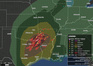
The Storm Prediction Center (SPC) is a US government agency that is part of the National Centers for Environmental Prediction (NCEP), operating under the control of the National Weather Service (NWS), which in turn is part of the National Oceanic and Atmospheric Administration (NOAA) of the United States Department of Commerce (DoC).

<span class="mw-page-title-main">Tornado outbreak sequence of May 2003</span>

From May 3 to May 11, 2003, a prolonged and destructive series of tornado outbreaks affected much of the Great Plains and Eastern United States. Most of the severe activity was concentrated between May 4 and May 10, which saw more tornadoes than any other week-long span in recorded history; 335 tornadoes occurred during this period, concentrated in the Ozarks and central Mississippi River Valley. Additional tornadoes were produced by the same storm systems from May 3 to May 11, producing 363 tornadoes overall, of which 62 were significant. Six of the tornadoes were rated F4, and of these four occurred on May 4, the most prolific day of the tornado outbreak sequence; these were the outbreak's strongest tornadoes. Damage caused by the severe weather and associated flooding amounted to US$4.1 billion, making it the costliest U.S. tornado outbreak of the 2000s. A total of 50 deaths and 713 injuries were caused by the severe weather, with a majority caused by tornadoes; the deadliest tornado was an F4 that struck Madison and Henderson counties in Tennessee, killing 11. In 2023, tornado expert Thomas P. Grazulis created the outbreak intensity score (OIS) as a way to rank various tornado outbreaks. The tornado outbreak sequence of May 2003 received an OIS of 232, making it the fourth worst tornado outbreak in recorded history.

<span class="mw-page-title-main">2010 New Year's Eve tornado outbreak</span> 2010 windstorm in the midwestern and southern United States

The 2010 New Year's Eve tornado outbreak was a three-day-long tornado outbreak that impacted the central and lower Mississippi Valley from December 30, 2010 to January 1, 2011. Associated with a low pressure system and a strong cold front, 37 tornadoes tracked across five states over the length of the severe event, killing nine and injuring several others. Activity was centered in the states of Missouri and later Mississippi on December 31. Seven tornadoes were rated EF3 on the Enhanced Fujita Scale; these were the strongest during the outbreak. Non-tornadic winds were recorded to have reached as high as 80 mph (130 km/h) at eight locations on December 31, while hail as large as 2.75 in (7.0 cm) was documented north-northeast of Mansfield, Missouri. Overall, damage from the outbreak totaled US$123.3 million, most of which was related to tornadoes. This is the most prolific tornado outbreak in Missouri in the month of December.

<span class="mw-page-title-main">Tornado outbreak of May 18–21, 2013</span> Tornado outbreak that struck the Midwestern United States on May 18–21, 2013

A significant and destructive tornado outbreak that affected parts of the Midwestern United States and lower Great Plains in mid-May 2013. This event occurred just days after a deadly outbreak struck Texas and surrounding southern states on May 15. On May 16, a slow moving trough crossed the Rockies and traversed the western Great Plains. Initially, activity was limited to scattered severe storms; however, by May 18, the threat for organized severe thunderstorms and tornadoes greatly increased. A few tornadoes touched down that day in Kansas and Nebraska, including an EF4 tornado near Rozel, Kansas. Maintaining its slow eastward movement, the system produced another round of severe weather nearby. Activity significantly increased on May 19, with tornadoes confirmed in Oklahoma, Kansas, Iowa, Missouri, and Illinois. In Oklahoma, two strong tornadoes, one rated EF4, caused significant damage in rural areas of the eastern Oklahoma City metropolitan area; two people lost their lives near Shawnee. The most dramatic events unfolded on May 20 as a large EF5 tornado devastated parts of Moore, Oklahoma, killing 24 people. Thousands of structures were destroyed, with many being completely flattened. Several other tornadoes occurred during the day in areas further eastward, though the majority were weak and caused little damage.

<span class="mw-page-title-main">Tornado outbreak of November 17, 2013</span> Natural disaster

On November 17, 2013, the deadliest and costliest November tornado outbreak in Illinois history took shape, becoming the fourth-largest for the state overall. With more than 30 tornadoes in Indiana, it was that state's largest tornado outbreak for the month of November, and the second largest outbreak recorded in Indiana. Associated with a strong trough in the upper levels of the atmosphere, the event resulted in 77 tornadoes tracking across regions of the Midwest United States and Ohio River Valley, impacting seven states. Severe weather during the tornado outbreak caused over 100 injuries and eleven fatalities, of which eight were tornado related. Two tornadoes—both in Illinois and rated EF4 on the Enhanced Fujita scale—were the strongest documented during the outbreak and combined for five deaths. In addition to tornadoes, the system associated with the outbreak produced sizeable hail peaking at 4.00 in (10.2 cm) in diameter in Bloomington, Illinois, as well as damaging winds estimated as strong as 100 mph (160 km/h) in three locations.

The following is a glossary of tornado terms. It includes scientific as well as selected informal terminology.

<span class="mw-page-title-main">Tornado outbreak of June 16–18, 2014</span> Summer tornado outbreak in the U.S. Great Plains and Midwest

The tornado outbreak of June 16–18, 2014, was a tornado outbreak concentrated in the Great Plains and the Midwestern United States. Two tornadoes also occurred in Ontario. The severe weather event most significantly affected the state of Nebraska, where twin EF4 tornadoes killed two and critically injured twenty others in and around the town of Pilger on the evening of June 16. The two Pilger tornadoes were part of a violent tornado family that produced four EF4 tornadoes and was broadcast live on television. The outbreak went on to produce multiple other strong tornadoes across the northern Great Plains states throughout the next two days.

<span class="mw-page-title-main">Tornado outbreak of February 5–7, 2020</span> 2020 tornado outbreak in the United States

There was a multi-day severe weather and tornado outbreak impacted the Southeastern and Mid-Atlantic United States from February 5–7. A powerful upper-level trough progressed eastward across the country, intersecting an abundant supply of moist air to produce severe weather. An eastward-propagating cold front supported a damaging squall line across the Southeast U.S. on February 5–6; supercell thunderstorms ahead of this line also produced numerous tornadoes. One EF1 tornado in the pre-dawn hours of February 6 killed one person in Demopolis, Alabama. On the morning of February 7, a secondary front progressed across Maryland and Virginia, unexpectedly leading to hundreds of damaging wind reports across Virginia, Maryland, Delaware, New Jersey, New York, Connecticut, Rhode Island, and Massachusetts. Five tornadoes were reported in the Washington, D.C., area, the most on record for a wintertime severe weather event. Across the three-day outbreak, 37 tornadoes were confirmed, including several that were strong and long-tracked.

<span class="mw-page-title-main">2020 Easter tornado outbreak</span> Tornado outbreak in southeast US

A widespread and deadly tornado outbreak affected the Southeastern United States on Easter Sunday and Monday, April 12–13, 2020. Several tornadoes were responsible for prompting tornado emergencies, including the first one to be issued by the National Weather Service in Charleston, South Carolina. A large squall line formed and tracked through the mid-Atlantic on April 13, prompting more tornado warnings and watches. A total of 15 watches were produced during the course of the event, two of which were designated Particularly Dangerous Situations.

<span class="mw-page-title-main">Tornado outbreak of April 21–23, 2020</span>

On April 22, 2020, an outbreak of discrete supercell thunderstorms across portions of Oklahoma, Texas, and Louisiana led to widespread severe weather, including multiple strong tornadoes. Two people were killed by a high-end EF2 that struck the town of Madill, Oklahoma, and three more were killed by an EF3 wedge tornado that moved through Onalaska, Texas. Dozens of others were injured as well. The event came to fruition as a trough progressed eastward across the United States, interacting with a moist and unstable environment. Tornado activity continued into Arkansas, Louisiana, Mississippi, Alabama, Florida, and Georgia overnight into the day on April 23. Isolated tornado activity also occurred during the overnight hours on April 21.

<span class="mw-page-title-main">Tornadoes of 2021</span>

This page documents notable tornadoes and tornado outbreaks worldwide in 2021. Strong and destructive tornadoes form most frequently in the United States, Argentina, Brazil, Bangladesh, and Eastern India, but can occur almost anywhere under the right conditions. Tornadoes also develop occasionally in southern Canada during the Northern Hemisphere's summer and somewhat regularly at other times of the year across Europe, Asia, Argentina, Australia and New Zealand. Tornadic events are often accompanied by other forms of severe weather, including strong thunderstorms, strong winds, and hail. Worldwide, 150 tornado-related deaths were confirmed with 103 in the United States, 28 in China, six in the Czech Republic, four in Russia, three in Italy, two in India, and one each in Canada, New Zealand, Indonesia, and Turkey.

<span class="mw-page-title-main">Tornado outbreak sequence of April 4–7, 2022</span> Tornadoes in the Southeastern U.S.

From April 4–5, 2022, a mesoscale convective system and numerous discrete supercells produced a swath of severe weather and several tornadoes in the Southeastern United States, including several strong, long tracked tornadoes. An EF3 tornado damaged or destroyed several homes in Bonaire, Georgia while a large EF3 tornado prompted a tornado emergency for Allendale and Sycamore, South Carolina. A violent EF4 tornado in Black Creek, Georgia resulted in one fatality as it destroyed several neighborhoods, and another large EF3 tornado caused widespread heavy tree damage northeast of Ulmer, South Carolina. More severe storms occurred across a large portion of the Southeast ahead of a cold front on April 6–7, with more tornadoes reported in South and Central Georgia and further south into Florida, all of which were weak. Along with the one tornadic death, trees felled by straight-line winds killed one person each in Louisiana and Texas.

Tornado outbreak of November 4–5, 2022 Late-season tornado outbreak in the Southern United States

A significant late-season tornado outbreak took place on November 4, 2022, across Northeast Texas, southwestern Arkansas, southeastern Oklahoma, and northwestern Louisiana with multiple large, destructive tornadoes occurring over a span of several hours. Major damage was reported in Sulphur Springs, Powderly, Caviness, Paris, Cason, Daingerfield, Athens, New Boston, Texas, and Idabel, Oklahoma, with the latter two communities being placed under tornado emergencies. Two fatalities occurred in Cason, Texas, and Pickens, Oklahoma respectively. Numerous PDS tornado warnings were issued as well. An additional tornado embedded within a narrow, but intense line of showers with damaging winds was also confirmed in Illinois the following morning as the system progressed eastward. Strong winds affected most of the western Great Lakes throughout the day before moving into Canada that evening. Two fatalities and at least 34 injuries were confirmed from tornadoes, and an additional fatality occurred near Stilwell, Oklahoma from drowning.

<span class="mw-page-title-main">Tornado outbreak of December 12–15, 2022</span> Late-season tornado outbreak in the Southern United States

A four-day tornado outbreak affected the Central and Southern United States in mid-December 2022. The outbreak produced strong tornadoes in Oklahoma, Texas, Louisiana, Mississippi, and Georgia, resulting in severe damage and three fatalities. On December 13, a high-end EF1 tornado was caught on video from multiple angles as it caused considerable damage in Grapevine, Texas, where five people were injured, and multiple EF2 tornadoes caused significant damage in other parts of Texas and Oklahoma that morning. Two large EF2 tornadoes occurred near DeBerry, Texas and Keachi, Louisiana to the southwest of Shreveport, Louisiana, with the second one causing severe damage and two fatalities. An EF3 tornado struck the northern fringes of Farmerville, causing major structural damage and 14 injuries.

<span class="mw-page-title-main">Tornado outbreak of March 24–27, 2023</span> 2023 severe weather outbreak in the Southern U.S

On March 24, 2023, a severe weather and tornado outbreak began across portions of the lower Mississippi River Valley in the United States. A slow-moving trough moved eastward across the United States and interacted with a moist and unstable airmass originating from the Gulf of Mexico, resulting in widespread heavy rainfall, severe thunderstorms, and significant tornadoes over a four-day period. A violent high-end EF4 tornado moved through the towns of Rolling Fork, Midnight, and Silver City in western Mississippi, causing catastrophic damage and many fatalities. Multiple tornado emergencies were issued for that tornado and two subsequent EF3 tornadoes from the same supercell that struck Winona and Amory.

<span class="mw-page-title-main">Tornado outbreak sequence of June 14–19, 2023</span> North American tornado outbreak

A multi-day period of significant tornado and severe weather activity occurred across the Southern United States, Ohio Valley, and southern High Plains in mid-June 2023. Starting on June 14, tornadoes occurred in Texas, Alabama, and Georgia, where they caused large-scale damage to trees and structures. The tornado outbreak continued on June 15, where tornadoes occurred in five states, including one EF3 tornado which moved directly through the center of Perryton, Texas, causing major damage and three fatalities. More tornadoes touched down on June 16 in the southern and northeastern United States, including an unusual anticyclonic tornado in Mobile and Baldwin counties in Alabama, where the tornado itself was associated with the anticyclonic bookend vortex of a powerful mesoscale convective system. More tornadoes occurred on June 17 and 18, including another EF3 tornado near Louin, Mississippi that destroyed numerous homes and other buildings, killed one person, and injured twenty-five others. This outbreak sequence was unusual in the sense that it produced strong tornadoes in the Deep South in June, despite the region's peak tornado season being March through mid-May, along with the autumn months.

<span class="mw-page-title-main">2023 Rolling Fork–Silver City tornado</span> 2023 EF4 tornado in Mississippi

On the evening of March 24, 2023, a large and destructive tornado struck the communities of Rolling Fork and Silver City, Mississippi, killing 17 people and injuring at least 165 others. The tornado was the strongest and deadliest of a widespread tornado outbreak in the Southern United States between March 24–27, 2023. The tornado damaged or destroyed much of Rolling Fork, with the most intense damage leading the National Weather Service to assign a rating of high-end EF4 on the Enhanced Fujita scale, with maximum windspeeds estimated at 195 miles per hour (314 km/h).

<span class="mw-page-title-main">Tornado outbreak and derecho of April 1–3, 2024</span> Tornado outbreak that impacted the US

From April 1 to 3, 2024, a significant tornado outbreak, which also included a derecho, affected much of the Midwestern and Southeastern United States. The National Weather Service issued dozens of severe thunderstorm and tornado warnings across West Virginia, Kentucky, Tennessee, Ohio, Oklahoma, Kansas Illinois, Indiana, and Missouri during the event. A total of 32 million people were estimated to be under watches or warnings, and over 150,000 people were estimated to be without power. and 15 people were injured. The event was given an outbreak intensity score of 28 points, ranking it as a significant tornado outbreak, and five people were killed by non-tornadic events as well.

<span class="mw-page-title-main">Tornado outbreak of April 26–28, 2024</span> April 2024 United States tornado outbreak and flood

From April 26–28, 2024, a very large, deadly and destructive tornado outbreak occurred across the Midwestern, Southern, and High Plains regions of the United States, primarily on April 26 and 27. The Storm Prediction Center (SPC) first issued an enhanced risk for the Plains on April 26, as a broad upper-trough moved eastwards, with tornadic activity erupted in the states of Iowa and Kansas that evening. A moderate risk was issued by the SPC on April 27 for areas further south in Oklahoma, where a deadly nocturnal event unfolded with many supercell thunderstorms and tornadoes tracking over towns several times. Millions were put under a particularly dangerous situation (PDS) tornado watch on April 27, and several PDS tornado warnings were issued that night as numerous strong tornadoes touched down. The outbreak served as the beginning of a broader 16-day period of constant severe weather and tornado activity across the United States that would continue until May 10.

References

  1. 1 2 3 4 National Centers for Environmental Information (18 September 2023). "Texas Event Report: EF3 Tornado (Motley County)". Storm Event Database. National Oceanic and Atmospheric Administration. Archived from the original on 18 September 2023. Retrieved 18 September 2023.
  2. 1 2 "National Weather Service Surveyed Damage From June 21, 2023 in Sioux County North Dakota". National Weather Service Forecast Office in Bismarck, North Dakota. June 25, 2023. Retrieved June 25, 2023 via Iowa Environmental Mesonet.
  3. Events: Billion-Dollar Weather and Climate Disasters, NOAA
  4. Almost 8,000 US flights delayed or canceled due to severe storms, CNN, June 26, 2023
  5. "Historic Tornado Event - June 21, 2023". National Weather Service of Boulder/Denver, Colorado. Retrieved 6 July 2023.
  6. John Hart; Brian Squitieri (June 21, 2023). "Jun 21, 2023 1630 UTC Day 1 Convective Outlook". Storm Prediction Center. Retrieved June 27, 2023.
  7. Steve Goss (June 21, 2023). "Mesoscale Discussion 1197". Storm Prediction Center. Retrieved June 27, 2023.
  8. Brian Squitieri (June 21, 2023). "Mesoscale Discussion 1191". Storm Prediction Center. Retrieved June 27, 2023.
  9. "SPC Storm Reports for 06/21/23". Storm Prediction Center. June 21, 2023. Retrieved June 27, 2023.
  10. "SPC Storm Reports for 06/22/23". Storm Prediction Center. June 22, 2023. Retrieved June 27, 2023.
  11. Jared Guyer; Aaron Gleason (June 23, 2023). "Jun 23, 2023 1630 UTC Day 1 Convective Outlook". Storm Prediction Center. Retrieved June 27, 2023.
  12. Aaron Gleason; Jared Guyer (June 23, 2023). "Mesoscale Discussion 1220". Storm Prediction Center. Retrieved June 27, 2023.
  13. "SPC Storm Reports for 06/23/23". Storm Prediction Center. June 23, 2023. Retrieved June 27, 2023.
  14. Andrew Lyons (June 23, 2023). "Mesoscale Discussion 1226". Storm Prediction Center. Retrieved June 27, 2023.
  15. "23 June 2023 Prowers and Baca Tornadoes". National Weather Service. June 26, 2023. Retrieved June 27, 2023.
  16. Jeremy Grams; Nathan Wendt (June 24, 2023). "Jun 24, 2023 1630 UTC Day 1 Convective Outlook". Storm Prediction Center. Retrieved June 27, 2023.
  17. Steve Goss (June 24, 2023). "Mesoscale Discussion 1246". Storm Prediction Center. Retrieved June 27, 2023.
  18. Steve Goss (June 24, 2023). "Mesoscale Discussion 1248". Storm Prediction Center. Retrieved June 27, 2023.
  19. Jeremy Grams; Brian Squitieri (June 25, 2023). "Jun 25, 2023 1630 UTC Day 1 Convective Outlook". Storm Prediction Center. Retrieved June 27, 2023.
  20. Aaron Gleason; Jeremy Grams (June 25, 2023). "Mesoscale Discussion 1252". Storm Prediction Center. Retrieved June 27, 2023.
  21. Aaron Gleason (June 25, 2023). "Mesoscale Discussion 1259". Storm Prediction Center. Retrieved June 27, 2023.
  22. "SPC Storm Reports for 06/25/23". Storm Prediction Center. June 25, 2023. Retrieved June 27, 2023.
  23. Aaron Gleason (June 25, 2023). "Mesoscale Discussion 1261". Storm Prediction Center. Retrieved June 27, 2023.
  24. Brian Squitieri; Jeremy Grams (June 25, 2023). "Mesoscale Discussion 1258". Storm Prediction Center. Retrieved June 27, 2023.
  25. Andrew Lyons (June 25, 2023). "Mesoscale Discussion 1271". Storm Prediction Center. Retrieved June 27, 2023.
  26. Jeremy Grams; Brian Squitieri (June 26, 2023). "Jun 26, 2023 1630 UTC Day 1 Convective Outlook". Storm Prediction Center. Retrieved June 27, 2023.
  27. Aaron Gleason; Jeremy Grams (June 26, 2023). "Mesoscale Discussion 1282". Storm Prediction Center. Retrieved June 27, 2023.
  28. Andrew Lyons (June 26, 2023). "Mesoscale Discussion 1292". Storm Prediction Center. Retrieved June 27, 2023.
  29. "SPC Storm Reports for 06/26/23". Storm Prediction Center. June 26, 2023. Retrieved June 27, 2023.
  30. Andrew Lyons (June 26, 2023). "Mesoscale Discussion 1296". Storm Prediction Center. Retrieved June 27, 2023.
  31. Steve Goss (June 26, 2023). "Mesoscale Discussion 1298". Storm Prediction Center. Retrieved June 27, 2023.
  32. 1 2 3 4 5 6 7 8 9 10 11 "Interactive Open Data for the Northern Tornadoes Project". University of Western Ontario. Northern Tornadoes Project. 2023. Retrieved June 30, 2023.
  33. 1 2 3 Hoye, Bryce (June 27, 2023). 3 tornadoes touched down during 'very intense' western Manitoba storms last week, experts say (Report). CBC News. Retrieved June 30, 2023.
  34. "Storm Events Database" . Retrieved 18 September 2023.
  35. 1 2 3 4 5 6 7 8 9 10 11 12 13 14 15 16 17 18 19 20 21 22 23 24 25 26 27 28 29 30 31 32 33 34 35 36 National Weather Service in Boulder, Colorado. Historic Tornado Event - June 21, 2023 (Report). National Weather Service. Retrieved July 7, 2023.
  36. 1 2 3 4 5 6 7 8 9 10 11 12 13 14 15 16 17 18 19 "Damage Assessment Toolkit". National Oceanic and Atmospheric Administration.
  37. "Storm Events Database" . Retrieved 18 September 2023.
  38. "Storm Events Database" . Retrieved 18 September 2023.
  39. "Storm Events Database" . Retrieved 18 September 2023.
  40. "Storm Events Database" . Retrieved 18 September 2023.
  41. "Storm Events Database" . Retrieved 18 September 2023.
  42. "Storm Events Database" . Retrieved 18 September 2023.
  43. "Storm Events Database" . Retrieved 18 September 2023.
  44. "Storm Events Database" . Retrieved 18 September 2023.
  45. "Storm Events Database" . Retrieved 18 September 2023.
  46. "Storm Events Database" . Retrieved 18 September 2023.
  47. "Storm Events Database" . Retrieved 18 September 2023.
  48. "Storm Events Database" . Retrieved 18 September 2023.
  49. "Storm Events Database" . Retrieved 18 September 2023.
  50. "Storm Events Database" . Retrieved 18 September 2023.
  51. "Storm Events Database" . Retrieved 18 September 2023.
  52. "Storm Events Database" . Retrieved 18 September 2023.
  53. "Storm Events Database" . Retrieved 18 September 2023.
  54. "Storm Events Database" . Retrieved 18 September 2023.
  55. "Storm Events Database" . Retrieved 18 September 2023.
  56. "Storm Events Database" . Retrieved 18 September 2023.
  57. "Storm Events Database" . Retrieved 18 September 2023.
  58. "Storm Events Database" . Retrieved 18 September 2023.
  59. "Storm Events Database" . Retrieved 18 September 2023.
  60. NWS Damage Survey for 06/23/2023 Tornado Event From Chugwater To Hawk Springs Wyoming and Gering Nebraska (Report). July 1, 2023. Retrieved July 2, 2023.{{cite report}}: Unknown parameter |agency= ignored (help)
  61. "Storm Events Database" . Retrieved 18 September 2023.
  62. "Storm Events Database" . Retrieved 18 September 2023.
  63. Reppenhagen, Cory (June 25, 2023). "Colorado sees its strongest tornado since 2015". KUSA. Retrieved June 26, 2023.
  64. Dumas, Tyler (June 24, 2023). "Tornado in Prowers County destroys home and vehicles, kills cows". KRDO. Retrieved June 25, 2023.
  65. "Storm Events Database" . Retrieved 18 September 2023.
  66. "Storm Events Database" . Retrieved 18 September 2023.
  67. "Storm Events Database" . Retrieved 18 September 2023.
  68. "Tornado Archive". tornadoarchive.com. 20 May 2023. Retrieved 24 March 2024.
  69. "Storm Events Database" . Retrieved 18 September 2023.
  70. Loeks, Maunette (June 24, 2023). "Tornado recovery: Scottsbluff family picking up the pieces after tornado destroys their home". starherald.com. Star Herald. Retrieved April 21, 2024.
  71. "Storm Events Database" . Retrieved 18 September 2023.
  72. "Storm Events Database" . Retrieved 18 September 2023.
  73. "Storm Events Database" . Retrieved 18 September 2023.
  74. "Storm Events Database" . Retrieved 18 September 2023.
  75. "Tornado Archive". tornadoarchive.com. 20 May 2023. Retrieved 24 March 2024.
  76. "Tornado Archive". tornadoarchive.com. 20 May 2023. Retrieved 24 March 2024.
  77. "Storm Events Database" . Retrieved 18 September 2023.
  78. Preliminary Local Storm Report (Report). June 24, 2023. Retrieved June 25, 2023 via Iowa Environmental Mesonet.{{cite report}}: Unknown parameter |agency= ignored (help)
  79. Preliminary Local Storm Report (Report). June 24, 2023. Retrieved June 25, 2023 via Iowa Environmental Mesonet.{{cite report}}: Unknown parameter |agency= ignored (help)
  80. Preliminary Local Storm Report (Report). June 24, 2023. Retrieved June 25, 2023 via Iowa Environmental Mesonet.{{cite report}}: Unknown parameter |agency= ignored (help)
  81. NWS Damage Survey for 06/24/2023 Tornado Event (Report). June 26, 2023. Retrieved June 23, 2023 via Iowa Environmental Mesonet.{{cite report}}: Unknown parameter |agency= ignored (help)
  82. "Storm Events Database" . Retrieved 18 September 2023.
  83. "Storm Events Database" . Retrieved 18 September 2023.
  84. Albeck-Ripka, Livia; Twomey, Matt (June 26, 2023). "At Least 1 Dead After Tornadoes Are Reported in Indiana". The New York Times. Retrieved June 26, 2023.
  85. "Storm Events Database" . Retrieved 18 September 2023.
  86. "Storm Events Database" . Retrieved 18 September 2023.
  87. "Storm Events Database" . Retrieved 18 September 2023.
  88. "Storm Events Database" . Retrieved 18 September 2023.
  89. "Storm Events Database" . Retrieved 18 September 2023.
  90. "Storm Events Database" . Retrieved 18 September 2023.
  91. "Storm Events Database" . Retrieved 18 September 2023.
  92. "Storm Events Database" . Retrieved 18 September 2023.
  93. "Storm Events Database" . Retrieved 18 September 2023.
  94. "Storm Events Database" . Retrieved 18 September 2023.
  95. "Storm Events Database" . Retrieved 18 September 2023.
  96. "Storm Events Database" . Retrieved 18 September 2023.
  97. "Storm Events Database" . Retrieved 18 September 2023.
  98. "Storm Events Database" . Retrieved 18 September 2023.
  99. "Storm Events Database" . Retrieved 18 September 2023.
  100. "Storm Events Database" . Retrieved 18 September 2023.
  101. "Storm Events Database" . Retrieved 18 September 2023.
  102. Barker, Aaron (2023-06-24). "Deadly Matador, Texas, tornado receives rating from National Weather Service". FOX Weather. Retrieved 2023-06-25.
  103. "Four dead and 10 injured after tornado strikes Texas town, destroying homes and businesses". NBC News. 2023-06-22. Retrieved 2023-06-25.
  104. "Multiple tornadoes in north Texas kill four, injure 9 as heat wave scorches state". USA TODAY. Retrieved 2023-06-25.
  105. "Tornado in Matador in Motley County". Iowa Environmental Mesonet. National Weather Service in Lubbock, Texas. Retrieved 24 June 2023.
  106. "Deadly storm slams northern Texas town of Matador, leaves trail of destruction - CBS News". www.cbsnews.com. 2023-06-22. Retrieved 2023-06-25.
  107. "Storm Events Database" . Retrieved 18 September 2023.
  108. DAMAGE ANALYSIS: Matador, TX EF3 Tornado on YouTube
  109. Man, 27, fatally struck by lightning while working, AccuWeather, June 26, 2023
  110. Hillan, Joel; Sarles, Jesse (June 22, 2023). "Hail batters concertgoers at Red Rocks, seven hospitalized: "All of a sudden, boom!"". CBS News. Retrieved June 27, 2023.
  111. 1 2 Cook, Lanie Lee (June 22, 2023). "Red Rocks hailstorm: Nearly 100 concertgoers hurt". KDVR. Retrieved June 27, 2023.
  112. 1 2 Smith, Logan (June 26, 2023). "Red Rocks employee: "I've never seen an event go south like that"". CBS News. Retrieved June 27, 2023.
  113. Major League Soccer match between Colorado and Vancouver postponed by severe weather, San Diego Tribune, June 22, 2023
  114. Colorado Event Report: Flash Flooding, NCEI
  115. 1 2 "Rare combination of tornadoes and softball-sized hail leads to deaths in Texas". The Guardian. Associated Press. June 22, 2023. Retrieved June 27, 2023.
  116. Preliminary Local Storm Report...Summary (Report). June 22, 2023. Retrieved June 27, 2023 via Iowa Environmental Mesonet.{{cite report}}: Unknown parameter |agency= ignored (help)
  117. Ferguson, John Wayne; Fonstein, Clare (June 22, 2023). "Severe overnight storms north of Houston leave more than 115,000 customers without power". The Houston Chronicle. Retrieved June 27, 2023.
  118. Fonstein, Claire (June 22, 2023). "Record-breaking winds detected during Wednesday night's storm, stronger than Hurricane Ike". The Houston Chronicle. Retrieved June 27, 2023.
  119. 1 2 Smith, Bill (June 26, 2023). "Arkansas declares State of Emergency over Sunday storms". KARK. Retrieved June 27, 2023.
  120. "Storms in Central Arkansas cause downed trees, over 100,000 power outages". TVH11. June 26, 2023. Retrieved June 27, 2023.
  121. Stacey, Jonathan (June 26, 2023). "Severe storms topple trees, leave thousands without power in Georgia". Fox5 Atlanta. Retrieved June 27, 2023.
  122. NWS Damage Survey for 06/25/23 Macroburst Event (Report). June 26, 2023. Retrieved June 27, 2023 via Iowa Environmental Mesonet.{{cite report}}: Unknown parameter |agency= ignored (help)
  123. NWS Damage Survey for June 25 2023 Straight-Line Wind Event (Report). June 26, 2023. Retrieved June 27, 2023 via Iowa Environmental Mesonet.{{cite report}}: Unknown parameter |agency= ignored (help)
  124. Floyd County, IN Straight-Line Wind Damage (Report). June 26, 2023. Retrieved June 27, 2023 via Iowa Environmental Mesonet.{{cite report}}: Unknown parameter |agency= ignored (help)
  125. As more rain falls, thousands without power and flash floods likely in North Jersey, NorthJersey, June 26, 2023
  126. Update: Severe storms dump torrential rain on Lehigh Valley, prompting flooding, Morning Call, June 27, 2023 (Archived July 11, 2023)
  127. Delaware hit with nearly 5 inches of rainfall Monday night, more to come this evening, Delaware Online, June 27, 2023
  128. NYC-area airports cancel hundreds of flights Monday, bracing for stormy weather, continued delays, Gothamist, June 26, 2023
  129. Over 800 Flights Canceled, 7,000 Delayed Amid Heavy Thunderstorms, Newsweek, June 26, 2023
  130. "Route 9 under Latham Circle reopened after flooding closure". WNYT. June 26, 2023. Retrieved September 3, 2023.
  131. Jordan Westburg solid in his rainy debut as the Orioles rout the Reds 10-3, ESPN, June 27, 2023
Matador, Texas