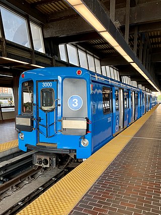
Line 3 Scarborough, originally known as Scarborough RT (SRT), was a light rapid transit line that was part of the Toronto subway system in Toronto, Ontario, Canada. The line ran entirely within the eastern district of Scarborough, encompassing six stations and 6.4 kilometres (4.0 mi) of mostly elevated track. It connected with Line 2 Bloor–Danforth at its southwestern terminus, Kennedy, and terminated in the northeast at McCowan. Until its closure in July 2023, the system had a ridership of 3,908,000.

Toronto Civic Railways (TCR) was a streetcar operator created and owned by the City of Toronto, Ontario, Canada, to serve newly annexed areas of the city that the private operator Toronto Railway Company refused to serve. When the Toronto Railway Company's franchise expired in 1921, its services were combined with those of the Toronto Civic Railways, and are now assumed by the new Toronto Transportation Commission (TTC). The first route of the TCR started operation on December 18, 1912.
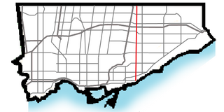
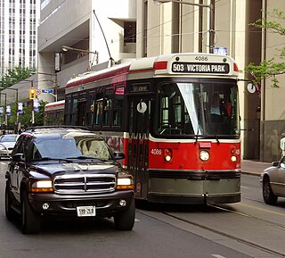
Victoria Park Avenue is a major north-south route in eastern Toronto, Ontario, Canada. It is the western border of Scarborough, separating it from Old Toronto, East York, and North York. The common nickname for it is VP or Vic Park.
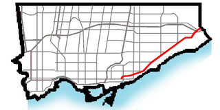
Kingston Road is a major arterial road in Toronto and Durham Region, Ontario. It is the southernmost major (mainly) east-west road in the eastern portion of Toronto, specifically in the district of Scarborough, and runs east to Ajax in Durham. Until 1998, it formed a portion of Highway 2. The name of the street is derived from Kingston, Ontario as the road was the primary route used to travel from Toronto to the settlements east of it situated along the shores of Lake Ontario; in the west end of Kingston, the road was referred to as the York Road until at least 1908, and is today named Princess Street.

The Toronto streetcar system is a network of eleven streetcar routes in Toronto, Ontario, Canada, operated by the Toronto Transit Commission (TTC). It is the third busiest light-rail system in North America. The network is concentrated primarily in Downtown Toronto and in proximity to the city's waterfront. Much of the streetcar route network dates from the 19th century. Three streetcar routes operate in their own right-of-way, one in a partial right-of-way, and six operate on street trackage shared with vehicular traffic with streetcars stopping on demand at frequent stops like buses. Since 2019, the network has used low-floor streetcars, making it fully accessible.

The 512 St. Clair is an east–west streetcar route in Toronto, Ontario, Canada, operated by the Toronto Transit Commission (TTC). It operates on St. Clair Avenue between St. Clair station on the Line 1 Yonge–University subway and Gunns Road, just west of Keele Street.

501 Queen is an east–west Toronto streetcar route in Ontario, Canada, operated by the Toronto Transit Commission (TTC). It stretches from Neville Park Loop in the east, running along Queen Street and in a reserved right-of-way within the median of the Queensway to Humber Loop in the west. In the late evenings, the 501 Queen route is extended west from Humber Loop, running on Lake Shore Boulevard to Long Branch Loop, replacing route 507 Long Branch. This route operates as part of the TTC's Blue Night Network service, operating in the early morning hours as the 301 Queen.

506 Carlton is a Toronto streetcar route run by the Toronto Transit Commission in Ontario, Canada. It runs from Main Street station on subway Line 2 Bloor–Danforth along Gerrard, Carlton and College Streets to High Park. Despite the route's name, less than 10 percent of its length actually uses Carlton Street.

The 505 Dundas is a Toronto streetcar route run by the Toronto Transit Commission in Ontario, Canada. The route is roughly U-shaped running mainly along Dundas Street between Dundas West and Broadview stations several blocks south of the Line 2 Bloor–Danforth subway.

Toronto and Scarboro' Electric Railway, Light and Power Company was established in August 1892 to provide street railway service to the Upper Beaches district within the City of Toronto, Ontario and to the neighbouring Township of Scarborough. Except for two branches, the line ran as a radial along Kingston Road.

The 502 Downtowner was a streetcar route operated by the Toronto Transit Commission in Toronto, Ontario, Canada. It ran from the Bingham Loop at Victoria Park Avenue and Kingston Road in the Beaches neighbourhood to McCaul Loop in downtown Toronto. Starting in September 2019, all streetcar services along Kingston Road were consolidated into the 503 Kingston Rd route.
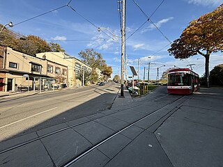
The 503 Kingston Rd is an east–west Toronto streetcar route in Ontario, Canada, operated by the Toronto Transit Commission. The 503 Kingston Rd travels on a route to the downtown financial district from the Bingham Loop along Kingston Road and shares much of its track with the 501 Queen and 504 King. Originally a rush-hour service, the route was upgraded in September 2019 to run weekdays excluding evenings after the consolidation of 502 Downtowner service into this route. Effective July 30, 2023, route 503 started running all day and all evening, seven days per week.

The Upper Beaches is a neighbourhood in Toronto, Ontario, Canada. It is directly north of the Beaches area. It stretches from Coxwell Avenue in the west to Victoria Park in the east. The southern border is Kingston Road, while the northern boundary is generally considered to be the Canadian National Railway tracks between Gerrard Street and Danforth Avenue. The western part of the area was originally called Norway, and the larger area was once part of the Town of East Toronto. The name "Upper Beaches" was first used by developers and real estate agents around the period of 2001 to 2003 for the selling of houses on redeveloped land in the area, and was used as a marketing tag to attract buyers. The area was never considered part of the Beaches neighbourhood but was close to it. The city's current name for this area is East End Danforth, though that is rarely used. The city also includes the buildings along and just north of Danforth Avenue in the neighbourhood. The western portion between Woodbine Avenue and Coxwell is referred to by the city as Woodbine Corridor.

Turning loops of the Toronto streetcar system serve as termini and turnback points for streetcar routes in Toronto, Ontario, Canada. The single-ended streetcars require track loops in order to reverse direction. Besides short off-street track loops these can also be larger interchange points, having shelters and driver facilities, or be part of a subway station structure for convenient passenger interchange.
Neville Park Loop is the eastern terminus of the 301/501 Queen streetcar line, the longest streetcar route of the Toronto Transit Commission (TTC). It is also the terminus of the 143 Beaches/Downtown express bus service. It is located at the southwest corner of Queen Street East and Nursewood Road in the Beaches neighbourhood of Toronto. It is named after the street which is just west of the loop.
The Russell Carhouse, located at Queen Street East and Connaught Avenue just east of Greenwood Avenue in Toronto, is the Toronto Transit Commission's second oldest carhouse.

High Park Loop is a turning loop and the western terminus of the 506 Carlton streetcar line of the Toronto Transit Commission (TTC) in Toronto. Streetcars enter westbound straight from Howard Park Avenue across to the west side of Parkside Drive and into the loop at the east entrance to High Park, turn anticlockwise through the loop, and return eastbound through the intersection.

The Birchmount Loop was the easternmost loop of the Toronto streetcar system, operated by the Toronto Transit Commission. It was located at the intersection of Kingston Road and Birchmount Road in the township of Scarborough, Ontario. t Scarboro radial line, originally a privately operated line, continued farther east until 1936.

Toronto-gauge railways are tram and rapid transit lines built to Toronto gauge, a broad gauge of 4 ft 10+7⁄8 in. This is 2+3⁄8 in (60 mm) wider than standard gauge of 4 ft 8+1⁄2 in which is by far the most common track gauge in Canada. The gauge is unique to the Greater Toronto Area and is currently used on the Toronto streetcar system and the Toronto subway, both operated by the Toronto Transit Commission. As well, the Halton County Radial Railway, a transport museum, uses the Toronto gauge so its rail line can accommodate its collection of Toronto streetcars and subway trains. Several now-defunct interurban rail systems also once used this gauge.


