Transportation in California

Last updated

Welcome to California road sign MUTCD-CA G10B.svg
Welcome to California road sign

California's transportation system is complex and dynamic. Although known for its car culture and extensive network of freeways and roads, the state also has a vast array of rail, sea, and air transport. Several subway, light rail, and commuter rail networks are found in many of the state's largest population centers. In addition, with the state's location on the West Coast of the United States, several important ports in California handle freight shipments from the Pacific Rim and beyond. A number of airports are also spread out across the state, ranging from small general aviation airports to large international hubs like Los Angeles International Airport and San Francisco International Airport.

Contents

However, in a state with over 39 million people, rapid population expansion, and diverse terrain and weather, that system is under pressure to stay ahead of population growth and transportation needs.

Map of California showing the primary cities and roadways California Map.PNG
Map of California showing the primary cities and roadways

Roads and highways

Caltrans builds tall "stack" interchanges with soaring ramps, such as the Newhall Pass interchange
.mw-parser-output div.crossreference{padding-left:0}
.mw-parser-output .hatnote{font-style:italic}.mw-parser-output div.hatnote{padding-left:1.6em;margin-bottom:0.5em}.mw-parser-output .hatnote i{font-style:normal}.mw-parser-output .hatnote+link+.hatnote{margin-top:-0.5em}
(pictured) Newhall Pass Interchange from bypass 2016-11-28.jpg
Caltrans builds tall "stack" interchanges with soaring ramps, such as the Newhall Pass interchange (pictured)
Along the historic Arroyo Seco Parkway between Los Angeles and Pasadena Arroyo Seco Parkway from Marmion Way.jpg
Along the historic Arroyo Seco Parkway between Los Angeles and Pasadena

California is known for its car culture; by the end of 2010, the California Department of Motor Vehicles had 23,799,513 driver's licenses and a total of 31,987,821 registered vehicles on file. [1] The state's residents typically take to the roads for their commutes, errands, and vacations, giving California's cities a reputation for severe traffic congestion.

California's vast terrain is connected by an extensive system of freeways, expressways, and highways, all maintained by the California Department of Transportation (Caltrans) and patrolled by the California Highway Patrol (CHP), except for the numbered expressways in Santa Clara County which were built and maintained by the county itself. The main north–south arteries are U.S. Route 101 (US 101), which travels close to the coast from Downtown Los Angeles, across the Golden Gate Bridge, and to the Oregon state line, and Interstate 5 (I-5), which travels inland from the Mexico–United States border to the Oregon state line, effectively bisecting the entire state. In addition, a major north–south artery is State Route 99 (SR 99), which travels from near Bakersfield to near Red Bluff; SR 99 is largely parallel to I-5, and connects the Central Valley cities not connected by the Interstate.

Perhaps it is a testament to California's sheer size that although it has one of the most extensive freeway systems in the United States, it contains many of the largest cities in the United States not served by an Interstate Highway, including the two largest, Fresno (pop. 471,479) and Bakersfield (pop. 247,057). [2] These cities, along with Modesto and Visalia, are passed by as I-5 veers west to avoid the congestion of the populated eastern side of the Central Valley as it connects Sacramento and Los Angeles. [3]

The state's freeway network has expanded ever since the Arroyo Seco Parkway, the first freeway in the Western United States, [4] connecting Los Angeles and Pasadena, opened in 1940. However, the state is not immune to freeway revolts, such as those that have prevented a freeway in San Francisco between the Golden Gate Bridge and the San Francisco–Oakland Bay Bridge, and an expansion of I-710 through South Pasadena.

Traffic signs, road surface markings, and traffic signals on all public streets and highways throughout the state are regulated by the California Vehicle Code and standardized in the California Manual on Uniform Traffic Control Devices .

Toll roads and bridges

The Golden Gate Bridge in San Francisco GoldenGateBridge.jpg
The Golden Gate Bridge in San Francisco

Almost all California highways are non-toll roads, including several major non-toll bridges in Los Angeles, Sacramento, and San Diego. However, there are four toll roads in Southern California, and eight toll bridges in the San Francisco Bay Area (including the state's most famous highway bridge, the Golden Gate Bridge). These toll facilities, along with several high-occupancy toll lanes, use the statewide electronic toll collection system known as FasTrak.

SF Bay Area
toll bridges
So. California
toll roads

Interstate Highways

Along southbound I-5 approaching Mount Shasta I-5 near Shasta.jpg
Along southbound I-5 approaching Mount Shasta
I-10 with the San Gorgonio Pass wind farm in the background Wind farm from Interstate 10.jpg
I-10 with the San Gorgonio Pass wind farm in the background

Primary Interstate Highways in California include:

I-5 (CA).svg Interstate 5: Bisects the state from the Mexican border to Oregon, linking the major cities of San Diego, Santa Ana, Los Angeles, Stockton, Sacramento, and Redding.
I-8 (CA).svg Interstate 8: Travels east from San Diego to the Imperial Valley before crossing into Arizona west of Yuma.
I-10 (CA).svg Interstate 10: Travels east from Santa Monica through Los Angeles, San Bernardino, and the Coachella Valley to Arizona.
I-15 (CA).svg Interstate 15: Originating from San Diego, serves as the major route from Southern California to Las Vegas, Nevada.
I-40 (CA).svg Interstate 40: Travels east from Barstow across the Mojave Desert to Needles before entering into Arizona.
I-80 (CA).svg Interstate 80: Travels northeast from San Francisco through Sacramento and over the Sierra Nevada mountain range before crossing into Nevada west of Reno.

Auxiliary (three-digit) Interstates are located in the Greater Los Angeles area, the Bay Area, and the San Diego Area:

Greater Los Angeles Area
San Francisco Bay Area
San Diego Area

U.S. Routes

U.S. Route 101 in Mendocino County US 101 Mendocino County.jpg
U.S. Route 101 in Mendocino County
U.S. Route 395 descending from the Sierra Nevada into Owens Valley US395descending intobishop.JPG
U.S. Route 395 descending from the Sierra Nevada into Owens Valley

The following are United States Numbered Highways in California:

US 6 (1961 cutout).svg US 6: Travels from Bishop east to Central Nevada.
US 50 (CA).svg US 50: Heads east from the Sacramento area through the South Lake Tahoe area before crossing into Nevada en route to Carson City.
US 95 (1961 cutout).svg US 95: Enters into California from Arizona through a concurrency with I-10. US 95 then splits from I-10 in Blythe, then travels north to Needles before crossing into Nevada en route to Las Vegas
US 97 (1961 cutout).svg US 97: Serves as the primary connection from the City of Weed to Klamath Falls, Oregon.
US 101 (CA).svg US 101: The primary north-south U.S. Highway in California, connecting Los Angeles with the Central Coast, the San Francisco Bay, and the North Coast.
US 199 (CA).svg US 199: Serves as the primary connection from the Crescent City area to Grants Pass, Oregon.
US 395 (1961 cutout).svg US 395: A major north–south route in the eastern areas of the state, connecting the Mojave Desert with the Owens Valley and the Eastern Sierra Nevada. The route then clips into Nevada to pass through Carson City and Reno, before returning to California to serve the Honey Lake and Modoc Plateau areas.

California still uses an older, cut-out version of the U.S. Route shield instead of the current design used in the other U.S. states, printed on a square blank with a black background.

State Routes

State Route 1 running right beside the Pacific Ocean somewhere near Pescadero, Pomponio and San Gregorio State Beaches Ca-1 somewhere near Pescadero, Pomponio and San Gregorio State Beaches.JPG
State Route 1 running right beside the Pacific Ocean somewhere near Pescadero, Pomponio and San Gregorio State Beaches
State Route 99 in Chico, facing north Ca-99 N in Chico.JPG
State Route 99 in Chico, facing north

State highways in California range from one-lane rural roads to full urban freeways. Each state highway is assigned a Route (officially State Highway Route [5] [6] ) number in the Streets and Highways Code (Sections 300–635). However, the state is also currently relinquishing a number of non-freeway segments, especially in urban areas, and turning them over to local control. [7]

The standard California state route marker consists of a white numeral on a green shield, with the name "California" displayed above the numeral. The shield is shaped like a miners' spade to honor the California Gold Rush. [8] [9]

Major long-distance, intercity state routes include:

California 1.svg State Route 1: Runs along most of the Pacific coastline from Dana Point north to Leggett. It links numerous coastal settlements, beaches, parks, and other attractions in the Greater Los Angeles Area, the Central Coast, the San Francisco Bay Area, and the North Coast.
California 41.svg State Route 41: Runs northeast, connecting the Central Coast with the central San Joaquin Valley, Fresno, and Yosemite National Park.
California 46.svg State Route 46: Heads east from the Central Coast to the southern San Joaquin Valley near the vicinity of Bakersfield.
California 49.svg State Route 49: Known as the Gold Country Highway, SR 49 links many historic mining communities of the California Gold Rush.
California 58.svg State Route 58: Although the western segment of SR 58 is a winding mountain road connecting the Central Coast to the southern San Joaquin Valley, its eastern segment is a major artery linking Bakersfield with the Mojave Desert and Barstow.
California 99.svg State Route 99: Serves as a major north–south artery in the California Central Valley, linking major cities such as Bakersfield, Visalia, Fresno, Madera, Merced, Modesto, Stockton, Sacramento, Yuba City, and Chico.
California 152.svg State Route 152: Heads east from the Monterey Bay Area to the Santa Clara Valley and the Central Valley.
California 299.svg State Route 299: Runs east across the northern part of the state from the Eureka area to Redding and Alturas.

County routes

County routes in California are controlled and maintained by the respective counties in which they reside, but are normally patrolled by the California Highway Patrol like any other state highway. Each county route is prefixed with a letter, depending on the region of the state (e.g. G2). Routes with letters A, B, and D are in the region of Northern California; letters E, G, and J are in Central California; and N, R, and S are in Southern California. County routes can range from two-lane roads to the full expressways found in Santa Clara County.

Rail travel

Although known for its car culture, California also has a number of local and regional passenger rail systems, including the following:

SystemImageTypeNo. of linesLength (mi.)No. of stationsDescription
Altamont Corridor Express ACE Train Pleasanton.jpg Commuter rail 18510The Altamont Commuter Express, also known as ACE, runs from San Jose northeast to Stockton, providing service from the Silicon Valley to Eastern Alameda County and San Joaquin County.
Bay Area Rapid Transit DalyCitysta.jpg Heavy rail, light rail, automated guideway transit 713150Bay Area Rapid Transit (BART) operates in the San Francisco Bay Area, connecting San Francisco with cities in the East Bay and suburbs in northern San Mateo County.
Caltrain Caltrain-Diesel Locomotive 921.jpg Commuter rail17731Caltrain runs from San Francisco south down the San Francisco Peninsula to the Silicon Valley and has a further extension south to Gilroy, California. The route from San Francisco to San Jose will be fully electrified by 2025.
COASTER Coaster2.jpg Commuter rail1418The San Diego Coast Express Rail (COASTER) operates in the central and northern coastal regions of San Diego County, running from San Diego north to Oceanside.
Metro Rail Breda A650.jpg Heavy and light rail 6116101Metro Rail is an integrated subway and light rail system serving Los Angeles County.
Metrolink Hyundai Rotem Cab Car.jpg Commuter rail754769Metrolink serves Los Angeles and the surrounding area of Southern California, connecting Los Angeles, San Diego, Orange, Riverside, San Bernardino and Ventura Counties.
Muni Metro T Third Islais.jpg Light rail772117Muni Metro is a premetro/light rail system connecting various neighborhoods and districts of San Francisco.
Sacramento RT Light Rail Sac RT Siemens.jpg Light rail34353The Sacramento Regional Transit District (RT) light rail system serves Sacramento and vicinity.
San Diego Trolley SD Trolley Green Line.jpg Light rail46562The San Diego Trolley serves the metropolitan area of San Diego. It runs from La Jolla in the north to San Ysidro in the south, and from Old Town and Downtown San Diego in the west to El Cajon and Santee in the east.
San Francisco cable car system 11 Cable Car on Powell St crop, SF, CA, jjron 25.03.2012.jpg Streetcar 3162The world's last manually operated cable car system continues to operate in northeast San Francisco on its very steep hills, but the system's small service area and premium fares for single rides currently make the cable cars used more as a tourist attraction.
Sonoma–Marin Area Rail Transit SMART Train 2017 Santa Rosa.jpg Commuter rail14512Sonoma–Marin Area Rail Transit (SMART) runs through Sonoma and Marin counties.
SPRINTER Sprinter light rail train.jpg Diesel light rail12215The SPRINTER operates in north region of San Diego County, running from Oceanside east to Escondido.
VTA light rail VTA Tasman Station (August 11th, 2005).jpg Light rail34260The Santa Clara Valley Transportation Authority (VTA) light rail system serves San Jose and its suburbs in the Silicon Valley.

Amtrak

Amtrak California train in Pinole Capitol Corridor Pinole.jpg
Amtrak California train in Pinole

Amtrak California is a collection of services supported by Amtrak and the California Department of Transportation. The three busiest intercity rail lines in the US outside the Northeast Corridor operate under this branding: the Capitol Corridor connects the San Francisco Bay Area to Sacramento; the Pacific Surfliner runs along the coast of Southern California from San Diego to San Luis Obispo; and the San Joaquin connects the major cities of the Central Valley with the Bay Area.

National Amtrak lines include the California Zephyr from Emeryville to Chicago, Illinois; the Coast Starlight from Los Angeles to Seattle, Washington; the Southwest Chief and the Texas Eagle from Los Angeles to Chicago; and the Sunset Limited from Los Angeles to New Orleans, Louisiana.

Bus travel

LA Metro 20 bus with bicycles.jpg
AC Transit 2203 on June 5, 2013.jpg
A Los Angeles Metro bus (l) and an AC Transit bus (r)

Local transit service is found in every county, from Los Angeles to Alpine County. [10] Some local bus transit agencies like the San Francisco Muni and the Orange County Transportation Authority primarily only serve a specific city or county, while other agencies like AC Transit in the San Francisco Bay Area and the San Diego Metropolitan Transit System serve a specific region regardless of city or county borders.

Intercity bus travel is provided by Greyhound, Megabus and Amtrak Thruway.

Major transit hubs that serve multiple bus and rail systems include Los Angeles Union Station, San Diego Santa Fe Depot, San Jose Diridon station, and Sacramento Valley Station.

Bicycle travel

LA river riverside bike path.jpg
L.A. River bike path (far right) at the Glendale Narrows
Bay Trail at the Golden Gate Bridge.jpg
The S.F. Bay Trail near the Golden Gate Bridge

There are numerous bike routes in California such as the Los Angeles River bicycle path in the Greater Los Angeles Area and the San Francisco Bay Trail in the San Francisco Bay Area. Caltrans uses three classes to segregate cycle facilities: [11]

Many of the state's local public transportation systems are bicycle accessible. Numerous buses are equipped with bicycle racks at the front of the vehicle for the attachment of approximately two bicycles. Several rail systems such as the Metro Rail and BART also allow riders to carry bikes onto the trains during certain hours of the day.

Air travel

LAX LA.jpg
SFO international terminal.jpg
The airports of Los Angeles (l) and San Francisco (r) are two of the major air hubs in the United States

Los Angeles International Airport (LAX) and San Francisco International Airport (SFO) are major hubs for both international and transcontinental traffic. In 2011, LAX and SFO were the sixth and 22nd busiest airports in the world by passenger count, respectively. [12]

San Diego, Sacramento, San Jose, John Wayne/Orange County, and Oakland are also among the 50 busiest airports in the United States. In total, there are about a dozen important commercial airports and many more general aviation airports throughout the state's 58 counties.

The following table shows all California airports designated by the FAA as a hub with enplanements for 2022: [13]

Area servedIATAAirport nameAirport typeEnpl.
Los Angeles LAX Los Angeles International Airport Large hub32,326,616
San Francisco SFO San Francisco International Airport Large hub20,411,420
San Diego SAN San Diego International Airport Large hub11,162,224
Sacramento SMF Sacramento International Airport Medium hub6,040,824
San Jose SJC San Jose International Airport Medium hub5,590,137
Orange County SNA John Wayne Airport Medium hub5,536,313
Oakland OAK Oakland International Airport Medium hub5,506,232
Burbank BUR Hollywood-Burbank Airport Medium hub3,054,729
Ontario ONT Ontario International Airport Medium hub2,840,758
Long Beach LGB Long Beach Airport Small hub1,600,987
Palm Springs PSP Palm Springs International Airport Small hub1,499.987
Fresno FAT Fresno Yosemite International Airport Small hub1,077,710
Santa Barbara SBA Santa Barbara Municipal Airport Small hub610,916

Seaports and harbors

LA-port+Long-Beach1.jpg
Oakland Skyline Telephoto.jpg
The port complex of Los Angeles and Long Beach (l) and the Port of Oakland (r) are two of the major sea hubs in California

California also has several important seaports. The giant seaport complex formed by the Port of Los Angeles and the Port of Long Beach in Southern California is the largest in the country and responsible for handling about a fourth of all container cargo traffic in the United States. The Port of Oakland handles most of the ocean containers passing through Northern California. The Port of Redwood City, the Port of Richmond, and the Port of San Diego are also significant ports for freight shipments. The Port of Sacramento and the Port of Stockton are two major inland deepwater ports located in the Central Valley, and thus only accessible via the Sacramento–San Joaquin River Delta. Instead of dredging the Sacramento River, the Sacramento Deep Water Ship Channel was built in 1963 to accommodate large ships traveling from the delta to Sacramento.

A number of ferry services take commuters across San Francisco Bay from San Francisco to other communities in the Bay Area. Ferry service is also available for commuters crossing San Diego Bay from San Diego to Coronado. Passenger ferries also serve the offshore city of Avalon on Santa Catalina Island. There is no regular vehicle ferry service to Avalon, however, since the city restricts the use of cars and trucks within its borders. [14]

Numerous local harbors are spread out across the Pacific Coast, San Francisco Bay, San Diego Bay, and the Sacramento – San Joaquin River Delta for commercial fishing or recreational use.

Current issues

Harborfreeway2.jpg
I-80 Eastshore Fwy.jpg
Traffic on the Harbor Freeway in Los Angeles (l) and the Eastshore Freeway in Berkeley (r). Traffic congestion is a regular occurrence along California's freeways

Because of the state's population growth, many settlements that were once small or rural communities in the 1940s and 50s, when much of California's transportation infrastructure was originally designed, are now thriving suburbs and exurbs. According to a 2011 study by Forbes , the cities of Lake Elsinore, Los Banos, Adelanto, and Brentwood were ranked as the top four longest commutes in the country. [15]

A regularly recurring issue in California politics is whether the state should continue to aggressively expand its freeway network or concentrate on improving mass transit networks in urban areas. Bay Area Rapid Transit, the Los Angeles Metro Rail, and several other public transportation systems have expansion plans either currently under construction or in the planning stages. Several HOT lanes across the state are also either currently under construction or in the planning stages.

Reloadable contactless smart card systems, allowing electronic fare payments on various public transportation systems, have been introduced since 2007, such as the Clipper Card in the San Francisco Bay Area, the Transit Access Pass in Los Angeles County, and the Compass Card (later replaced in 2021 by the Pronto card) in San Diego County.

The California High-Speed Rail Authority was created in 1996 by the state legislature to implement an extensive 800 miles (1,300 km) high-speed rail system. It would provide a TGV-style high-speed link between the state's four major metropolitan areas, and would allow travel between Los Angeles' Union Station and the San Francisco Transbay Terminal in two hours and forty minutes. Voters approved Proposition 1A in November 2008, approving a $9 billion state bond to begin the project. In 2012, the California legislature and Governor Jerry Brown approved construction financing for an initial stage of the project. [16] The Authority estimates that the first segment of the California High-Speed Rail will be operational by the end of 2030. The project has been widely described as troubled, being far behind schedule, suffering from management inexperience, and delays in procuring land, and engineering issues. [17]

Traffic safety considerations

Texas and California are comparable being the two largest states in the contiguous United States as California contains 39 million inhabitants. This results in these states to have higher traffic fatalities than other states. [18]

There were more traffic fatalities in California than in Texas until 2007. Since 2017, there have been less fatalities in California than in Texas. [18]

Fatalities in CaliforniaFatalities in California by zone
by VMTby population
Sources: https://cdan.nhtsa.gov/SASStoredProcess/guest

(Eurostat/CARE for comparison to France and Germany); California traffic-fatalities 2010–2091: https://seriousaccidents.com/blog/california-traffic-fatalities-data/

California Housing Crisis and Climate Change

In California, around 40% of the state's greenhouse gas emissions are from vehicle transportation, and this number is increasing. Distant suburbs such as Stockton, and Modesto have the two highest percentages of residents who are super commuters in the United States, at around 11% of Stockton residents, and 9% of Modesto residents commuting over 90 minutes to get to work. [19] The transportation problem is beginning to threaten the state's future goals in terms of emissions and carbon neutrality. By 2030, California hopes to limit greenhouse gases to 40% below 1990 levels, and hopes to achieve carbon neutrality by 2045. [20] As time goes on, however, these goals are becoming increasingly difficult to reach unless the state takes significant measures to combat their transportation problem. With 1.7 million renting households in California spending half their income on rent, California has a housing crisis that is impacting their climate goals. [21] [22] Infill housing is seen as a solution to build more affordable housing in coastal cities where people would not need to drive to work or other errands. Senate Bill 50, The More Homes Act is waiting to be voted on, and attempts to address the housing crisis by overriding local zoning codes to legalize small apartment buildings (up to 5 stories) in urban areas near jobs and public transportation. [23] Caltrans plans to work on their infrastructure to make sustainable transportation methods such as trains, biking, and walking more accessible to more people. In 2008, California passed a law requiring communities to alter their land use and transportation plans to actively combat climate change, however, statistically the bill has done little to change the state's emissions. Caltrans has acknowledged that extreme wildfires and floods, driven by climate change, have plagued California in recent years which has impacted transportation infrastructure. In 2013 Caltrans released the "Caltrans Activities to Address Climate Change- Reducing Greenhouse Gas Emissions and Adapting to Impacts" report, which highlighted statewide efforts to address climate related damage. [24]

See also

Transportation history
Transportation by region

Related Research Articles

<span class="mw-page-title-main">Interstate 880 (California)</span> Interstate highway in California

Interstate 880 (I-880) is a north–south auxiliary Interstate Highway in the San Francisco Bay Area of Northern California. It runs from I-280 and State Route 17 (SR 17) in San Jose to I-80 and I-580 in Oakland, running parallel to the eastern shore of San Francisco Bay. For most of its route, I-880 is officially known as the Nimitz Freeway, after World War II fleet admiral Chester W. Nimitz, who retired to the Bay Area. The northernmost five miles (8.0 km) is also commonly referred to as the Cypress Freeway, after the former alignment of the freeway and its subsequent replacement.

<span class="mw-page-title-main">Interstate 580 (California)</span> Interstate highway in California

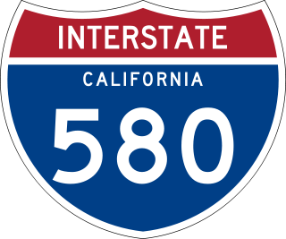
Interstate 580 (I-580) is an approximately 76-mile-long (122 km) east–west auxiliary Interstate Highway in Northern California. The heavily traveled spur route of I-80 runs from US Route 101 (US 101) in San Rafael in the San Francisco Bay Area to I-5 at a point outside the southern city limits of Tracy in the Central Valley. I-580 forms a concurrency with I-80 between Albany and Oakland, the latter of which is the location of the MacArthur Maze interchange immediately east of the San Francisco–Oakland Bay Bridge. I-580 provides a connection from the Bay Area to the southern San Joaquin Valley and Southern California via I-5, as I-5 bypasses the Bay Area to the east.

<span class="mw-page-title-main">Interstate 110 and State Route 110 (California)</span> Interstate and state highway in California

Route 110, consisting of State Route 110 (SR 110) and Interstate 110 (I-110), is a state and auxiliary Interstate Highway in the Los Angeles metropolitan area of the US state of California. The entire route connects San Pedro and the Port of Los Angeles with Downtown Los Angeles and Pasadena. The southern segment from San Pedro to I-10 in downtown Los Angeles is signed as I-110, while the northern segment to Pasadena is signed as SR 110. The entire length of I-110, as well as SR 110 south of the Four Level Interchange with US Route 101 (US 101), is the Harbor Freeway, and SR 110 north from US 101 to Pasadena is the historic Arroyo Seco Parkway, the first freeway in the western United States.

<span class="mw-page-title-main">Interstate 710 and State Route 710 (California)</span> Interstate and state highway in California

Route 710, consisting of the non-contiguous segments of State Route 710 (SR 710) and Interstate 710 (I-710), is a major north–south state highway and auxiliary Interstate Highway in the Los Angeles metropolitan area of the U.S. state of California. Also called the Los Angeles River Freeway prior to November 18, 1954, the highway was initially planned to connect Long Beach and Pasadena, but a gap in the route exists from Alhambra to Pasadena through South Pasadena due to community opposition to its construction.

<span class="mw-page-title-main">Interstate 405 (California)</span> Interstate Highway in California

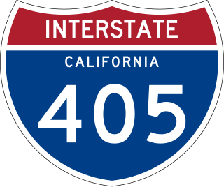
Interstate 405 is a major north–south auxiliary Interstate Highway in Southern California. The entire route is known as the northern segment of the San Diego Freeway. I-405 is a bypass auxiliary route of I-5, running along the southern and western parts of the Greater Los Angeles urban area from Irvine in the south to Sylmar in the north.

<span class="mw-page-title-main">Interstate 105 (California)</span> Auxiliary Interstate Highway in Los Angeles County, California, United States

Interstate 105 (I-105) is an east–west auxiliary Interstate Highway in the Greater Los Angeles urban area of Southern California. It runs from State Route 1 (SR 1) near El Segundo and Los Angeles International Airport (LAX) to I-605 in the City of Norwalk. It is commonly known as the Century Freeway after Century Boulevard which it parallels, and also officially known as the Glenn Anderson Freeway after the late congressman Glenn M. Anderson who advocated for its construction.

<span class="mw-page-title-main">California State Route 85</span> Highway in California

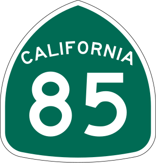
State Route 85 is a state highway which connects the cities of southern San Jose and Mountain View in the U.S. State of California. The highway intersects with major highways such as I-280, SR 17, and SR 87. The route serves as a bypass of U.S. Route 101 in the Santa Clara Valley area, running through the foothill cities of Los Gatos, Saratoga, Cupertino, roughly paralleling the Santa Cruz Mountains up to its interchange with I-280.

<span class="mw-page-title-main">California State Route 138</span> Highway in California

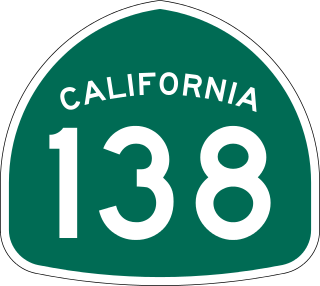
State Route 138 is an east–west state highway in the U.S. state of California that generally follows the northern foothills of the San Gabriel Mountains and the western Mojave Desert. The scenic highway begins in the west at its junction with Interstate 5 located south of Gorman in the Sierra Pelona Mountains, continues eastward through the Antelope Valley and Cajon Pass, to its junction with State Route 18 in the east, located in the San Bernardino Mountains south of Crestline.

<span class="mw-page-title-main">California State Route 92</span> Highway in California

State Route 92 is a state highway in the U.S. state of California, serving as a major east-west corridor in the San Francisco Bay Area. From its west end at State Route 1 in Half Moon Bay near the coast, it heads east across the San Francisco Peninsula and the San Mateo–Hayward Bridge to downtown Hayward in the East Bay at its junction with State Route 238 and State Route 185. It has interchanges with three freeways: Interstate 280, U.S. Route 101 in or near San Mateo, and Interstate 880 in Hayward. It also connects indirectly to Interstates 238 and 580 by way of Hayward's Foothill Boulevard, which carries Route 238 and flows directly into Route 92.

<span class="mw-page-title-main">California State Route 87</span> Highway in San Jose, California

State Route 87, known as the Guadalupe Freeway or referred to by the locals as Highway 87, is a north–south state highway in San Jose, California, United States. Before being upgraded to a freeway, it was Guadalupe Parkway.

<span class="mw-page-title-main">California State Route 160</span> Highway in California

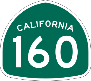
State Route 160 is a state highway in the U.S. state of California consisting of two sections. The longer, southern, section is a scenic highway through the alluvial plain of the Sacramento River, linking SR 4 in Antioch with Sacramento via the Antioch Bridge. The northern section, separated from the southern by Sacramento city streets, is the North Sacramento Freeway, running from the 16th Street Bridge over the American River to Interstate 80 Business towards Roseville.

<span class="mw-page-title-main">Transportation in Los Angeles</span> Complex multimodal regional, national and international hub for passenger and freight traffic

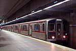
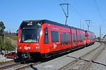
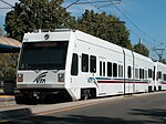
Los Angeles has a complex multimodal transportation infrastructure, which serves as a regional, national and international hub for passenger and freight traffic. The system includes the United States' largest port complex; an extensive freight and passenger rail infrastructure, including light rail lines and rapid transit lines; numerous airports and bus lines; vehicle for hire companies; and an extensive freeway and road system. People in Los Angeles rely on cars as the dominant mode of transportation, but since 1990 the Los Angeles County Metropolitan Transportation Authority has built over one hundred miles (160 km) of light and heavy rail serving more and more parts of Los Angeles and the greater area of Los Angeles County. As a result, Los Angeles was the last major city in the United States to get a permanent rail system installed.

<span class="mw-page-title-main">Southern California freeways</span> Freeway system

The Southern California freeways are a vast network of interconnected freeways in the megaregion of Southern California, serving a population of 23 million people. The Master Plan of Metropolitan Los Angeles Freeways was adopted by the Regional Planning Commission in 1947 and construction began in the early 1950s. The plan hit opposition and funding limitations in the 1970s, and by 2004, only some 61% of the original planned network had been completed.

<span class="mw-page-title-main">MacArthur Maze</span> Freeway interchange in California

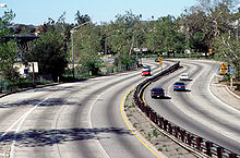
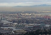
The MacArthur Maze is a large freeway interchange in Oakland, California. It splits traffic coming off the east end of the San Francisco–Oakland Bay Bridge into three freeways: the Eastshore (I-80/I-580), MacArthur (I-580) and Nimitz (I-880).

<span class="mw-page-title-main">Transportation in the San Francisco Bay Area</span> Overview of transportation in the San Francisco Bay Area, California, United States

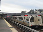
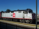
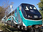
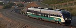
People in the San Francisco Bay Area rely on a complex multimodal transportation infrastructure consisting of roads, bridges, highways, rail, tunnels, airports, seaports, and bike and pedestrian paths. The development, maintenance, and operation of these different modes of transportation are overseen by various agencies, including the California Department of Transportation (Caltrans), the Association of Bay Area Governments, San Francisco Municipal Transportation Agency, and the Metropolitan Transportation Commission. These and other organizations collectively manage several interstate highways and state routes, eight passenger rail networks, eight trans-bay bridges, transbay ferry service, local and transbay bus service, three international airports, and an extensive network of roads, tunnels, and bike paths.

<span class="mw-page-title-main">U.S. Route 101 in California</span> U.S. Highway in California

U.S. Route 101 (US 101) is a major north–south United States Numbered Highway, stretching from Los Angeles, California, to Tumwater, Washington. The California portion of US 101 is one of the last remaining and longest U.S. Routes still active in the state, and the longest highway of any kind in California. US 101 was also one of the original national routes established in 1926. Significant portions of US 101 between the Los Angeles area and the San Francisco Bay Area follow El Camino Real, the commemorative route connecting the former Alta California's 21 missions.

<span class="mw-page-title-main">Interstate 80 in California</span> Section of Interstate Highway in California, United States

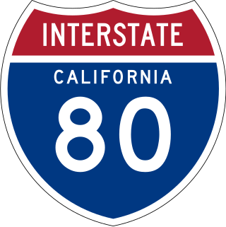
Interstate 80 (I-80) is a transcontinental Interstate Highway in the United States, stretching from San Francisco, California, to Teaneck, New Jersey. The segment of I-80 in California runs east from San Francisco across the San Francisco–Oakland Bay Bridge to Oakland, where it turns north and crosses the Carquinez Bridge before turning back northeast through the Sacramento Valley. I-80 then traverses the Sierra Nevada, cresting at Donner Summit, before crossing into the state of Nevada within the Truckee River Canyon. The speed limit is at most 65 mph (105 km/h) along the entire route instead of the state's maximum of 70 mph (110 km/h) as most of the route is in either urban areas or mountainous terrain. I-80 has portions designated as the Eastshore Freeway and Alan S. Hart Freeway.

<span class="mw-page-title-main">Interstate 5 in California</span> Section of Interstate Highway in California, United States

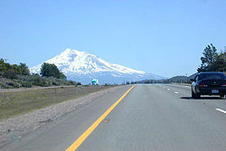
Interstate 5 (I-5) is a major north–south route of the Interstate Highway System in the United States, stretching from the Mexican border at the San Ysidro crossing to the Canadian border near Blaine, Washington. The segment of I-5 in California runs 796.77 miles (1,282.28 km) across the length of the state from San Ysidro to the Oregon state line south of the Medford-Ashland metropolitan area. It is the longest interstate in California, and accounts for more than half of I-5's total length.

<span class="mw-page-title-main">Transportation in Kern County, California</span>

Kern County’s transportation system was quoted as the “unseen industry.” Located at the southern end of the San Joaquin Valley, the county is at a prime location to ship goods west to the central coast, south to ports in Los Angeles, and east to corridors that connect to the rest of the country. It is also on major corridors that link to all northern points.

<span class="mw-page-title-main">Transportation in the Sacramento metropolitan area</span> Complex multi-modal network moving people and goods in the region of Californias state capital

Transportation in the Sacramento metropolitan area consists of a variety of modes of travel in El Dorado County, Placer County, Sacramento County, and Yolo County, which are the four counties that comprise the Sacramento metropolitan area.

References

  1. "California DMV Statistics - January to December 2010" (PDF). Archived from the original (PDF) on April 29, 2011. Retrieved February 25, 2012.
  2. "Future Interstates and Potential Interstate Corridors". Interstate-Guide.com.
  3. "Interstate 2000: Improvement for the Next Millenium". www.publicpurpose.com.
  4. Pool, Bob (June 25, 1010). "Pasadena Freeway getting a new look and a new name". Los Angeles Times . Retrieved August 28, 2011.
  5. California Streets and Highways Code, Section 231
  6. Caltrans, Other State Highway Routes
  7. California Streets and Highways Code, Sections 301-635
  8. "Economic Development History of State Route 99 in California". Federal Highway Administration . Retrieved July 16, 2012. In the 1960s, green and white CA-99 signs that resemble miners' spades replaced the black and white U.S. 99 shields
  9. Papoulias, Alexander (January 4, 2008). "Car Sales Curbed Along El Camino". Palo Alto Weekly. Office of California State Senator Leland Yee. Archived from the original on October 19, 2012. Retrieved July 16, 2012. State routes can be identified by the green State Highway Route shield, which is in the shape of a spade in honor of the California Gold Rush, and bears the route's number
  10. "Alpine County, CA - Official Website - Dial-A-Ride". www.alpinecountyca.gov.
  11. "Caltrans Highway Design Manual" . Retrieved February 25, 2012.
  12. "Asia Pacific airports move up the ranks in 2011, with Beijing this year to overtake Atlanta". CAPA Centre for Aviation. April 17, 2012. Retrieved May 8, 2012.
  13. "Preliminary CY2022 Commercial Service Airports, Rank Order" (PDF). Federal Aviation Administration. Retrieved August 25, 2023.
  14. "City of Avalon - FAQ". Archived from the original on July 8, 2011. Retrieved September 1, 2011.
  15. Vardi, Nathan (February 22, 2011). "America's Worst Commutes". Forbes . Retrieved September 5, 2011.
  16. Michael Martinez (July 19, 2012). "Governor signs law to make California home to nation's first truly high-speed rail". CNN. Retrieved September 3, 2012.
  17. "US will restore $1B for California's troubled bullet train". ABC News. The Associated Press. June 11, 2021. Retrieved February 26, 2022.
  18. 1 2 Walden, Troy D.; Ko, Myunghoon; Wu, Lingtao. "Comparative Analysis of Fatal Crashes in Texas vs. California and Implications for Traffic Safety in Texas" (PDF). Texas A&M Transportation Institute via Texas Department of Transportation.
  19. Wiener, Scott; Kammen, Daniel (March 25, 2019). "Opinion | Why Housing Policy Is Climate Policy". The New York Times.
  20. grist.org/article/california-has-big-dreams-and-theyre-stuck-in-traffic/.
  21. "I've covered California's housing crisis for years. Living it is a different story". Los Angeles Times. November 4, 2019.
  22. Wallace, Annette (January 11, 2019). "California Housing Crisis: Is Rent Control the Solution?". Abraham Lincoln University . Retrieved March 17, 2020.
  23. cayimby.org/morehomes/
  24. dot.ca.gov/programs/transportation-planning/office-of-smart-mobility-climate-change/climate-change
Regional 5-1-1 links