
Fort Wayne is a city in and the county seat of Allen County, Indiana, United States. Located in northeastern Indiana, the city is 18 miles (29 km) west of the Ohio border and 50 miles (80 km) south of the Michigan border. The city's population was 263,886 as of the 2020 census, making it the second-most populous city in Indiana after Indianapolis, and the 83rd-most populous city in the United States. It is the principal city of the Fort Wayne metropolitan area, consisting of Allen and Whitley counties which had an estimated population of 423,038 as of 2021. Fort Wayne is the cultural and economic center of northeastern Indiana. In addition to the two core counties, the combined statistical area (CSA) includes Adams, DeKalb, Huntington, Noble, Steuben, and Wells counties, with an estimated population of 649,105 in 2021.

Little Turtle was a Sagamore (chief) of the Miami people, who became one of the most famous Native American military leaders. Historian Wiley Sword calls him "perhaps the most capable Indian leader then in the Northwest Territory," although he later signed several treaties ceding land, which caused him to lose his leader status during the battles which became a prelude to the War of 1812. In the 1790s, Mihšihkinaahkwa led a confederation of native warriors to several major victories against U.S. forces in the Northwest Indian Wars, sometimes called "Little Turtle's War", particularly St. Clair's defeat in 1791, wherein the confederation defeated General Arthur St. Clair, who lost 900 men in the most decisive loss by the U.S. Army against Native American forces.

Lackawanna County is a county in the Commonwealth of Pennsylvania. It is located in Northeastern Pennsylvania and had a population of 215,896 as of the 2020 census. Its county seat and largest city is Scranton.

Boone County is a county in the U.S. state of Iowa. As of the 2020 census, the population was 26,715. Its county seat is Boone.
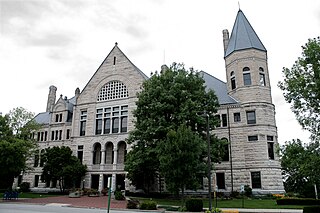
Wayne County is a county located in east central Indiana, United States, on the border with Ohio. As of the 2020 United States Census, the population was 66,553. The county seat is Richmond. Wayne County comprises the Richmond, IN Micropolitan Statistical Area. Richmond hosts Earlham College, a small private liberal arts college.

The Northwest Territory, also known as the Old Northwest and formally known as the Territory Northwest of the River Ohio, was formed from unorganized western territory of the United States after the American Revolution. Established in 1787 by the Congress of the Confederation through the Northwest Ordinance, it was the nation's first post-colonial organized incorporated territory.

The Territory of Michigan was an organized incorporated territory of the United States that existed from June 30, 1805, until January 26, 1837, when the final extent of the territory was admitted to the Union as the State of Michigan. Detroit was the territorial capital.
Abington Township may refer to the following places in the United States:

William Dale Owen was a U.S. Representative from Indiana. Before serving in Congress he was a clergyman, attorney, newspaper editor, and the author of two books. After serving in Congress and as Secretary of State of Indiana, he engaged in various business ventures, including promotion of coffee and rubber plantations in Mexico. In 1905 his business partner was arrested; in 1906 the partner was convicted of fraud and theft, and imprisoned. Owen left the United States to avoid prosecution; what happened to him after he fled the country is not known.

Brownsville Township is one of six townships in Union County, Indiana, United States. As of the 2010 census, its population was 845 and it contained 351 housing units.

Waterloo Township is one of nine townships in Fayette County, Indiana. As of the 2010 census, its population was 607 and it contained 240 housing units.

Abington Township is one of fifteen townships in Wayne County, Indiana, United States. As of the 2010 census, its population was 853 and it contained 366 housing units.

Center Township is one of fifteen townships in Wayne County, Indiana, United States. As of the 2010 census, its population was 7,579 and it contained 3,204 housing units.

Washington Township is one of fifteen townships in Wayne County, Indiana, United States. As of the 2010 census, its population was 1,436 and it contained 626 housing units.
Williamsburg is an unincorporated community in Green Township, Wayne County, in the U.S. state of Indiana.

Indiana is a U.S. state in the Midwestern United States. It is the 38th-largest by area and the 17th-most populous of the 50 States. Its capital and largest city is Indianapolis. Indiana was admitted to the United States as the 19th state on December 11, 1816. It is bordered by Lake Michigan to the northwest, Michigan to the north and northeast, Ohio to the east, the Ohio River and Kentucky to the south and southeast, and the Wabash River and Illinois to the west.
The following outline is provided as an overview of and topical guide to the U.S. state of Indiana:
Orlando Harrison Manning was an American politician.
Corydon Township is a township in Wayne County, Iowa.


