
Fort Wayne is a city in and the county seat of Allen County, Indiana, United States. Located in northeastern Indiana, the city is 18 miles (29 km) west of the Ohio border and 50 miles (80 km) south of the Michigan border. The city's population was 263,886 as of the 2020 census, making it the second-most populous city in Indiana after Indianapolis, and the 83rd-most populous city in the United States. It is the principal city of the Fort Wayne metropolitan area, consisting of Allen and Whitley counties which had an estimated population of 423,038 as of 2021. Fort Wayne is the cultural and economic center of northeastern Indiana. In addition to the two core counties, the combined statistical area (CSA) includes Adams, DeKalb, Huntington, Noble, Steuben, and Wells counties, with an estimated population of 649,105 in 2021.
Wayne County is a county located in east central Indiana, United States, on the border with Ohio. As of the 2020 United States Census, the population was 66,553. The county seat is Richmond. Wayne County comprises the Richmond, IN Micropolitan Statistical Area. Richmond hosts Earlham College, a small private liberal arts college.

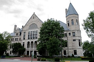
Allen County is a county in the U.S. state of Indiana. As of the 2020 Census, the population was 385,410, making it the third-most populous county in Indiana. The county seat and largest city is Fort Wayne, the second largest city in Indiana.

Indiana University–Purdue University Fort Wayne (IPFW) was a public university in Fort Wayne, Indiana. Founded in 1964, IPFW was a cooperatively-managed regional campus of two state university systems: Indiana University and Purdue University. IPFW hit its highest enrollment in 2014, with 13,459 undergraduate and postgraduate students in nine colleges and schools, including a branch of the Indiana University School of Medicine. During its last academic year (2017–2018), IPFW had a total enrollment of 10,414 students. IPFW offered more than 200 graduate and undergraduate degree programs through IU or Purdue universities. The university's 14 men's and women's athletic teams competed in Division I of the NCAA Summit League.
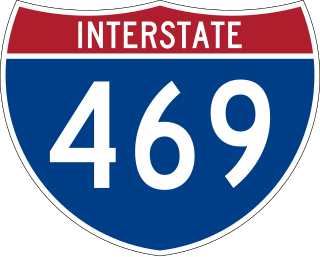
Interstate 469 (I-469) is an Interstate Highway in northeastern Indiana. It is an auxiliary route of parent I-69 that also carries portions of US Highway 24 (US 24), US 30, and US 33 around the urban parts of Fort Wayne. It is 30.83 miles (49.62 km) in length. The Interstate was originally conceived as a bypass for US 24 around the south and east ends of Fort Wayne. Due to heavy traffic on US 30 through the city, support was gained to connect the bypass to I-69 on the city's north end. I-469 was given the name Ronald Reagan Expressway in 2005.

As of March 2020, the Fort Wayne–Huntington–Auburn Combined Statistical Area (CSA), or Fort Wayne Metropolitan Area, or Northeast Indiana is a federally designated metropolitan area consisting of eight counties in northeast Indiana, anchored by the city of Fort Wayne.

State Road 1 (SR 1) is a north–south state highway in eastern Indiana, consisting of two segments. Its southern segment begins at U.S. Highway 50 and Interstate 275 in east-central Dearborn County, just east of Lawrenceburg, and ends at Interstate 469 south of Fort Wayne. Its northern segment begins at Interstate 69 on Fort Wayne's north side, and ends at U.S. Route 20 in east-central Steuben County, approximately 6 miles (9.7 km) east of Angola.

State Road 3 (SR 3) in the U.S. state of Indiana is a discontinuous state highway running through eastern Indiana from near the Ohio River to near the Michigan state line. The southernmost terminus is at SR 62 in Charlestown, and the northernmost terminus is at SR 120 near Brighton.
Ink was a weekly publication targeted to Northeast Indiana's Black community. Based in Fort Wayne, Indiana, Ink was published by Diversity Media Group, Inc., a locally owned, family-owned company founded in 2001 by siblings Vince Robinson and Terri Miller.

U.S. Route 30 (US 30) is a road in the United States Numbered Highway System that runs from Astoria, Oregon, to Atlantic City, New Jersey. In Indiana, the route runs from the Illinois state line at Dyer to the Ohio state line east of Fort Wayne and New Haven. The 155.96 miles (250.99 km) of US 30 that lie within Indiana serve as a major conduit. The entire length of U.S. Route 30 in Indiana is included in the National Highway System (NHS). The highway includes four-lane, rural sections, an urbanized, four-lane divided expressway, and several high-traffic, six-lane freeway areas. First designated as a US Highway in 1926, US 30 replaced the original State Road 2 (SR 2) and SR 44 designation of the highway which dated back to the formation of the Indiana State Road system. A section of the highway originally served as part of the Lincoln Highway. Realignment and construction projects have expanded the highway to four lanes across the state, and the road is now part of a long stretch of US 30 from New Lenox, Illinois, to Canton, Ohio, where the road has at least four lanes. There are over 40 traffic signals between I-65 at Merrillville and I-69 at Fort Wayne.

Northern Indiana is a region of the U.S. State of Indiana, including 26 counties which border the states of Illinois, Michigan, and Ohio. Northern Indiana is also considered part of the Great Lakes Megalopolis. The area is generally classified into other sub-regions; Northwest Indiana is closely tied with Chicago economically, culturally, and politically and is part of the Chicago metropolitan area. The north central region centers on South Bend metropolitan area, with economic connections to southwest Michigan. Northeast Indiana is centered on the Fort Wayne metropolitan area.

State Road 930 (SR 930) is an Indiana State Road that runs between Fort Wayne and New Haven in the US state of Indiana. The 12.97 miles (20.87 km) of SR 930 serve as a connection with U.S. Route 30 (US 30) through these two cities between the beginning of the concurrency with Interstate 69 (I-69) in Fort Wayne and the end of its concurrency with I-469 in New Haven. All of the highway is listed on the National Highway System. Various sections are urban two-lane highway, urbanized four-lane divided highway, and urbanized six-lane divided highway. The highway passes through industrial and commercial properties. SR 930 was designated in 1998, and replaced segments of US 30 in Fort Wayne and New Haven that were formerly part of the Lincoln Highway in the 1920s, as well as Coliseum Boulevard, which was designated as part of US 30 in the 1950s.

Indiana's 3rd congressional district is a congressional district in the U.S. state of Indiana. Based in Fort Wayne, the district takes in the northeastern part of the state. This district includes all of Adams, Allen, Blackford, DeKalb, Huntington, LaGrange, Noble, Steuben, Wells and Whitley counties, as well as northern Jay and northeast Kosciusko counties.
George W. Gillie was an American veterinarian and politician who served five terms as a U.S. Representative from Indiana from 1939 to 1949.

James McClellan Robinson was an American lawyer and politician who served four terms as a U.S. Representative from Indiana from 1897 to 1905.

U.S. Route 27 (US 27) is a part of the United States Numbered Highway System that runs from Miami, Florida, to Fort Wayne in the U.S. state of Indiana. In Indiana, it is a state road that enters the state in College Corner, Ohio, and West College Corner. The 117.765 miles (189.524 km) of US 27 that lie within Indiana serve as a major conduit. Most of the highway is listed on the National Highway System. Various sections are a rural two-lane highway or an urbanized four-lane divided highway. The northernmost community along the highway is Fort Wayne in the northeast part of the state. The highway ends at an interchange with Interstate 69 (I-69) north of downtown Fort Wayne after serving the east central and northeast regions of Indiana.

U.S. Route 33 (US 33) is part of the United States Numbered Highway System that runs from Richmond, Virginia, to Elkhart of the US state of Indiana. In Indiana, it is a state road that enters the state at the Ohio state line between Willshire, Ohio, and Pleasant Mills, Indiana. The 106.217 miles (170.940 km) of US 33 that lie within Indiana serve as a major conduit. All of the highway is listed on the National Highway System. Various sections are rural two-lane highway, urbanized four-lane divided expressway and the Lincoln Highway. The northernmost community along the highway is Elkhart. The highway ends at an interchange in southern Elkhart after serving the northeastern region of Indiana. US 33 passes through farm fields and urban areas.

Indiana is a U.S. state in the Midwestern United States. It is the 38th-largest by area and the 17th-most populous of the 50 States. Its capital and largest city is Indianapolis. Indiana was admitted to the United States as the 19th state on December 11, 1816. It is bordered by Lake Michigan to the northwest, Michigan to the north and northeast, Ohio to the east, the Ohio River and Kentucky to the south and southeast, and the Wabash River and Illinois to the west.

Indiana University (IU) is a system of public universities in the U.S. state of Indiana.

Elections are held in Fort Wayne, Indiana to elect the city's mayor. Currently, such elections are regularly scheduled to be held every four years, in the year immediately preceding that of United States presidential elections.


