Whitewater, Indiana

Last updated

Whitewater, Indiana
Whitewater, Indiana.jpg
Wayne County Indiana Incorporated and Unincorporated areas Whitewater Highlighted 1884086.svg
Location of Whitewater in Wayne County, Indiana.
Coordinates: 39°56′41″N84°49′52″W / 39.94472°N 84.83111°W / 39.94472; -84.83111
Country United States
State Indiana
County Wayne
Township Franklin
Area
[1]
  Total0.08 sq mi (0.20 km2)
  Land0.08 sq mi (0.20 km2)
  Water0.00 sq mi (0.00 km2)
Elevation
[2]
1,132 ft (345 m)
Population
 (2020)
  Total71
  Density898.73/sq mi (348.49/km2)
Time zone UTC-5 (Eastern (EST))
  Summer (DST) UTC-4 (EDT)
ZIP code
47374
Area code 765
FIPS code 18-84086 [3]
GNIS feature ID2397742 [2]

Whitewater is a town in Franklin Township, Wayne County, in the U.S. state of Indiana. [2] The population was 83 at the 2010 census.

Contents

History

Whitewater was originally called Hillsborough, and under the latter name was laid out and platted in 1828. [4] The community was named after the nearby Whitewater River. [5]

The first post office in Whitewater was established in 1832. [6]

Geography

According to the 2010 census, Whitewater has a total area of 0.08 square miles (0.21 km2), all land. [7]

Demographics

Historical population
CensusPop.Note
1880 181
1890 123−32.0%
1900 15526.0%
1910 112−27.7%
1920 96−14.3%
1930 12126.0%
1940 114−5.8%
1950 104−8.8%
1960 102−1.9%
1970 1118.8%
1980 107−3.6%
1990 1113.7%
2000 78−29.7%
2010 836.4%
2020 71−14.5%
U.S. Decennial Census [8]

2010 census

As of the census [9] of 2010, there were 83 people, 35 households, and 27 families living in the town. The population density was 1,037.5 inhabitants per square mile (400.6/km2). There were 36 housing units at an average density of 450.0 per square mile (173.7/km2). The racial makeup of the town was 100.0% White.

There were 35 households, of which 28.6% had children under the age of 18 living with them, 54.3% were married couples living together, 11.4% had a female householder with no husband present, 11.4% had a male householder with no wife present, and 22.9% were non-families. 14.3% of all households were made up of individuals, and 5.7% had someone living alone who was 65 years of age or older. The average household size was 2.37 and the average family size was 2.63.

The median age in the town was 38.5 years. 25.3% of residents were under the age of 18; 3.5% were between the ages of 18 and 24; 25.2% were from 25 to 44; 26.4% were from 45 to 64; and 19.3% were 65 years of age or older. The gender makeup of the town was 55.4% male and 44.6% female.

2000 census

As of the census [3] of 2000, there were 78 people, 28 households, and 25 families living in the town. The population density was 976.0 inhabitants per square mile (376.8/km2). There were 32 housing units at an average density of 400.4 per square mile (154.6/km2). The racial makeup of the town was 100.00% White.

There were 28 households, out of which 32.1% had children under the age of 18 living with them, 75.0% were married couples living together, 7.1% had a female householder with no husband present, and 10.7% were non-families. 7.1% of all households were made up of individuals, and 7.1% had someone living alone who was 65 years of age or older. The average household size was 2.79, and the average family size was 2.84.

In the town, the population was spread out, with 28.2% under the age of 18, 5.1% from 18 to 24, 25.6% from 25 to 44, 23.1% from 45 to 64, and 17.9% who were 65 years of age or older. The median age was 40 years. For every 100 females, there were 122.9 males. For every 100 females age 18 and over, there were 100.0 males.

The median income for a household in the town was $31,875, and the median income for a family was $33,125. Males had a median income of $43,250 versus $26,250 for females. The per capita income for the town was $13,987. There were 9.5% of families and 6.7% of the population living below the poverty line, including no under eighteens and none of those over 64.

Related Research Articles

<span class="mw-page-title-main">Onward, Indiana</span> Town in Indiana, United States

Onward is a town in Tipton Township, Cass County, Indiana, United States. The population was 100 at the 2010 census.

<span class="mw-page-title-main">Milltown, Indiana</span> Town in Indiana, United States

Milltown is a town in Whiskey Run Township in Crawford County, Indiana and in Blue River and Spencer townships in Harrison County. The population was 818 at the time of the 2010 census.

<span class="mw-page-title-main">Brookville, Indiana</span> Town in Indiana, United States

Brookville is a town in Brookville Township, Franklin County, Indiana, United States. The town is the county seat of and the largest community entirely within Franklin County. The population was 2,596 at the 2010 census.

<span class="mw-page-title-main">Laurel, Indiana</span> Town in Indiana, United States

Laurel is a town in Laurel Township, Franklin County, Indiana, United States. The population was 512 at the 2010 census.

<span class="mw-page-title-main">Shirley, Indiana</span> Town in Indiana, United States

Shirley is a town in Brown Township, Hancock County and Greensboro Township, Henry County, Indiana, United States. The population was 830 at the 2010 census.

<span class="mw-page-title-main">Wilkinson, Indiana</span> Town in Indiana, United States

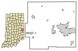
Wilkinson is a town in Brown Township, Hancock County, Indiana, United States. The population was 449 at the 2010 census.

<span class="mw-page-title-main">New Middletown, Indiana</span> Town in Indiana, United States

New Middletown is a town in Webster Township, Harrison County, Indiana, United States. The population was 93 at the 2010 census.

<span class="mw-page-title-main">Greensboro, Indiana</span> Town in Indiana, United States

Greensboro is a town in Greensboro Township, Henry County, Indiana, United States. The population was 143 at the 2010 census. The town was a 'station' on the Underground Railroad and was recognized for its active abolitionists.

<span class="mw-page-title-main">Sidney, Indiana</span> Town in Indiana, United States

Sidney is a town in Jackson Township, Kosciusko County, in the U.S. state of Indiana. The population was 83 at the 2010 census.

<span class="mw-page-title-main">Silver Lake, Indiana</span> Town in Indiana, United States

Silver Lake is a town in Lake Township, Kosciusko County, in the U.S. state of Indiana. The population was 915 at the 2010 census.

<span class="mw-page-title-main">Topeka, Indiana</span> Town in Indiana, United States

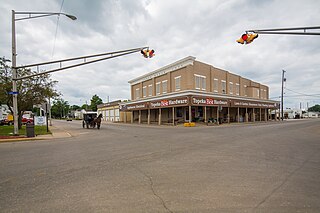
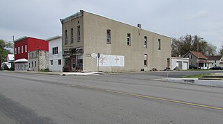
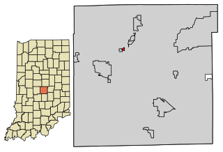
Topeka is a town in Clearspring and Eden townships, LaGrange County, Indiana, United States. The population was 1,153 at the 2010 census. Topeka is located approximately eleven miles south of Shipshewana, Indiana.

<span class="mw-page-title-main">Kingsbury, Indiana</span> Town in Indiana, United States

Kingsbury is a town in Washington Township, LaPorte County, Indiana, just northwest of the intersection of U.S. Route 35 and U.S. Route 6. The town was founded in 1835 and incorporated on March 3, 1941. During 1940 - 1941, the Kingsbury Ordnance Plant (KOP) was built for use during World War II. The plant closed after the war but reopened during the Korean War, closing permanently in 1959. The population was 242 at the 2010 census. It is included in the Michigan City, Indiana-La Porte, Indiana Metropolitan Statistical Area. The town has its own fire department, KVFD, and a Greek revival style First Baptist church built in 1851 with its own graveyard and Winchell Cemetery.

<span class="mw-page-title-main">Saratoga, Indiana</span> Town in Indiana, United States

Saratoga is a town in Ward Township, Randolph County, in the U.S. state of Indiana. The population was 254 at the 2010 census.

<span class="mw-page-title-main">Hudson, Indiana</span> Town in Indiana, United States

Hudson is a town in Salem and Steuben townships, Steuben County, in the U.S. state of Indiana. The population was 518 at the 2010 census.

<span class="mw-page-title-main">Boston, Indiana</span> Town in Indiana, United States

Boston is a town in Boston Township, Wayne County, Indiana, United States. The population was 138 at the 2010 census.

<span class="mw-page-title-main">Cambridge City, Indiana</span> Town in Indiana, United States

Cambridge City is a town in Jackson Township, Wayne County, in the U.S. state of Indiana. The population was 1,870 at the 2010 census.

<span class="mw-page-title-main">Milton, Indiana</span> Town in Indiana, United States

Milton is a town in Washington Township, Wayne County, in the U.S. state of Indiana. The population was 490 at the 2010 census.

<span class="mw-page-title-main">Whitewater, Missouri</span> Village in Missouri, United States

Whitewater is a village in Hubble Township in southwestern Cape Girardeau County, Missouri, United States. The population was 88 at the 2020 census. It is part of the Cape Girardeau–Jackson, MO-IL Metropolitan Statistical Area.

<span class="mw-page-title-main">Meridian Hills, Indiana</span> Town in Indiana, United States

Meridian Hills is a town in Washington Township, Marion County, Indiana, about 8 miles (13 km) north of downtown Indianapolis. It had a population of 1,774 at the 2020 census, up from 1,616 in 2010.

<span class="mw-page-title-main">Spring Hill, Indiana</span> Town in Indiana, United States

Spring Hill is a town in Marion County, Indiana, United States. The population was 95 at the 2020 census. It has existed as an "included town" since 1970, when it was incorporated into Indianapolis as part of Unigov. It is part of Indianapolis, but retains town governmental powers under IC 36-3-1-11.

References

  1. "2020 U.S. Gazetteer Files". United States Census Bureau. Retrieved March 16, 2022.
  2. 1 2 3 U.S. Geological Survey Geographic Names Information System: Whitewater, Indiana
  3. 1 2 "U.S. Census website". United States Census Bureau . Retrieved January 31, 2008.
  4. Young, Andrew White (1872). History of Wayne County, Indiana, from Its First Settlement to the Present Time. R. Clarke & Company. pp.  217.
  5. "Profile for Whitewater, IN". ePodunk . Retrieved July 7, 2016.
  6. History of Wayne County, Indiana: Together with Sketches of Its Cities, Villages and Towns, Volume 2. Inter-State Publishing Company. 1884. p. 399.
  7. "G001 - Geographic Identifiers - 2010 Census Summary File 1". United States Census Bureau. Archived from the original on February 13, 2020. Retrieved July 25, 2015.
  8. "Census of Population and Housing". Census.gov. Retrieved June 4, 2015.
  9. "U.S. Census website". United States Census Bureau . Retrieved December 11, 2012.