Milton, Indiana

Last updated

Milton, Indiana
Milton, Indiana.jpg
Wayne County Indiana Incorporated and Unincorporated areas Milton Highlighted 1849860.svg
Location of Milton in Wayne County, Indiana.
Coordinates: 39°47′10″N85°09′23″W / 39.78611°N 85.15639°W / 39.78611; -85.15639
Country United States
State Indiana
County Wayne
Township Washington
Area
[1]
  Total0.28 sq mi (0.73 km2)
  Land0.28 sq mi (0.72 km2)
  Water0.00 sq mi (0.01 km2)
Elevation
[2]
935 ft (285 m)
Population
 (2020)
  Total455
  Density1,642.60/sq mi (633.15/km2)
Time zone UTC-5 (Eastern (EST))
  Summer (DST) UTC-4 (EDT)
ZIP code
47357
Area code 765
FIPS code 18-49860 [3]
GNIS feature ID2396767 [2]

Milton is a town in Washington Township, Wayne County, in the U.S. state of Indiana. [2] The population was 490 at the 2010 census.

Contents

History

Milton was laid out and platted in 1824. [4] The community was named for the presence of several watermills in the area. [5]

The Milton post office has been in operation since 1825. [6] The Milton post office is currently closed. Due to arson.

By 1826, Milton had a population of nearly 200. [7]

Geography

According to the 2010 census, Milton has a total area of 0.27 square miles (0.70 km2), all land. [8]

Demographics

Historical population
CensusPop.Note
1850 765
1870 823
1880 8553.9%
1890 742−13.2%
1900 682−8.1%
1910 601−11.9%
1920 580−3.5%
1930 6125.5%
1940 6465.6%
1950 75216.4%
1960 700−6.9%
1970 694−0.9%
1980 7295.0%
1990 634−13.0%
2000 611−3.6%
2010 490−19.8%
2020 455−7.1%
U.S. Decennial Census [9]

2010 census

As of the census [10] of 2010, there were 490 people, 197 households, and 136 families living in the town. The population density was 1,814.8 inhabitants per square mile (700.7/km2). There were 227 housing units at an average density of 840.7 per square mile (324.6/km2). The racial makeup of the town was 98.4% White, 0.2% African American, 1.2% Native American, and 0.2% from two or more races. Hispanic or Latino of any race were 0.8% of the population.

There were 197 households, of which 29.9% had children under the age of 18 living with them, 47.7% were married couples living together, 11.2% had a female householder with no husband present, 10.2% had a male householder with no wife present, and 31.0% were non-families. 24.9% of all households were made up of individuals, and 12.7% had someone living alone who was 65 years of age or older. The average household size was 2.49 and the average family size was 2.85.

The median age in the town was 40.2 years. 22% of residents were under the age of 18; 8.8% were between the ages of 18 and 24; 28.5% were from 25 to 44; 26.5% were from 45 to 64; and 14.1% were 65 years of age or older. The gender makeup of the town was 50.4% male and 49.6% female.

2000 census

As of the census [3] of 2000, there were 611 people, 235 households, and 173 families living in the town. The population density was 2,251.3 inhabitants per square mile (869.2/km2). There were 244 housing units at an average density of 899.0 per square mile (347.1/km2). The racial makeup of the town was 98.85% White, and 1.15% from two or more races. Hispanic or Latino of any race were 0.16% of the population.

There were 235 households, out of which 33.6% had children under the age of 18 living with them, 59.1% were married couples living together, 10.2% had a female householder with no husband present, and 26.0% were non-families. 23.4% of all households were made up of individuals, and 10.2% had someone living alone who was 65 years of age or older. The average household size was 2.60 and the average family size was 3.06.

In the town, the population was spread out, with 27.3% under the age of 18, 7.2% from 18 to 24, 31.9% from 25 to 44, 20.3% from 45 to 64, and 13.3% who were 65 years of age or older. The median age was 35 years. For every 100 females, there were 96.5 males. For every 100 females age 18 and over, there were 92.2 males.

The median income for a household in the town was $35,167, and the median income for a family was $36,635. Males had a median income of $30,250 versus $18,036 for females. The per capita income for the town was $15,131. About 10.2% of families and 11.3% of the population were below the poverty line, including 16.7% of those under age 18 and 7.8% of those age 65 or over.

Notable people

See also

Related Research Articles

<span class="mw-page-title-main">Zanesville, Indiana</span> Town in Indiana, United States

Zanesville is a town in Wells and Allen counties in the U.S. state of Indiana, southwest of Fort Wayne. The population was 580 at the 2020 Census, down from 600 at the 2010 census.

<span class="mw-page-title-main">Hartsville, Indiana</span> Town in Indiana, United States

Hartsville is a town in Haw Creek and Clifty townships, Bartholomew County, Indiana, United States. The population was 362 at the 2010 census. It is part of the Columbus, Indiana metropolitan statistical area.

<span class="mw-page-title-main">Jonesville, Indiana</span> Town in Indiana, United States

Jonesville is a town in Wayne Township, Bartholomew County, in the U.S. state of Indiana. The population was 177 at the 2010 census. It is part of the Columbus, Indiana metropolitan statistical area.

<span class="mw-page-title-main">Chesterfield, Indiana</span> Town in Indiana, United States

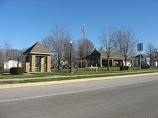
Chesterfield is a town in the U.S. state of Indiana which lies in Union Township, Madison County, and Salem Township, Delaware County. The population was 2,490 at the 2020 census. It is part of the Indianapolis–Carmel–Anderson metropolitan statistical area.

<span class="mw-page-title-main">Upland, Indiana</span> Town in Indiana, United States

Upland is a town in Jefferson Township, Grant County, Indiana, United States. The population was 3,821 at the 2020 census. It is the home of Taylor University, a Christian college.

<span class="mw-page-title-main">Bryant, Indiana</span> Town in Indiana, United States

Bryant is a town in Bearcreek Township, Jay County, Indiana, United States. The population was 252 at the 2010 census.

<span class="mw-page-title-main">Salamonia, Indiana</span> Town in Indiana, United States

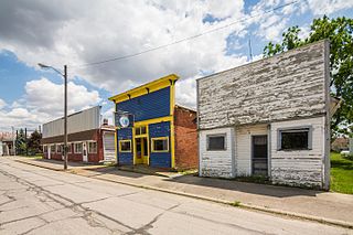
Salamonia is a town in Madison Township, Jay County, Indiana, United States. The population was 157 at the 2010 census. The town is situated along the Salamonie River, near its headwaters in Northern Indiana.

<span class="mw-page-title-main">Brooksburg, Indiana</span> Town in Indiana, United States

Brooksburg is a town in Milton Township, Jefferson County, Indiana, United States. The population was 81 at the 2010 census.

<span class="mw-page-title-main">Wolcottville, Indiana</span> Town in Indiana, United States

Wolcottville is a town in Orange Township, Noble County and Johnson Township, LaGrange County in the U.S. state of Indiana. The population was 998 at the 2010 census.

<span class="mw-page-title-main">Hamlet, Indiana</span> Town in Starke County, Indiana, United States

Hamlet is a town in Davis and Oregon Townships, Starke County, in the U.S. state of Indiana. The population was 800 as of the 2010 census.

<span class="mw-page-title-main">Boston, Indiana</span> Town in Indiana, United States

Boston is a town in Boston Township, Wayne County, Indiana, United States. The population was 138 at the 2010 census.

<span class="mw-page-title-main">Cambridge City, Indiana</span> Town in Indiana, United States

Cambridge City is a town in Jackson Township, Wayne County, in the U.S. state of Indiana. The population was 1,870 at the 2010 census.

<span class="mw-page-title-main">Dublin, Indiana</span> Town in Indiana, United States

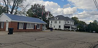
Dublin is a town in Jackson Township, Wayne County, in the U.S. state of Indiana. The population was 679 at the 2020 census.

<span class="mw-page-title-main">East Germantown, Indiana</span> Town in Indiana, United States

East Germantown is a town in Jackson Township, Wayne County, in the U.S. state of Indiana. The population was 410 at the 2010 census.

<span class="mw-page-title-main">Economy, Indiana</span> Town in Indiana, United States

Economy is a town in Perry Township, Wayne County, in the U.S. state of Indiana. The population was 173 at the 2021 census.

<span class="mw-page-title-main">Fountain City, Indiana</span> Town in Indiana, United States

Fountain City, formerly Newport, is a town in New Garden Township, Wayne County, in the U.S. state of Indiana. The population was 796 at the 2010 census.

<span class="mw-page-title-main">Mount Auburn, Indiana</span> Town in Indiana, United States

Mount Auburn is a town in Jackson Township, Wayne County, in the U.S. state of Indiana. The population was 117 at the 2010 census. The town is sandwiched between Dublin and Cambridge City.

<span class="mw-page-title-main">Spring Grove, Indiana</span> Town in Indiana, United States

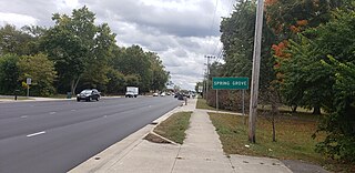
Spring Grove is a town in Wayne Township, Wayne County, in the U.S. state of Indiana. The population was 344 at the 2010 census.

<span class="mw-page-title-main">Whitewater, Indiana</span> Town in Indiana, United States

Whitewater is a town in Franklin Township, Wayne County, in the U.S. state of Indiana. The population was 83 at the 2010 census.

<span class="mw-page-title-main">Ludlow Falls, Ohio</span> Village in Ohio, United States

Ludlow Falls is a village in Miami County, Ohio, United States. The population was 175 at the 2020 census. It is part of the Dayton Metropolitan Statistical Area. Ludlow Falls is named after surveyor Israel Ludlow.

References

  1. "2020 U.S. Gazetteer Files". United States Census Bureau. Retrieved March 16, 2022.
  2. 1 2 3 U.S. Geological Survey Geographic Names Information System: Milton, Indiana
  3. 1 2 "U.S. Census website". United States Census Bureau . Retrieved January 31, 2008.
  4. Young, Andrew White (1872). History of Wayne County, Indiana, from Its First Settlement to the Present Time. R. Clarke & Company. pp.  325.
  5. "Profile for Milton, IN". ePodunk . Retrieved July 7, 2016.
  6. "Wayne County". Jim Forte Postal History. Retrieved July 7, 2016.
  7. History of Wayne County, Indiana: Together with Sketches of Its Cities, Villages and Towns, Volume 2. Inter-State Publishing Company. 1884. p. 722.
  8. "G001 - Geographic Identifiers - 2010 Census Summary File 1". United States Census Bureau. Archived from the original on February 13, 2020. Retrieved July 17, 2015.
  9. "Census of Population and Housing". Census.gov. Retrieved June 4, 2015.
  10. "U.S. Census website". United States Census Bureau . Retrieved December 11, 2012.