
Berwick is an unincorporated community in Polk County, Iowa, United States, on the east bank of Fourmile Creek. It is part of the Des Moines–West Des Moines Metropolitan Statistical Area.
Duncan is a census-designated place (CDP) in Hancock County, Iowa, United States. The population was 131 at the 2010 census.
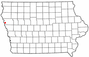
Luton is a town located in Woodbury County, Iowa, United States. It is part of the Sioux City/Nebraska/South Dakota Metropolitan Statistical Area.
Bolan is an unincorporated community and census-designated place in Worth County, Iowa, United States. As of the 2010 Census the population was 33. It lies at 43°22′19″N93°07′10″W, at an altitude of 1,227 feet (374 m). The community is part of the Mason City Micropolitan Statistical Area.
Green Mountain is a rural unincorporated community and census-designated place (CDP) in Marshall County, Iowa, United States. It is located in Marion Township. As of the 2020 census the population of Green Mountain was 113.
Folletts is an unincorporated community in Clinton County, Iowa, United States. It is located at the intersections of 292nd Street and County Highway Z36 on the north bank of the Wapsipinicon River. It is one mile west of Shaffton and three miles east of McCausland, at 41.750099N, -90.354990W.
Allendorf is an unincorporated community in Osceola County, Iowa, United States. It is located on Highway 59, five miles east of Sibley, at 43.413270N, -95.64318W, adjacent to the Johnson Wilderness Area.
Zaneta is an unincorporated community in Grundy County, Iowa, United States.
Adaza is an unincorporated community in Greene County, Iowa, United States. It is located on County Road E13, three miles northwest of Churdan, at 42.194705N, -94.4969273W.
Ardon is a former townsite and unincorporated community in Muscatine County, Iowa, United States. It is located at the intersection of 250th Street and Jasper Avenue, four miles east of Cranston, at 41.366543N, -94.317809W.
Dunbar is an unincorporated community and former railroad depot village in Green Castle Township, Marshall County, Iowa, United States.
Plato is an unincorporated community in Cedar County, Iowa, United States. Plato is located at 41°44′17″N91°18′31″W.
Cleves, Iowa, is a small town in north central Iowa with a bank, a repair shop, and a grain elevator. Cleves is in Hardin County, Iowa.
Nashville is an unincorporated community in Jackson County, in the U.S. state of Iowa.
James is an unincorporated community in Plymouth County, in the U.S. state of Iowa.
Van Cleve is an unincorporated community in Marshall County, in the U.S. state of Iowa.
Vandalia is an unincorporated community in Jasper County, in the U.S. state of Iowa.
Macy is a former unincorporated community in northern Hardin County, in the U.S. state of Iowa.
Jacobs was an unincorporated community in Poweshiek County, in the U.S. state of Iowa.
Bromley is a former village in Minerva Township, Marshall County, Iowa, United States.


