
Marshall County is a county located in the U.S. state of Iowa. As of the 2020 census, the population was 40,105. The county seat is Marshalltown. The county was formed on January 13, 1846, and named after John Marshall, Chief Justice of the United States Supreme Court.

Linn County is a county located in the U.S. state of Iowa. As of the 2020 census, the population was 230,299, making it the second-most populous county in Iowa. The county seat is Cedar Rapids. Linn County is named in honor of Senator Lewis F. Linn of Missouri. Linn County is included in the Cedar Rapids, IA Metropolitan Statistical Area.

La Moille is a village in Bureau County, Illinois, United States. The population was 679 at the 2020 census. It is part of the Ottawa Micropolitan Statistical Area.

Ely is a city in Linn County, Iowa. The population was 2,328 at the time of the 2020 census. It is part of the Cedar Rapids metropolitan area

Marion is a city in Linn County, Iowa, United States. The population was 26,294 at the 2000 census and was 41,535 in 2020, an increase of 58%. The city is located next to Cedar Rapids and part of the Cedar Rapids Metropolitan Statistical Area.

Marshalltown is a city in the U.S. state of Iowa and the seat of Iowa's Marshall County. With a population of 27,591 at the 2020 census, it is the 16th largest city in the state. Marshalltown is home to the Iowa Veterans Home and Marshalltown Community College.

Ackley is a city in the Franklin and Hardin counties in the U.S. state of Iowa. The population was 1,599 at the 2020 census.
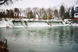
The Cedar River is a 338-mile-long (544 km) river in Minnesota and Iowa. It is a tributary of the Iowa River, which flows to the Mississippi River. The Cedar River takes its name from the red cedar trees growing there, and was originally called the Red Cedar River by the Mequaci. The first Mississippi steamboat reached Cedar Rapids, Iowa in 1844, and during the next decade, the Red Cedar was an important commercial waterway. The surrounding region is known officially as the Cedar River Valley, though it is more commonly referred to simply as the Cedar Valley. The stream is young geologically, and only in places where the glacial material has been removed is the underlying bedrock exposed.

Monti is an unincorporated community located in the southeast corner of Buchanan County, Iowa, in the United States. Founded in the 1880s and platted in 1905, the community lies on the west bank of Buffalo Creek, 6 miles (10 km) east of Quasqueton and 8 miles (13 km) west of Ryan.

U.S. Highway 30 (US 30) is a major east–west U.S. Highway which spans 330 miles (530 km) across the state of Iowa. It is the longest primary highway in the state and is maintained by the Iowa Department of Transportation. The route in Iowa begins at the Missouri River crossing at Blair, Nebraska, and ends at the Mississippi River crossing at Clinton, Iowa. Along the way, it serves Denison and Carroll in western Iowa, Boone, Ames, and Marshalltown in central Iowa, and Tama, Cedar Rapids, and DeWitt in eastern Iowa. Cutting across the central portion of the state, US 30 runs within close proximity of the Union Pacific Railroad's Overland Route for its entire length.

Iowa Highway 330 is a 47-mile-long (76 km) state highway that runs northeasterly from Altoona past Albion, to just north of Marshalltown in Marshall County. Originally the two-lane, unpaved road was numbered Iowa 88. It became part of Iowa 64 in the 1903s and it received its current route number in 1969. Iowa 330 is mostly a four-lane, divided expressway along much of its length. In conjunction with U.S. Route 65 in Iowa (US 65), Iowa 14 and US 20, Iowa 330 is commonly used as a connector between Des Moines and the Waterloo–Cedar Falls area.

Benton Township is one of twenty townships in Benton County, Iowa, USA. As of the 2000 census, its population was 900.
Bruce Township is one of twenty townships in Benton County, Iowa, USA. As of the 2000 census, its population was 319. As of 2018, the population is 298.

Jackson Township is one of twenty townships in Benton County, Iowa, USA. As of the 2000 census, its population was 710.

Socrates Hotchkiss Tryon Sr. was a pioneer physician in what became the U.S. state of Oregon. A native of Vermont, he later lived in Iowa and California before moving to the Oregon Territory where he settled the land that now comprises part of the Tryon Creek State Natural Area in Portland and Lake Oswego. He was also a member of the 1846 Iowa Constitutional Convention.
Green Mountain is a rural unincorporated community and census-designated place (CDP) in Marshall County, Iowa, United States. It is located in Marion Township. As of the 2020 census the population of Green Mountain was 113.
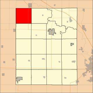
Minerva Township is a township in Iowa's Marshall County, near the geographic center of the state.

Marshalltown is an unincorporated community located within Mannington Township, in Salem County, New Jersey. It has also been known as Frogtown.
Secor, previously known as Xenia and Delanti, is a ghost town in Hardin County, Iowa, United States. The community was 3.5 miles (5.6 km) south-southeast of Eldora. In its early years, the community was the site of one of the few bridges across the Iowa River in Hardin County. By the mid-20th century, however, the community had lost its school, mill, post office, and businesses, and Secor was considered a ghost town.
Van Cleve is an unincorporated community in Marshall County, in the U.S. state of Iowa.


