St. Anthony, Iowa

Last updated
St. Anthony, Iowa
Marshall County Iowa Incorporated and Unincorporated areas St. Anthony Highlighted.svg
Location of St. Anthony, Iowa
Coordinates: 42°7′27″N93°11′48″W / 42.12417°N 93.19667°W / 42.12417; -93.19667 Coordinates: 42°7′27″N93°11′48″W / 42.12417°N 93.19667°W / 42.12417; -93.19667
Country Flag of the United States.svg  United States
State Flag of Iowa.svg  Iowa
County Marshall
Area
[1]
  Total0.61 sq mi (1.59 km2)
  Land0.61 sq mi (1.59 km2)
  Water0.00 sq mi (0.00 km2)
Elevation
1,010 ft (308 m)
Population
 (2020)
  Total76
  Density123.98/sq mi (47.87/km2)
Time zone UTC-6 (Central (CST))
  Summer (DST) UTC-5 (CDT)
ZIP code
50239 [2]
Area code 641
FIPS code 19-69780
GNIS feature ID0460930

St. Anthony is a city in Marshall County, Iowa, United States. The population was 76 at the time of the 2020 census. [3]

Contents

History

St. Anthony was incorporated in 1897 and it was named by two of its founders, John Q. Saint and Anthony R. Pierce. [4]

Geography

St. Anthony is located at 42°7′27″N93°11′48″W / 42.12417°N 93.19667°W / 42.12417; -93.19667 (42.124164, -93.196667). [5]

According to the United States Census Bureau, the city has a total area of 0.56 square miles (1.45 km2), all land. [6]

Demographics

Historical populations
YearPop.±%
1900 174    
1910 199+14.4%
1920 203+2.0%
1930 202−0.5%
1940 211+4.5%
1950 175−17.1%
1960 130−25.7%
1970 156+20.0%
1980 140−10.3%
1990 112−20.0%
2000 109−2.7%
2010 102−6.4%
2020 76−25.5%
Source: "U.S. Census website". United States Census Bureau . Retrieved 2020-03-29. and Iowa Data Center
Source:
U.S. Decennial Census [7] [3]

2010 census

As of the census [8] of 2010, there were 102 people, 40 households, and 27 families living in the city. The population density was 182.1 inhabitants per square mile (70.3/km2). There were 50 housing units at an average density of 89.3 per square mile (34.5/km2). The racial makeup of the city was 92.2% White, 1.0% African American, 2.9% Native American, 1.0% Asian, and 2.9% from two or more races. Hispanic or Latino of any race were 5.9% of the population.

There were 40 households, of which 37.5% had children under the age of 18 living with them, 40.0% were married couples living together, 15.0% had a female householder with no husband present, 12.5% had a male householder with no wife present, and 32.5% were non-families. 25.0% of all households were made up of individuals, and 5% had someone living alone who was 65 years of age or older. The average household size was 2.55 and the average family size was 3.00.

The median age in the city was 35 years. 28.4% of residents were under the age of 18; 4% were between the ages of 18 and 24; 27.4% were from 25 to 44; 33.3% were from 45 to 64; and 6.9% were 65 years of age or older. The gender makeup of the city was 53.9% male and 46.1% female.

2000 census

As of the census [9] of 2000, there were 109 people, 44 households, and 28 families living in the city. The population density was 194.5 inhabitants per square mile (75.1/km2). There were 52 housing units at an average density of 92.8 per square mile (35.8/km2). The racial makeup of the city was 96.33% White, 0.92% Native American, 0.92% from other races, and 1.83% from two or more races. Hispanic or Latino of any race were 0.92% of the population.

There were 44 households, out of which 29.5% had children under the age of 18 living with them, 50.0% were married couples living together, 11.4% had a female householder with no husband present, and 34.1% were non-families. 25.0% of all households were made up of individuals, and 6.8% had someone living alone who was 65 years of age or older. The average household size was 2.48 and the average family size was 2.90.

In the city, the population was spread out, with 24.8% under the age of 18, 11.0% from 18 to 24, 35.8% from 25 to 44, 15.6% from 45 to 64, and 12.8% who were 65 years of age or older. The median age was 34 years. For every 100 females, there were 84.7 males. For every 100 females age 18 and over, there were 100.0 males.

The median income for a household in the city was $30,625, and the median income for a family was $37,500. Males had a median income of $26,875 versus $19,375 for females. The per capita income for the city was $15,218. There were 7.9% of families and 13.1% of the population living below the poverty line, including 15.4% of under eighteens and 5.3% of those over 64.

Related Research Articles

<span class="mw-page-title-main">Bloomingdale, Georgia</span> City in Georgia, United States

Bloomingdale is a city in Chatham County, Georgia, United States. As of the 2020 census, the city had a population of 2,790. It is part of the Savannah Metropolitan Statistical Area.

Lake Catherine is an unincorporated community and census-designated place (CDP) in Lake County, Illinois, United States. Per the 2020 census, the population was 1,279.

<span class="mw-page-title-main">Udell, Iowa</span> City in Iowa, United States

Udell is a city in Appanoose County, Iowa, United States. The population was 28 at the time of the 2020 census.

<span class="mw-page-title-main">Frederika, Iowa</span> City in Iowa, United States

Frederika is a city in Bremer County, Iowa, United States. The population was 204 at the time of the 2020 census. It is named for Fredrika Bremer, the Swedish author, for whom the surrounding county was also named.

<span class="mw-page-title-main">Maynard, Iowa</span> City in Iowa, United States

Maynard is a city in Fayette County, Iowa, United States. The population was 476 at the time of the 2020 census.

<span class="mw-page-title-main">Ladora, Iowa</span> City in Iowa, United States

Ladora is a city in Iowa County, Iowa, United States. The population was 229 at the time of the 2020 census.

<span class="mw-page-title-main">Oakland Acres, Iowa</span> City in Iowa, United States

Oakland Acres is a city in Jasper County, Iowa, United States. The population was 176 at the time of the 2020 census.

<span class="mw-page-title-main">Hayesville, Iowa</span> City in Iowa, United States

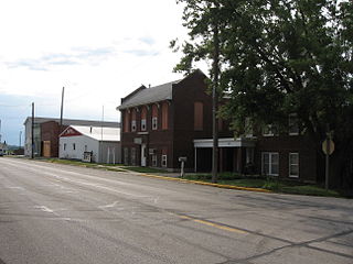
Hayesville is a city in Keokuk County, Iowa, United States. The population was 41 at the time of the 2020 census.

<span class="mw-page-title-main">North Branch, Michigan</span> Village in Michigan, United States

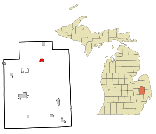
North Branch is a village in Lapeer County in the U.S. state of Michigan. The population was 1,033 at the 2010 census. The village is located within North Branch Township.

<span class="mw-page-title-main">Fountain, Minnesota</span> City in Minnesota, United States

Fountain is a city in Fillmore County, Minnesota, United States. The population was 410 at the 2010 census. Fountain is the western terminus of the Root River segment of the Root River State Trail. Local attractions include the Fillmore County History Center.

<span class="mw-page-title-main">Hoyt Lakes, Minnesota</span> City in Minnesota, United States

Hoyt Lakes is a city in Saint Louis County, Minnesota. The population was 2,017 at the time of the 2010 census.

<span class="mw-page-title-main">Leonidas, Minnesota</span> City in Minnesota, United States

Leonidas is a city in Saint Louis County, Minnesota, United States. The population was 52 at the 2010 census.

<span class="mw-page-title-main">Orr, Minnesota</span> City in Minnesota, United States

Orr is a city in Saint Louis County, Minnesota, United States. The population was 211 at the 2020 census.

<span class="mw-page-title-main">Montrose, Mississippi</span> Town in Mississippi, United States

Montrose is a town in Jasper County, Mississippi, United States. The population was 140 at the 2010 census.

<span class="mw-page-title-main">Tuscarora Township, Bradford County, Pennsylvania</span> Township in Pennsylvania, United States

Tuscarora Township is a township in Bradford County, Pennsylvania. It is part of Northeastern Pennsylvania. The population was 1,131 at the 2010 census.

<span class="mw-page-title-main">Castanea Township, Clinton County, Pennsylvania</span> Township in Pennsylvania, United States

Castanea Township is a township in Clinton County, Pennsylvania, United States. The population was 1,095 at the 2020 census.

<span class="mw-page-title-main">Wayne Township, Clinton County, Pennsylvania</span> Township in Pennsylvania, United States

Wayne Township is a township in Clinton County, Pennsylvania, United States. As of the 2020 census, the township had a population of 1,476, down from 1,666 in 2010.

<span class="mw-page-title-main">Bay City, Wisconsin</span> Village in Wisconsin, United States

Bay City is a village on the Mississippi River in Pierce County, Wisconsin, United States. The population was 500 at the 2010 census.

<span class="mw-page-title-main">Barnes City, Iowa</span> City in Iowa, United States

Barnes City is a city in Mahaska and Poweshiek counties in the U.S. state of Iowa. The population was 156 at the 2020 census.

<span class="mw-page-title-main">Mount Hope, Wisconsin</span> Village in Wisconsin, United States

Mount Hope is a village in Grant County, Wisconsin, United States. The population was 225 at the 2010 census. The village is located within the Town of Mount Hope.

References

  1. "2020 U.S. Gazetteer Files". United States Census Bureau. Retrieved March 16, 2022.
  2. "Saint Anthony ZIP Code". zipdatamaps.com. 2022. Retrieved November 11, 2022.
  3. 1 2 "2020 Census State Redistricting Data". census.gov. United states Census Bureau. Retrieved 12 August 2021.
  4. Battin, William (1912). Past and Present of Marshall County, Iowa, Volume 1. Brookhaven Press. p. 186. ISBN   9781581038972.
  5. "US Gazetteer files: 2010, 2000, and 1990". United States Census Bureau. 2011-02-12. Retrieved 2011-04-23.
  6. "US Gazetteer files 2010". United States Census Bureau. Archived from the original on 2012-01-25. Retrieved 2012-05-11.
  7. "Census of Population and Housing". Census.gov. Retrieved June 4, 2015.
  8. "U.S. Census website". United States Census Bureau . Retrieved 2012-05-11.
  9. "U.S. Census website". United States Census Bureau . Retrieved 2008-01-31.