
Lower Merion Township is a township in Montgomery County, Pennsylvania and part of the Philadelphia Main Line. As of the 2016 U.S. Census, the township had a total population of 58,288. Lower Merion has the 5th highest per-capita income and the 12th highest median household income in the country with a population of 50,000 or more.
Narberth is a borough in Montgomery County, Pennsylvania, United States. It is one of many neighborhoods on the historic Pennsylvania Main Line. The population was 4,282 at the 2010 census.

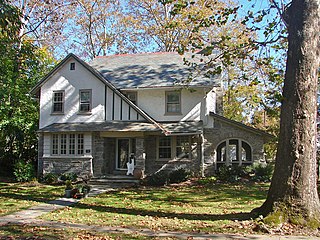
Merion Station is an unincorporated community in Pennsylvania, United States, bordering Philadelphia to the city's west. It is one of the communities that make up the Philadelphia Main Line, and is part of the municipality of Lower Merion Township, Montgomery County. Merion Station is known for its grand mansions and for the wealth of its residents.
The Philadelphia Main Line, known simply as the Main Line, is an informally delineated historical and social region of suburban Philadelphia, Pennsylvania. Lying along the former Pennsylvania Railroad's once prestigious Main Line, it runs northwest from Center City Philadelphia parallel to Lancaster Avenue.

Bala Cynwyd is a community in Lower Merion Township, Pennsylvania, US. It is located on the Main Line in southeastern Pennsylvania, bordering the western edge of Philadelphia at US Route 1. It was originally two separate towns, Bala and Cynwyd, but is commonly treated as a single community. This came about when a single US Post Office served both towns using ZIP code 19004. The community was long known as hyphenated Bala-Cynwyd. Bala and Cynwyd are currently served by separate stations on SEPTA's Cynwyd Line of Regional Rail.

Wynnefield is a diverse middle-class neighborhood in West Philadelphia. Its borders are 53rd Street at Jefferson to the south, Philadelphia's Fairmount Park to the east, City Avenue to the north and the Amtrak Main Line tracks to the west.

Manayunk is a neighborhood in the section of Lower Northwest Philadelphia in the state of Pennsylvania. Located adjacent to the neighborhoods of Roxborough and Wissahickon and also on the banks of the Schuylkill River, Manayunk contains the first canal begun in the United States. The area's name is derived from the language of the Lenape Indians. In 1686-dated papers between William Penn and the Lenape, the Lenape referred to the Schuylkill River as "Manaiung", their word for "river", which literally translates as "place to drink"; the word was later altered and adopted as the town's name.

West Philadelphia, nicknamed West Philly, is a section of Philadelphia, Pennsylvania. Though there is no official definition of its boundaries, it is generally considered to reach from the western shore of the Schuylkill River, to City Avenue to the northwest, Cobbs Creek to the southwest, and the SEPTA Media/Elwyn Line to the south. An alternate definition includes all city land west of the Schuylkill; this would also include Southwest Philadelphia and its neighborhoods. The eastern side of West Philadelphia is also known as University City.

Wynnewood is a suburban unincorporated community, west of Philadelphia, that straddles Lower Merion Township, Montgomery County and Haverford Township, Delaware County, Pennsylvania, United States. It was named in 1691 for Dr. Thomas Wynne, William Penn's physician and the first Speaker of the Pennsylvania General Assembly. Wynnewood is one of many neighborhoods on the historic Pennsylvania Main Line, and is the home of institutions such as Lankenau Hospital, St. Charles Borromeo Seminary, Palmer Theological Seminary, and Friends' Central School.
The Schuylkill Expressway, locally known as "the Schuylkill" or "the Skook", is a two to eight lane freeway through southwestern Montgomery County and the city of Philadelphia, and the easternmost segment of Interstate 76 (I-76) in the U.S. state of Pennsylvania. It extends from the Valley Forge exit of the Pennsylvania Turnpike in King of Prussia, paralleling its namesake Schuylkill River for most of the route, to the Walt Whitman Bridge in South Philadelphia. It serves as the primary corridor into Philadelphia from points west. Maintenance and planning are administered through Pennsylvania Department of Transportation (PennDOT) District 6. Constructed over a period of ten years from 1949 to 1959, a large portion of the expressway predates the 1956 introduction of Interstate Highway System; many of these portions were not built to contemporary standards. The rugged terrain, limited riverfront space covered by the route and narrow spans of bridges passing over the highway have largely stymied later attempts to upgrade or widen the highway. With the road being highly over capacity, it has become notorious for its chronic congestion. An average of 163,000 vehicles use the road daily in Philadelphia County, and an average of 109,000 use the highway in Montgomery County, making it the busiest road in Pennsylvania. Its narrow lane and left shoulder configuration, left lane entrances and exits, common construction activity and generally congested conditions have led to many accidents, critical injuries and fatalities, leading to the highway's humorous nickname of the "Surekill Expressway" or in further embellishment, the "Surekill Distressway" or the “Surekill Crawlway".

Cobbs Creek is an 11.8-mile-long (19.0 km) tributary of Darby Creek in Delaware County, Pennsylvania, in the United States. It forms an approximate border between Montgomery County and Delaware County. After Cobbs Creek passes underneath Township Line Road, it forms the border between Philadelphia County and Delaware County. It runs directly through the two sides of Mount Moriah Cemetery which spans the border of Southwest Philadelphia and Yeadon, Pennsylvania. It later joins Darby Creek before flowing into the Delaware River.

Strawberry Mansion is a neighborhood in the U.S. city of Philadelphia, Pennsylvania, located east of Fairmount Park in North Philadelphia. The neighborhood is bounded by 33rd Street to the west, 29th Street to the east, Lehigh Avenue to the north, and Oxford Street to the south. As of the 2000 census, the neighborhood had a population of 22,562. It is often associated with the historic house of the same name, Historic Strawberry Mansion, located adjacent to the neighborhood and generally thought to be the source of the community's name.

East Falls is a neighborhood in the Northwest section of Philadelphia, Pennsylvania, United States on the east or left bank side of the "Falls of the Schuylkill," cataracts submerged in 1822 by the Schuylkill Canal and Fairmount Water Works projects. East Falls sits next to the Germantown, Roxborough, Allegheny West, and Nicetown-Tioga neighborhoods, and to Wissahickon Valley Park. The neighborhood runs along a few miles of Ridge Avenue, along the banks of the Schuylkill River then extends northeast to Wissahickon Avenue. It overlooks the multi-use recreational path of Fairmount Park along Kelly Drive, and is desirable for its central location, an easy commute to Center City, with easy access to several major roadways and public transportation. East Falls continues to develop, with new housing, retail space and recreation centers in production. It has three streets with the word "Queen" in them, two train stations, a number of bars and restaurants, and illustrious mansions as well as some recently renovated housing.

Penn Valley is an unincorporated community located within Lower Merion Township, Pennsylvania. Penn Valley residents share a zip code with Merion, Narberth, or Wynnewood because the town does not have its own post office. However, Penn Valley is a distinct community whose civic association demarcates the town's boundaries with iconic signs featuring William Penn and a farmhouse in blue or red on white, dating from the town's incorporation in 1930.

Overbrook Farms is a neighborhood on the western edge of the West Philadelphia section of Philadelphia, Pennsylvania, United States. It is roughly bounded by City Avenue, 58th Street, Woodbine Avenue, and 66th Street at Morris Park. The neighborhood is bisected by Lancaster Avenue and the original Pennsylvania Railroad "main line". Today the rail line is used by both Amtrak passenger service and SEPTA's commuter Paoli/Thorndale Line.

Wynnefield Heights is a middle class neighborhood located in the greater West Philadelphia area of Philadelphia, Pennsylvania, United States. The neighborhood is bounded by City Avenue to the north, Belmont Avenue to the west, Fairmount Park to the south and east, and the Schuylkill Expressway to the east. The area is also known as Woodside Park or Balwynne Park. "Woodside Park" is the name of a former amusement park that was constructed in 1897 by the Fairmount Park Transportation Company, and that continued in operation until 1955. There are a number of apartment complexes and hotels in the neighborhood as the Schuylkill Expressway and Belmont Avenue provide quick access to Center City, Philadelphia and the near by suburbs located in Montgomery County, PA. Major business and government facilities in the neighborhood are ABC Channel 6's studios, Target, the Phila. Water Dept. Belmont Water Treatment Facility and Reservoir, the Pennsylvania State Police Troop K Barracks, and Philadelphia College of Osteopathic Medicine's (PCOM) main campus.
Located in Lower Merion Township, Pennsylvania, Belmont Hills is a suburb of Philadelphia. Belmont Hills is a neighborhood within the village of Bala Cynwyd. It is a distinct community with its own public elementary school, public pool, fire department and public library. Belmont Hills is known for its hilly terrain. Belmont means "Beautiful Mountain" so its literal name is "Beautiful Mountain Hills".
Route 38 is a bus and former streetcar route operated by the Southeastern Pennsylvania Transportation Authority (SEPTA) in Philadelphia, Pennsylvania, United States.

The Cynwyd Line is a SEPTA Regional Rail line running from Center City Philadelphia to Cynwyd in Montgomery County. Originally known as the Ivy Ridge Line, service was truncated on May 17, 1986, at its current terminus at Cynwyd. Track between Cynwyd and Ivy Ridge was dismantled between 2008 and 2010 for conversion as an interim rail trail, preventing service restoration for the foreseeable future. The Cynwyd line is the shortest of the SEPTA regional rail lines, and is the second shortest regional rail line in the United States, with only the New Jersey Transit Princeton Branch being shorter. It is by far the least ridden and least trafficked SEPTA Regional Rail Line. It is fully grade-separated.


