Related Research Articles

In archaeology and anthropology, the term excarnation refers to the practice of removing the flesh and organs of the dead before burial. Excarnation may be achieved through natural means, such as leaving a dead body exposed to the elements or for animals to scavenge; or by butchering the corpse by hand. Following excarnation, some societies retrieved the excarnated bones for burial. Excarnation has been practiced throughout the world for hundreds of thousands of years. The earliest archaeological evidence of excarnation is from the Awash River Valley in Ethiopia, 160,000 years ago. Examples of excarnation include "sky burials" in parts of Asia, the Zoroastrian "Tower of Silence", and Native American "tree burials". Excarnation is practiced for a variety of spiritual and practical reasons, including the Tibetian spiritual belief that excarnation is the most generous form of burial and the Comanche practical concern that in the winter the ground is too hard for an underground burial. Excarnation sites are identifiable in the archaeological record by a concentration of smaller bones, which would be the bones that would be the easiest to fall off the body, and that would not be noticed by practitioners of excarnation.

The Adena culture was a Pre-Columbian Native American culture that existed from 500 BCE to 100 CE, in a time known as the Early Woodland period. The Adena culture refers to what were probably a number of related Native American societies sharing a burial complex and ceremonial system. The Adena culture was centered on the location of the modern state of Ohio, but also extended into contiguous areas of northern Kentucky, eastern Indiana, West Virginia, and parts of extreme western Pennsylvania.

The Xagħra Stone Circle, also known as the Xagħra Hypogeum or the Brochtorff Circle, is a Neolithic funerary complex located in Xagħra, Gozo, Malta. It consists of a series of caves which were used to bury the dead, and which were surrounded by a walled enclosure. It mainly dates back to around 3000 to 2400 BC, although the earliest tombs at the site date back to 4100 to 3800 BC. The caves collapsed sometime before 2000 BC, and the site was later used for domestic and agricultural purposes.

Town Creek Indian Mound is a prehistoric Native American archaeological site located near present-day Mount Gilead, Montgomery County, North Carolina, in the United States. The site, whose main features are a platform mound with a surrounding village and wooden defensive palisade, was built by the Pee Dee, a South Appalachian Mississippian culture people that developed in the region as early as 980 CE. They thrived in the Pee Dee River region of North and South Carolina during the Pre-Columbian era. The Town Creek site was an important ceremonial site occupied from about 1150—1400 CE. It was abandoned for unknown reasons. It is the only ceremonial mound and village center of the Pee Dee located within North Carolina.
Indian Knoll is an archaeological site near the Green River in Ohio County, Kentucky that was declared to be a U.S. National Historic Landmark.
Mumba Cave, located near the highly alkaline Lake Eyasi in Karatu District, Arusha Region, Tanzania. The cave is a rich archaeological site noted for deposits spanning the transition between the Middle Stone Age and Late Stone Age in Eastern Africa. The transitional nature of the site has been attributed to the large presence of its large assemblage of ostrich eggshell beads and more importantly, the abundance of microlith technology. Because these type artifacts were found within the site it has led archaeologists to believe that the site could provide insight into the origins of modern human behavior. The cave was originally tested by Ludwig Kohl-Larsen and his wife Margit in their 1934 to 1936 expedition. They found abundant artifacts, rock art, and burials. However, only brief descriptions of these findings were ever published. That being said, work of the Kohl-Larsens has been seen as very accomplished due to their attention to detail, especially when one considers that neither was versed in proper archaeological techniques at the time of excavation. The site has since been reexamined in an effort to reanalyze and complement the work that has already been done, but the ramifications of improper excavations of the past are still being felt today, specifically in the unreliable collection of C-14 data and confusing stratigraphy.

The Upper Mississippian cultures were located in the Upper Mississippi basin and Great Lakes region of the American Midwest. They were in existence from approximately A.D. 1000 until the Protohistoric and early Historic periods.
Garden Creek site is an archaeological site located 24 miles (39 km) west of Asheville, North Carolina in Haywood County, on the south side of the Pigeon River and near the confluence of its tributary Garden Creek. It is near modern Canton and the Pisgah National Forest. The earliest human occupation at the site dates to 8000 BCE. The 12-acre site features remains of two villages (31Hw7) occupied first in the Woodland period and, most prominently, in the Pisgah phase associated with the South Appalachian Mississippian culture. A total of four earthwork mounds have been found at the site; three have been excavated.

Los Placeres is an archeological site located between the “Waspán” and “Tabacalera Nicaragüense” neighborhoods at kilometer 41⁄2 of the “Carretera Norte”, in Managua, en Nicaragua. The site extends to the coast of Lake Managua. A large part of the area that delimits the site is being impacted by a new urban settlement known as Barrio Hugo Chávez, which divides the site, where its new settlers have disturbed the ground for installation of pipes for drinking water, toilet and housing, this activity has caused a serious incidental findings and impacts to the prehispanic archaeological site.

Cueva de la Candelaria is an archaeological site located the Mexican state of Coahuila. It is a cave that was used as cemetery by nomad visitors. Early site research was made in 1953 and there was a later season in 1954. As a result of these investigations, many materials were recovered and are kept by Instituto Nacional de Antropología e Historia (INAH).

The Younge site is an archeological site located in Goodland Township, Lapeer County, Michigan. It is classified as a prehistoric Late Woodland site and was designated as a Michigan State Historic Site on October 29, 1971. It was added to the National Register of Historic Places on October 29, 1976.

The Riverside Site, also known as 20-ME-1, is an archaeological site located near the Riverside Cemetery in Menominee, Michigan. It was listed on the National Register of Historic Places in 1978.

The Juntunen site, also known as 20MK1, is a stratified prehistoric Late Woodland fishing village located on the western tip of Bois Blanc Island. It was listed on the National Register of Historic Places in 1978.
The Baum Site (31Ck9) is one of the most prominent Middle and Late Woodland Period sites of the Colington Phase in the state of North Carolina. It is located north of Poplar Branch in Currituck County, North Carolina. This phase, marked by cultures of the Algonkian peoples, aligns with the Late Woodland period in North Carolina, occurring during English explorations between 1584 and 1587, and permanent settlement at 1650. This village is what the first English explorers encountered when entering the coastal region. The site contained ossuaries and evidence for a coastal village adaptation. The site was registered with the National Register of Historic Places on December 8, 1982, after testing and excavations in 1972 and 1973 by David Sutton Phelps, who was an archaeologist at East Carolina University. The site is suffering from erosion due to wave action. After the initial discovery, which was the result of erosion uncovering of remains, Phelps claimed, “this will provide the first glimpse of a coastal village of this type in the state”. A residential subdivision, Currituck Crossing, is now located on the Baum site. https://web.archive.org/web/20160617035403/http://co.currituck.nc.us/pdf/board-of-commissioners-minutes-2013/boc-minutes-13nov04.pdf.

The Dumaw Creek Site is an archaeological site designated 20OA5, located along Dumaw Creek northeast of Pentwater, Michigan, that was the location of a 17th-century village and cemetery. It is one of the youngest pre-historic sites in Michigan, dating to the terminal Late Woodland Period just prior to European contact. It was listed on the National Register of Historic Places in 1972.

The Hidden Valley Rockshelter (44-BA-31) is a significant archaeological site located near the community of Warm Springs in Bath County, Virginia, United States. A large rockshelter located near the Jackson River, it has been occupied by humans for thousands of years, and it has been named a historic site.
The Romito cave is a natural limestone cave in the Lao Valley of Pollino National Park, near the town of Papasidero in Calabria, Italy. Stratigraphic record of the first excavation confirmed prolonged paleo-human occupation during the Upper Paleolithic from 17,000 years ago and the Neolithic from 6,400 years ago. A single, but exquisite piece of Upper Paleolithic parietal rock engraving was documented. Several burial sites of varying age were initially discovered. Irregularly recurring sessions have led to additional finds, which suggests future excavation work. Notable is the amount of accumulated data that has revealed deeper understanding of prehistoric daily life, the remarkable quality of the rock carvings and the burial named Romito 2, who exhibits features of pathological skeletal conditions (dwarfism).
The Huber Site (11Ck-1) is located on Tinley Creek 2 miles west of Blue Island in Cook County, Illinois, near the city of Chicago. It is classified as a late prehistoric site with Upper Mississippian affiliation.
The Fisher Mound Group is a group of burial mounds with an associated village site located on the DesPlaines River near its convergence with the Kankakee River where they combine to form the Illinois River, in Will County, Illinois, about 60 miles southwest of Chicago. It is a multi-component stratified site representing several Prehistoric Upper Mississippian occupations as well as minor Late Woodland and Early Historic components.

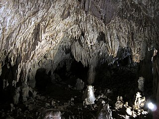
The Guyangan Cave System is a group of caves located in the island municipality of Banton, Romblon in the Philippines. It is located in Guyangan Hill, a limestone formation situated in barangays Togbongan and Toctoc, and consists of seven caves spread in an 85.3-hectare (211-acre) area of forest land.
References
- 1 2 3 Boyd Jr., C. Clifford; Boyd, Donna; Barber, Michael J.; Hubbard Jr., David A.; Barber, Michael R. (2001). "Southwest Virginia's Burial Caves: Skeletal Biology, Mortuary Behavior, and Legal Issues". Midcontinental Journal of Archaeology. 26 (2): 219-231. Retrieved May 5, 2024.
- 1 2 "National Register Information System". National Register of Historic Places . National Park Service. July 9, 2010.
- ↑ "Virginia Landmarks Register". Virginia Department of Historic Resources. Archived from the original on 2013-09-21. Retrieved 5 June 2013.
