Related Research Articles

Russell Cave National Monument is a U.S. national monument in northeastern Alabama, United States, close to the town of Bridgeport. The monument was established on May 11, 1961, when 310 acres (1.3 km2) of land were donated by the National Geographic Society to the American people. It is now administered and maintained by the National Park Service. The national monument was listed on the National Register of Historic Places on October 15, 1966.

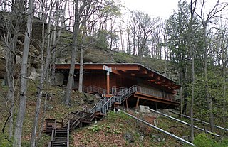
Wickliffe Mounds is a prehistoric, Mississippian culture archaeological site located in Ballard County, Kentucky, just outside the town of Wickliffe, about 3 miles (4.8 km) from the confluence of the Ohio and Mississippi rivers. Archaeological investigations have linked the site with others along the Ohio River in Illinois and Kentucky as part of the Angel phase of Mississippian culture. Wickliffe Mounds is controlled by the State Parks Service, which operates a museum at the site for interpretation of the ancient community. Listed on the National Register of Historic Places, it is also a Kentucky Archeological Landmark and State Historic Site.
The Meadowcroft Rockshelter is an archaeological site which is located near Avella in Jefferson Township, Pennsylvania. The site is a rock shelter in a bluff overlooking Cross Creek, and contains evidence that the area may have been continually inhabited for more than 19,000 years. If accurately dated, it would be one of the earliest known sites with evidence of a human presence and continuous human occupation in the New World.

The Stanfield-Worley Bluff Shelter, located on private property in Colbert County in northwestern Alabama, United States, is one of the most important prehistoric sites excavated in the state due to the archeological evidence deposited by the Paleo-Indians who once occupied the rock shelter. Lying in Sanderson Cove along a tributary of Cane Creek approximately seven miles (11 km) south of the Tennessee Valley, the shelter and the high bluffs of the surrounding valley provided a well-protected environment for the Native American occupants.

The Modoc Rock Shelter is a rock shelter or overhang located beneath the sandstone bluffs that form the eastern border of the Mississippi River floodplain at which Native American peoples lived for thousands of years. This site is significant for its archaeological evidence of thousands of years of human habitation during the Archaic period in the Eastern United States. It is located on the northeastern side of County Road 7 southeast of Prairie du Rocher in Randolph County, Illinois, United States. It was declared a National Historic Landmark in 1961.
David G. Anderson is an archaeologist in the department of anthropology at the University of Tennessee, Knoxville, who specializes in Southeastern archaeology. His professional interests include climate change and human response, exploring the development of cultural complexity in Eastern North America, maintaining and improving the nation's Cultural Resource management (CRM) program, teaching and writing about archaeology, and developing technical and popular syntheses of archaeological research. He is the project director of the on-line Paleoindian Database of the Americas (PIDBA). and a co-director, with Joshua J. Wells, Eric C, Kansa, and Sarah Whitcher Kansa, of the Digital Index of North American Archaeology (DINAA)

The Thunderbird Archaeological District, near Limeton, Virginia, is an archaeological district described as consisting of "three sites—Thunderbird Site, the Fifty Site, and the Fifty Bog—which provide a stratified cultural sequence spanning Paleo-Indian cultures through the end of Early Archaic times with scattered evidence of later occupation."

Mummy Cave is a rock shelter and archeological site in Park County, Wyoming, United States, near the eastern entrance to Yellowstone National Park. The site is adjacent to the concurrent U.S. Routes 14/16/20, on the left bank of the North Fork of the Shoshone River at an altitude of 6,310 feet (1,920 m) in Shoshone National Forest.

The Carl Potter Mound is a historic Native American mound in southern Champaign County, Ohio, United States. Located near Mechanicsburg, it lies on a small ridge in a pasture field in southeastern Union Township. In 1974, the mound was listed on the National Register of Historic Places as a potential archaeological site, primarily because of its use as a burial mound.
Dust Cave is a Paleoindian archaeology site located in northern Alabama. It is in the Highland Rim in the limestone bluffs that overlook Coffee Slough, a tributary of the Tennessee River. The site was occupied during the Pleistocene and early Holocene eras. 1LU496, another name for Dust Cave, was occupied seasonally for 7,000 years. The cave was discovered in 1984 by Dr. Richard Cobb and initially excavated in 1989 under Dr. Boyce Driskell from the University of Alabama.

The Bullskin Creek Site is an archaeological site in the southwestern portion of the U.S. state of Ohio. Located near Felicity in Clermont County, the site appears to have been a base camp for nomads during the Late Archaic period. The site comprises three loci: two significant areas of various debris and a large midden that underlies everything else. From these components, which cover an area of approximately 400 feet (120 m) by 600 feet (180 m), collectors and archaeologists have recovered hundreds of artifacts, including stone tools, weapons, and bone tools. Because the site is located in a farm field, it has frequently been cultivated, and the plow has brought at least five burials to the surface from a cemetery on the edge of the site. Among the types of features found at the site are ovens, trash pits, and postmolds. Bodies at the site were generally adorned with red ochre and buried in a flexed position.

Franktown Cave is located 25 miles (40 km) south of Denver, Colorado on the north edge of the Palmer Divide. It is the largest rock shelter documented on the Palmer Divide, which contains artifacts from many prehistoric cultures. Prehistoric hunter-gatherers occupied Franktown Cave intermittently for 8,000 years beginning about 6400 BC The site held remarkable lithic and ceramic artifacts, but it is better known for its perishable artifacts, including animal hides, wood, fiber and corn. Material goods were produced for their comfort, task-simplification and religious celebration. There is evidence of the site being a campsite or dwelling as recently as AD 1725.
The Rucker's Bottom site (9EB91) is an archaeological site in located on the upper Savannah River in Elbert County, Georgia.

Shawnee-Minisink Site is a prehistoric archaeological site located in Smithfield Township, Monroe County, Pennsylvania in the upper Delaware Valley. It was the site of a Paleoindian camp site. It was added to the National Register of Historic Places in 2007.
Hell Gap is a deeply stratified archaeological site located in the Great Plains of eastern Wyoming, approximately thirteen miles north of Guernsey, where an abundant amount of Paleoindian and Archaic artifacts have been found and excavated since 1959. This site has had an important impact on North American archaeology because of the large quantity and breadth of prehistoric Paleoindian and Archaic period artifacts and cultures it encompasses. It was designated a National Historic Landmark in 2016.

The Hidden Valley Rockshelter (44-BA-31) is a significant archaeological site located near the community of Warm Springs in Bath County, Virginia, United States. A large rockshelter located near the Jackson River, it has been occupied by humans for thousands of years, and it has been named a historic site.
The Seven Mile Island Archeological District is an archeological site on an island in the Tennessee River in Colbert and Lauderdale County, Alabama. The island is believed to have been inhabited for about 9,000 years, with the earliest artifacts dated to the early Archaic Period. Out of 18 sites identified on the island, two have had extensive study. The Perry Site (1Lu25) is a seven-foot (2.1-meter) thick midden containing ceramic potsherds from the Archaic period. The Seven Mile Island site (1Lu21) is a Mississippian village site and mound. A number of arrowheads and flint knives, as well as a bottle with an engraved bird have been found at the site. 41 burials from the Mississippian era were also unearthed.
The Quad site is a series of Paleoindian sites and localities in Limestone County near Decatur, Alabama. It was first reported by Frank Soday in 1954, and later findings were also documented by James Cambron, David Hulse and Joe Wright and Cambron and Hulse. The Quad Locale can seldom be viewed at current lake levels, even during normal winter pool, due to extensive erosion, but is considered one of the most important and well known Paleoindian sites in the Southeastern United States.
David Lloyd DeJarnette (1907-1991) was an archaeologist and professor with the University of Alabama, generally considered the "Father of Alabama Archaeology".
The Heaven's Half Acre complex is a concentration of Paleoindian sites situated on a series of Pleistocene terraces overlooking a sinkhole in northeastern Colbert County, Alabama, near the town of Leighton. Over one hundred and fifty fluted points have been recovered on these sites, making it one of the most dense fluted point localities in North America.
References
- 1 2 National Register of Historic Places, Alabama, Colbert County. "LaGrange Rock Shelter". National Register of Historic Places. Archived from the original on June 30, 2016. Retrieved February 16, 2017.
{{cite web}}: CS1 maint: multiple names: authors list (link) - ↑ Gramly, Dr. Richard Michael. "Archaeological Investigations at Moccasin Island, Brush Pond, Colbert County, Alabama, manuscript submitted to the Journal of Alabama Archaeology" (PDF). American Society for Amateur Archaeology. Retrieved February 16, 2017.
- ↑ Floyd, W. Warner (December 7, 1973), "La Grange Rock Shelter", National Register of Historic Places Inventory-Nomination Form, National Park Service
- 1 2 Office of Archaeological Research, University of Alabama. "COLLECTION 1972.002, SEASON I INVESTIGATIONS AT THE LAGRANGE SHELTER, SITE 1CT90, COLBERT COUNTY, ALABAMA". University of Alabama. Archived from the original on June 9, 2010. Retrieved February 16, 2017.
- ↑ Office of Archaeological Research, University of Alabama. "COLLECTION 1975.001, SEASON II INVESTIGATIONS AT THE LAGRANGE SHELTER, SITE 1CT90, COLBERT COUNTY, ALABAMA". University of Alabama. Retrieved February 16, 2017.
