
Cajon Pass is a mountain pass between the San Bernardino Mountains to the east and the San Gabriel Mountains to the west in Southern California. Created by the movements of the San Andreas Fault, it has an elevation of 3,777 ft (1,151 m). Located in the Mojave Desert, the pass is an important link from the Greater San Bernardino Area to the Victor Valley, and northeast to Las Vegas. The Cajon Pass area is on the Pacific Crest Trail.

The Victor Valley is a valley in the Mojave Desert and subregion of the Inland Empire, in San Bernardino County in Southern California.
The College Area is a residential community in the Mid-City region of San Diego, California, United States. The College Area is dominated by San Diego State University, after which the area is named. Several neighborhoods in the College Area were developed in the 1930s, with others becoming established in the post-war period. The College Area is bordered on the west by Kensington and Talmadge and on the east by the city of La Mesa. El Cajon Boulevard is a busy shopping district; additional retail, entertainment and dining establishments are located in a new housing and commercial complex known as South Campus Plaza on College Avenue at Aztec Center. The College Area includes the neighborhoods of the Catoctin Area, Dennstedt Point, East Falls View Drive, Saranac-Mohawk, and an Orthodox Jewish neighborhood in the area near Congregation Beth Jacob Orthodox Synagogue on College Avenue. The region includes Alvarado Hospital, a 306-bed acute care facility, and the College-Rolando branch of the San Diego Public Library.

The San Bernardino Valley is a valley in Southern California, USA located at the south base of the Transverse Ranges. It is bordered on the north by the eastern San Gabriel Mountains and the San Bernardino Mountains; on the east by the San Jacinto Mountains; on the south by the Temescal Mountains and Santa Ana Mountains; and on the west by the Pomona Valley. Elevation varies from 590 feet (180 m) on valley floors near Chino to 1,380 feet (420 m) near San Bernardino and Redlands. The valley floor is home to over 80% of the more than 4 million people of the Inland Empire region.

Devore Heights, or Devore, is a residential rural neighborhood of the city of San Bernardino, California. It is located just north of the junction of Interstate 15 and Interstate 215, about 12 miles northwest of downtown San Bernardino. It is also the last town to pass through before taking the Cajon Pass to reach Hesperia, California. The area is just outside the boundaries of the San Bernardino National Forest; nearby cities and communities include Verdemont, University Hills, Rancho Cucamonga, Fontana, and Rialto. Glen Helen Pavilion/Amphitheater, the largest amphitheater in North America, is located just south of Devore. Devore is completely within the city's 92407 ZIP Code and is within the 909 and 840 area codes as well.
Talmadge is a neighborhood of the mid-city region of San Diego, California. Its borders are defined by Fairmount Avenue to the West, Montezuma Road/Collwood Boulevard to the Northeast, and El Cajon Boulevard to the South.
El Cerrito is a neighborhood of the Mid-City region of San Diego, California. El Cerrito is a residential neighborhood, consisting mostly of suburban homes, with some commercial activity along the streets that define its borders.

Rolando is a neighborhood of the Mid-City region of San Diego, California. Rolando is mostly residential with the exception of El Cajon Boulevard, which features the Campus Plaza shopping center. Rolando is divided by University Avenue into two sections: Rolando Village to the north, and Rolando Park to the south.

The 2006 Mercy Air helicopter accident occurred on December 10, 2006, about 17:55 Pacific Standard Time, when a Bell 412SP helicopter, call sign "Mercy Air 2" impacted mountainous terrain near Hesperia, California and the Cajon Pass. The commercial helicopter pilot and two medical crew members were killed, and the helicopter was destroyed by impact forces and a postcrash fire.

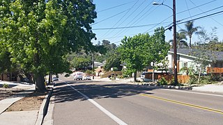
El Cajon Boulevard is a major east–west thoroughfare through San Diego, La Mesa and El Cajon, California. Before the creation of Interstate 8 it was the principal automobile route from San Diego to El Cajon, the Imperial Valley, and points east as U.S. Route 80; it is now signed as a business loop of Interstate 8.

Rancho San Juan Cajón de Santa Ana was a 35,971-acre (145.57 km2) Mexican land grant in present-day Orange County, California.
Rancho Muscupiabe was a 30,145-acre (121.99 km2) Mexican land grant in present day San Bernardino County, California given to Michael C. White on April 29, 1843, by Governor Manuel Micheltorena. The name comes from the Serrano word muscupiabit, meaning "place of little pines." The rancho was adjacent to Cajon Pass.

Glen Helen Regional Park is a county park located in San Bernardino, California, United States adjacent to the Cajon Pass. It was the site of both US Festivals of the early 1980s. It is also home to the Glen Helen Amphitheater, the largest outdoor amphitheater in the United States. The park also hosts several off-road races since 1985.
Cajon Wash is a tributary of Lytle Creek in San Bernardino County, California.
Crowder Canyon, originally Coyote Canyon, is a valley in San Bernardino County, California. Its mouth was at an elevation of 2,999 feet / 914 meters at its confluence with Cajon Canyon. Its source was at an elevation of 4200 feet at 34°21′02″N117°26′04″W near Cajon Summit. The canyon runs southward just west of the top of Cajon Pass then turns southwestward to meet Cajon Canyon.
Baldy Mesa is a summit whose tallest peaks on its southern extremity, overlook the upper Cajon Canyon in San Bernardino County, California. Its tallest point is an unnamed 4,964 foot high hill on the southwest end of the mesa overlooking the upper Cajon Canyon. The heights that lie along the ridge overlooking the canyon toward the east gradually descend in elevation from one approximately 4,770 feet to the 4,606 foot hill at its far southeastern end at 34°21′34″N117°28′39″W. The mesa descends gradually in elevation to the north, toward the distant Mohave River. it is bounded on the east by the Oro Grande Wash.
Summit Valley is a valley along SR 138 in the San Bernardino Mountains, east of Cajon Pass within San Bernardino County, California.
Cajon Canyon, originally named El Cajon De San Gabriel De Amuscopiabit, El Cajon in Spanish meaning "the box" in English, is a long valley ending in a box canyon in the northeastern San Gabriel Mountains, within San Bernardino County, California.
Horsethief Canyon, is a canyon comprising the upper part of the Summit Valley in San Bernardino County, California. Its head lies at 34°19′33″N117°25′38″W at an elevation of 3,800 feet just east of the summit of Cajon Pass, and its mouth at an elevation of 3,123 feet / 952 meters. California State Routes 138 and 173 pass through it.

The Santa Fe And Salt Lake Trail Monument was designated a California Historic Landmark (No.576) on May 17, 1957. Santa Fe And Salt Lake Trail Monument marks the place two Historic trail merged in Cajon Pass in San Bernardino County, California. The Old Spanish Trail and the Mohave Trail-Mojave Road merged in Cajon Pass. The large white marker is just off the Interstate 15 in Cajon Pass, was U.S. Route 66 in the past. It was built by the Pioneer Society of San Bernardino to remember and honor the pioneers that came west. The marker is 12 feet tall and 7 feet square at the base. Cajon Pass was home to the Serrano Indian, Native Californians that lived in the nearby Atongaibit village, in what is now Hesperia.
