
Jones County is a county in the U.S. state of Iowa. As of the 2020 census the population was 20,646. The county seat is Anamosa. The county was founded in 1837 and named after George Wallace Jones, a United States Senator and member of Congress.

Anamosa is a city in Jones County, Iowa, United States. The population was 5,450 at the 2020 census. It is the county seat of Jones County.

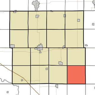
Martelle, Iowa is a city in Jones County, Iowa, United States. The population was 249 at the time of the 2020 census. It is part of the Cedar Rapids Metropolitan Statistical Area.

Morley is a city in Jones County, Iowa, United States. The population was 96 at the time of the 2020 census. It is part of the Cedar Rapids Metropolitan Statistical Area.

Monti is an unincorporated community located in the southeast corner of Buchanan County, Iowa, United States. Founded in the 1880s and platted in 1905, the community lies on the west bank of Buffalo Creek, 6 miles (10 km) east of Quasqueton and 8 miles (13 km) west of Ryan.

Canton is an unincorporated community in Jackson and Jones counties, Iowa, United States.
Augusta is an unincorporated community situated on the Skunk River in Des Moines County, Iowa, United States. It is located 10 miles southwest of Burlington and nine miles north of Fort Madison, off U.S. Route 61 and Iowa Highway 16. The community is part of the Burlington, IA–IL Micropolitan Statistical Area.
The Anamosa Community School District (ACSD) is a rural public school district headquartered in Anamosa, Iowa.
Newton Township is one of sixteen townships in Buchanan County, Iowa, USA. As of the 2000 census, its population was 423.
Langworthy is an unincorporated community in north-central Jones County, Iowa, United States. It lies along U.S. Route 151 north of the city of Anamosa, the county seat of Jones County. Its elevation is 860 feet (262 m).
Troy Mills is an unincorporated community in northern Linn County, Iowa, United States. It lies along local roads north of the city of Cedar Rapids, the county seat of Linn County. Its elevation is 869 feet (265 m). Although Troy Mills is unincorporated, it has a post office, with the ZIP code of 52344, which opened on 10 June 1867, and a full volunteer fire department.
Viola is an unincorporated community in eastern Linn County, Iowa, United States. It lies along local roads, northeast of the city of Cedar Rapids, the county seat of Linn County. Its elevation is 978 feet (298 m). Although Viola is unincorporated, it has a post office, with the ZIP code of 52350, which opened on 7 October 1861.

Stone City is an unincorporated community and census-designated place in Jones County, Iowa, United States. Stone City began as a company town for the workers of the local quarries. Stone City is known for its Anamosa Limestone quarries, historic limestone architecture, and 1930s art colony.
Amber is an unincorporated community in Jones County, Iowa, United States. It is located northeast of Anamosa, northwest of Center Junction, south of Monticello and north of Olin. Amber is located approximately in the center of Jones County.
Hale is an unincorporated community in Jones County, Iowa, United States. Hale is north of the Wapsipinicon River, east of Olin, and west of Oxford Junction.
Robinson is an unincorporated community in Delaware County, Iowa, United States. It is located at the junction of County Highway D47 and 310th Street, five miles west of Ryan and three miles southeast of Monti, at 42.340037N, -91.578738W.
Arbor Hill is an unincorporated community or ghost town in Adair County, Iowa, United States. It is located on County Road P28, south of Stuart, at 41.366543N, -94.317809W.
Mederville is an unincorporated community in Clayton County, Iowa, United States.
Miller is an unincorporated community and census-designated place in Hancock County, Iowa, United States. As of the 2010 census, the population was 60.
Albaton is an unincorporated community in Fairview Township, Monona County, Iowa, United States. Albaton is located in the northwest corner of the county, 4.8 miles (7.7 km) southwest of Sloan.


