
Jones County is a county in the U.S. state of Iowa. As of the 2020 census the population was 20,646. The county seat is Anamosa. The county was founded in 1837 and named after George Wallace Jones, a United States senator and member of Congress.
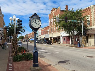
Anamosa is a city in Jones County, Iowa, United States. The population was 5,450 at the 2020 census. It is the county seat of Jones County.

George Wallace Jones was an American frontiersman, entrepreneur, attorney, and judge, was among the first two United States Senators to represent the state of Iowa after it was admitted to the Union in 1846. A Democrat who was elected before the birth of the Republican Party, Jones served over ten years in the Senate, from December 7, 1848 to March 3, 1859. During the American Civil War, he was arrested by Federal authorities and briefly jailed on suspicion of having pro-Confederate sympathies.
Canton is an unincorporated community in Jackson and Jones counties, Iowa, United States. There is a restaurant there, and no other businesses or services.
Augusta is an unincorporated community situated on the Skunk River in Des Moines County, Iowa, United States. It is located 10 miles southwest of Burlington and nine miles north of Fort Madison, off U.S. Route 61 and Iowa Highway 16. The community is part of the Burlington, IA–IL Micropolitan Statistical Area.

Adoniram Judson Holmes a Republican, was the first U.S. Representative from Iowa's 10th congressional district.
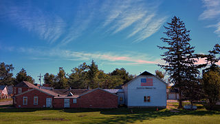
Scotch Grove is an unincorporated community in Jones County, Iowa, United States. Scotch Grove is located on Iowa Highway 38, southeast of Monticello and north of Center Junction. The townsite was listed as a historic district on the National Register of Historic Places in 2014.
Fairview is an unincorporated community in Jones County, Iowa, United States. Fairview is north of the junction of U.S. Route 151 and Iowa Highway 1 and is southwest of Anamosa.
Sharon Center is an unincorporated community in Johnson County, Iowa, United States. Sharon Center is located at the junction of County Highways F62 and W62, 9.3 miles (15.0 km) southwest of Iowa City.
Volney is an unincorporated community in Allamakee County, Iowa, United States.

Downey is an unincorporated community in Cedar County, Iowa.
Centerdale is an unincorporated community in Cedar County, Iowa, United States.
Buchanan is an unincorporated community in Cedar County, Iowa, United States.
Hale Township is a township in Jones County, Iowa.
Dean is an unincorporated community in Appanoose County, Iowa, United States.
St. Joseph is an unincorporated community and census-designated place (CDP) in Riverdale Township, Kossuth County, Iowa, United States. As of the 2010 census the population was 61.
Watson is an unincorporated community in Clayton County, Iowa, United States. The county seat of Elkader lies approximately 15 miles to the southwest.
Talmage is an unincorporated community in Jones Township, Union County, Iowa, United States. Talmage is located along U.S. routes 34 and 169, 4.5 miles (7.2 km) east of Afton.
Thorpe is an unincorporated community in Honey Creek Township, Delaware County, Iowa, United States.
Veo is a former unincorporated community in northwest Penn Township, Jefferson County, in the U.S. state of Iowa.


