Onslow, Iowa

Last updated
Onslow, Iowa
Jones County Iowa Incorporated and Unincorporated areas Onslow Highlighted.svg
Location of Onslow, Iowa
Coordinates: 42°6′20″N91°0′55″W / 42.10556°N 91.01528°W / 42.10556; -91.01528 Coordinates: 42°6′20″N91°0′55″W / 42.10556°N 91.01528°W / 42.10556; -91.01528
Country Flag of the United States.svg  United States
State Flag of Iowa.svg  Iowa
County Jones
Area
[1]
  Total0.19 sq mi (0.50 km2)
  Land0.19 sq mi (0.50 km2)
  Water0.00 sq mi (0.00 km2)
Elevation
919 ft (280 m)
Population
 (2020)
  Total201
  Density1,036.08/sq mi (399.97/km2)
Time zone UTC-6 (Central (CST))
  Summer (DST) UTC-5 (CDT)
ZIP code
52321
Area code 563
FIPS code 19-59250
GNIS feature ID0459871

Onslow is a city in Jones County, Iowa, United States. The population was 201 at the time of the 2020 census. [2] It is part of the Cedar Rapids Metropolitan Statistical Area.

Contents

History

Onslow was platted in 1871 by E. M. Franks. [3]

Geography

Onslow is located at 42°6′20″N91°0′55″W / 42.10556°N 91.01528°W / 42.10556; -91.01528 (42.105603, -91.015158). [4]

According to the United States Census Bureau, the city has a total area of 0.23 square miles (0.60 km2), all land. [5]

Demographics

Historical populations
YearPop.±%
1890 237    
1900 263+11.0%
1910 207−21.3%
1920 218+5.3%
1930 210−3.7%
1940 230+9.5%
1950 244+6.1%
1960 269+10.2%
1970 253−5.9%
1980 218−13.8%
1990 216−0.9%
2000 223+3.2%
2010 197−11.7%
1880 233+18.3%
2020 201−13.7%
Source: "U.S. Census website". United States Census Bureau . Retrieved 2020-03-29. and Iowa Data Center
Source:
U.S. Decennial Census [6] [2]

2010 census

As of the census [7] of 2010, there were 197 people, 94 households, and 52 families living in the city. The population density was 856.5 inhabitants per square mile (330.7/km2). There were 109 housing units at an average density of 473.9 per square mile (183.0/km2). The racial makeup of the city was 95.9% White, 2.5% African American, 0.5% Asian, and 1.0% from two or more races. Hispanic or Latino of any race were 1.0% of the population.

There were 94 households, of which 26.6% had children under the age of 18 living with them, 43.6% were married couples living together, 7.4% had a female householder with no husband present, 4.3% had a male householder with no wife present, and 44.7% were non-families. 39.4% of all households were made up of individuals, and 17% had someone living alone who was 65 years of age or older. The average household size was 2.10 and the average family size was 2.83.

The median age in the city was 42.9 years. 24.4% of residents were under the age of 18; 3.5% were between the ages of 18 and 24; 25.4% were from 25 to 44; 28.4% were from 45 to 64; and 18.3% were 65 years of age or older. The gender makeup of the city was 46.7% male and 53.3% female.

2000 census

As of the census [8] of 2000, there were 223 people, 96 households, and 60 families living in the city. The population density was 965.4 inhabitants per square mile (372.7/km2). There were 107 housing units at an average density of 463.2 per square mile (178.8/km2). The racial makeup of the city was 99.55% White, and 0.45% from two or more races.

There were 96 households, out of which 25.0% had children under the age of 18 living with them, 54.2% were married couples living together, 7.3% had a female householder with no husband present, and 37.5% were non-families. 33.3% of all households were made up of individuals, and 22.9% had someone living alone who was 65 years of age or older. The average household size was 2.32 and the average family size was 3.02.

In the city, the population was spread out, with 27.4% under the age of 18, 5.4% from 18 to 24, 25.1% from 25 to 44, 16.6% from 45 to 64, and 25.6% who were 65 years of age or older. The median age was 38 years. For every 100 females, there were 82.8 males. For every 100 females age 18 and over, there were 82.0 males.

The median income for a household in the city was $24,375, and the median income for a family was $34,500. Males had a median income of $30,625 versus $20,375 for females. The per capita income for the city was $11,916. About 15.4% of families and 19.4% of the population were below the poverty line, including 26.5% of those under the age of eighteen and 21.6% of those 65 or over.

Education

Onslow is within the Midland Community School District. [9]

Related Research Articles

<span class="mw-page-title-main">Egypt Lake-Leto, Florida</span> Census-designated place in Florida, United States

Egypt Lake-Leto is a census-designated place in an unincorporated part of Hillsborough County, Florida, United States. The population was 35,282 at the 2010 census. The area is located just north of Tampa International Airport. The ZIP code for Egypt Lake-Leto is 33614.

<span class="mw-page-title-main">Eden Roc, Hawaii</span> Census-designated place in Hawaii, United States

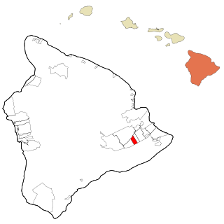
Eden Roc is a census-designated place (CDP) in Hawaiʻi County, Hawaiʻi, United States, located in the District of Puna. The population was 942 at the 2010 census, up from 451 at the 2000 census.

<span class="mw-page-title-main">Yates City, Illinois</span> Village in Illinois, United States

Yates City is a village in Knox County, Illinois, United States. The population was 693 at the 2010 census. It is part of the Galesburg Micropolitan Statistical Area.

<span class="mw-page-title-main">Boxholm, Iowa</span> City in Iowa, United States

Boxholm is a city in Grant Township, Boone County, Iowa, United States. The population was 181 at the 2020 census. It is part of the Boone, Iowa Micropolitan Statistical Area, which is a part of the larger Ames-Boone, Iowa Combined Statistical Area.

<span class="mw-page-title-main">Larrabee, Iowa</span> City in Iowa, United States

Larrabee is a city in Cherokee County, Iowa, United States. The population was 123 at the time of the 2020 census.

<span class="mw-page-title-main">Charter Oak, Iowa</span> City in Iowa, United States

Charter Oak is a city in Crawford County, Iowa, United States, along the East Soldier River. The population was 535 at the 2020 census.

<span class="mw-page-title-main">Durango, Iowa</span> City in Iowa, United States

Durango is a city in Dubuque County, Iowa, United States. It is part of the Dubuque, Iowa Metropolitan Statistical Area. The population was 20 at the time of the 2020 census, down from 24 in 2000.

<span class="mw-page-title-main">Sageville, Iowa</span> City in Iowa, United States

Sageville is a city in Dubuque County, Iowa, United States. The population was 95 at the time of the 2020 census, down from 203 in 2000.

<span class="mw-page-title-main">Maynard, Iowa</span> City in Iowa, United States

Maynard is a city in Fayette County, Iowa, United States. The population was 476 at the time of the 2020 census.

<span class="mw-page-title-main">Wakefield, Kansas</span> City in Clay County, Kansas

Wakefield is a city in Clay County, Kansas, United States. As of the 2020 census, the population of the city was 858.

<span class="mw-page-title-main">Haviland, Kansas</span> City in Kiowa County, Kansas

Haviland is a city in Kiowa County, Kansas, United States. As of the 2020 census, the population of the city was 678. It is home of Barclay College and known for meteorite finds connected to the Haviland Crater and for an annual meteorite festival held in July.

<span class="mw-page-title-main">Ovando, Montana</span> CDP in Montana, United States

Ovando is a census-designated place (CDP) in Powell County, Montana, United States. It is approximately fifty-four miles ENE of Missoula, Montana. The population was 71 at the 2000 census.

<span class="mw-page-title-main">Lake Mykee Town, Missouri</span> Village in Missouri, United States

Lake Mykee Town was a village in Callaway County, Missouri, United States whose government was dissolved and land area annexed into Holts Summit, Missouri. Because of this, Lake Mykee no longer exists and the former village is now referred to as Holts Summit. The population was 350 at the 2010 census. It is part of the Jefferson City Metropolitan Statistical Area.

<span class="mw-page-title-main">Churchville, New York</span> Village in New York, United States

Churchville is a village in Monroe County, New York, United States. According to the 2010 census, the population was 1,961. The village is named after Samuel Church, an early settler.

<span class="mw-page-title-main">Oberon, North Dakota</span> City in North Dakota, United States

Oberon is a city in Benson County, North Dakota, United States. The population was 101 at the 2020 census. Oberon was founded in 1886.

<span class="mw-page-title-main">Wickliffe, Oklahoma</span> CDP in Oklahoma, United States

Wickliffe is a census-designated place (CDP) in Mayes County, Oklahoma, United States. The population was 99 at the 2000 census, which declined to 75 in 2010, a drop of 25 percent.

<span class="mw-page-title-main">Fairview, Butler County, Pennsylvania</span> Borough in Pennsylvania, United States

Fairview is a borough in Butler County, Pennsylvania, United States. The population was 198 at the 2010 census. It should not be confused with Fairview in Erie County, which carries the ZIP code 16415.

<span class="mw-page-title-main">Loomis, South Dakota</span> CDP in South Dakota, United States

Loomis is a census-designated place (CDP) in Davison County, South Dakota, United States. The population was 33 at the 2020 census. It is part of the Mitchell, South Dakota Micropolitan Statistical Area.

<span class="mw-page-title-main">Ladson, South Carolina</span> Census-designated place in South Carolina, United States

Ladson is a census-designated place (CDP) in Berkeley, Charleston and Dorchester counties in the U.S. state of South Carolina. The population was 13,790 at the 2010 census. It is named in honor of the Ladson family, one of the oldest planter and merchant families in the Charleston area; one of its members was lieutenant governor James Ladson.

Richmond is a census-designated place (CDP) in the town of Richmond in Sagadahoc County, Maine. The population was 1,864 at the 2000 census. It is part of the Portland–South Portland–Biddeford, Maine Metropolitan Statistical Area.

References

  1. "2020 U.S. Gazetteer Files". United States Census Bureau. Retrieved March 16, 2022.
  2. 1 2 "2020 Census State Redistricting Data". census.gov. United states Census Bureau. Retrieved 12 August 2021.
  3. Corbit, Robert McClain (1910). History of Jones County, Iowa: Past and Present, Volume 1. S. J. Clarke Publishing Company. p. 728.
  4. "US Gazetteer files: 2010, 2000, and 1990". United States Census Bureau. 2011-02-12. Retrieved 2011-04-23.
  5. "US Gazetteer files 2010". United States Census Bureau. Archived from the original on 2012-01-25. Retrieved 2012-05-11.
  6. "Census of Population and Housing". Census.gov. Retrieved June 4, 2015.
  7. "U.S. Census website". United States Census Bureau . Retrieved 2012-05-11.
  8. "U.S. Census website". United States Census Bureau . Retrieved 2008-01-31.
  9. "Midland" (PDF). Iowa Department of Education . Retrieved 2020-03-26.