Farmersburg, Iowa

Last updated
Farmersburg, Iowa
Clayton County Iowa Incorporated and Unincorporated areas Farmersburg Highlighted.svg
Location of Farmersburg, Iowa
Coordinates: 42°57′31″N91°22′03″W / 42.958516°N 91.367555°W / 42.958516; -91.367555 Coordinates: 42°57′31″N91°22′03″W / 42.958516°N 91.367555°W / 42.958516; -91.367555
Country Flag of the United States.svg  United States
State Flag of Iowa.svg  Iowa
County Clayton
Area
[1]
  Total0.41 sq mi (1.05 km2)
  Land0.41 sq mi (1.05 km2)
  Water0.00 sq mi (0.00 km2)
Elevation
919 ft (280 m)
Population
 (2020)
  Total271
  Density665.85/sq mi (257.40/km2)
Time zone UTC-6 (Central (CST))
  Summer (DST) UTC-5 (CDT)
ZIP code
52047
Area code 563
FIPS code 19-26850
GNIS feature ID0456536

Farmersburg is a city in Clayton County, Iowa, United States. The population was 271 at the time of the 2020 census, down from 300 in 2000. [2] The current Mayor is Glenn Radloff, a cross-country truck driver.

Contents

History

Farmersburg was first called Windsor when it was surveyed in 1856. [3]

In 1916, Farmersburg contained three general stores, bank, hotel, grain elevator, and lumber yards. [4]

Geography

Farmersburg's longitude and latitude coordinates
in decimal form are 42.958516, -91.367555. [5]
The city is located in Farmersburg Township, T94N R4W §18.

According to the United States Census Bureau, the city has a total area of 0.40 square miles (1.04 km2), all land. [6]

Demographics

Historical populations
YearPop.±%
1900 143    
1910 259+81.1%
1920 290+12.0%
1930 275−5.2%
1940 296+7.6%
1950 263−11.1%
1960 250−4.9%
1970 232−7.2%
1980 276+19.0%
1990 291+5.4%
2000 300+3.1%
2010 302+0.7%
2020 271−10.3%
Source: "U.S. Census website". United States Census Bureau . Retrieved 2020-03-28. and Iowa Data Center
Source:
U.S. Decennial Census [7] [2]
The population of Farmersburg, Iowa from US census data FarmersburgIowaPopPlot.png
The population of Farmersburg, Iowa from US census data

2010 census

As of the census [8] of 2010, there were 302 people, 126 households, and 80 families living in the city. The population density was 755.0 inhabitants per square mile (291.5/km2). There were 133 housing units at an average density of 332.5 per square mile (128.4/km2). The racial makeup of the city was 97.0% White, 0.3% African American, 0.3% Asian, and 2.3% from two or more races. Hispanic or Latino of any race were 0.3% of the population.

There were 126 households, of which 34.9% had children under the age of 18 living with them, 52.4% were married couples living together, 6.3% had a female householder with no husband present, 4.8% had a male householder with no wife present, and 36.5% were non-families. 28.6% of all households were made up of individuals, and 13.5% had someone living alone who was 65 years of age or older. The average household size was 2.40 and the average family size was 2.96.

The median age in the city was 37.4 years. 26.8% of residents were under the age of 18; 8.3% were between the ages of 18 and 24; 24.2% were from 25 to 44; 26.2% were from 45 to 64; and 14.6% were 65 years of age or older. The gender makeup of the city was 48.3% male and 51.7% female.

2000 census

As of the census [9] of 2000, there were 300 people, 123 households, and 83 families living in the city. The population density was 745.9 inhabitants per square mile (288.0/km2). There were 130 housing units at an average density of 323.2 per square mile (124.8/km2). The racial makeup of the city was 98.33% White, and 1.67% from two or more races. Hispanic or Latino of any race were 1.67% of the population.

There were 123 households, out of which 30.1% had children under the age of 18 living with them, 60.2% were married couples living together, 4.9% had a female householder with no husband present, and 32.5% were non-families. 29.3% of all households were made up of individuals, and 17.1% had someone living alone who was 65 years of age or older. The average household size was 2.44 and the average family size was 3.02.

In the city, the population was spread out, with 26.0% under the age of 18, 6.3% from 18 to 24, 28.7% from 25 to 44, 20.3% from 45 to 64, and 18.7% who were 65 years of age or older. The median age was 39 years. For every 100 females, there were 93.5 males. For every 100 females age 18 and over, there were 89.7 males.

The median income for a household in the city was $34,000, and the median income for a family was $40,694. Males had a median income of $28,750 versus $20,278 for females. The per capita income for the city was $14,796. About 2.6% of families and 6.3% of the population were below the poverty line, including none of those under the age of eighteen and 10.9% of those 65 or over.

Education

It is within the MFL MarMac Community School District. [10] The district formed on July 1, 1994 with the merger of the Mar-Mac and M-F-L districts. [11]

Notable person


Related Research Articles

<span class="mw-page-title-main">Newhall, Iowa</span> City in Iowa, United States

Newhall is a city in Benton County, Iowa, United States. The population was 876 at the time of the 2020 census. It is part of the Cedar Rapids Metropolitan Statistical Area.

<span class="mw-page-title-main">Lawler, Iowa</span> City in Iowa, United States

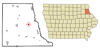
Lawler is a city in Chickasaw County, Iowa, United States. The population was 406 at the time of the 2020 census.

<span class="mw-page-title-main">Garnavillo, Iowa</span> City in Iowa, United States

Garnavillo is a city in Clayton County, Iowa, United States. The population was 763 at the time of the 2020 census, up from 754 in 2000.

<span class="mw-page-title-main">Luana, Iowa</span> City in Iowa, United States

Luana is a city in Clayton County, Iowa, United States. The population was 301 at the time of the 2020 census, up from 249 in 2000.

<span class="mw-page-title-main">Marquette, Iowa</span> City in Iowa, United States

Marquette is a city in Clayton County, Iowa, United States. The population was 429 at the time of the 2020 census, up from 421 in 2000. The city, which is located on the Mississippi River, is named after Jesuit missionary Jacques Marquette, who along with Louis Joliet discovered the Mississippi River just southeast of the city on June 17, 1673.

<span class="mw-page-title-main">Monona, Iowa</span> City in Iowa, United States

Monona is a city in Clayton County, Iowa, United States. The population was 1,471 at the time of the 2020 census.

<span class="mw-page-title-main">Osterdock, Iowa</span> City in Iowa, United States

Osterdock is a city located in Clayton County, Iowa, United States. As of the 2020 census, the city had a total population of 43, down from 50 in 2000.

<span class="mw-page-title-main">St. Olaf, Iowa</span> City in Iowa, United States

St. Olaf is a city in Clayton County, Iowa, United States. The population was 106 at the time of the 2020 census, down from 136 in 2000. Swiss Valley has a large cheese packaging plant in St. Olaf.

<span class="mw-page-title-main">Volga, Iowa</span> City in Iowa, United States

Volga is a city in Clayton County, Iowa, United States. The population was 203 at the time of the 2020 census, down from 247 in 2000.

<span class="mw-page-title-main">Drakesville, Iowa</span> City in Iowa, United States

Drakesville is a city in Davis County, Iowa, United States. The population was 164 at the time of the 2020 census.

<span class="mw-page-title-main">Mondamin, Iowa</span> City in Iowa, United States

Mondamin is a city in Harrison County, Iowa, United States. The population was 339 at the time of the 2020 census.

<span class="mw-page-title-main">Ottosen, Iowa</span> City in Iowa, United States

Ottosen is a city in Humboldt County, Iowa, United States. The population was 40 in the 2020 census, a decline from 61 in 2000.

<span class="mw-page-title-main">Morning Sun, Iowa</span> City in Iowa, United States

Morning Sun is a city in Morning Sun Township, Louisa County, Iowa, United States. The population was 752 at the time of the 2020 census. It is part of the Muscatine Micropolitan Statistical Area.

<span class="mw-page-title-main">Earlham, Iowa</span> City in Iowa, United States

Earlham is a city in Madison County, Iowa, United States. The population was 1,410 at the time of the 2020 census. It is part of the Des Moines–West Des Moines Metropolitan Statistical Area.

<span class="mw-page-title-main">Emerson, Iowa</span> City in Iowa, United States

Emerson is a city in Mills County, Iowa, United States. The population was 403 at the time of the 2020 census.

<span class="mw-page-title-main">Carson, Iowa</span> City in Iowa, United States

Carson is a city in Pottawattamie County, Iowa, United States. The population was 766 at the 2020 census.

<span class="mw-page-title-main">Tingley, Iowa</span> City in Iowa, United States

Tingley is a city in northern Ringgold County, Iowa, United States. The population was 136 at the time of the 2020 census.

<span class="mw-page-title-main">Humeston, Iowa</span> City in Iowa, United States

Humeston is a city in Wayne County, Iowa, United States. The population was 465 in the 2020 census, a decline from 542 in 2000.

<span class="mw-page-title-main">Stratford, Iowa</span> City in Iowa, United States

Stratford is a city in Hamilton and Webster counties in the U.S. state of Iowa. The population was 707 at the time of the 2020 census.

<span class="mw-page-title-main">Bevington, Iowa</span> City in Iowa, United States

Bevington is a city in Madison and Warren Counties in the U.S. state of Iowa. The population was 57 at the 2020 census. It is part of the Des Moines–West Des Moines Metropolitan Statistical Area.

References

  1. "2020 U.S. Gazetteer Files". United States Census Bureau. Retrieved March 16, 2022.
  2. 1 2 "2020 Census State Redistricting Data". census.gov. United states Census Bureau. Retrieved 12 August 2021.
  3. Price, Realto E. (1916). History of Clayton County, Iowa: From the Earliest Historical Times Down to the Present. Robert O. Law Company. pp.  316.
  4. Price, Realto E. (1916). History of Clayton County, Iowa: From the Earliest Historical Times Down to the Present. Robert O. Law Company. pp.  338.
  5. "US Gazetteer files: 2010, 2000, and 1990". United States Census Bureau. 2011-02-12. Retrieved 2011-04-23.
  6. "US Gazetteer files 2010". United States Census Bureau. Archived from the original on 2012-01-25. Retrieved 2012-05-11.
  7. "Census of Population and Housing". Census.gov. Retrieved June 4, 2015.
  8. "U.S. Census website". United States Census Bureau . Retrieved 2012-05-11.
  9. "U.S. Census website". United States Census Bureau . Retrieved 2008-01-31.
  10. "MFL Mar Mac" (PDF). Iowa Department of Education . Retrieved 2020-03-27.
  11. "REORGANIZATION & DISSOLUTION ACTIONS SINCE 1965-66" (PDF). Iowa Department of Education. Archived from the original (PDF) on 2019-02-09. Retrieved 2020-03-22.