Garber, Iowa

Last updated
Garber, Iowa
Clayton County Iowa Incorporated and Unincorporated areas Garber Highlighted.svg
Location of Garber, Iowa
Coordinates: 42°44′38″N91°15′47″W / 42.74389°N 91.26306°W / 42.74389; -91.26306 Coordinates: 42°44′38″N91°15′47″W / 42.74389°N 91.26306°W / 42.74389; -91.26306
Country Flag of the United States.svg  United States
State Flag of Iowa.svg  Iowa
County Clayton
Area
[1]
  Total0.23 sq mi (0.58 km2)
  Land0.23 sq mi (0.58 km2)
  Water0.00 sq mi (0.00 km2)
Elevation
663 ft (202 m)
Population
 (2020)
  Total76
  Density337.78/sq mi (130.63/km2)
Time zone UTC-6 (Central (CST))
  Summer (DST) UTC-5 (CDT)
ZIP code
52048
Area code 563
FIPS code 19-29685
GNIS feature ID0456820

Garber is a city in Clayton County, Iowa, United States. The population was 76 at the time of the 2020 census, down from 103 in 2000. [2]

Contents

History

Garber, first called East Elkport, was surveyed in 1872 by John Garber, who also served as the first postmaster there. [3]

Geography

Garber is located at 42°44′38″N91°15′47″W / 42.74389°N 91.26306°W / 42.74389; -91.26306 (42.743892, -91.263004). [4]

According to the United States Census Bureau, the city has a total area of 0.23 square miles (0.60 km2), all land. [5]

Demographics

Historical populations
YearPop.±%
1910 131    
1920 189+44.3%
1930 120−36.5%
1940 158+31.7%
1950 153−3.2%
1960 148−3.3%
1970 148+0.0%
1980 140−5.4%
1990 118−15.7%
2000 103−12.7%
2010 88−14.6%
2020 76−13.6%
Source: "U.S. Census website". United States Census Bureau . Retrieved 2020-03-28. and Iowa Data Center
Source:
U.S. Decennial Census [6] [2]
The population of Garber, Iowa from US census data GarberIowaPopPlot.png
The population of Garber, Iowa from US census data

2010 census

As of the census [7] of 2010, there were 88 people, 43 households, and 23 families living in the city. The population density was 382.6 inhabitants per square mile (147.7/km2). There were 48 housing units at an average density of 208.7 per square mile (80.6/km2). The racial makeup of the city was 100.0% White.

There were 43 households, of which 23.3% had children under the age of 18 living with them, 41.9% were married couples living together, 9.3% had a female householder with no husband present, 2.3% had a male householder with no wife present, and 46.5% were non-families. 32.6% of all households were made up of individuals, and 4.7% had someone living alone who was 65 years of age or older. The average household size was 2.05 and the average family size was 2.57.

The median age in the city was 43 years. 17% of residents were under the age of 18; 9.1% were between the ages of 18 and 24; 28.4% were from 25 to 44; 29.6% were from 45 to 64; and 15.9% were 65 years of age or older. The gender makeup of the city was 51.1% male and 48.9% female.

2000 census

As of the census [8] of 2000, there were 103 people, 54 households, and 21 families living in the city. The population density was 434.9 inhabitants per square mile (167.9/km2). There were 57 housing units at an average density of 240.7 per square mile (92.9/km2). The racial makeup of the city was 99.03% White and 0.97% Asian.

There were 54 households, out of which 20.4% had children under the age of 18 living with them, 33.3% were married couples living together, 5.6% had a female householder with no husband present, and 59.3% were non-families. 50.0% of all households were made up of individuals, and 25.9% had someone living alone who was 65 years of age or older. The average household size was 1.91 and the average family size was 2.77.

In the city, the population was spread out, with 22.3% under the age of 18, 7.8% from 18 to 24, 31.1% from 25 to 44, 16.5% from 45 to 64, and 22.3% who were 65 years of age or older. The median age was 37 years. For every 100 females, there were 71.7 males. For every 100 females age 18 and over, there were 63.3 males.

The median income for a household in the city was $22,708, and the median income for a family was $28,125. Males had a median income of $27,500 versus $20,417 for females. The per capita income for the city was $11,618. There were 12.0% of families and 16.0% of the population living below the poverty line, including 21.2% of under eighteens and 13.3% of those over 64.

Education

The municipality is within the boundary of the Central Community School District. [9]

Related Research Articles

<span class="mw-page-title-main">Alexandria, Indiana</span> City in Indiana, United States

Alexandria is a city in Monroe Township, Madison County, Indiana, United States. It is about 46 miles (74 km) northeast of Indianapolis. According to the 2010 census, its population was 5,145, a decrease of 17.8% from 6,260 in 2000.

<span class="mw-page-title-main">Sale City, Georgia</span> Town in Georgia, United States

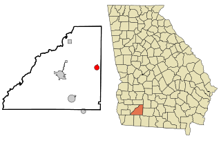
Sale City is a town in Mitchell County, Georgia, United States. The population was 380 at the 2010 census.

<span class="mw-page-title-main">Stewardson, Illinois</span> Village in Illinois, United States

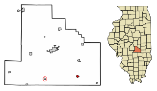
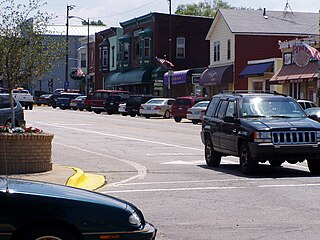
Stewardson is a village in Shelby County, Illinois, United States. The population was 734 at the 2010 census.

<span class="mw-page-title-main">Stanley, Iowa</span> City in Iowa, United States

Stanley is a city in Buchanan and Fayette counties in the U.S. state of Iowa. The population was 81 at the time of the 2020 census.

<span class="mw-page-title-main">St. Olaf, Iowa</span> City in Iowa, United States

St. Olaf is a city in Clayton County, Iowa, United States. The population was 106 at the time of the 2020 census, down from 136 in 2000. Swiss Valley has a large cheese packaging plant in St. Olaf.

<span class="mw-page-title-main">Maynard, Iowa</span> City in Iowa, United States

Maynard is a city in Fayette County, Iowa, United States. The population was 476 at the time of the 2020 census.

<span class="mw-page-title-main">Pleasant Plain, Iowa</span> City in Iowa, United States

Pleasant Plain is a city in northeast Penn Township, Jefferson County, Iowa, United States. At the time of the 2020 census, the population was 84.

<span class="mw-page-title-main">Hills, Iowa</span> City in Iowa, United States

Hills is a city in Johnson County, Iowa, United States. It is part of the Iowa City, Iowa Metropolitan Statistical Area. The population was 863 at the time of the 2020 census. It is part of the Iowa City Community School District.

<span class="mw-page-title-main">Howard, Kansas</span> City in Elk County, Kansas

Howard is a city in and the county seat of Elk County, Kansas, United States. As of the 2020 census, the population of the city was 570.

<span class="mw-page-title-main">Rexford, Kansas</span> City in Thomas County, Kansas

Rexford is a city in Thomas County, Kansas, United States. As of the 2020 census, the population of the city was 197.

<span class="mw-page-title-main">New Buffalo, Michigan</span> City in Michigan, United States

New Buffalo is a city in Berrien County in the U.S. state of Michigan. The population was 1,883 at the time of the 2010 census.

<span class="mw-page-title-main">Vining, Minnesota</span> City in Minnesota, United States

Vining is a city in Otter Tail County, Minnesota, United States. The population was 62 at the 2020 census.

<span class="mw-page-title-main">Hector, Minnesota</span> City in Minnesota, United States

Hector is a city in Renville County, Minnesota, United States. The population was 1,151 at the 2010 census.

<span class="mw-page-title-main">Steen, Minnesota</span> City in Minnesota, United States

Steen is a city in Rock County, Minnesota, United States. The population was 180 at the 2010 census.

<span class="mw-page-title-main">St. Bonifacius, Minnesota</span> City in Minnesota, United States

Saint Bonifacius, often stylized as St. Bonifacius, is a small city in Hennepin County, Minnesota, United States, 25 miles west of Minneapolis. Settled in the 1850s, the town has a combination of rural and exurban features. It is completely surrounded by Minnetrista, Minnesota, and is close to the county line with Carver County. It hosted a Nike Hercules battery during the Cold War, one of four protecting Minneapolis–Saint Paul from Soviet bombers.

<span class="mw-page-title-main">Hunker, Pennsylvania</span> Borough in Pennsylvania, United States

Hunker is a borough in Westmoreland County, Pennsylvania, United States, and since 1950 has been part of the Pittsburgh metropolitan area. The population was 307 at the 2020 census.

<span class="mw-page-title-main">Meggett, South Carolina</span> Town in South Carolina, United States

Meggett is a town in Charleston County, South Carolina, United States. The population was 1,226 at the 2010 census. Meggett is part of the Charleston-North Charleston-Summerville metropolitan area.

<span class="mw-page-title-main">Anawalt, West Virginia</span> Town in West Virginia, United States

Anawalt is a town in McDowell County, West Virginia, United States. At one time it was known as Jeanette. It is named in honor of James White Anawalt, who was then manager of Union Supply Company, a subsidiary of the United States Steel Company. The population was 186 at the 2020 census. Coal mining was the town's chief industry.

<span class="mw-page-title-main">Minneiska, Minnesota</span> City in Minnesota, United States

Minneiska is a city in Wabasha and Winona counties in the U.S. state of Minnesota. The population was 111 at the 2010 census.

Crystal Township is a civil township of Montcalm County in the U.S. state of Michigan. As of the 2000 census, the township population was 2,824.

References

  1. "2020 U.S. Gazetteer Files". United States Census Bureau. Retrieved March 16, 2022.
  2. 1 2 "2020 Census State Redistricting Data". census.gov. United states Census Bureau. Retrieved 12 August 2021.
  3. Price, Realto E. (1916). History of Clayton County, Iowa: From the Earliest Historical Times Down to the Present. Robert O. Law Company. pp.  322.
  4. "US Gazetteer files: 2010, 2000, and 1990". United States Census Bureau. 2011-02-12. Retrieved 2011-04-23.
  5. "US Gazetteer files 2010". United States Census Bureau. Archived from the original on 2012-07-02. Retrieved 2012-05-11.
  6. "Census of Population and Housing". Census.gov. Retrieved June 4, 2015.
  7. "U.S. Census website". United States Census Bureau . Retrieved 2012-05-11.
  8. "U.S. Census website". United States Census Bureau . Retrieved 2008-01-31.
  9. "Central" (PDF). Iowa Department of Education . Retrieved 2020-04-05.