North Buena Vista, Iowa

Last updated

North Buena Vista, Iowa
Clayton County Iowa Incorporated and Unincorporated areas North Buena Vista Highlighted.svg
Location of North Buena Vista, Iowa
Coordinates: 42°40′45″N90°57′24″W / 42.67917°N 90.95667°W / 42.67917; -90.95667
Country Flag of the United States (23px).png  United States
State Flag of Iowa.svg  Iowa
County Clayton
Government
  MayorAlan Breitbach
Area
[1]
  Total0.96 sq mi (2.49 km2)
  Land0.93 sq mi (2.40 km2)
  Water0.04 sq mi (0.09 km2)
Elevation
650 ft (198 m)
Population
 (2020)
  Total109
  Density117.46/sq mi (45.35/km2)
Time zone UTC-6 (Central (CST))
  Summer (DST) UTC-5 (CDT)
ZIP code
52066
Area code 563
FIPS code 19-57135
GNIS feature ID0459566

North Buena Vista is a city in Clayton County, Iowa, United States. The population was 109 at the time of the 2020 census, down from 124 in 2000. [2]

Contents

Geography

North Buena Vista is located at 42°40′45″N90°57′24″W / 42.67917°N 90.95667°W / 42.67917; -90.95667 (42.679299, -90.956783). [3]

According to the United States Census Bureau, the city has a total area of 1.04 square miles (2.69 km2), of which 1.00 square mile (2.59 km2) is land and 0.04 square miles (0.10 km2) is water. [4]

Picnic

The Buenie Picnic has been held since 1929, on the Sunday of Labor Day weekend, as a benefit by the local Immaculate Conception Catholic Church. In 1971 the picnic was raided and parish priest Rev. Carl Ruhland was charged with "running a gambling house". He was fined $100. Following that incident, in 1973, the Iowa Legislature legalized bingo, raffles and other low-stakes games of chance. [5]

Demographics

Historical populations
YearPop.±%
1910 162    
1920 144−11.1%
1930 183+27.1%
1940 203+10.9%
1950 148−27.1%
1960 150+1.4%
1970 118−21.3%
1980 155+31.4%
1990 145−6.5%
2000 124−14.5%
2010 121−2.4%
2020 109−9.9%
Source: "U.S. Census website". United States Census Bureau . Retrieved March 29, 2020. and Iowa Data Center
Source:
U.S. Decennial Census [6] [2]

2010 census

As of the census [7] of 2010, there were 121 people, 63 households, and 34 families living in the city. The population density was 121.0 inhabitants per square mile (46.7/km2). There were 157 housing units at an average density of 157.0 per square mile (60.6/km2). The racial makeup of the city was 98.3% White, 0.8% Asian, and 0.8% from two or more races.

There were 63 households, of which 9.5% had children under the age of 18 living with them, 47.6% were married couples living together, 6.3% had a female householder with no husband present, and 46.0% were non-families. 41.3% of all households were made up of individuals, and 6.4% had someone living alone who was 65 years of age or older. The average household size was 1.92 and the average family size was 2.53.

The median age in the city was 49.9 years. 12.4% of residents were under the age of 18; 5.8% were between the ages of 18 and 24; 14.9% were from 25 to 44; 45.4% were from 45 to 64; and 21.5% were 65 years of age or older. The gender makeup of the city was 57.0% male and 43.0% female.

2000 census

As of the census [8] of 2000, there were 124 people, 54 households, and 34 families living in the city. The population density was 178.4 inhabitants per square mile (68.9/km2). There were 146 housing units at an average density of 210.1 per square mile (81.1/km2). The racial makeup of the city was 99.19% White, and 0.81% from two or more races. Hispanic or Latino of any race were 0.81% of the population.

There were 54 households, out of which 31.5% had children under the age of 18 living with them, 51.9% were married couples living together, 5.6% had a female householder with no husband present, and 35.2% were non-families. 25.9% of all households were made up of individuals, and 9.3% had someone living alone who was 65 years of age or older. The average household size was 2.30 and the average family size was 2.80.

In the city, the population was spread out, with 22.6% under the age of 18, 9.7% from 18 to 24, 31.5% from 25 to 44, 26.6% from 45 to 64, and 9.7% who were 65 years of age or older. The median age was 38 years. For every 100 females, there were 113.8 males. For every 100 females age 18 and over, there were 108.7 males.

The median income for a household in the city was $20,625, and the median income for a family was $38,750. Males had a median income of $21,875 versus $17,361 for females. The per capita income for the city was $12,729. There were 25.0% of families and 13.8% of the population living below the poverty line, including no under eighteens and none of those over 64.

Education

Public schools are operated by the Clayton Ridge Community School District, [9] which formed in 2005 in the merger of the Guttenberg Community School District and the Garnavillo Community School District. [10]

Immaculate Conception School, under the Roman Catholic Archdiocese of Dubuque, was in operation until it merged into St. Mary's Catholic School in Guttenberg in 1968. [11]

Cemetery

The Immaculate Conception Catholic Cemetery is located on the top of a hill a short distance from the Immaculate Conception Church. [12] There is a Pioneer Cemetery aka old city cemetery Buena Vista, located off of country lane. https://www.google.com/maps/place/North+Buena+Vista,+IA/@42.678778,-90.9558171,17.64z/data=!4m5!3m4!1s0x87fcb7131a753625:0xf562c64150e75fb0!8m2!3d42.6797163!4d-90.9565171 According to the residents there were some old family cemeteries in N. Buena Vista, but supposedly the graves were moved to Immaculate Conception Cemetery years ago. Buenie residents also said; some old cemetery records of the past were lost during a terrible fire at the first church in N. Buena Vista Iowa. I could not find the date of the fire.

Related Research Articles

<span class="mw-page-title-main">Clayton County, Iowa</span> County in Iowa, United States

Clayton County is a county located in the U.S. state of Iowa. As of the 2020 census, the population was 17,043. Its county seat is Elkader. The county was established in 1837 and was named in honor of John M. Clayton, United States Senator from Delaware and later Secretary of State under President Zachary Taylor.

<span class="mw-page-title-main">Buena Vista County, Iowa</span> County in Iowa, United States

Buena Vista County is a county located in the U.S. state of Iowa. As of the 2020 census, the population was 20,823. Its county seat is Storm Lake. The county is named for the final victory of Field General Zachary Taylor in the Mexican–American War.

<span class="mw-page-title-main">Buena Vista, San Jose</span> Neighborhood of San Jose in Santa Clara, California, United States

Buena Vista is a former census-designated place (CDP) in Santa Clara County, California, United States. The population was 1,704 at the 2000 census. The area is now part of the city of San Jose.

<span class="mw-page-title-main">Gilbertville, Iowa</span> City in Iowa, United States

Gilbertville is a city in Black Hawk County, Iowa, United States. The population was 794 at the time of the 2020 census. It is part of the Waterloo–Cedar Falls Metropolitan Statistical Area.

<span class="mw-page-title-main">Lakeside, Iowa</span> City in Iowa, United States

Lakeside is a city in Buena Vista County, Iowa, United States. The population was 700 at the time of the 2020 census. It is the most densely populated city in Iowa.

<span class="mw-page-title-main">Linn Grove, Iowa</span> City in Iowa, United States

Linn Grove is a city in Buena Vista County, Iowa, United States. The population was 163 at the time of the 2020 census. The nearby Chan-Ya-Ta Site contains the remains of a 1000-year-old prehistoric village, and is on the National Register of Historic Places.

<span class="mw-page-title-main">Marathon, Iowa</span> City in Iowa, United States

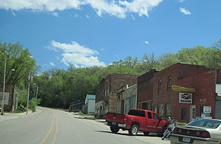
Marathon is a city in Buena Vista County, Iowa, United States. The population was 230 at the time of the 2020 census. The food writer Richard Olney grew up in Marathon.

<span class="mw-page-title-main">Newell, Iowa</span> City in Iowa, United States

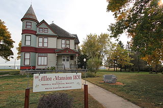
Newell is a city in Buena Vista County, Iowa, United States. The population was 906 according to the 2020 census.

<span class="mw-page-title-main">Rembrandt, Iowa</span> City in Iowa, United States

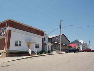
Rembrandt is a city in Buena Vista County, Iowa, United States. The population was 209 at the time of the 2020 census.

<span class="mw-page-title-main">Sioux Rapids, Iowa</span> City in Iowa, United States

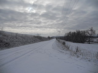
Sioux Rapids is a city in Buena Vista County, Iowa, United States. The population was 748 at the time of the 2020 census.

<span class="mw-page-title-main">Holy Cross, Iowa</span> City in Iowa, United States

Holy Cross is a city in Dubuque County, Iowa, United States. It is part of the Dubuque, Iowa Metropolitan Statistical Area. The population was 356 at the time of the 2020 census, down from 399 in 2000.

<span class="mw-page-title-main">Sherrill, Iowa</span> City in Iowa, United States

Sherrill is a city in Dubuque County, Iowa, United States. The population was 189 at the time of the 2020 census, up from 186 in 2000.

<span class="mw-page-title-main">Haverhill, Iowa</span> City in Iowa, United States

Haverhill is a city in Marshall County, Iowa, United States. The population was 165 at the time of the 2020 census.

<span class="mw-page-title-main">Buena Vista, Michigan</span> Place in Michigan, United States

Buena Vista is an unincorporated community and census-designated place (CDP) within Buena Vista Charter Township, Saginaw County in the U.S. state of Michigan. The U.S. Census Bureau has defined a census-designated place (CDP) with the same name for statistical purposes. The CDP has no official status as a municipality and the boundaries defined by the Census Bureau may not precisely correspond to local understanding of the Buena Vista area. The CDP consists of an area adjacent to the city of Saginaw on its east side and mostly east of Interstate 75. The population was 7,845 at the 2000 census.

<span class="mw-page-title-main">Buena Vista Charter Township, Michigan</span> Charter township in Michigan, United States

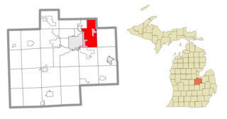
Buena Vista Charter Township is a charter township of Saginaw County in the U.S. state of Michigan. Per the 2020 census, the population was 7,664.

<span class="mw-page-title-main">Willernie, Minnesota</span> City in Minnesota, United States

Willernie is a city in Washington County, Minnesota, United States. It is bordered on all sides by the city of Mahtomedi. The population was 507 at the 2010 census.

<span class="mw-page-title-main">Bastress Township, Lycoming County, Pennsylvania</span> Township in Pennsylvania, United States

Bastress Township is a township in Lycoming County, Pennsylvania, United States. The population was 528 at the 2020 census. It is part of the Williamsport, Pennsylvania Metropolitan Statistical Area.

<span class="mw-page-title-main">Buena Vista, Portage County, Wisconsin</span> Town in Wisconsin, United States

Buena Vista is a town in Portage County, Wisconsin, United States. The population was 1,198 at the 2010 census. The unincorporated communities of Coddington and Keene are located within the town.

<span class="mw-page-title-main">St. Marys, Kansas</span> City in Pottawatomie and Wabaunsee Counties of Kansas

St. Marys or Saint Marys is a city in Pottawatomie and Wabaunsee counties in the U.S. state of Kansas in the United States. As of the 2020 census, the population of the city was 2,759. It is home of Saint Mary's Academy and College.

The Town of Potosi is located in Grant County, Wisconsin, United States. The population was 831 at the 2000 census. The Village of Potosi and the unincorporated communities of British Hollow, Buena Vista, Rockville, and Van Buren are located in the town.

References

  1. "2020 U.S. Gazetteer Files". United States Census Bureau. Retrieved March 16, 2022.
  2. 1 2 "2020 Census State Redistricting Data". census.gov. United states Census Bureau. Retrieved August 12, 2021.
  3. "US Gazetteer files: 2010, 2000, and 1990". United States Census Bureau. February 12, 2011. Retrieved April 23, 2011.
  4. "US Gazetteer files 2010". United States Census Bureau. Archived from the original on July 2, 2012. Retrieved May 11, 2012.
  5. Offenburger, Chuck (August 26, 2001). "The little place that launched gambling in Iowa". Archived from the original on October 26, 2006. Retrieved February 26, 2013.
  6. "Census of Population and Housing". Census.gov. Retrieved June 4, 2015.
  7. "U.S. Census website". United States Census Bureau . Retrieved May 11, 2012.
  8. "U.S. Census website". United States Census Bureau . Retrieved January 31, 2008.
  9. "Clayton Ridge." Iowa Department of Education. Retrieved on February 23, 2019.
  10. "REORGANIZATION & DISSOLUTION ACTIONS SINCE 1965-66." Iowa Department of Education. Retrieved on February 23, 2019.
  11. "History". St. Mary's Catholic School. Retrieved April 7, 2020.
  12. "Immaculate Conception Catholic Cemetery, North Buena Vista, Iowa". Archived from the original on March 18, 2013. Retrieved February 25, 2013.