Flowing Wells, Arizona

Last updated

Flowing Wells, Arizona
CDP
Pima County Incorporated and Unincorporated areas Flowing Wells highlighted.svg
Location in Pima County and the state of Arizona
Usa edcp location map.svg
Red pog.svg
Flowing Wells, Arizona
Location in the United States
Coordinates: 32°17′29″N111°0′32″W / 32.29139°N 111.00889°W / 32.29139; -111.00889
Country United States
State Arizona
County Pima
Area
[1]
  Total3.81 sq mi (9.87 km2)
  Land3.81 sq mi (9.87 km2)
  Water0.00 sq mi (0.00 km2)
Elevation
2,270 ft (692 m)
Population
 (2020)
  Total15,657
  Density4,110.53/sq mi (1,586.98/km2)
Time zone UTC-7 (MST (no DST))
Area code 520
FIPS code 04-23960
GNIS feature ID 1866983

Flowing Wells is a census-designated place (CDP) in Pima County, Arizona, United States. It is a suburb of Tucson. The population was 16,419 at the 2010 census. [2]

Contents

The Flowing Wells community was given an All-America City Award by the National Civic League in 2007.

Geography

Flowing Wells is located at 32°17′29″N111°0′32″W / 32.29139°N 111.00889°W / 32.29139; -111.00889 (32.291305, -111.008859). [3]

According to the United States Census Bureau, the CDP has a total area of 3.4 square miles (8.8 km2), all land.

Flowing Wells is roughly bound by Interstate 10 to the West, the Rillito River to the North, and the City of Tucson to the South and East.

It is entirely within Arizona's 2nd congressional district, on the western side of the district. Additionally, it is within Arizona's 9th legislative district and primarily within Pima County's 3rd supervisor district, though the northern portion of the CDP is within the 1st supervisor district.

Demographics

Historical population
CensusPop.Note
1990 14,013
2000 15,0507.4%
2010 16,4199.1%
2020 15,657−4.6%
source: [4] [5]

As of the census [6] of 2020, there were 15,657 people, 6,951 households, and 3,849 families residing in the CDP. The population density was 4,110.5 inhabitants per square mile (1,587.1/km2). There were 7,210 housing units at an average density of 2,114.2 per square mile (816.3/km2). The racial makeup of the CDP was 43.4% White, 1.5% Black or African American, 0.8% Native American, 1.3% Asian, 0.0% Pacific Islander, 4.0% from other races, and 17.3% from two or more races. 49.0% of the population were Hispanic or Latino of any race.

There were 6,951 households, out of which 23.7% had children under the age of 18 living with them, 42.3% were married couples living together, 14.0% had a female householder with no husband present, and 38.4% were non-families. 31.6% of all households were made up of individuals, and 14.8% had someone living alone who was 65 years of age or older. The average household size was 2.4 and the average family size was 3.0.

In the CDP, the population was spread out, with 25.4% under the age of 18, 7.9% from 18 to 24, 27.5% from 25 to 44, 20.9% from 45 to 64, and 18.2% who were 65 years of age or older. The median age was 38 years. For every 100 females, there were 91.5 males. For every 100 females age 18 and over, there were 87.7 males.

The median income for a household in the CDP was $37,092, and the median income for a family was $31,786. Males had a median income of $26,235 versus $21,972 for females. The per capita income for the CDP was $14,833. About 15.2% of families and 17.1% of the population were below the poverty line, including 24.2% of those under age 18 and 9.8% of those age 65 or over.

In 2010 Flowing Wells had a population of 16,419. The racial and ethnic composition of the population was 58.2% non-Hispanic white, 1.7% African American, 2.0% Native American, 1.2% Asian, 0.1% Pacific Islander, 0.1% non-Hispanic of some other race, 3.7% two or more races and 36.3% Hispanic or Latino. [7]

Public safety

Law enforcement services are provided by the Foothills District of the Pima County Sheriff's Department with the portion of the CDP lying west of La Cholla Boulevard served by Beat 4 and the portion lying east of La Cholla Boulevard served by Beat 3. [8] Fire protection and paramedic services are provided by the Northwest Fire District. [9]

Economy

Primary and secondary schools

Flowing Wells Unified School District operates public schools in Flowing Wells and serves much of Flowing Wells (the extreme eastern part of the census-designated place is served by Amphitheater Public Schools). [10]

Flowing Wells USD schools: Emily Meschter Early Learning Center is located in Flowing Wells. [11] District elementary schools in Flowing Wells include Centennial Elementary School, [12] Homer Davis Elementary School, [13] and Laguna Elementary School. [14] Flowing Wells Junior High School is located in Flowing Wells. [15]

Public libraries

Pima County Public Library operates the Flowing Wells Branch Library. [16]

Water

The Flowing Wells Irrigation District, [17] an independent public water provider founded in 1922, provides water for the southern majority portion of the CDP. [18]

See also

Related Research Articles

<span class="mw-page-title-main">Pima County, Arizona</span> County in Arizona, United States

Pima County is a county in the south central region of the U.S. state of Arizona. As of the 2020 census, the population was 1,043,433, making it Arizona's second-most populous county. The county seat is Tucson, where most of the population is centered. The county is named after the Pima Native Americans, also known as Tohono O'odham, who are indigenous to this area.

<span class="mw-page-title-main">Red Mesa, Arizona</span> CDP in Apache County, Arizona

Red Mesa is a census-designated place (CDP) in Apache County, Arizona, United States. The population was 480 at the 2010 census.

<span class="mw-page-title-main">St. Michaels, Arizona</span> CDP in Apache County, Arizona

St. Michaels is a chapter of the Navajo Nation and a census-designated place (CDP) in Apache County, Arizona, United States. The Navajo Nation Government Campus is located within the chapter at Window Rock.

<span class="mw-page-title-main">Teec Nos Pos, Arizona</span> Census-designated place in Arizona, United States

Teec Nos Pos is a census-designated place (CDP) in Apache County, Arizona, United States. The population was 507 at the 2020 census. It is the western terminus of U.S. Route 64.

<span class="mw-page-title-main">Arizona Village, Arizona</span> Census-designated place in Arizona, United States

Arizona Village is a census-designated place (CDP) on the Fort Mojave Indian Reservation in Mohave County, Arizona, United States. The population was 1,057 at the 2020 census, up from 946 in 2010 and 351 in 2000.

<span class="mw-page-title-main">Cibecue, Arizona</span> Fort Apache Indian Reservation community

Cibecue is a census-designated place (CDP) in Navajo County, Arizona, United States, on the Fort Apache Indian Reservation. The population was 1,713 in the 2010 United States Census.

<span class="mw-page-title-main">Ajo, Arizona</span> Community in Pima County, Arizona

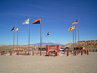
Ajo is an unincorporated community in Pima County, Arizona, United States. It is the closest community to Organ Pipe Cactus National Monument. The population was 3,039 at the 2020 census. Ajo is located on State Route 85 just 43 miles (69 km) from the Mexican border.

<span class="mw-page-title-main">Avra Valley, Arizona</span> CDP in Pima County, Arizona

Avra Valley is a census-designated place (CDP) in Pima County, Arizona, United States. The population was 6,050 at the 2010 census, up from 5,038 in 2000.

<span class="mw-page-title-main">Casas Adobes, Arizona</span> CDP in Pima County, Arizona

Casas Adobes is an unincorporated community and census-designated place (CDP) located in the northern metropolitan area of Tucson, Arizona. The population was 66,795 at the 2010 census. Casas Adobes is situated south and southwest of the town of Oro Valley, and west of the community of Catalina Foothills.

<span class="mw-page-title-main">Catalina Foothills, Arizona</span> CDP in Pima County, Arizona

Catalina Foothills is an unincorporated community and census-designated place (CDP) located north of Tucson in Pima County, Arizona, United States. Situated in the southern foothills of the Santa Catalina Mountains, Catalina Foothills had a population of 50,796 at the 2010 census. Catalina Foothills is one of the most affluent communities in Arizona and in the U.S., with the 6th highest per capita income in Arizona, and the 14th highest per capita income in the U.S. of communities with a population of at least 50,000. The Catalina Foothills community includes some of Arizona's most expensive homes and land, and has the highest median property value. It also includes resorts, golf courses, and spas.

<span class="mw-page-title-main">Corona de Tucson, Arizona</span> CDP in Pima County, Arizona

Corona de Tucson is a census-designated place (CDP) in Pima County, Arizona, United States. The population was 9,240 at the 2020 census, an increase of 1036% from the 2000 population of 813.

<span class="mw-page-title-main">Drexel-Alvernon, Arizona</span> CDP in Pima County, Arizona

Drexel-Alvernon was a census-designated place (CDP) in Pima County, Arizona, United States. The population was 4,192 at the 2000 census.

<span class="mw-page-title-main">Littletown, Arizona</span> CDP in Pima County, Arizona

Littletown was a census-designated place (CDP) in Pima County, Arizona, United States. The population was 1,010 at the 2000 census. The area was annexed into Tucson in 2017.

<span class="mw-page-title-main">South Tucson, Arizona</span> City in Arizona, United States

South Tucson is a city in Pima County, Arizona, United States and an enclave of the much larger city of Tucson. South Tucson is known for being heavily influenced by Hispanic, and especially Mexican, culture; restaurants and shops which sell traditional Mexican food and other goods can be found throughout the city. According to the 2010 census, the population of the city is 5,652.

<span class="mw-page-title-main">Blackwater, Arizona</span> CDP in Pinal County, Arizona

Blackwater is a native village and census-designated place (CDP) on the Gila River Reservation in Pinal County, Arizona, United States. The population was 1,062 at the 2010 census, up from 504 in 2000.

<span class="mw-page-title-main">Wilhoit, Arizona</span> Census-designated place in Yavapai County, Arizona, United States

Wilhoit is a census-designated place (CDP) in Yavapai County, Arizona, United States. The population was 664 at the 2000 census.

<span class="mw-page-title-main">Amphitheater Public Schools</span>

Amphitheater Public Schools, also known as Amphi or District 10, is the third largest public school district in Tucson, Arizona, in terms of enrollment, with about 13,500 students and a staff of about 2000 employees Amphi was established on July 3, 1893. With its headquarters in Flowing Wells, presently serves segments of North Tucson, Casas Adobes, Catalina Foothills, and the communities of Oro Valley, eastern Tortolita, and Catalina northwest of the city.

Rillito is a census-designated place (CDP) in Pima County, Arizona, United States, surrounded by the town of Marana. The largest business in the community is Arizona Portland Cement and the community has had a post office since the 1920s. There is a regional park and recreation center in the middle of the community. Rillito has the ZIP Code of 85654; in 2000, the population of the 85654 ZIP Code Tabulation Area was 148.

<span class="mw-page-title-main">Flowing Wells Unified School District</span> School district in Arizona, United States

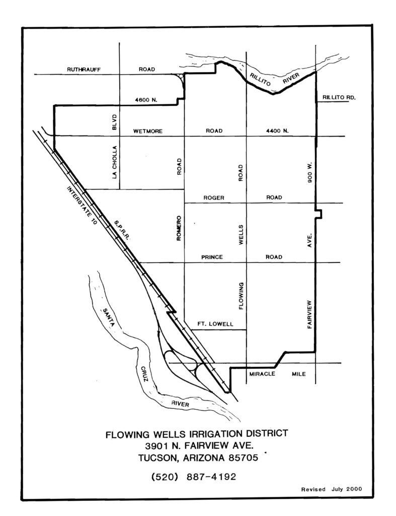
The Flowing Wells Unified School District is a unified school district headquartered at 1556 West Prince Road, Tucson, Arizona. It serves much of Flowing Wells, as well as bits of Tucson, Marana, Cortaro, Casas Adobes, & unnamed, unincorporated parts of Pima County. The district does practice open enrollment for students outside of district boundaries, provided said students maintain certain academic performance.

Nelson is a census-designated place (CDP) in Pima County, Arizona, United States. The population was 259 at the 2010 census.

References

  1. "2020 U.S. Gazetteer Files". United States Census Bureau. Retrieved October 29, 2021.
  2. Bureau, U.S. Census. "U.S. Census website". United States Census Bureau . Retrieved February 29, 2016.
  3. "US Gazetteer files: 2010, 2000, and 1990". United States Census Bureau. February 12, 2011. Retrieved April 23, 2011.
  4. "Census of Population and Housing (1790–2000)". U.S. Census Bureau . Retrieved July 17, 2010.
  5. "U.S. Census website". United States Census Bureau . Retrieved February 29, 2016.
  6. "U.S. Census website". United States Census Bureau . Retrieved February 21, 2024.
  7. 2010 population figures for Flowing Wells
  8. "Geocortex Viewer for HTML5".
  9. "Geocortex Viewer for HTML5".
  10. "2020 CENSUS - SCHOOL DISTRICT REFERENCE MAP: Pima County, AZ" (PDF). U.S. Census Bureau. p. 2. Retrieved January 25, 2023.
  11. "sitelayout_03.jpg Archived 2011-07-26 at the Wayback Machine ." Emily Meschter Early Learning Center. Retrieved on January 18, 2011. "4605 N. La Cholla Blvd. Tucson, AZ 85705"
  12. "centennial_edit08_09.jpg Archived 2011-07-26 at the Wayback Machine ." Centennial Elementary School. Retrieved on January 18, 2011. "2200 W. Wetmore Road Tucson, AZ 85705"
  13. "sitelayout_042.jpg Archived 2011-07-26 at the Wayback Machine ." Homer Davis Elementary School. Retrieved on January 18, 2011. "4250 North Romero Road Tucson, Arizona 85705."
  14. "footer_main_new.jpg Archived 2011-07-26 at the Wayback Machine ." Laguna Elementary School. Retrieved on January 18, 2011. "5001 N. Shannon Rd Tucson, AZ 85705."
  15. "Contact Us Archived 2011-07-26 at the Wayback Machine ." Flowing Wells Junior High School. Retrieved on January 18, 2011. "Flowing Wells Junior High 4545 North La Cholla Blvd. Tucson, Arizona 85705."
  16. "Flowing Wells Branch Library." Pima County Public Library. Retrieved on January 18, 2011.
  17. "About". Flowing Wells Irrigation District. March 18, 2019. Retrieved April 21, 2021.
  18. Flowing Wells Irrigation District. "Service Area Map". Flowing Wells Irrigation District. Retrieved April 21, 2021.