Summerhaven, Arizona

Last updated

Summerhaven, Arizona
Shop in SummerhavenAZ.JPG
The Summerhaven general store
Pima County Incorporated and Unincorporated areas Summerhaven located.svg
Location of Summerhaven in Pima County and the state of Arizona
USA Arizona location map.svg
Red pog.svg
Summerhaven
Location in the United States
Usa edcp location map.svg
Red pog.svg
Summerhaven
Summerhaven (the United States)
Coordinates: 32°26′18″N110°45′33″W / 32.43833°N 110.75917°W / 32.43833; -110.75917
CountryUnited States
State Arizona
County Pima
Area
[1]
  Total4.60 sq mi (11.93 km2)
  Land4.60 sq mi (11.93 km2)
  Water0.00 sq mi (0.00 km2)
Elevation
7,700 ft (2,300 m)
Population
 (2020)
  Total71
  Density15.42/sq mi (5.95/km2)
Time zone UTC-7 (MST)
ZIP Code
85619
Area code 520
GNIS feature ID 34939
FIPS code 04-70175

Summerhaven is a small unincorporated community and census-designated place (CDP) on Mount Lemmon in the Santa Catalina Mountains north of Tucson in Pima County, Arizona, United States. As of the 2010 census it had a permanent population of 40. [2] Summerhaven sits at an elevation of approximately 7,600 to 8,200 feet (2,300 to 2,500 m) above sea level. Summerhaven is accessed via the Catalina Highway from suburban northeast Tucson, and it is about 24.5 miles (39.4 km) from the base of the mountains to Summerhaven.

Contents

History

White Anglo-Americans originally used the area of Summerhaven when the U.S. Army at Fort Lowell in Tucson put a military camp there in its defense against the Apache in the 1870s and 1880s. As to white settlement of the vicinity, the Ransier School in Carter Canyon, run by Lydia Ransier and 'Auntie' Broadbent, had two cabins, the larger log one being built in 1912, "one of the oldest cabins on the mountain." [3]

According to historian David Leighton, Summerhaven at one point had the highest golf links in the world. He wrote, "F.E.A Kimball (namesake of Mount Kimball), head of the Summerhaven Land and Improvement Co. on Mount Lemmon, constructed a six-hole golf links. The course was on 50 acres, a mix of Forest Service and private land, with two trout streams running through the acreage. The links were about 7,800 feet above sea level, making it the highest golf course in the world...." [4]

Geography

House in Summerhaven Summerhavenarizona.jpg
House in Summerhaven

Summerhaven is located in the Santa Catalina Mountains and is surrounded by pine trees. According to the U.S. Census Bureau, the Summerhaven CDP has a total area of 4.6 sq mi (11.8 km2), almost all land. [2]

Climate

Due to its high elevation of 8,200 feet (2,500 m), Summerhaven experiences moderately warm summers and cool snowy winters. Yearly snowfall averages can be significant, on average reaching 65 inches (1,700 mm) a year. A windstorm hit Summerhaven in May 2010 and caused extensive damage to the forest around it. Some trails were severely damaged, although repair efforts were underway. The climate could be classified as a subtropical highland climate (Cfb).

Climate data for Mount Lemmon, Arizona (1958–2009)
MonthJanFebMarAprMayJunJulAugSepOctNovDecYear
Record high °F (°C)65
(18)
65
(18)
68
(20)
74
(23)
82
(28)
91
(33)
89
(32)
82
(28)
81
(27)
76
(24)
71
(22)
65
(18)
91
(33)
Mean daily maximum °F (°C)49.2
(9.6)
48.3
(9.1)
52.9
(11.6)
60.8
(16.0)
69.1
(20.6)
76.4
(24.7)
76.5
(24.7)
73.6
(23.1)
70.4
(21.3)
61.7
(16.5)
56.3
(13.5)
50.6
(10.3)
62.2
(16.8)
Mean daily minimum °F (°C)22.8
(−5.1)
21.8
(−5.7)
25.7
(−3.5)
31.7
(−0.2)
36.6
(2.6)
44.4
(6.9)
49.8
(9.9)
49.8
(9.9)
45.1
(7.3)
36.4
(2.4)
29.7
(−1.3)
24.3
(−4.3)
34.8
(1.6)
Record low °F (°C)−4
(−20)
−7
(−22)
−1
(−18)
19
(−7)
27
(−3)
32
(0)
39
(4)
42
(6)
31
(−1)
20
(−7)
4
(−16)
4
(−16)
−7
(−22)
Average precipitation inches (mm)3.15
(80)
1.69
(43)
1.17
(30)
0.50
(13)
0.25
(6.4)
0.62
(16)
4.41
(112)
6.99
(178)
3.39
(86)
3.05
(77)
1.75
(44)
2.60
(66)
29.56
(751)
Average snowfall inches (cm)16.5
(42)
20.4
(52)
6.8
(17)
2.0
(5.1)
0
(0)
0
(0)
0
(0)
0
(0)
0
(0)
2.0
(5.1)
6.2
(16)
11.0
(28)
64.9
(165)
Average precipitation days5553221011533559
Mean monthly sunshine hours 2412432993253743723273193153012602423,618
Source 1: [5]
Source 2: [6]

Demographics

Historical population
CensusPop.Note
2020 71
U.S. Decennial Census [7]

In 2010, the population of the Summerhaven census-designated place was 40. [2] Note that this includes only people who were living in Summerhaven on the day of the census, thus excluding many part-time or seasonal residents. As of the 2010 census, the racial composition of Summerhaven was:

Tourism and recreation

Summerhaven is a popular tourist destination. Several small shops in Summerhaven attract visitors, including the Mount Lemmon General Store and The Cookie Cabin, which offers homemade cookies and pizzas. In the winter, residents from lower elevations travel to Summerhaven, when the Catalina Highway is open, to enjoy the snow. Also during the summer, the same residents will frequent the area to get away from the heat. Because of the elevation difference between the Tucson area (5,000–6,000 feet), the temperature in Summerhaven will be anywhere from 15–30 degrees F cooler depending on weather patterns, which usually makes it a very comfortable place to be compared to the hot desert heat in the summer time.

October 2010 saw the inaugural running of the Mount Lemmon Marathon, in which nearly 800 participants finished the race from near the start of the Catalina Highway up to Summerhaven. [9]

Mount Lemmon Ski Valley

The Mount Lemmon Ski Valley located outside Summerhaven is the southernmost ski location in the continental United States.

Aspen Fire

Burnt pine trees, snow, and a cabin among the stark landscape after the Aspen Fire in 2003 MtLemmon Summerhaven Recovery From Aspen Fire.jpg
Burnt pine trees, snow, and a cabin among the stark landscape after the Aspen Fire in 2003

The Aspen wildfire struck Summerhaven in the summer of 2003, which resulted in the destruction of more than 250 of the 700 homes in the community. Arizona Governor Janet Napolitano assessed the damage, and both federal and county officials surveyed the extensive loss. In the months that followed, Tucson residents organized "Lemmon Aid" to help rebuild Summerhaven.

City services

There is a general store and several food venues, but no gasoline or automotive services. The Mount Lemmon Fire Department maintains a station near Summerhaven, providing fire and EMS services. Summerhaven is not located in a school district; the closest district is Tanque Verde Unified School District. [10]

Related Research Articles

<span class="mw-page-title-main">Tucson, Arizona</span> City in Arizona

Tucson is a city in and the county seat of Pima County, Arizona, United States, and is home to the University of Arizona. It is the second-largest city in Arizona behind Phoenix, with a population of 542,629 in the 2020 United States census, while the population of the entire Tucson metropolitan statistical area (MSA) is 1,043,433. The Tucson MSA forms part of the larger Tucson-Nogales combined statistical area. Both Tucson and Phoenix anchor the Arizona Sun Corridor. The city is 108 miles (174 km) southeast of Phoenix and 60 mi (100 km) north of the United States–Mexico border.

<span class="mw-page-title-main">Pima County, Arizona</span> County in Arizona, United States

Pima County is a county in the south central region of the U.S. state of Arizona. As of the 2020 census, the population was 1,043,433, making it Arizona's second-most populous county. The county seat is Tucson, where most of the population is centered. The county is named after the Pima Native Americans, also known as Tohono O'odham, who are indigenous to this area.

<span class="mw-page-title-main">Casas Adobes, Arizona</span> CDP in Pima County, Arizona

Casas Adobes is an unincorporated community and census-designated place (CDP) located in the northern metropolitan area of Tucson, Arizona. The population was 66,795 at the 2010 census. Casas Adobes is situated south and southwest of the town of Oro Valley, and west of the community of Catalina Foothills.

<span class="mw-page-title-main">Catalina, Arizona</span> CDP in Pima County, Arizona

Catalina is a census-designated place (CDP) in Pima County, Arizona, United States. The population was 7,025 at the 2000 census. Catalina continues to experience increasing population growth, while attempting to maintain its rural character. Catalina remains an unincorporated community, with no plans for annexation into any nearby towns.

<span class="mw-page-title-main">Catalina Foothills, Arizona</span> CDP in Pima County, Arizona

Catalina Foothills is an unincorporated community and census-designated place (CDP) located north of Tucson in Pima County, Arizona, United States. Situated in the southern foothills of the Santa Catalina Mountains, Catalina Foothills had a population of 50,796 at the 2010 census. Catalina Foothills is one of the most affluent communities in Arizona and in the U.S., with the 6th highest per capita income in Arizona, and the 14th highest per capita income in the U.S. of communities with a population of at least 50,000. The Catalina Foothills community includes some of Arizona's most expensive homes and land, and has the highest median property value. It also includes resorts, golf courses, and spas.

<span class="mw-page-title-main">Corona de Tucson, Arizona</span> CDP in Pima County, Arizona

Corona de Tucson is a census-designated place (CDP) in Pima County, Arizona, United States. The population was 9,240 at the 2020 census, an increase of 1036% from the 2000 population of 813.

<span class="mw-page-title-main">Drexel Heights, Arizona</span> CDP in Pima County, Arizona

Drexel Heights is an unincorporated community and census-designated place (CDP) in Pima County, Arizona, United States. The population was 27,749 at the 2010 census.

<span class="mw-page-title-main">Marana, Arizona</span> Town in Pima County, Arizona

Marana is a town that mostly lies in Pima County with a small portion in Pinal County, in the U.S. state of Arizona. It is located northwest of Tucson, Arizona. As of the 2020 census, the population of the town was 51,908.

<span class="mw-page-title-main">Oro Valley, Arizona</span> Town in Pima County, Arizona

Oro Valley, incorporated in 1974, is a suburban town located 6 miles (9.7 km) north of Tucson, Arizona, United States, in Pima County. According to the 2020 census, the population of the town is 47,070, an increase from 29,700 in 2000. Dubbed the "Upscale Tech Mecca" of Southern Arizona by the Arizona Daily Star newspaper, Oro Valley is home to over 10 high tech firms and has a median household income nearly 50% higher than the U.S. median. The town is located approximately 110 miles (180 km) southeast of the state capital of Phoenix.

<span class="mw-page-title-main">Oracle, Arizona</span> CDP in Pinal County, Arizona

Oracle is a census-designated place (CDP) in Pinal County, Arizona, United States. The population was 3,686 at the 2010 Census, falling to 3,051 at the 2020 Census.

<span class="mw-page-title-main">Santa Catalina Mountains</span> Mountain range in Pima and Pinal counties, Arizona, United States

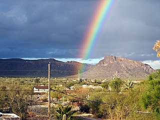
The Santa Catalina Mountains, commonly referred to as the Catalina Mountains or the Catalinas, are north and northeast of Tucson in Arizona, United States, on Tucson's north perimeter. The mountain range is the most prominent in the Tucson area, with the highest average elevation. The highest point in the Catalinas is Mount Lemmon at an elevation of 9,157 feet (2,791 m) above sea level and receives 18 inches (46 cm) of precipitation annually.

<span class="mw-page-title-main">Mount Lemmon</span> Mountain in Arizona, United States

Mount Lemmon, with a summit elevation of 9,159 feet (2,792 m), is the highest point in the Santa Catalina Mountains. It is located in the Coronado National Forest north of Tucson, Arizona, United States. Mount Lemmon was named for botanist Sara Plummer Lemmon, who trekked to the top of the mountain with her husband and E. O. Stratton, a local rancher, by horse and foot in 1881. Mount Lemmon is also known as Babad Do'ag, or Frog Mountain to the Tohono O'odham.

<span class="mw-page-title-main">Amphitheater Public Schools</span>

Amphitheater Public Schools, also known as Amphi or District 10, is the third largest public school district in Tucson, Arizona, in terms of enrollment, with about 13,500 students and a staff of about 2000 employees Amphi was established on July 3, 1893. With its headquarters in Flowing Wells, presently serves segments of North Tucson, Casas Adobes, Catalina Foothills, and the communities of Oro Valley, eastern Tortolita, and Catalina northwest of the city.

<span class="mw-page-title-main">Arivaca, Arizona</span> Unincorporated community in Pima County

Arivaca is an unincorporated community in Pima County, Arizona, United States. It is located 11 miles (18 km) north of the Mexican border and 35 miles (56 km) northwest of the port of entry at Nogales. The European-American history of the area dates back at least to 1695, although the community was not founded until 1878. Arivaca has the ZIP code 85601. The 85601 ZIP Code Tabulation Area had a population of 909 at the 2000 census.

The Catalina Highway, officially the General Hitchcock Highway, is the popular name for a Forest Highway and scenic route located in Pima County in southern Arizona. Also known as the Sky Island Scenic Byway, the Mount Lemmon Highway and Arizona Forest Highway 39, the Catalina Highway is the only paved roadway providing access to the resort village of Summerhaven as well as various recreational and scientific facilities located near the summit of Mount Lemmon. Ascending from the desert floor in Tucson to near the summit of Mount Lemmon, the short highway gains over 6,000 ft (1,800 m), showcasing a variety of climates ranging from lowland desert to alpine forests. The name sky island comes from the analogy of these mountains being like islands of forest in a sea of desert. It is designated as a scenic byway by the National Scenic Byways Program. and an Arizona Scenic Road by the Federal Highway Administration.

<span class="mw-page-title-main">Pima Canyon</span> Landform in the Santa Catalina Mountains, Arizona

Pima Canyon is a major canyon located in the Santa Catalina Mountains, north of Catalina Foothills and Tucson, Arizona, US. Pusch Ridge forms the northwestern cliffs of Pima Canyon, dramatically rising from Pima Creek on the canyon floor. Pima Canyon varies greatly in elevation, from 2,900 feet (880 m) above sea level at Pima Creek to 6,350 feet (1,940 m) at Pima Saddle. Mount Kimball is the highest peak in the vicinity of the canyon.

<span class="mw-page-title-main">Mount Lemmon Ski Valley</span> Recreational ski area in Arizona, United States

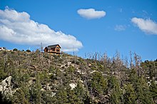
Mount Lemmon Ski Valley is a recreational ski area in the U.S. state of Arizona, and the southernmost ski destination in the continental United States. Mount Lemmon Ski Valley is located on the slopes of Mount Lemmon in the Santa Catalina Mountains just north of Tucson, Arizona. It is part of the Coronado National Forest, located near the mountaintop village of Summerhaven. The summit is 9,157 feet (2,791 m) above sea level, and receives approximately 180 inches (4.6 m) of snow annually.

<span class="mw-page-title-main">Geography of Arizona</span>

Arizona is a landlocked state situated in the southwestern region of the United States of America. It has a vast and diverse geography famous for its deep canyons, high- and low-elevation deserts, numerous natural rock formations, and volcanic mountain ranges. Arizona shares land borders with Utah to the north, the Mexican state of Sonora to the south, New Mexico to the east, and Nevada to the northwest, as well as water borders with California and the Mexican state of Baja California to the southwest along the Colorado River. Arizona is also one of the Four Corners states and is diagonally adjacent to Colorado.

<span class="mw-page-title-main">Mount Lemmon Marathon</span>

The Mount Lemmon Marathon were a pair of separate road race marathon events that took place in the Santa Catalina Mountains near the city of Tucson, Arizona, United States. The initial race, which was in the uphill direction, was held between 2010 and 2013. The uphill race started near the desert floor and ended at the village of Summerhaven near the top of Mount Lemmon.

<span class="mw-page-title-main">Bighorn Fire</span> 2020 Arizona wildfire

The Bighorn Fire was a wildfire in the Santa Catalina Mountains north of Tucson, Arizona. It burned 119,987 acres (48,557 ha) until it was finally put out on July 23, 2020. A lightning strike from a storm at 9:46 PM on June 5, 2020 caused the fire. The fire was named after the bighorn sheep that inhabit the area.

References

  1. "2020 U.S. Gazetteer Files". United States Census Bureau. Retrieved October 29, 2021.
  2. 1 2 3 "Geographic Identifiers: 2010 Demographic Profile Data (G001): Summerhaven CDP, Arizona". American Factfinder. U.S. Census Bureau. Archived from the original on February 13, 2020. Retrieved January 27, 2016.
  3. Mary Ellen Barnes, The Road to Mount Lemmon, Univ. Arizona Press, 2009, pp. 8–9"
  4. Leighton, David (February 1, 2021). "Street Smarts: The Story Behind Barnum Hill – and golf – in Tucson's Reid Park". Arizona Daily Star.
  5. "Mount Lemmon, Arizona Climate Summary". Western Regional Climate Center. Retrieved December 4, 2011.
  6. "Mount Lemmon, Arizona Averages". Chinci World Atlas. Retrieved December 4, 2011.
  7. "Census of Population and Housing". Census.gov. Retrieved June 4, 2016.
  8. "Profile of General Population and Housing Characteristics: 2010 Census Summary File 1 (DP-1): Summerhaven CDP, Arizona". American Factfinder. U.S. Census Bureau. Archived from the original on February 13, 2020. Retrieved January 27, 2016.
  9. Marc Lacey (October 17, 2010). "A Finish Line With a Real High: 8,000 Feet". New York Times. Retrieved October 28, 2010.
  10. https://www.schools.pima.gov/schools/unorganized-territories

Commons-logo.svg Media related to Summerhaven, Arizona at Wikimedia Commons