Lacey, Washington

Last updated

Lacey
St.Martin's College - panoramio.jpg
Thurston County Washington Incorporated and Unincorporated areas Lacey Highlighted.svg
Location within Thurston County in Washington
Coordinates: 47°1′35″N122°48′26″W / 47.02639°N 122.80722°W / 47.02639; -122.80722
CountryUnited States
State Washington
County Thurston
Incorporated December 5, 1966
Government
  Type Council–manager [1]
   Mayor Andy Ryder [2]
   Deputy mayor Malcolm Miller [3]
Area
[4]
   City 17.66 sq mi (45.75 km2)
  Land17.20 sq mi (44.55 km2)
  Water0.47 sq mi (1.20 km2)
Elevation
203 ft (62 m)
Population
 (2020) [5]
   City 53,526
  Estimate 
(2022) [6]
58,552
  RankUS: 669th
WA: 23rd
  Density3,057.67/sq mi (1,180.57/km2)
   Metro
298,758 (US: 172nd)
Time zone UTC-8 (Pacific (PST))
  Summer (DST) UTC-7 (PDT)
ZIP code
98516
Area code 360
FIPS code 53-36745
GNIS feature ID1512362 [7]
Website cityoflacey.org

Lacey is a city in Thurston County, Washington, United States. It is a suburb of Olympia with a population of 53,526 at the 2020 census, making it the 24th most populous city in Washington. [5] Lacey is located along Interstate 5 between Olympia and the Nisqually River, which marks the border with Pierce County and Joint Base Lewis–McChord.

Contents

History

Lacey was originally called Woodland after settlers Isaac and Catherine Wood, who claimed land there in 1853. [8] By 1891, the railroad had come to the community of Woodland and the residents decided it was time to apply for a post office. The request was denied because there was already a town called Woodland on the Columbia River. The name Lacey was chosen for the new post office application, presumably after O. C. Lacey, a Justice of the Peace in Olympia. [9] The small settlements of Woodland and Chambers Prairie consolidated into Lacey in the 1950s. The city of Lacey was not officially incorporated until 1966. [10] At the time, the main industries were cattle, milk, forest products, and retail. Lacey became a commuter town for Olympia, Fort Lewis [11] and to some extent, Tacoma; in recent years, however, business developments, community groups, and population growth have led Lacey to develop into a city in its own right.

Geography

According to the United States Census Bureau, the city has a total area of 16.51 square miles (42.76 km2), of which, 16.06 square miles (41.60 km2) is land and 0.45 square miles (1.17 km2) is water. [12]

Demographics

Historical population
CensusPop.Note
1960 6,630
1970 9,69646.2%
1980 13,94043.8%
1990 19,27938.3%
2000 31,22662.0%
2010 42,39335.8%
2020 53,52626.3%
2022 (est.)58,552 [6] 9.4%
U.S. Decennial Census [13]
2020 Census [5]

2020 census

As of the 2020 census, there were 53,526 people, 20,984 households in the city.

2010 census

As of the 2010 census, there were 42,393 people, 16,949 households, and 10,869 families residing in the city. The population density was 2,639.7 inhabitants per square mile (1,019.2/km2). There were 18,493 housing units at an average density of 1,151.5 per square mile (444.6/km2). The racial makeup of the city was 74.2% White, 5.4% African American, 1.2% Native American, 8.0% Asian, 1.7% Pacific Islander, 2.6% from other races, and 7.0% from two or more races. Hispanic or Latino of any race were 9.2% of the population.

There were 16,949 households, of which 33.9% had children under the age of 18 living with them, 46.7% were married couples living together, 12.9% had a female householder with no husband present, 4.5% had a male householder with no wife present, and 35.9% were non-families. 28.3% of all households were made up of individuals, and 11% had someone living alone who was 65 years of age or older. The average household size was 2.44 and the average family size was 2.99.

The median age in the city was 34 years. 24.6% of residents were under the age of 18; 10.1% were between the ages of 18 and 24; 29.5% were from 25 to 44; 21.8% were from 45 to 64; and 14.1% were 65 years of age or older. The gender makeup of the city was 47.4% male and 52.6% female.

2000 census

As of 2000 the median income for a household in the city was $46,848, and the median income for a family was $54,923. Males had a median income of $41,053 versus $32,497 for females. The per capita income for the city was $20,224. About 7.1% of families and 8.8% of the population were below the poverty line, including 10.5% of those under age 18 and 5.5% of those age 65 or over.

Neighborhoods

Mushroom Corner is located along Interstate 5 and is included in the Tanglewilde-Thompson Place Census-designated place (CDP) for Census purposes. The "corner" in Mushroom Corner is located at the intersection of Steilacoom Road SE and Marvin Road SE. The community takes its name from the local mushroom crop; the Ostrom Mushroom Farm operated nearby. [14] [15]

Economy

South Sound Center is a shopping mall in Lacey.

Sustainability

Lacey was the twelfth city to be designated an official "Green Power Community" by the U.S. Environmental Protection Agency for its use of renewable energy sources; 8.4% of its total energy use comes from green power sources. [16] It is working to meet its Alternative Energy Initiative, which includes using 100 percent green electrical energy in all of its municipal buildings, parks, utilities, and 3,000 streetlights and traffic signals; providing electric vehicle charging stations to visitors and employees at its city hall and library campus; and initiating conversion of its municipal fleet to energy efficient vehicles powered by electricity, hybrid technology, and 80/20 biofuel. [17] Lacey has received the "Tree City, USA" designation from the National Arbor Day Foundation for twenty six years. [18]

Education

In addition to being the home of many public and private schools, Lacey is also home to Saint Martin's University, Charter College.

The city is entirely within the boundaries of North Thurston Public Schools, [19] the largest school district in Thurston County. Lacey is also home to various faith based schools, such as Holy Family School (Roman Catholic Preschool through 8th grade), Faith Lutheran School (Preschool through 8th Grade) and Foundation Campus, which includes Community Christian Academy (Pre-school to Middle School) and Northwest Christian High School. Lacey is also the home of Pope John Paul II High School.

Public secondary schools

Notable people

Sister city

Lacey has a sister city in Poland, Mińsk Mazowiecki. [22]

Related Research Articles

<span class="mw-page-title-main">Olympia, Washington</span> Capital city of Washington, United States

Olympia is the capital of the U.S. state of Washington and the county seat and most populous city of Thurston County.

<span class="mw-page-title-main">Thurston County, Washington</span> County in Washington, United States

Thurston County is a county located in the U.S. state of Washington. As of the 2020 census, its population was 294,793. The county seat and largest city is Olympia, the state capital.

<span class="mw-page-title-main">Forest Park, Georgia</span> City in Georgia, United States

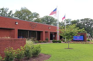
Forest Park is a city in Clayton County, Georgia, United States. It is located approximately nine miles (14 km) south of Atlanta and is part of the Atlanta–Sandy Springs–Marietta Metropolitan Statistical Area. As of the 2020 census, the city had a population of 19,932.

<span class="mw-page-title-main">Tyrone, Georgia</span> Town in Georgia, United States

Tyrone is a town in Fayette County, Georgia, United States. The population was 6,879 at the 2010 census, up from 3,916 in 2000. The estimated population in 2018 was 7,388. It is a part of the Atlanta metropolitan area.

<span class="mw-page-title-main">Olympia Fields, Illinois</span> Village in Illinois, United States

Olympia Fields is a village in Cook County, Illinois, United States. The population was 4,718 as of the 2020 census. It is a southern suburb of Chicago. The municipality grew up around the prestigious Olympia Fields Country Club, originally established in 1915.

<span class="mw-page-title-main">Urbandale, Iowa</span> City in Iowa, United States

Urbandale is a city in Polk and Dallas counties, Iowa, United States. As of the 2020 U.S. Census, the city population was 45,580. It is part of the Des Moines–West Des Moines Metropolitan Statistical Area.

<span class="mw-page-title-main">Clinton, Maryland</span> Census-designated place in Maryland, United States

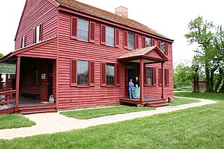
Clinton is an unincorporated census-designated place (CDP) in Prince George's County, Maryland, United States. Clinton was formerly known as Surrattsville until after the time of the Civil War. The population of Clinton was 38,760 at the 2020 census. Clinton is historically known for its role in the American Civil War concerning the Abraham Lincoln assassination. Clinton is adjacent to Camp Springs, Rosaryville, Melwood, and Andrews Air Force Base.

<span class="mw-page-title-main">Centerville, Ohio</span> City in Ohio, United States

Centerville is a city in Montgomery County, Ohio, United States. A core suburb of Metro Dayton, its population was 24,240 as of the 2020 census.

<span class="mw-page-title-main">Jenks, Oklahoma</span> City in Oklahoma, United States

Jenks is a city in Tulsa County, Oklahoma, United States, and a suburb of Tulsa, in the northeastern part of the state. It is situated between the Arkansas River and U.S. Route 75. Jenks is one of the fastest-growing cities in Oklahoma. The city's population was 16,924 in the 2010 census, but by 2020, this had grown to 25,949. The Census estimated Jenks' population as 27,141 in 2022.

<span class="mw-page-title-main">Franklin, Pennsylvania</span> City in Pennsylvania, United States

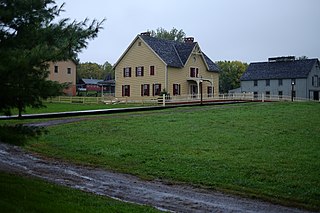
Franklin is a city in and the county seat of Venango County, Pennsylvania, United States, located at the confluence of French Creek and the Allegheny River. The population was 6,097 in the 2020 census. Franklin is part of the Oil City micropolitan area.

<span class="mw-page-title-main">McCleary, Washington</span> City in Washington, United States

McCleary is a city in Grays Harbor County, Washington, United States. The population was 1,997 at the 2020 census.

<span class="mw-page-title-main">Mercer Island, Washington</span> City in Washington, United States

Mercer Island is a city in King County, Washington, United States, located on an island of the same name in the southern portion of Lake Washington. Mercer Island is in the Seattle metropolitan area, with Seattle to its west and Bellevue to its east.

<span class="mw-page-title-main">Rainier, Washington</span> City in Washington, United States

Rainier is a city in Thurston County, Washington, United States. Beginning as a train stop in the 1870s, Rainier was first settled in 1890 and would become known as a logging town. The city was officially incorporated in 1947.

<span class="mw-page-title-main">Tanglewilde, Washington</span> CDP in Washington, United States

Tanglewilde is a census-designated place (CDP) in Thurston County, Washington, United States, part of the Urban Growth Area of the city of Lacey.

<span class="mw-page-title-main">Tenino, Washington</span> City in Washington, United States

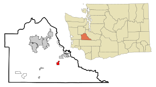
Tenino is a city in Thurston County, Washington, United States. The population was 1,870 at the 2020 census.

<span class="mw-page-title-main">Tumwater, Washington</span> City in Washington, United States

Tumwater is a city in Thurston County, Washington, United States. The population was 25,350 at the 2020 census. The city is situated near where the Deschutes River enters Budd Inlet, the southernmost point of Puget Sound; it also borders the state capital of Olympia to the north. Tumwater is the oldest permanent Anglo-American settlement on Puget Sound.

<span class="mw-page-title-main">Yelm, Washington</span> City in Washington, United States

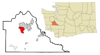
Yelm is a city in Thurston County, Washington, United States. Its population was 10,617 at the 2020 census.

<span class="mw-page-title-main">Pullman, Washington</span> City in Washington, United States

Pullman is the most populous city in Whitman County, located in southeastern Washington within the Palouse region of the Pacific Northwest. The population was 32,901 at the 2020 census, and estimated to be 32,508 in 2022. Originally founded as Three Forks, the city was renamed after industrialist George Pullman in 1884.

<span class="mw-page-title-main">Beaver Dam, Wisconsin</span> City in Wisconsin, United States

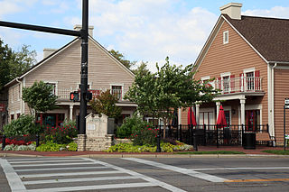
Beaver Dam is a city in Dodge County, Wisconsin, United States, along Beaver Dam Lake and the Beaver Dam River. The population was 16,708 at the 2020 census, making it the largest city primarily located in Dodge County. It is the principal city of the Beaver Dam Micropolitan Statistical area which is included in the larger Milwaukee–Waukesha–Racine CSA. The city is adjacent to the Town of Beaver Dam.

<span class="mw-page-title-main">Timberline High School (Lacey, Washington)</span> Public school in Lacey, Washington, United States

Timberline High School is a comprehensive public secondary school in Lacey, Washington. Opened in 1970 and part of North Thurston Public Schools, its school colors are green and gold and the mascot is a blazer.

References

  1. "City Council". City of Lacey. Retrieved March 26, 2022.
  2. "Andy Ryder, Mayor | Meet the Lacey City Council | City Council | City of Lacey, Washington, USA". Archived from the original on September 20, 2020. Retrieved June 28, 2017.
  3. "City Council". City of Lacey. Retrieved March 26, 2022.
  4. "2020 U.S. Gazetteer Files". United States Census Bureau. Retrieved July 24, 2022.
  5. 1 2 3 "Explore Census Data". United States Census Bureau . Retrieved November 11, 2023.
  6. 1 2 "City and Town Population Totals: 2020-2022". United States Census Bureau. November 11, 2023. Retrieved November 11, 2023.
  7. "US Board on Geographic Names". United States Geological Survey. October 25, 2007. Retrieved January 31, 2008.
  8. "Thurston County Sesquicentennial" Archived February 13, 2002, at archive.today — The Olympian
  9. "A Rich History | Living in Lacey | City of Lacey, Washington, USA".
  10. "Thurston County Place Names: A Heritage Guide" (PDF). Thurston County Historical Commission. 1992. p. 42. Retrieved March 28, 2018.
  11. "Joint Base Lewis McChord Growth Coordination - JBLM.growth.com". Archived from the original on April 13, 2011. Retrieved March 20, 2011.
  12. "US Gazetteer files 2010". United States Census Bureau. Archived from the original on July 2, 2012. Retrieved December 19, 2012.
  13. "Census of Population and Housing". Census.gov. Retrieved June 4, 2016.
  14. Boone, Rolf (July 21, 2023). "Development plans emerge for former Ostrom's mushroom farm, Pacific Ave. apartments". The Olympian.
  15. "Thurston County Place Names: A Heritage Guide" (PDF). Thurston County Historical Commission. 1992. p. 56. Retrieved March 28, 2018.
  16. "United States Environmental Protection Agency". October 8, 2015. Retrieved August 7, 2023.
  17. "Lacey Alternative Energy Fair Named Top Event by Washington Recreation and Park Association" — Lacey Online - Press Releases
  18. "City of Lacey Marks 26 Years as a Tree City USA" Archived September 29, 2021, at the Wayback Machine — Lacey Online - Press Releases
  19. 2020 Census – School District Reference Map: Thurston County, WA (PDF) (Map). United States Census Bureau. Archived (PDF) from the original on October 9, 2022. Retrieved March 13, 2024. - Text list
  20. "Construction & Design - Salish Middle School". Archived from the original on April 6, 2017. Retrieved August 7, 2023.
  21. Rosenzweig, David (January 24, 2001). "White supremacist agrees to plead guilty in rampage". The Seattle Times. pp. A13.
  22. Minutes of a regular meeting of the Lacey City Council held Thursday, January 25, 2007, at Lacey Council Chambers Archived January 15, 2016, at the Wayback Machine — Retrieved October 24, 2009.