San Juan County, Washington

Last updated

San Juan County
San Juan County Courthouse.JPG
San Juan County Courthouse
Flag of San Juan County, Washington.svg
Map of Washington highlighting San Juan County.svg
Location within the U.S. state of Washington
Washington in United States.svg
Washington's location within the U.S.
Coordinates: 48°34′N122°58′W / 48.57°N 122.97°W / 48.57; -122.97
CountryFlag of the United States.svg United States
StateFlag of Washington.svg  Washington
FoundedOctober 31, 1873
Named for San Juan Islands
Seat Friday Harbor
Largest townFriday Harbor
Area
  Total621 sq mi (1,610 km2)
  Land174 sq mi (450 km2)
  Water447 sq mi (1,160 km2)  72%
Population
 (2020)
  Total17,788
  Estimate 
(2022)
18,662 Increase2.svg
  Density96/sq mi (37/km2)
Time zone UTC−8 (Pacific)
  Summer (DST) UTC−7 (PDT)
Congressional district 2nd
Website www.sanjuanco.com

San Juan County (Spanish : Condado de San Juan) is a county located in the Salish Sea in the far northwestern corner of the U.S. state of Washington. As of the 2020 census, its population was 17,788. [1] The county seat and only incorporated town is Friday Harbor, [2] located on San Juan Island. The county was formed on October 31, 1873, from Whatcom County [3] and is named for the San Juan Islands, which are in turn named for Juan Vicente de Güemes, 2nd Count of Revillagigedo, [4] the Viceroy of New Spain.

Contents

Although the islands themselves have no state highways, the ferry routes serving the islands are designated as part of the state highway system.

History

Straits Steamship Company house flag, shipping firm that operated steamships on Puget Sound and the Strait of Juan de Fuca. Straits Steamship Company house flag.svg
Straits Steamship Company house flag, shipping firm that operated steamships on Puget Sound and the Strait of Juan de Fuca.

The San Juan Islands were the subject of a territorial dispute between Great Britain and the United States from 1846 to 1872, leading to the Pig War in 1859. The bloodless conflict ended through arbitration led by Kaiser Wilhelm I, which awarded the islands to the United States. [5] San Juan County was home to Henry Cayou, one of the first elected officials of Native descent in Washington. [6]

Geography

According to the United States Census Bureau, the county has a total area of 621 square miles (1,610 km2), of which 174 square miles (450 km2) is land and 447 square miles (1,160 km2) (72%) is water. [7] It is the smallest county in Washington by land area and fourth-smallest by total area.

San Juan County is a cluster of more than 400 islands and rocks with elevations above mean high tide. 134 of these islands and rocks are named. The county has a rugged, rocky shoreline and several mountains. The highest point in the county is Mount Constitution on Orcas Island at 2,407 feet (734 m) above sea level.

Geographic features

Major islands

There are approximately 743 islands and rocks in the San Juan Island chain. Most of the county's population lives on the largest four islands, which are the only county islands served by the Washington State Ferries. The four largest islands are:

Adjacent counties

National protected areas

Demographics

Historical population
CensusPop.Note
1870 554
1880 94871.1%
1890 2,072118.6%
1900 2,92841.3%
1910 3,60323.1%
1920 3,6050.1%
1930 3,097−14.1%
1940 3,1571.9%
1950 3,2452.8%
1960 2,872−11.5%
1970 3,85634.3%
1980 7,838103.3%
1990 10,03528.0%
2000 14,07740.3%
2010 15,76912.0%
2020 17,78812.8%
2022 (est.)18,662 [8] 4.9%
U.S. Decennial Census [9]
1790–1960 [10] 1900–1990 [11]
1990–2000 [12] 2010–2020 [1]

The county's population grew from around 4,000 in 1970 to nearly 19,000 by 2022, including a significant contingent of remote workers. Due to high housing costs, San Juan County has the highest income inequality rate in Washington. [13]

2020 census

As of the 2020 census, there were 17,788 people, and 8,378 households in the county. [1] The population density was 102.3 people per square mile (39.5 people/km2). The racial makeup was 93.5% White, 0.9% African American, 1.1% Native American, 1.7% Asian, 0.1% Pacific Islander, and 2.6% from two or more races. Those of Hispanic or Latino origin made up 6.8% of the population. [1]

12.5% of the population were under 18, and 2.8% were under 5. People over 65 made up 35.1% of the population. The gender makeup of the county was 50.9% female, and 49.1% male. [1]

The median household income was $68,577, and the per capita income was $52,881. 10.8% of the population were below the poverty line. [1]

2010 census

As of the 2010 census, there were 15,769 people, 7,613 households, and 4,438 families residing in the county. [14] The population density was 90.7 people per square mile (35.0 people/km2). There were 13,313 housing units at an average density of 76.5 units per square mile (29.5 units/km2). [15] The racial makeup of the county was 92.6% white, 1.1% Asian, 0.7% American Indian, 0.3% black or African American, 0.1% Pacific islander, 2.6% from other races, and 2.5% from two or more races. Those of Hispanic or Latino origin made up 5.4% of the population. [14] The largest ancestry groups were: [16]

  • 19.6% German
  • 19.3% English
  • 14.1% Irish
  • 5.6% Norwegian
  • 5.6% Scottish
  • 5.0% French
  • 4.4% Swedish
  • 4.2% Mexican
  • 3.6% Italian
  • 3.1% Scotch-Irish
  • 2.9% Dutch
  • 2.8% American
  • 2.1% Welsh
  • 1.8% Polish
  • 1.7% Russian
  • 1.6% Danish
  • 1.4% British
  • 1.1% Swiss
  • 1.0% Canadian

Of the 7,613 households, 19.3% had children under the age of 18 living with them, 48.3% were married couples living together, 6.6% had a female householder with no husband present, 41.7% were non-families, and 34.0% of all households were made up of individuals. The average household size was 2.05 and the average family size was 2.56. The median age was 52.7 years. [14]

The median income for a household in the county was $50,726 and the median income for a family was $61,096. Males had a median income of $44,190 versus $32,911 for females. The per capita income for the county was $35,487. About 7.6% of families and 10.1% of the population were below the poverty line, including 13.3% of those under age 18 and 5.2% of those age 65 or over. [17]

2000 census

As of the 2000 census there were 14,077 people living in the county in 6,466 households and 4,015 families, resulting in a population density of 80 people per square mile (31 people/km2). The census reported 9,752 housing units at an average density of 56 units per square mile (22 units/km2). The residents of the county reported their race as 95.0% White, 0.3% Black or African American, 0.8% Native American, 0.9% Asian, 0.1% Pacific Islander, 0.9% from other races, and 2.0% from two or more races. 2.4% of the population identified themselves as Hispanic or Latino of any race. In response to the census question concerning ancestry, 16.7% reported English ancestry; 15.0%, German; 11.6%, Irish; 5.7%, United States or American; 5.4%, French; and 5.0%, Norwegian.

Of the 6,466 households, 22.90% had children under the age of 18; 51.80% were married couples living together; 6.90% had a female householder with no husband present; 37.90% were not families; 30.60% were individuals; and 10.70% were individuals 65 years of age or older, living alone. The average household size was 2.16 persons and the average family size was 2.65.

19.1% of the county's population was under the age of 18; 4.5% ranged in age from 18 to 24; 21.7%, 25–44; 35.7%, 45–64; and 19.0%, 65 or older. The median age was 47 years. For every 100 females, there were 95.10 males. For every 100 females age 18 and over, there were 93.00 males.

The median income for a household in the county was $43,491, and the median income for a family was $51,835. Males had a median income of $36,250 versus $26,516 for females. The per capita income for the county was $30,603. About 6.0% of families and 9.2% of the population were below the poverty line, including 12.4% of those under age 18 and 3.1% of those age 65 or over.

San Juan County has the highest per capita income in the state of Washington. Deer Harbor, located in the county, has a per capita income exceeding $100,000. Waldron Island, with a population of 104 in the 2000 census, is considered one of the most impoverished areas in Washington, with about 56% of the people living in poverty.[ citation needed ]

In a survey by the University of Wisconsin Population Health Institute and the Robert Wood Johnson Foundation, San Juan County was ranked the healthiest in the state of Washington. [18]

Religion

According to a 2020 survey by the Public Religion Research Institute, San Juan County has the highest concentration of religiously unaffiliated people of any county in the United States. The unaffiliated make up 49% of the population. [19]

Law enforcement

The San Juan County Sheriff's Office is responsible for maintaining the county jail, providing security at the San Juan County Superior Court, serving civil processes, coordinating emergency management among the county's emergency services, and maintaining law and order throughout the county, as there are no municipal police departments in San Juan County. [20] Due to San Juan County's island geography, the sheriff also operates a robust marine unit equipped with four small patrol craft, used for search and rescue and for transporting deputies and prisoners to and from remote islands. [21] The sheriff has a mutual aid agreement with the National Park Service Law Enforcement Rangers assigned to the San Juan Island National Historical Park and, in the event of an exigency, can also request assistance from the Washington State Patrol's District 7 field detachment. [21] [20] [22] [23]

The county's first sheriff was Stephen Boyce, who was known among area Native Americans as Hyas Tyee ("great and powerful man" in the Coast Salish language).[ dubious ] Boyce helped investigate the sensational "Kanaka Joe" murders of 1873, and supervised the hanging of Joe "Kanaka Joe" Nuanna. [24] [25]

Politics

The county has voted heavily Democratic in presidential elections since the 1990s. The only area of the county won by George W. Bush in 2004 was the Decatur Island/Blakely Island precinct, with just over 50 votes. Waldron Island's precinct voted 96.5% for John Kerry. In 2006, Maria Cantwell, the Democrat running for re-election to the U.S. Senate, won all precincts. [26] The county's legislative body is the San Juan County Council, which was created in 2006. [27]

United States presidential election results for San Juan County, Washington [28]
Year Republican Democratic Third party
No.%No.%No.%
2020 3,05723.16%9,72573.69%4153.14%
2016 2,68824.14%7,17264.42%1,27411.44%
2012 3,11129.10%7,12566.64%4564.26%
2008 2,95827.94%7,37469.66%2542.40%
2004 3,29032.56%6,58965.21%2252.23%
2000 3,00535.67%4,42652.54%99311.79%
1996 2,52334.31%3,66349.81%1,16815.88%
1992 1,90126.71%3,35347.11%1,86326.18%
1988 2,66045.75%3,00851.74%1462.51%
1984 2,90052.48%2,51445.49%1122.03%
1980 2,36346.97%1,66633.11%1,00219.92%
1976 1,99853.68%1,46739.41%2576.90%
1972 1,78663.90%90632.42%1033.69%
1968 1,16459.30%68534.90%1145.81%
1964 83947.94%90651.77%50.29%
1960 1,11263.91%62435.86%40.23%
1956 1,10565.27%58434.49%40.24%
1952 1,13364.16%61935.05%140.79%
1948 88155.94%63640.38%583.68%
1944 70351.92%64447.56%70.52%
1940 80848.24%86051.34%70.42%
1936 69043.26%77548.59%1308.15%
1932 60740.44%78652.37%1087.20%
1928 81466.72%40032.79%60.49%
1924 74466.67%867.71%28625.63%
1920 83366.64%19615.68%22117.68%
1916 59142.37%66947.96%1359.68%
1912 34127.52%31125.10%58747.38%
1908 58165.95%17820.20%12213.85%
1904 55471.95%11314.68%10313.38%
1900 42861.49%24535.20%233.30%
1896 41158.30%29141.28%30.43%
1892 34854.89%22635.65%609.46%

Transportation

San Juan County is connected to the rest of Washington by the state ferries system, which operates the Anacortes–San Juan Islands ferry. The ferry's runs include inter-island service as well as bypass runs that only serve Friday Harbor and Anacortes. It also includes service to Sidney, British Columbia, which was suspended in 2020. [29] Due to high demand, vehicle spaces on the ferry runs generally require reservations during the summer months. [30]

A public transit system, named San Juan Transit, was established in 1993 and primarily operates buses on San Juan Island for residents and visitors. [31]

Communities

Town

Unincorporated communities

See also

Related Research Articles

<span class="mw-page-title-main">Wahkiakum County, Washington</span> County in Washington, United States

Wahkiakum County is a county located in the U.S. state of Washington. As of the 2020 census, the population was 4,422, making it one of the least populous counties in Washington. The county seat and only incorporated town is Cathlamet. The county was formed out of Cowlitz County in April 1854 and is named for Chief Wahkiakum of the Chinook, who is buried in the Pioneer Cemetery in Cathlamet.

<span class="mw-page-title-main">Skagit County, Washington</span> County in Washington, United States

Skagit County is a county in the U.S. state of Washington. As of the 2020 census, the population was 129,523. The county seat and largest city is Mount Vernon. The county was formed in 1883 from Whatcom County and is named for the Skagit Indian tribe, which has been indigenous to the area prior to European-American settlement.

<span class="mw-page-title-main">Pacific County, Washington</span> County in Washington, United States

Pacific County is a county in the U.S. state of Washington. As of the 2020 census, the population was 23,365. Its county seat is South Bend, and its largest city is Raymond. The county was formed by the government of Oregon Territory in February 1851 and is named for the Pacific Ocean.

<span class="mw-page-title-main">Lincoln County, Washington</span> County in Washington, United States

Lincoln County is a county located in the U.S. state of Washington. As of the 2020 census, the population was 10,876, making it the fifth-least populous county in the state. The county seat and largest city is Davenport.

<span class="mw-page-title-main">Jefferson County, Washington</span> County in Washington, United States

Jefferson County is a county located in the U.S. state of Washington. As of the 2020 census, the population was 32,977. The county seat and only incorporated city is Port Townsend. The county is named for Thomas Jefferson.

<span class="mw-page-title-main">Island County, Washington</span> County in Washington, United States

Island County is a county located in the U.S. state of Washington. As of the 2020 census, its population was 86,857. Its county seat is Coupeville, while its largest city is Oak Harbor.

<span class="mw-page-title-main">Ferry County, Washington</span> County in Washington, United States

Ferry County is a county located on the northern border of the U.S. state of Washington. As of the 2020 census, the population was 7,178, making it the fourth-least populous county in Washington. The county seat and largest city is Republic. The county was created out of Stevens County in February 1899 and is named for Elisha P. Ferry, the state's first governor.

<span class="mw-page-title-main">Colleton County, South Carolina</span> County in South Carolina, United States

Colleton County is in the Lowcountry region of the U.S. state of South Carolina. As of the 2020 census, the population was 38,604. Its county seat is Walterboro. The county is named after Sir John Colleton, 1st Baronet, one of the eight Lords Proprietor of the Province of Carolina. After two previous incarnations, the current Colleton County was created in 1800.

<span class="mw-page-title-main">Providence County, Rhode Island</span> County in Rhode Island, United States

Providence County is the most populous county in the U.S. state of Rhode Island. As of the 2020 census, the county's population was 660,741, or 60.2% of the state's population. Providence County contains the city of Providence, the state capital of Rhode Island and the county's most populous city, with an estimated 190,934 residents in 2020. Providence County is included in the Providence-Warwick, RI-MA Metropolitan Statistical Area, which in turn constitutes a portion of the greater Boston-Worcester-Providence, MA-RI-NH-CT Combined Statistical Area. As of 2010, the center of population in Rhode Island is located in Providence County, in the city of Cranston.

<span class="mw-page-title-main">Newport County, Rhode Island</span> County in Rhode Island, United States

Newport County is one of five counties located in the U.S. state of Rhode Island. As of the 2020 census, the population was 85,643. It is also one of the seven regions of Rhode Island. The county was created in 1703. Like all of the counties in Rhode Island, Newport County no longer has any governmental functions. All of those functions in Rhode Island are now carried out either by the state government, or by the cities and towns of Rhode Island. Newport County is included in the Providence-Warwick, RI-MA Metropolitan Statistical Area, which is in turn constitutes a portion of the greater Boston-Worcester-Providence, MA-RI-NH-CT Combined Statistical Area.

<span class="mw-page-title-main">San Juan County, New Mexico</span> County in New Mexico, United States

San Juan County is located in the U.S. state of New Mexico. As of the 2020 census, the population was 121,661 making it the fifth-most populous county in New Mexico. Its county seat is Aztec. The county was created in 1887.

<span class="mw-page-title-main">Boundary County, Idaho</span> County in Idaho, United States

Boundary County is the northernmost county of the U.S. state of Idaho. As of the 2020 census, the population was 12,056. The county seat and largest city is Bonners Ferry.

<span class="mw-page-title-main">San Juan, New Mexico</span> CDP in New Mexico, United States

San Juan is a census-designated place (CDP) in Rio Arriba County, New Mexico, United States. The population was 592 at the 2000 census.

Napi Headquarters is a census-designated place (CDP) in San Juan County, New Mexico, United States. The population was 706 at the 2000 census.

<span class="mw-page-title-main">Sheep Springs, New Mexico</span> CDP in New Mexico, United States

Sheep Springs is a census-designated place (CDP) in San Juan County, New Mexico, United States. The population was 237 at the 2000 census. It is part of the Farmington Metropolitan Statistical Area.

<span class="mw-page-title-main">Asotin, Washington</span> City in Washington, United States

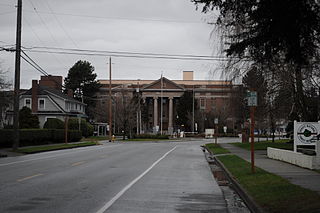
Asotin is the county seat of the county of the same name, in the state of Washington, United States. The population of the city was 1,204 at the 2020 census. It is part of the Lewiston, ID-WA Metropolitan Statistical Area.

<span class="mw-page-title-main">Clinton, Washington</span> CDP in Washington, United States

Clinton is a community and census-designated place (CDP) located on southern Whidbey Island in Island County, Washington, United States. The town was named after Clinton, Michigan. As of the 2010 census, the population was 928. However, the post office serves at least 2,500 people.

<span class="mw-page-title-main">Oak Harbor, Washington</span> City in Washington, United States

Oak Harbor is a city located on Whidbey Island in Island County, Washington, United States. The population was 22,075 at the 2010 census. Oak Harbor was incorporated on May 14, 1915.

<span class="mw-page-title-main">Friday Harbor, Washington</span> Town in Washington, United States

Friday Harbor is a town in San Juan County, Washington, United States. The population was 2,162 at 2010 census. Located on San Juan Island, Friday Harbor is the major commercial center of the San Juan Islands archipelago and is the county seat of San Juan County.

<span class="mw-page-title-main">Bolivar, West Virginia</span> Town in West Virginia, United States

Bolivar is a town in Jefferson County, West Virginia, United States. The population was 1,072 at the 2020 census. The town is named for South American revolutionary leader Simón Bolívar. Located in West Virginia's Eastern Panhandle, it is part of the northwestern fringes of the Washington metropolitan area.

References

  1. 1 2 3 4 5 6 "State & County QuickFacts". United States Census Bureau. Retrieved October 31, 2023.
  2. "Find a County". National Association of Counties. Retrieved June 7, 2011.
  3. Hayes, Derek (1999). Historical Atlas of the Pacific Northwest: Maps of Exploration and Discovery; British Columbia, Washington, Oregaon, Alaska, Yukon. Sasquatch Books. pp. 72–73. ISBN   978-1-57061-215-2 . Retrieved April 21, 2013.
  4. Oldham, Kit (September 16, 2004). "San Juan Island Pig War — Part 2". HistoryLink . Retrieved November 8, 2022.
  5. Walker, Richard Arlin (April 14, 2021). "'A bridge between cultures'". Indian Country Today. Retrieved November 22, 2022.
  6. "2010 Census Gazetteer Files". United States Census Bureau. August 22, 2012. Retrieved July 16, 2015.
  7. "Annual Estimates of the Resident Population for Counties: April 1, 2020 to July 1, 2022". United States Census Bureau. Retrieved October 31, 2023.
  8. "U.S. Decennial Census". United States Census Bureau. Retrieved January 7, 2014.
  9. "Historical Census Browser". University of Virginia Library. Retrieved January 7, 2014.
  10. "Population of Counties by Decennial Census: 1900 to 1990". United States Census Bureau. Retrieved January 7, 2014.
  11. "Census 2000 PHC-T-4. Ranking Tables for Counties: 1990 and 2000" (PDF). United States Census Bureau. Archived from the original (PDF) on February 26, 2015. Retrieved January 7, 2014.
  12. Wheeler, Kathryn (August 9, 2023). "Proposed San Juan Island trail divides farmers, recreation advocates". The Seattle Times. Retrieved August 14, 2023.
  13. 1 2 3 "DP-1 Profile of General Population and Housing Characteristics: 2010 Demographic Profile Data". United States Census Bureau. Archived from the original on February 13, 2020. Retrieved March 6, 2016.
  14. "Population, Housing Units, Area, and Density: 2010 – County". United States Census Bureau. Archived from the original on February 13, 2020. Retrieved March 6, 2016.
  15. "DP02 SELECTED SOCIAL CHARACTERISTICS IN THE UNITED STATES – 2006–2010 American Community Survey 5-Year Estimates". United States Census Bureau. Archived from the original on February 13, 2020. Retrieved March 6, 2016.
  16. "DP03 SELECTED ECONOMIC CHARACTERISTICS – 2006–2010 American Community Survey 5-Year Estimates". United States Census Bureau. Archived from the original on February 13, 2020. Retrieved March 6, 2016.
  17. The News Tribune, February 17, 2010 – Tacoma, WA. [ permanent dead link ],
  18. Jenkins, Jack (July 8, 2021). "Survey: White mainline Protestants outnumber white evangelicals, while 'nones' shrink". Religion News Service.
  19. 1 2 "Deputy tosses hat into sheriff election ring". San Juan Journal. May 14, 2016. Retrieved September 18, 2016.
  20. 1 2 "Maritime Patrol". sanjuanco.com. San Juan County, Washington. Retrieved September 18, 2016.
  21. San Juan Island National Historical Park, General Management Plan. National Park Service. 2008. p. 174.
  22. "Field Operations · District 7 Home Page". wsp.wa.gov. Washington State Patrol. Archived from the original on September 15, 2016. Retrieved September 18, 2016.
  23. Vouri, Mike (2010). San Juan Island. Arcadia Publishing. p. 17. ISBN   9780738581477.
  24. Camfield, Tom. "Kanaka Joe HangedPort Townsend 1873". Port Townsend Leader. Retrieved October 20, 2022.
  25. Leip, David (2005). "2006 Senatorial General Election Results – San Juan County, WA".
  26. "San Juan County Council". San Juan County. Retrieved March 21, 2021.
  27. Leip, David. "Dave Leip's Atlas of U.S. Presidential Elections". uselectionatlas.org. Retrieved April 10, 2018.
  28. MacLeod, Alex (September 22, 2022). "Collapse of WA ferry system hits hardest in San Juan Islands". The Seattle Times. Retrieved August 14, 2023.
  29. Clement, Bethany Jean (July 18, 2019). "How to get yourself and your car to the San Juan Islands: 5 tips for scoring ferry reservations (and what to do if you don't get one)". The Seattle Times. Retrieved August 14, 2023.
  30. Lane, Bob (July 30, 1995). "Busing around the islands". The Seattle Times. Retrieved August 14, 2023.

48°34′N122°58′W / 48.57°N 122.97°W / 48.57; -122.97