Island County, Washington

Last updated

Island County
Shoreline at Fort Ebey StatePark.jpg
Map of Washington highlighting Island County.svg
Location within the U.S. state of Washington
Washington in United States.svg
Washington's location within the U.S.
Coordinates: 48°09′N122°35′W / 48.15°N 122.58°W / 48.15; -122.58
CountryFlag of the United States.svg United States
StateFlag of Washington.svg  Washington
Founded1852
Seat Coupeville
Largest city Oak Harbor
Area
  Total517 sq mi (1,340 km2)
  Land208 sq mi (540 km2)
  Water309 sq mi (800 km2)  60%
Population
 (2020)
  Total86,857
  Estimate 
(2022)
86,625 Decrease2.svg
  Density381/sq mi (147/km2)
Time zone UTC−8 (Pacific)
  Summer (DST) UTC−7 (PDT)
Congressional district 2nd
Website www.islandcountywa.gov

Island County is a county located in the U.S. state of Washington. As of the 2020 census, its population was 86,857. [1] Its county seat is Coupeville, [2] while its largest city is Oak Harbor.

Contents

The county's name reflects the fact that it is composed entirely of islands. [3] It contains two large islands, Whidbey and Camano, and seven smaller islands (Baby, Ben Ure, Deception, Kalamut, Minor, Smith, and Strawberry). Island County was created out of Thurston County on December 22, 1852, by the legislature of Oregon Territory, [4] [5] and is the eighth-oldest county in Washington. It originally encompassed what are now Snohomish, Skagit, Whatcom, and San Juan Counties.

Island County comprises the Oak Harbor, Washington Micropolitan Statistical Area, which is also included in the SeattleTacoma, WA Combined Statistical Area.

Geography

According to the United States Census Bureau, the county has a total area of 517 square miles (1,340 km2), of which 208 square miles (540 km2) is land and 309 square miles (800 km2) (60%) is water. [6] It is the second smallest county in Washington by land area after San Juan, and second smallest by total area after Wahkiakum.

Geographic features

National protected areas

Demographics

Historical population
CensusPop.Note
1860 294
1870 626112.9%
1880 1,08773.6%
1890 1,78764.4%
1900 1,8704.6%
1910 4,704151.6%
1920 5,48916.7%
1930 5,369−2.2%
1940 6,09813.6%
1950 11,07981.7%
1960 19,63877.3%
1970 27,01137.5%
1980 44,04863.1%
1990 60,19536.7%
2000 71,55818.9%
2010 78,5069.7%
2020 86,85710.6%
2022 (est.)86,625 [7] −0.3%
U.S. Decennial Census [8]
1790–1960 [9] 1900–1990 [10]
1990–2000 [11] 2010–2020 [1]

2020 census

As of the 2020 census, there were 86,857 people, 35,102 households in the county. [1] The racial makeup of the county was 84.8% White, 5.3% Asian, 1.0% American Indian, 3.3% African American, 0.5% Pacific Islander, and 5.2% from two or more races. Those of Hispanic or Latino origin made up 8.7% of the population. [1]

2010 census

As of the 2010 census, there were 78,506 people, 32,746 households, and 22,156 families living in the county. The population density was 376.6 inhabitants per square mile (145.4/km2). There were 40,234 housing units at an average density of 193.0 per square mile (74.5/km2). The racial makeup of the county was 86.1% white, 4.4% Asian, 2.2% black or African American, 0.8% American Indian, 0.5% Pacific islander, 1.5% from other races, and 4.5% from two or more races. Those of Hispanic or Latino origin made up 5.5% of the population. The largest ancestry groups were:

  • 21.4% German
  • 14.3% Irish
  • 14.0% English
  • 6.1% Norwegian
  • 4.5% Scottish
  • 4.3% French
  • 4.1% Dutch
  • 4.0% Swedish
  • 4.0% American
  • 3.6% Mexican
  • 3.5% Italian
  • 2.9% Filipino
  • 2.5% Scotch-Irish
  • 2.1% Polish
  • 1.6% Welsh
  • 1.5% Danish

Of the 32,746 households, 27.3% had children under the age of 18 living with them, 56.6% were married couples living together, 7.9% had a female householder with no husband present, 32.3% were non-families, and 25.9% of all households were made up of individuals. The average household size was 2.35 and the average family size was 2.81. The median age was 43.2 years.

The median income for a household in the county was $57,190 and the median income for a family was $68,106. Males had a median income of $46,801 versus $35,189 for females. The per capita income for the county was $29,079. About 5.7% of families and 8.0% of the population were below the poverty line, including 12.1% of those under age 18 and 4.0% of those age 65 or over.

Transportation

The primary islands of Island County, Whidbey Island and Camano Island are served by a total of 3 Washington State Routes, those being SR 20 and SR 525 on Whidbey Island, and SR 532 on Camano Island. SR 20 enters Island County via the Port Townsend-Coupeville (Keystone) ferry route from the West, and departs via the Deception Pass Bridge in the North. SR 525 enters Island County from the East/South via the Mukilteo-Clinton ferry and terminates at an intersection with SR 20, South of Coupeville. SR 532 begins on Camano Island at Terry's Corner and departs Island County to the East via the Camano Gateway Bridge.

These islands are also served by a fare-free/pre-paid bus service called Island Transit.

Government and politics

The county government is led by a board of commissioners with three elected members that represent geographical regions of Island County. [12]

Island County is divided politically between its north and south. While the north (Oak Harbor) is conservative – Donald Trump received almost 55 percent of the 2016 vote and carried most precincts – most southern and central precincts voted for Hillary Clinton.

The south-central area (Coupeville, Langley) voted over 50 percent for Clinton, just over 30 percent for Trump. [13]

United States presidential election results for Island County, Washington [14]
Year Republican Democratic Third party
No.%No.%No.%
2020 22,74642.18%29,21354.17%1,9663.65%
2016 18,46541.71%20,96047.34%4,84810.95%
2012 19,60546.27%21,47850.69%1,2893.04%
2008 19,42646.07%22,05852.31%6801.61%
2004 19,75451.20%18,21647.22%6101.58%
2000 16,40849.72%14,77844.78%1,8185.51%
1996 12,38743.52%12,15742.71%3,92013.77%
1992 9,52635.06%9,55535.17%8,08729.77%
1988 12,55258.78%8,51039.85%2911.36%
1984 13,54865.72%6,85033.23%2181.06%
1980 10,92658.87%5,42229.21%2,21111.91%
1976 7,80455.33%5,85941.54%4413.13%
1972 7,49568.12%3,14928.62%3593.26%
1968 4,07750.96%3,23840.48%6858.56%
1964 3,04443.49%3,94656.38%90.13%
1960 3,59659.01%2,47040.53%280.46%
1956 3,19661.20%2,00938.47%170.33%
1952 2,90161.68%1,77237.68%300.64%
1948 1,80549.05%1,69446.03%1814.92%
1944 1,48746.66%1,66252.15%381.19%
1940 1,37144.85%1,62653.19%601.96%
1936 92132.74%1,68759.97%2057.29%
1932 80330.17%1,51756.99%34212.85%
1928 1,48771.25%55626.64%442.11%
1924 83246.25%1146.34%85347.42%
1920 88351.19%28516.52%55732.29%
1916 80443.58%85546.34%18610.08%
1912 33221.11%31019.71%93159.19%
1908 45058.21%19224.84%13116.95%
1904 42471.99%8314.09%8213.92%
1900 26362.62%12329.29%348.10%
1896 20650.86%19147.16%81.98%
1892 16140.66%12732.07%10827.27%

Communities

Cities

Town

Census-designated places

Other unincorporated communities

Juniper Beach, a wedding ceremony locale in past years, [15] has given its name to the Juniper Beach Water District. [16]

See also

Related Research Articles

<span class="mw-page-title-main">Whidbey Island</span> Island in Puget Sound in Washington, United States

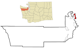
Whidbey Island is the largest of the islands composing Island County, Washington, in the United States, and the largest island in Washington state. Whidbey is about 30 miles (48 km) north of Seattle, and lies between the Olympic Peninsula and the I-5 corridor of western Washington. The island forms the northern boundary of Puget Sound. It is home to Naval Air Station Whidbey Island. The state parks and natural forests are home to numerous old growth trees.

<span class="mw-page-title-main">Snohomish County, Washington</span> County in Washington, United States

Snohomish County is a county located in the U.S. state of Washington. With a population of 827,957 as of the 2020 census, it is the third-most populous county in Washington, after nearby King and Pierce counties, and the 72nd-most populous in the United States. The county seat and largest city is Everett. The county forms part of the Seattle metropolitan area, which also includes King and Pierce counties to the south.

<span class="mw-page-title-main">Skagit County, Washington</span> County in Washington, United States

Skagit County is a county in the U.S. state of Washington. As of the 2020 census, the population was 129,523. The county seat and largest city is Mount Vernon. The county was formed in 1883 from Whatcom County and is named for the Skagit Indian tribe, which has been indigenous to the area prior to European-American settlement.

<span class="mw-page-title-main">San Juan County, Washington</span> County in Washington, United States

San Juan County is a county located in the Salish Sea in the far northwestern corner of the U.S. state of Washington. As of the 2020 census, its population was 17,788. The county seat and only incorporated town is Friday Harbor, located on San Juan Island. The county was formed on October 31, 1873, from Whatcom County and is named for the San Juan Islands, which are in turn named for Juan Vicente de Güemes, 2nd Count of Revillagigedo, the Viceroy of New Spain.

<span class="mw-page-title-main">Mason County, Washington</span> County in Washington, United States

Mason County is a county located in the U.S. state of Washington. As of the 2020 census, the population was 65,726. The county seat and only incorporated city is Shelton. The county was formed out of Thurston County on March 13, 1854. Originally named Sawamish County, it took its present name in 1864 in honor of Charles H. Mason, the first Secretary of Washington Territory.

<span class="mw-page-title-main">Jefferson County, Washington</span> County in Washington, United States

Jefferson County is a county located in the U.S. state of Washington. As of the 2020 census, the population was 32,977. The county seat and only incorporated city is Port Townsend. The county is named for Thomas Jefferson.

<span class="mw-page-title-main">Sumner County, Tennessee</span> County in Tennessee, United States

Sumner County is a county located on the central northern border of Tennessee in the United States. As of the 2020 United States Census, the population was 196,281. Its county seat is Gallatin, and its most populous city is Hendersonville. The county is named after an American Revolutionary War hero, General Jethro Sumner.

<span class="mw-page-title-main">Curry County, Oregon</span> County in Oregon, United States

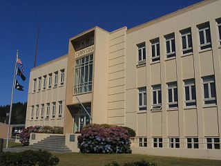
Curry County is the southwesternmost county in the U.S. state of Oregon located on the South Coast. As of the 2020 census, the population was 23,446. The county seat is Gold Beach. The county is named for George Law Curry, a two-time governor of the Oregon Territory. Curry County includes the Brookings, OR Micropolitan Statistical Area.

<span class="mw-page-title-main">Lucas County, Ohio</span> County in Ohio, United States

Lucas County is a county located in the northwestern part of the U.S. state of Ohio. It is bordered to the east by Lake Erie, and to the southeast by the Maumee River, which runs to the lake. As of the 2020 census, the population was 431,279. Its county seat and largest city is Toledo, located at the mouth of the Maumee River on the lake. The county was named for Robert Lucas, 12th governor of Ohio, in 1835 during his second term. Its establishment provoked the Toledo War conflict with the Michigan Territory, which claimed some of its area. Lucas County is the central county of the Toledo Metropolitan Statistical Area.

<span class="mw-page-title-main">Fayette County, Ohio</span> County in Ohio, United States

Fayette County is a county located in the U.S. state of Ohio. As of the 2020 census, the population was 28,951. Its county seat and largest city is Washington Court House. The county was named for the Marquis de Lafayette, a Frenchman who was an officer in the American Army in the Revolution, when established on March 1, 1810.

<span class="mw-page-title-main">Clinton, Washington</span> CDP in Washington, United States

Clinton is a community and census-designated place (CDP) located on southern Whidbey Island in Island County, Washington, United States. The town was named after Clinton, Michigan. As of the 2010 census, the population was 928. However, the post office serves at least 2,500 people.

<span class="mw-page-title-main">Coupeville, Washington</span> Town in Washington, United States

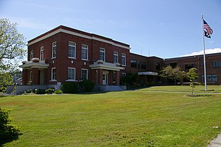
Coupeville is a town on Whidbey Island, in Island County, Washington, United States.

<span class="mw-page-title-main">Freeland, Washington</span> Census-designated place in Washington, United States

Freeland is an unincorporated community and census-designated place (CDP) on Whidbey Island in Island County, Washington, United States. At the time of the 2010 census the population was 7,812. The town received its name based on its origins as a socialist commune in the early 1900s: in the eyes of its founders, the land of the town was literally to be free for all people. Some of the first settlers were veterans of a prior experiment in socialism, the nearby Equality Colony.

<span class="mw-page-title-main">Langley, Washington</span> City in Washington, United States

Langley is a city in Island County, Washington, United States. It sits at the south end of Whidbey Island, overlooking the Saratoga Passage. The city's population was 1,035 at the 2010 census, while the ZIP Code Tabulation Area (ZCTA) for Langley's post office had a population of 4,878. Langley proper only covers 0.8 square miles (2.1 km2), but its ZCTA extends for 26.20 square miles (67.9 km2).

<span class="mw-page-title-main">Oak Harbor, Washington</span> City in Washington, United States

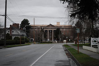
Oak Harbor is a city located on Whidbey Island in Island County, Washington, United States. The population was 22,075 at the 2010 census. Oak Harbor was incorporated on May 14, 1915.

<span class="mw-page-title-main">Marrowstone, Washington</span> CDP in Washington, United States

Marrowstone is a census-designated place (CDP) in Jefferson County, Washington, United States. The population was 844 at the 2010 census. All Marrowstone addresses are in Nordland, Washington, and the ZIP code for Marrowstone Island is 98358.

<span class="mw-page-title-main">Camano Island</span> CDP in Washington, United States

Camano Island is a large island in Possession Sound, a section of Puget Sound. It is part of Island County, Washington, and is located between Whidbey Island and the mainland by the Saratoga Passage to the west and Port Susan and Davis Slough to the east. The island has one road connection to the mainland, via State Route 532 over the Camano Gateway Bridge at the northeast end of the island, connecting to the city of Stanwood.

<span class="mw-page-title-main">Naval Air Station Whidbey Island</span> U.S. Navy airbase in Washington state

Naval Air Station Whidbey Island (NASWI) is a naval air station of the United States Navy located on two pieces of land near Oak Harbor, on Whidbey Island, in Island County, Washington.

<span class="mw-page-title-main">Island Transit (Washington)</span> Local public transit operator in Island County, Washington

Island Transit is a zero-fare transit system in Island County, Washington, serving Whidbey Island and Camano Island. The system consists of fixed-route bus service, paratransit, and vanpools, and carried a total of 974,899 passengers in 2015. There is no Sunday or holiday service on Island Transit routes.

<i>Camano</i> (steamboat)

Camano was a steamboat built in 1906 at Coupeville, Washington which operated on Puget Sound from 1906 to 1917. Camano was later known as Tolo. As Tolo the vessel was sunk in 1917 as a result of a collision at sea. Four people died as a result.

References

  1. 1 2 3 4 "State & County QuickFacts". United States Census Bureau. Retrieved August 16, 2023.
  2. "Find a County". National Association of Counties. Archived from the original on May 31, 2011. Retrieved June 7, 2011.
  3. Gannett, Henry (1905). The Origin of Certain Place Names in the United States. Government Printing Office. pp.  166.
  4. Reinartz, Kay. "History of King County Government 1853–2002" (PDF). p. 2. Archived from the original (PDF) on March 25, 2009. Retrieved December 30, 2007.
  5. "Washington: Individual County Chronologies". Washington Atlas of Historical County Boundaries. The Newberry Library. 2007. Retrieved July 17, 2015.
  6. "2010 Census Gazetteer Files". United States Census Bureau. August 22, 2012. Retrieved July 5, 2015.
  7. "Annual Estimates of the Resident Population for Counties: April 1, 2020 to July 1, 2022". United States Census Bureau. Retrieved August 16, 2023.
  8. "U.S. Decennial Census". United States Census Bureau. Retrieved January 7, 2014.
  9. "Historical Census Browser". University of Virginia Library. Retrieved January 7, 2014.
  10. "Population of Counties by Decennial Census: 1900 to 1990". United States Census Bureau. Retrieved January 7, 2014.
  11. "Census 2000 PHC-T-4. Ranking Tables for Counties: 1990 and 2000" (PDF). United States Census Bureau. Archived from the original (PDF) on February 26, 2015. Retrieved January 7, 2014.
  12. Stensland, Jessie (January 19, 2024). "Oddly, Island Transit board is now an even six". South Whidbey Record. Retrieved February 29, 2024.
  13. "November 8, 2016 Island County Election Results" (PDF). Islandcountywa.gov. Archived (PDF) from the original on February 24, 2020.
  14. Leip, David. "Dave Leip's Atlas of U.S. Presidential Elections". uselectionatlas.org. Retrieved April 6, 2018.
  15. Island County Marriage Register, January-April 1939, paid subscription site accessed October 2017.
  16. Juniper Beach Water District, accessed October 2017

48°09′N122°35′W / 48.15°N 122.58°W / 48.15; -122.58