
Interstate 12 (I-12) is an Interstate Highway located entirely within the US state of Louisiana. It spans a total of 85.59 miles (137.74 km) in an east–west direction from I-10 in Baton Rouge to an interchange with both I-10 and I-59 in Slidell. Along the way, it passes through the city of Hammond, where it intersects I-55 and US Route 51 (US 51). It also serves the cities of Ponchatoula and Denham Springs, as well as the St. Tammany Parish cities of Covington and Mandeville. Skirting the northern shore of Lake Pontchartrain, I-12 serves as both a northern bypass of the New Orleans metropolitan area and an alternate route for I-10, which serves the city of New Orleans itself.

Washington Parish is a parish located in the interior southeast corner of the U.S. state of Louisiana, one of the Florida Parishes. As of the 2020 census, the population was 45,463. Its parish seat is Franklinton. Its largest city is Bogalusa. The parish was founded in 1819.
Tangipahoa Parish is a parish located on the southeastern border of the U.S. state of Louisiana. As of the 2020 census, the population was 133,157. The parish seat is Amite City, while the largest city is Hammond. Southeastern Louisiana University is located in Hammond. Lake Pontchartrain borders the southeastern side of the parish.

St. Tammany Parish is a parish located in the U.S. state of Louisiana named after Tamanend, the legendary Lenape Chief of Chiefs and the "Patron Saint of America." At the 2020 census, the population was 264,570, making it the fourth-most populous parish in Louisiana. The parish seat is Covington. The parish was founded in 1810.

Livingston Parish is a parish in the U.S. state of Louisiana. Its parish seat is the town of Livingston. Livingston Parish is one of the Florida Parishes, a region which, unlike the rest of the state, was part of the Spanish Empire rather than the French Empire.

LaPlace is a census-designated place (CDP) in St. John the Baptist Parish, Louisiana, United States, situated along the east bank of the Mississippi River, in the New Orleans metropolitan area. In 2020, it had a population of 28,841.

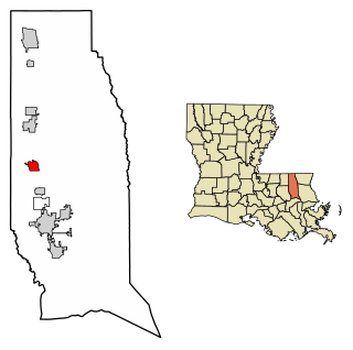
Amite City is a town in and the seat of Tangipahoa Parish in southeastern Louisiana, United States. The population was 4,141 at the 2010 census. It is part of the Hammond Micropolitan Statistical Area.

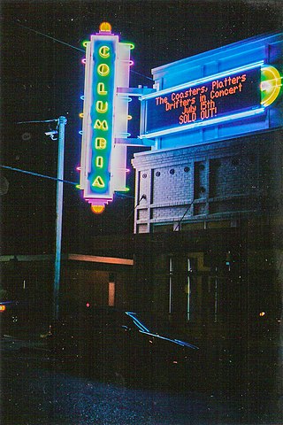
Hammond is the largest city in Tangipahoa Parish, Louisiana, United States, located 45 miles (72 km) east of Baton Rouge and 45 miles (72 km) northwest of New Orleans. Its population was 20,019 in the 2010 U.S. census, and 21,359 at the 2020 population estimates program.
Independence, originally known as Uncle Sam, is a town in Tangipahoa Parish, Louisiana, United States. The population was 1,665 at the 2010 census. It is part of the Hammond Micropolitan Statistical Area.

Manchac is an unincorporated community in Tangipahoa Parish, Louisiana, United States.
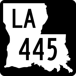
Louisiana Highway 445 is a state highway in Louisiana that serves Tangipahoa Parish. It spans 24.6 miles (39.6 km) in a south to north direction. Near its north end, it is known as Husser Road.

U.S. Highway 51 (US 51) is a part of the United States Numbered Highway System that spans 1,277 miles (2,055 km) from LaPlace, Louisiana to a point north of Hurley, Wisconsin. Within the state of Louisiana, the highway travels 69.12 miles (111.24 km) from the national southern terminus at US 61 in LaPlace to the Mississippi state line north of Kentwood.
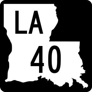
Louisiana Highway 40 (LA 40) is a state highway located in southeastern Louisiana. It runs 53.11 miles (85.47 km) in an east–west direction from LA 43 south of Montpelier to LA 41 in Bush.

Harry D. Wilson was a Democratic politician from Tangipahoa Parish, one of the Florida Parishes of southeastern Louisiana, who served from 1916 until his death as the Louisiana Commissioner of Agriculture and Forestry. He was the father of the humorist and chef Justin E. Wilson.
Husser is an unincorporated community in Tangipahoa Parish, Louisiana, United States. Its ZIP code is 70442.
Uneedus is an unincorporated community in Tangipahoa Parish, in the U.S. state of Louisiana.
Bedico is an unincorporated community in Tangipahoa Parish, Louisiana, United States. Bedico is located on Highway 22, 13 mi (20.92 km) miles east of Hammond.
Kirkville is an unincorporated community in Tangipahoa Parish, Louisiana, United States. The community is located 1 mile S of Osyka, Mississippi and 18 miles N of Amite City, Louisiana
Lees Landing is an unincorporated community in Tangipahoa Parish, Louisiana, United States. The community is located 7 miles SE of Ponchatoula, Louisiana.


