
Lower Manhattan, also known as Downtown Manhattan or Downtown New York City, is the southernmost part of Manhattan, the central borough for business, culture, and government in New York City, which is the most populated city in the United States with over 8.8 million residents as of the 2020 census.

Forsyth Street runs from Houston Street south to Henry Street in the New York City borough of Manhattan. The street was named in 1817 for Lt. Colonel Benjamin Forsyth.

Downtown Brooklyn is the third largest central business district in New York City, and is located in the northwestern section of the borough of Brooklyn. The neighborhood is known for its office and residential buildings, such as the Williamsburgh Savings Bank Tower and the MetroTech Center office complex.
Stanton Street is a west-to-east street in the New York City borough of Manhattan, in the neighborhood of the Lower East Side. The street begins at the Bowery in the west and runs east to a dead end past Pitt Street, adjacent to Hamilton Fish Park. A shorter section of Stanton Street also exists east of Columbia Street; it was isolated from the remainder of the street in 1959 with the construction of the Gompers Houses and the Masaryk Towers.

Cherry Street is a one-way street in the New York City borough of Manhattan. It currently has two sections, mostly running along parks, public housing, co-op buildings, tenements, and crossing underneath the Manhattan Bridge.
Vanderbilt Avenue is the name of three thoroughfares in the New York City boroughs of Brooklyn, Manhattan, and Staten Island. They were named after Cornelius Vanderbilt (1794–1877), the builder of Grand Central Terminal in Midtown Manhattan.

Drumgoole Plaza is a public park that sits below the ramps to the Brooklyn Bridge in Manhattan, New York City, on Frankfort Street between Park Row and Gold Street, and next to the main building of Pace University at One Pace Plaza. Opened on November 5, 2003, the park is maintained by Pace under the management of the New York City Department of Parks and Recreation.
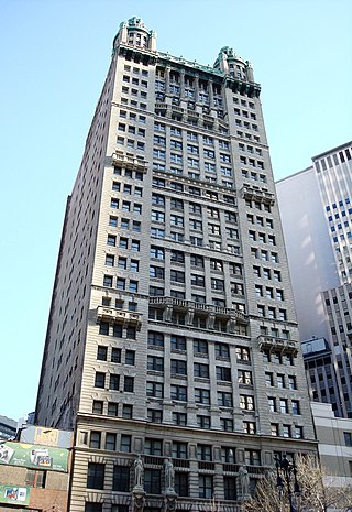
Park Row is a street located in the Financial District, Civic Center, and Chinatown neighborhoods of the New York City borough of Manhattan. The street runs east-west, sometimes called north-south because the western end is nearer to the Financial District. At the north end of Park Row is the confluence of Bowery, East Broadway, St. James Place, Oliver Street, Mott Street, and Worth Street at Chatham Square. At the street's south end, Broadway, Vesey Street, Barclay Street, and Ann Street intersect. The intersection includes a bus turnaround loop designated as Millennium Park. Park Row was once known as Chatham Street; it was renamed Park Row in 1886, a reference to the fact that it faces City Hall Park, the former New York Common.
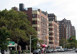
Cooperative Village is a community of housing cooperatives on the Lower East Side of Manhattan, New York City. The cooperatives are centered on Grand Street in an area south of the entrance ramp to the Williamsburg Bridge and west of the FDR Drive. Combined, the four cooperatives have 4,500 apartments in twelve buildings.

Centre Street is a north–south street in the New York City borough of Manhattan, running through the Civic Center, Chinatown (曼哈頓華埠), and Little Italy neighborhoods of Lower Manhattan. It connects Park Row to the south with Spring Street to the north, where it merges with Lafayette Street. Centre Street carries northbound traffic north of Reade Street and two-way traffic between Reade Street and the Brooklyn Bridge.

The Manhattan Waterfront Greenway is a waterfront greenway for walking or cycling, 32 miles (51 km) long, around the island of Manhattan, in New York City. The largest portions are operated by the New York City Department of Parks and Recreation. It is separated from motor traffic, and many sections also separate pedestrians from cyclists. There are three principal parts — the East, Harlem and Hudson River Greenways.

Chambers Street is a two-way street in the New York City borough of Manhattan. It runs from River Terrace, Battery Park City in the west, past PS 234, The Borough of Manhattan Community College, and Stuyvesant High School, to the Manhattan Municipal Building at 1 Centre Street in the east. Between Broadway and Centre Street, Chambers Street forms the northern boundary of the grounds surrounding New York City Hall and the Tweed Courthouse. Opposite the Tweed Courthouse sits the Surrogate's Courthouse for Manhattan. 280 Broadway the Marble Palace, lies west of there, on the north side of Chambers.
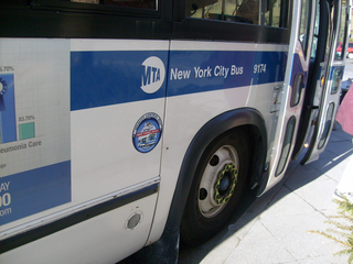
MTA Regional Bus Operations operates local and express buses serving New York City in the United States out of 29 bus depots. These depots are located in all five boroughs of the city, with the exception of one located in nearby Yonkers in Westchester County. 21 of these depots serve MTA New York City Transit (NYCT)'s bus operations, while the remaining eight serve the MTA Bus Company These facilities perform regular maintenance, cleaning, and painting of buses, as well as collection of revenue from bus fareboxes. Several of these depots were once car barns for streetcars, while others were built much later and have only served buses. Employees of the depots are represented by local divisions of the Transport Workers Union of America (TWU), particularly the TWU Local 100 and 101, or of the Amalgamated Transit Union (ATU)'s Local's 726 for all depots in Staten Island, 1056 for Casey Stengel, Jamaica, and Queens Village Depots, and 1179 for JFK & Far Rockaway Depots.

East Side of Manhattan refers to the side of Manhattan which abuts the East River and faces Brooklyn and Queens. Fifth Avenue, Central Park from 59th to 110th Streets, and Broadway below 8th Street separate it from the West Side.

Division Street is a one-way street in the Two Bridges neighborhood of Lower Manhattan in New York City. It carries westbound traffic from the intersection of Canal Street and Ludlow Street westward to Bowery.

Bridge Plaza is the northeastern corner of the downtown area of the New York City borough of Brooklyn. Its borders are Flatbush Avenue Extension and Manhattan Bridge on the west, Tillary Street on the south, and the Brooklyn–Queens Expressway (BQE) on the north and east.

The East River Greenway is an approximately 9.44-mile-long (15.19 km) foreshoreway for walking or cycling on the east side of the island of Manhattan on the East River. It is part of the Manhattan Waterfront Greenway. The largest portions are operated by the New York City Department of Parks and Recreation. It is separated from motor traffic, and many sections also separate pedestrians from cyclists. The greenway is parallel to the Franklin D. Roosevelt East River Drive for a majority of its length.

Broome Street is an east–west street in Lower Manhattan. It runs nearly the full width of Manhattan island, from Hudson Street in the west to Lewis Street in the east, near the entrance to the Williamsburg Bridge. The street is interrupted in a number of places by parks, buildings, and Allen Street's median. The street was named after Staten Island-born John Broome, who was a Colonial merchant and politician and became a Lieutenant Governor of New York State.

The West Street pedestrian bridges are a series of pedestrian bridges that cross West Street to connect the neighborhoods of Tribeca and the Financial District with Battery Park City in Lower Manhattan, New York City. The bridges were built to provide alternatives to crossing the busy street. Prior to the September 11 attacks, there were three bridges at Chambers Street, Vesey Street and Liberty Street. The Vesey Street and Liberty Street bridges connected the former World Trade Center complex with the World Financial Center.


