Broadway is a road in the U.S. state of New York. Broadway runs from State Street at Bowling Green for 13 mi (20.9 km) through the borough of Manhattan and 2 mi (3.2 km) through the Bronx, exiting north from New York City to run an additional 18 mi (29.0 km) through the Westchester County municipalities of Yonkers, Hastings-On-Hudson, Dobbs Ferry, Irvington, and Tarrytown, and terminating north of Sleepy Hollow.

William Colgate was an English-American soap industrialist who founded in 1806 what became the Colgate-Palmolive company.

The Flatiron District is a neighborhood in the New York City borough of Manhattan, named after the Flatiron Building at 23rd Street, Broadway and Fifth Avenue. Generally, the Flatiron District is bounded by 14th Street, Union Square and Greenwich Village to the south; the Avenue of the Americas and Chelsea to the west; 23rd Street and Madison Square to the north; and Park Avenue South and Gramercy Park to the east.

Union Square is a historic intersection and surrounding neighborhood in Manhattan, New York City, United States, located where Broadway and the former Bowery Road – now Fourth Avenue – came together in the early 19th century. Its name denotes that "here was the union of the two principal thoroughfares of the island". The current Union Square Park is bounded by 14th Street on the south, 17th Street on the north, and Union Square West and Union Square East to the west and east respectively. 17th Street links together Broadway and Park Avenue South on the north end of the park, while Union Square East connects Park Avenue South to Fourth Avenue and the continuation of Broadway on the park's south side. The park is maintained by the New York City Department of Parks and Recreation.

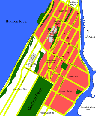
Upper Manhattan is the most northern region of the New York City borough of Manhattan. Its southern boundary has been variously defined, but some of the most common usages are 96th Street, the northern boundary of Central Park, 125th Street, or 155th Street. The term Uptown can refer to Upper Manhattan, but is often used more generally for neighborhoods above 59th Street; in the broader definition, Uptown encompasses Upper Manhattan.
The General Theological Seminary of the Episcopal Church (GTS) is an Episcopal seminary in New York City. Founded in 1817, GTS is the oldest seminary of the Episcopal Church and the longest continuously operating seminary in the Anglican Communion. The seminary was chartered by an act of the Episcopal Church's General Convention and its name was chosen to reflect its founders' vision that it be a seminary to serve the whole Church. In 2022, the General Theological Seminary entered into a formal affiliation with Virginia Theological Seminary whereby the two separate institutions share a common leadership structure.

Tenth Avenue, known as Amsterdam Avenue between 59th Street and 193rd Street, is a north-south thoroughfare on the West Side of Manhattan in New York City. It carries uptown (northbound) traffic as far as West 110th Street, after which it continues as a two-way street.
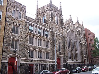
The Abyssinian Baptist Church is a Baptist megachurch located at 132 West 138th Street between Adam Clayton Powell Jr. Boulevard and Lenox Avenue in the Harlem neighborhood of Manhattan, New York City. It is affiliated with the National Baptist Convention, USA and American Baptist Churches USA. Its senior pastor is Johnnie D. Brooker, Jr., since 2023.

Grace Church is a historic parish church in Manhattan, New York City which is part of the Episcopal Diocese of New York. The church is located at 800–804 Broadway, at the corner of East 10th Street, where Broadway bends to the south-southeast, bringing it in alignment with the avenues in Manhattan's grid. Grace Church School and the church houses—which are now used by the school—are located to the east at 86–98 Fourth Avenue between East 10th and 12th Streets. In 2021, it reported 1,038 members, average attendance of 212, and $1,034,712 in plate and pledge income.

Stuyvesant Square is the name of both a park and its surrounding neighborhood in the New York City borough of Manhattan. The park is located between 15th Street, 17th Street, Rutherford Place, and Nathan D. Perlman Place. Second Avenue divides the park into two halves, east and west, and each half is surrounded by the original cast-iron fence.

Lafayette Street is a major north–south street in New York City's Lower Manhattan. It originates at the intersection of Reade Street and Centre Street, one block north of Chambers Street. The one-way street then successively runs through Chinatown, Little Italy, NoLIta, and NoHo and finally, between East 9th and East 10th streets, merges with Fourth Avenue. A buffered bike lane runs outside the left traffic lane. North of Spring Street, Lafayette Street is northbound (uptown)-only; south of Spring Street, Lafayette is southbound (downtown)-only.

Claremont Avenue is a short avenue in the Morningside Heights neighborhood of Manhattan, New York City. It begins at 116th Street and runs north for a length of eleven blocks until it ends at Tiemann Place.

West Presbyterian Church was a congregation and two houses of worship in Manhattan, New York City. The congregation was founded in 1829 and merged in 1911 with Park Presbyterian Church to form West-Park Presbyterian Church. The first house of worship, also known as the Carmine Street Presbyterian Church, in Greenwich Village, was used from 1832 to 1865, and the second, on West 42nd Street between Fifth Avenue and Sixth Avenue, from 1865 until 1911, when it was sold and demolished. Proceeds from the sale were used, in accordance with the merger agreement, to build and endow a church for an underserved neighborhood, Washington Heights: Fort Washington Presbyterian Church. In addition, the West Church congregation had earlier established two mission churches which eventually merged to become Good Shepherd-Faith Presbyterian Church. West-Park, Fort Washington, and Good Shepherd-Faith are all active today.

Burke Library of the Union Theological Seminary is located at 3041 Broadway, in the Morningside Heights neighborhood of Manhattan, New York City. Founded in 1838, since 2004 it has been a part of the Columbia University Libraries. Holding over 700,000 items, it is one of the largest theological libraries in North America.

14th Street is a major crosstown street in the New York City borough of Manhattan, traveling between Eleventh Avenue on Manhattan's West Side and Avenue C on Manhattan's East Side. It forms a boundary between several neighborhoods and is sometimes considered the border between Lower Manhattan and Midtown Manhattan.

The East 17th Street/Irving Place Historic District is a small historic district located primarily on East 17th Street between Union Square East and Irving Place in the Union Square neighborhood of Manhattan, New York City. It was designated by the New York City Landmarks Preservation Commission on June 30, 1988, and encompasses nine mid-19th century rowhouses and apartment buildings on the south side of East 17th Street, from number 104 to number 122, plus one additional building at 47 Irving Place just south of 17th Street.