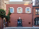
New Brighton is a neighborhood located on the North Shore of Staten Island in New York City. The neighborhood comprises an older industrial and residential harbor front area along the Kill Van Kull west of St. George. New Brighton is bounded by Kill Van Kull on the north, Jersey Street on the east, Brighton and Castleton Avenues to the south, and Lafayette Avenue and Snug Harbor Cultural Center to the west. It is adjacent to St. George to the east, Tompkinsville to the south, and West New Brighton to the west.

Mews is a British name for a row or courtyard of stables and carriage houses with living quarters above them, built behind large city houses before motor vehicles replaced horses in the early twentieth century. Mews are usually located in desirable residential areas having been built to cater for the horses, coachmen and stable-servants of prosperous residents.

8th Street is a street in the New York City borough of Manhattan that runs from Sixth Avenue to Third Avenue, and also from Avenue B to Avenue D; its addresses switch from West to East as it crosses Fifth Avenue. Between Third Avenue and Avenue A, it is named St. Mark's Place, after the nearby St. Mark's Church in-the-Bowery on 10th Street at Second Avenue.

Clinton Hill is a neighborhood within the south-central portion of the city of Newark in Essex County, New Jersey, United States. It is centered at Clinton Avenue, and bounded roughly by Elizabeth Avenue in the east, Hawthorne Avenue in the south, Avon Avenue in the north, and Irvington in the west.
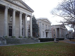
Sailors' Snug Harbor, also known as Sailors Snug Harbor and informally as Snug Harbor, is a collection of architecturally significant 19th-century buildings on Staten Island, New York City. The buildings are set in an 83-acre (34 ha) park along the Kill Van Kull in New Brighton, on the North Shore of Staten Island. Some of the buildings and the grounds are used by arts organizations under the umbrella of the Snug Harbor Cultural Center and Botanical Garden.

Randall Manor is a neighborhood on the North Shore of Staten Island, one of the five boroughs of New York City, United States. The neighborhood is bound by Bard Avenue to the West, Henderson Avenue to the North, Forest Avenue to the South, and Lafayette Avenue to the East.
Eighth Avenue is a major north–south avenue on the west side of Manhattan in New York City, carrying northbound traffic below 59th Street. It is one of the original avenues of the Commissioners' Plan of 1811 to run the length of Manhattan, though today the name changes twice. At 59th Street/Columbus Circle it becomes Central Park West, where it forms the western boundary of Central Park. North of 110th Street/Frederick Douglass Circle it is known as Frederick Douglass Boulevard before merging onto Harlem River Drive north of 155th Street.

Third Avenue is a north-south thoroughfare on the East Side of the New York City borough of Manhattan, as well as in the center portion of the Bronx. Its southern end is at Astor Place and St. Mark's Place. It transitions into Cooper Square, and further south, the Bowery, Chatham Square, and Park Row. The Manhattan side ends at East 128th Street. Third Avenue is two-way from Cooper Square to 24th Street, but since July 17, 1960 has carried only northbound (uptown) traffic while in Manhattan; in the Bronx, it is again two-way. However, the Third Avenue Bridge carries vehicular traffic in the opposite direction, allowing only southbound vehicular traffic, rendering the avenue essentially non-continuous to motor vehicles between the boroughs.
The Metropolitan Tract is an area of land in downtown Seattle owned by the University of Washington. Originally covering 10 acres (40,000 m2), the 1962 purchase of land for a garage for the Olympic Hotel expanded the plot to 11 acres (45,000 m2). The Metropolitan Tract is primarily located in a rectangle formed by Seneca St, Third Ave, Union St, and Sixth Ave.

Livingston is a name sometimes applied to the northeastern portion of West Brighton, a neighborhood located on the North Shore of the New York City borough of Staten Island.
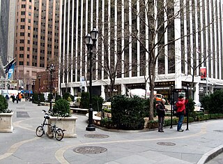
Hanover Square is a square with a public park in the Financial District of Lower Manhattan in New York City. It is triangular in shape, formed by the intersections of Pearl Street and Hanover Street; Pearl Street and a street named "Hanover Square" itself (whose opposite side of Pearl continues as Hanover St.; and William Street and Stone Street. The side between Hanover/Pearl intersection and William/Stone intersection is a pedestrian pathway along the building front facing the square and Pearl Street. Most surrounding buildings are primarily commercial.
Minard Lafever (1798–1854) was an American architect of churches and houses in the United States in the early nineteenth century.

Dey Street is a short street in Lower Manhattan, in New York City. It passes the west side of the World Trade Center site and the World Trade Center Transportation Hub. It runs for one block between Church Street and Broadway. It originally ran to West Street, but the western reaches were demolished to make way for the World Trade Center in the late 1960s. It now extends to Greenwich Street. 15 Dey Street is the site of the first transcontinental telephone call.

712 Fifth Avenue is a 650-foot-tall (200 m) skyscraper at 56th Street and Fifth Avenue in the Midtown Manhattan neighborhood of New York City. Constructed from 1987 to 1990, it was designed by SLCE Architects and Kohn Pedersen Fox Associates. The skyscraper's base includes the Coty Building at 714 Fifth Avenue and the Rizzoli Bookstore building at 712 Fifth Avenue, both of which are New York City designated landmarks.

Sailors' Snug Harbor is a former station on the abandoned North Shore Branch of the Staten Island Railway. It had two tracks and two side platforms. Located in the Livingston section of Staten Island north of Richmond Terrace, the station was approximately 1.2 miles (1.9 km) from Saint George Terminal. It is at the northernmost end of the Snug Harbor Cultural Center and Botanical Garden.

Robert W. Gibson, AIA, was an English-born American ecclesiastical architect active in late-nineteenth- and early-twentieth-century New York City and New York State. He designed several large Manhattan churches and a number of prominent residences and institutional buildings.
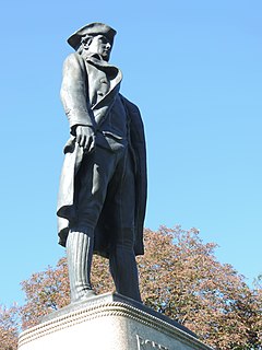
Robert Richard Randall was a noted sea captain in life, and, after his death in New York City on June 5, 1801, an important philanthropist, caring for thousands of retired seafarers.

901 New York Avenue NW is a mid-rise Postmodern high-rise located in Washington, D.C., in the United States. The structure was developed by Boston Properties in an effort to help to revitalize the Mount Vernon Square neighborhood, and was completed in 2005. It is located on a roughly triangular parcel bounded by New York Avenue NW, K Street NW, and 10th Street NW, and is north of the CityCenterDC mixed-use residential, office, and retail project.
One Fifth Avenue is a residential skyscraper in the Washington Square area of Greenwich Village. It was designed by Harvey Wiley Corbett of the firm Helme & Corbett.