Texas State Highway 207

Last updated

Texas 207.svg

State Highway 207

Texas State Highway 207
SH 207, highlighted in red
Route information
Maintained by TxDOT
Length199.712 mi [1]  (321.405 km)
Existed1934–present
Major junctions
South endUS 380.svg US 380 in Post
Major intersections
North endCR 202 at Oklahoma state line southeast of Guymon
Location
Country United States
State Texas
Highway system
Texas 206.svg SH 206 Texas 208.svg SH 208

State Highway 207 (SH 207) is a state Highway that runs from Post, Texas through the South Plains and Texas Panhandle to the Oklahoma state line.

Contents

History

The highway was originally designated on August 1, 1934 between Floydada and Ralls. [2] On August 1, 1938, a section from Post to Garden City was designated, creating a gap. [3] On October 24, 1938, the section from Ralls to Post was added, closing the gap. [4] On February 21, 1939, SH 207 was extended north to Silverton. [5] On August 27, 1940, the section of SH 207 from Big Spring to Garden City was cancelled. On February 4, 1941, the section of SH 207 from Gail to 8 miles north of Big Spring was cancelled. on March 6, 1941, the section of SH 207 from 8 miles north of Big Spring to Big Spring and the section of SH 207 from Post to Gail was cancelled. On February 28, 1945, the section of SH 207 from Ralls to Post was cancelled and transferred to FM 122. On October 10, 1947, the section of SH 207 from Ralls to Floydada was transferred to US 62, leaving only the section between Silverton and Floydada. On September 1, 1965, the route was extended north and south along its current route, replacing FM 122 south to Post, the portion of FM 284 north to Claude, a portion of the rerouted SH 15 to Sperman, and SH 282 to the Oklahoma state line. [6] [7] [8] [9]

Junction list

CountyLocationmikmDestinationsNotes
Garza Post US 380.svgSouth plate.svg
Texas Loop 46.svg
To plate.svg
East plate.svg
US 84.svg
US 380  / Loop 46 south to US 84 east Tahoka, Clairemont, Snyder
North plate.svg
Texas FM 651.svg
FM 651 north Crosbyton
East plate.svg
Texas Spur 575.svg
To plate.svg
West plate.svg
US 84.svg
Spur 575 east to US 84 west Lubbock
West plate.svg
Texas FM 211.svg
FM 211 west Wilson
Crosby East plate.svg
Texas FM 40.svg
FM 40 east
South end of FM 40 overlap
West plate.svg
Texas FM 40.svg
FM 40 west Lubbock
North end of FM 40 overlap
Ralls US 82.svgTexas 114.svg US 82  / SH 114  Lubbock, Crosbyton
East plate.svg
Texas FM 122.svg
FM 122 east Downtown Ralls
West plate.svg
US 62.svg
US 62 west Lubbock
South end of US 62 overlap
Texas FM 1471.svg FM 1471
Texas FM 193.svg FM 193
Floyd West plate.svg
Texas FM 54.svg
FM 54 west Petersburg
West plate.svg
Texas FM 37.svg
FM 37 west
Floydada West plate.svg
US 70.svg
US 70 west Plainview
South end of US 70 overlap
East plate.svg
US 62.svg
East plate.svg
US 70.svg
South plate.svg
Texas FM 1958.svg
US 62 east / US 70 east / FM 1958 south Matador
North end of US 62 / US 70 overlap
West plate.svg
Texas FM 784.svg
FM 784 west
East plate.svg
Texas FM 786.svg
FM 786 east
South end of FM 786 overlap
West plate.svg
Texas FM 786.svg
FM 786 west
North end of FM 786 overlap
West plate.svg
Texas FM 97.svg
FM 97 west Lockney
South end of FM 97 overlap
East plate.svg
Texas FM 97.svg
FM 97 east Flomot
North end of FM 97 overlap
Texas FM 2286.svg FM 2286  Plainview
East plate.svg
Texas FM 689.svg
FM 689 east
Briscoe Texas FM 145.svg FM 145
Silverton East plate.svg
Texas 86.svg
East plate.svg
Texas 256.svg
SH 86 east / SH 256 east Turkey, Memphis
South end of SH 86 overlap
North plate.svg
Texas FM 3030.svg
FM 3030 north
West plate.svg
Texas 86.svg
South plate.svg
Texas FM 284.svg
SH 86 west / FM 284 south Tulia
North end of SH 86 overlap
West plate.svg
Texas FM 3300.svg
FM 3300 west
West plate.svg
Texas FM 146.svg
FM 146 west Vigo Park
Armstrong West plate.svg
Texas FM 285.svg
FM 285 west Wayside
East plate.svg
Texas FM 2272.svg
FM 2272 east
West plate.svg
Texas FM 1258.svg
FM 1258 west
Claude Texas FM 1151.svg FM 1151  Amarillo
US 287.svg US 287  Amarillo, Clarendon
Carson West plate.svg
Texas FM 2161.svg
FM 2161 west
Former Route 66
I-40.svg I-40  Amarillo, Shamrock I-40 exit 96
Panhandle US 60.svg US 60  Amarillo, Pampa
West plate.svg
Texas FM 293.svg
FM 293 west
East plate.svg
Texas FM 2385.svg
FM 2385 east White Deer
Hutchinson Borger North plate.svg
Texas Spur 246.svg
West plate.svg
Texas FM 1551.svg
Spur 246 north / FM 1551 west
South plate.svg
Texas 136.svg
SH 136 south Amarillo
South end of SH 136 overlap
East plate.svg
Texas 152.svg
SH 152 east Pampa
South end of SH 152 overlap
East plate.svg
Texas Spur 119.svg
Spur 119 east Phillips
East plate.svg
Texas Spur 140.svg
Spur 140 east
West plate.svg
Texas RM 3474.svg
RM 3474 west
South plate.svg
Texas FM 1559.svg
FM 1559 south
East plate.svg
Texas RM 2277.svg
RM 2277 east
Stinnett West plate.svg
Texas 152.svg
SH 152 west Dumas
North end of SH 152 overlap
East plate.svg
Texas RM 1526.svg
RM 1526 east
West plate.svg
Business plate.svg
Texas 152.svg
Bus. SH 152 west
North plate.svg
Texas 136.svg
SH 136 north Gruver
North end of SH 136 overlap
Texas FM 281.svg FM 281  Sunray
Hansford East plate.svg
Texas 51.svg
SH 51 east
West plate.svg
Texas FM 520.svg
FM 520 west
Spearman East plate.svg
Texas 15.svg
East plate.svg
Texas FM 759.svg
SH 15 east / FM 759 east Perryton
South end of SH 15 overlap
South plate.svg
Texas FM 760.svg
FM 760 south
North plate.svg
Texas FM 2387.svg
FM 2387 north
West plate.svg
Texas FM 2018.svg
FM 2018 west
West plate.svg
Texas 15.svg
SH 15 west Gruver
North end of SH 15 overlap
West plate.svg
Texas FM 278.svg
FM 278 west Gruver
North plate.svg
Texas FM 1261.svg
FM 1261 north
East plate.svg
Texas FM 2535.svg
FM 2535 east
Oklahoma CR 202Texas/Oklahoma state line
1.000 mi = 1.609 km; 1.000 km = 0.621 mi

See also

Related Research Articles

<span class="mw-page-title-main">Texas State Highway 47</span> State highway in Texas

State Highway 47 (SH 47) runs from FM 60 near Easterwood Airport and Texas A&M University Research Park in College Station to SH 21 at Texas A&M University-Riverside near Bryan. This highway was designated on January 28, 1987.

<span class="mw-page-title-main">Texas State Highway 46</span> State highway in Texas

State Highway 46 is a 71.4-mile (114.9 km) state highway in the U.S. state of Texas that runs from SH 16 east of Bandera to the intersection of SH 123 and SH 123 Business just south of Seguin.

<span class="mw-page-title-main">Texas State Highway 18</span> State highway in Texas

State Highway 18 is a state highway in the U.S. state of Texas maintained by the Texas Department of Transportation (TxDOT) that runs from Fort Stockton in western Texas to the New Mexico state line between Kermit and Jal, New Mexico. This route was designated in 1958 over the northern half of what was previously SH 82.

<span class="mw-page-title-main">Texas State Highway 21</span> State highway in Texas

State Highway 21 runs from the Texas-Louisiana boundary east of San Augustine to San Marcos in east and central Texas. SH 21 mostly follows the alignment of the Old San Antonio Road and the El Camino Real, except for the portion between Midway and Bryan, where the Old San Antonio Road took a more northerly route, and SH 21 follows a more direct route. That section of the Old San Antonio Road is served by Texas State Highway OSR.

<span class="mw-page-title-main">Texas State Highway 22</span> State highway in Texas

State Highway 22 (SH 22) is a 111.215-mile-long (178.983 km) state highway in the U.S. state of Texas that travels from Corsicana to Hamilton in the north central part of the state.

<span class="mw-page-title-main">Texas State Highway 114</span> State highway in Texas, United States

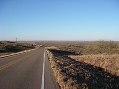
State Highway 114 is a state highway that runs from the Dallas-Fort Worth Metroplex westward across Texas to the New Mexico state line, where it becomes New Mexico State Road 114, which eventually ends at Elida, New Mexico at US 70 / NM 330.

<span class="mw-page-title-main">Texas State Highway 37</span> State highway in Wood, Franklin, and Red River counties in Texas, United States

State Highway 37 is a state highway that runs from the Oklahoma state line near Albion to Mineola in the northeast corner of the state.

<span class="mw-page-title-main">Texas State Highway 44</span> State highway in Texas

State Highway 44 (SH 44) is a Texas state highway that runs from west of Encinal to Corpus Christi, Texas. This highway is also known as the Cesar Chavez Memorial Highway outside the city limits of Robstown, Banquete, Agua Dulce, Alice, and Corpus Christi in Nueces and Jim Hogg counties.

<span class="mw-page-title-main">Texas State Highway 51</span> State highway in Texas

State Highway 51 is a short state highway located entirely in Hansford County, Texas, just south of Spearman.

<span class="mw-page-title-main">Texas State Highway 86</span> State highway in Texas

State Highway 86 is a state highway in the U.S. state of Texas that runs 149 miles (240 km) from Texico to Estelline. This route was designated on August 21, 1923 as the renumbered SH 5A. On September 17, 1923, the section from Estelline to Turkey was cancelled, as SH 18 extended northeast from Turkey to Memphis. By 1929, it was shortened to Bovina, as it was constructed on that route, instead. It has travelled its present course since then, except for the addition of the northern portion of SH 18 between Turkey and Estelline on December 22, 1936.

<span class="mw-page-title-main">Texas State Highway 97</span> State highway in Texas

State Highway 97 is a state highway running 143 miles (230 km) from Cotulla to Waelder in the U.S. state of Texas.

<span class="mw-page-title-main">Texas State Highway 158</span> State highway in Texas

State Highway 158 is a state highway running from near Goldsmith, Texas eastward to Ballinger, Texas.

<span class="mw-page-title-main">Texas State Highway 128</span> State highway in Texas

State Highway 128 is a state highway in Andrews County, Texas.

<span class="mw-page-title-main">Texas State Highway 137</span> State highway in Texas

State Highway 137 (SH 137) is a state highway in west Texas. It runs 192.238 miles (309.377 km) from SH 163 near Ozona to U.S. Highway 385 (US 385) near Brownfield. SH 137 was originally established in 1928, and it has been realigned several times since then.

<span class="mw-page-title-main">Texas State Highway 152</span> State Highway oklahoma/texas

State Highway 152 is a Texas state highway that runs from Dumas east to the Oklahoma state line. The route was originally designated in 1930 between Pampa and Wheeler, but was extended both west and east to its current termini in 1938.

<span class="mw-page-title-main">Texas State Highway 153</span> State highway in Texas

State Highway 153 is a highway in the U.S. State of Texas that runs from Coleman northwest to a junction south of Sweetwater.

<span class="mw-page-title-main">Texas State Highway 154</span> Highway in Texas

State Highway 154 is a state highway that runs from Cooper to Marshall in northeast Texas.

<span class="mw-page-title-main">Texas State Highway 173</span> State highway in Texas

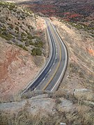
State Highway 173 (SH 173) is a state highway that runs for 97.9 miles (157.6 km) from Jourdanton to Kerrville in south Texas, traversing through the Texas Hill Country.

<span class="mw-page-title-main">Texas State Highway 214</span> State highway in Texas

State Highway 214 (SH 214) is a Texas state highway that runs from Adrian to Seminole.

References

  1. Transportation Planning and Programming Division (n.d.). "State Highway No. 207". Highway Designation Files. Texas Department of Transportation . Retrieved 2008-04-03.
  2. "Minutes" (PDF). publicdocs.txdot.gov. Texas Department of Transportation. July 30, 1934. Archived (PDF) from the original on February 5, 2018. Retrieved 28 April 2023.
  3. "Minutes" (PDF). publicdocs.txdot.gov. Texas Department of Transportation. July 30, 1938. Archived (PDF) from the original on September 14, 2017. Retrieved 28 April 2023.
  4. "Minutes" (PDF). publicdocs.txdot.gov. Texas Department of Transportation. October 24, 1938. Archived (PDF) from the original on October 21, 2017. Retrieved 28 April 2023.
  5. "Minutes" (PDF). publicdocs.txdot.gov. Texas Department of Transportation. February 20, 1939. Archived (PDF) from the original on October 22, 2017. Retrieved 28 April 2023.
  6. Transportation Planning and Programming Division (n.d.). "Farm to Market Road No. 122". Highway Designation Files. Texas Department of Transportation . Retrieved September 30, 2016.
  7. Transportation Planning and Programming Division (n.d.). "Farm to Market Road No. 284". Highway Designation Files. Texas Department of Transportation . Retrieved September 30, 2016.
  8. Transportation Planning and Programming Division (n.d.). "State Highway No. 282". Highway Designation Files. Texas Department of Transportation . Retrieved September 30, 2016.
  9. Transportation Planning and Programming Division (n.d.). "State Highway No. 15". Highway Designation Files. Texas Department of Transportation . Retrieved September 30, 2016.