Blękwit is a village in the administrative district of Gmina Złotów, within Złotów County, Greater Poland Voivodeship, in west-central Poland.
Kamenica is a village located in the Užice municipality of Serbia. In the 2002 census, the village had a population of 272.
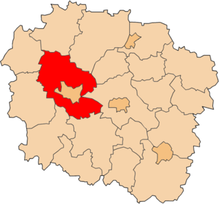
Drzewianowo is a village in the administrative district of Gmina Mrocza, within Nakło nad Notecią County, Kuyavian-Pomeranian Voivodeship, in north-central Poland.

Sokole-Kuźnica is a village in the administrative district of Gmina Koronowo, within Bydgoszcz County, Kuyavian-Pomeranian Voivodeship, in north-central Poland. It lies 12 kilometres (7 mi) north of Koronowo and 34 km (21 mi) north of Bydgoszcz.
Tuszyny is a village in the administrative district of Gmina Koronowo, within Bydgoszcz County, Kuyavian-Pomeranian Voivodeship, in north-central Poland. It lies approximately 4 kilometres (2 mi) east of Koronowo and 23 km (14 mi) north of Bydgoszcz.
Nowa Jedlanka is a village in the administrative district of Gmina Uścimów, within Lubartów County, Lublin Voivodeship, in eastern Poland.
Nowa Jastrzębia is a village in the administrative district of Gmina Gostynin, within Gostynin County, Masovian Voivodeship, in east-central Poland.
Rataje is a village in the administrative district of Gmina Łobżenica, within Piła County, Greater Poland Voivodeship, in west-central Poland.
Witrogoszcz-Kolonia is a village in the administrative district of Gmina Łobżenica, within Piła County, Greater Poland Voivodeship, in west-central Poland.
Lipczyno is a settlement in Gmina Miastko, Bytów County, Pomeranian Voivodeship, in northern Poland. It lies approximately 36 kilometres (22 mi) south-west of Bytów and 113 km (70 mi) south-west of Gdańsk.
Świeszyno is a village in Gmina Miastko, Bytów County, Pomeranian Voivodeship, in northern Poland. It lies approximately 21 kilometres (13 mi) south-west of Bytów and 68 km (42 mi) south-west of Gdańsk.
Borowy Młyn is a village in Gmina Lipnica, Bytów County, Pomeranian Voivodeship, in northern Poland. It lies approximately 15 kilometres (9 mi) south-west of Bytów and 60 km (37 mi) south-west of Gdańsk.
Błoto is a settlement in the administrative district of Gmina Czersk, within Chojnice County, Pomeranian Voivodeship, in northern Poland.
Duża Klonia is a village in the administrative district of Gmina Czersk, within Chojnice County, Pomeranian Voivodeship, in northern Poland.
Młynki is a settlement in the administrative district of Gmina Czersk, within Chojnice County, Pomeranian Voivodeship, in northern Poland.
Uboga is a settlement in the administrative district of Gmina Czersk, within Chojnice County, Pomeranian Voivodeship, in northern Poland.

Umespirone (KC-9172) is a drug of the azapirone class which possesses anxiolytic and antipsychotic properties. It behaves as a 5-HT1A receptor partial agonist (Ki = 15 nM), D2 receptor partial agonist (Ki = 23 nM), and α1-adrenoceptor receptor antagonist (Ki = 14 nM), and also has weak affinity for the sigma receptor (Ki = 558 nM). Unlike many other anxiolytics and antipsychotics, umespirone produces minimal sedation, cognitive/memory impairment, catalepsy, and extrapyramidal symptoms.
Kute is a village in the municipality of Gornji Vakuf, Bosnia and Herzegovina.
Čevo, historically also known as Kčevo (Кчево), is a village in the Cetinje Municipality, in central Montenegro.

Milštejn castle are the remaining ruins of a castle in the north of the Czech Republic. The ruins are located in the Lusatian Mountains at an altitude of 562 m, about 3.5 km north from the town of Cvikov. The exact date when the castle was built is unknown. Based on the surrounding sites, the castle was founded between the 13th and 14th centuries to protect the country trail leading from Lipé to Zittau. The first known owners of the castle were Berka z Dubé, a prominent cadet branch of a Bohemian noble family.