
The 1971 Canberra flood was a flash flood that occurred on 26 January 1971, in the Woden Valley district of Canberra, Australia.

The 1971 Canberra flood was a flash flood that occurred on 26 January 1971, in the Woden Valley district of Canberra, Australia.
The flood killed seven people including four children, injured 15 and affected 500 people. [1] The insurance damage was estimated at A$ 9 million. [1] It was estimated that around 95 mm of rain fell in one hour during this event. [2] The Yarralumla Creek drainage channel peak rate of flow measured 186,891 litres per second at the Carruthers Street pluviograph near Yarra Glen at around 8:50pm. [3]
The force of the water was strong enough to turn a bus 180 degrees on Melrose Drive south east of the intersection with Yarra Glen. The intersection was covered to a depth of an estimated 1.83m and the floodwaters spread an estimated 183m wide, east to west across the intersection of Yamba Drive, Melrose Drive and Yarra Glen. A number of people and cars were swept into the Yarralumla Creek drainage channel from a low level crossing at the junction of Yamba Drive, Melrose Drive and Yarra Glen.
Yamba Drive was covered in fast flowing water to at least 275m south of the Hindmarsh Drive intersection where a white car and the driver were swept into the Long Gully drainage channel.
The 1971 Canberra flood victims names and ages: [4]
One Australian Police Officer, Constable Jeff Brown, was six months later awarded the British Empire Medal for Gallantry for rescue efforts during the event. Four Australian Police Officers were later awarded the Queen's Commendation for Brave Conduct for rescue efforts during the event. [5] [6]
Following the flood seven crosses were erected near the side of the road to mark the victims. A permanent memorial was officially dedicated on 26 January 2010. [7] [8]

Yarralumla is a large inner south suburb of Canberra, the capital city of Australia. Located approximately 3.5 km (2.2 mi) south-west of the city, Yarralumla extends along the south-west bank of Lake Burley Griffin from Scrivener Dam to Commonwealth Avenue.

Woden Valley is a district in the Australian Capital Territory in Australia. The district is subdivided into divisions (suburbs), sections and blocks.
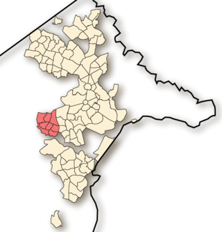
Weston Creek is a district in the Australian Capital Territory in Australia. The district is subdivided into divisions (suburbs), sections and blocks. The district comprises eight residential suburbs, situated to the west of the Woden Valley district and approximately 13 kilometres (8.1 mi) southwest of the Canberra City centre. Situated adjacent to the district was the large Stromlo Forest pine plantation until the forest was destroyed by bushfires in 2001 and 2003.
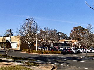
Waramanga is a suburb of Canberra, Australian Capital Territory, Australia in the district of Weston Creek.
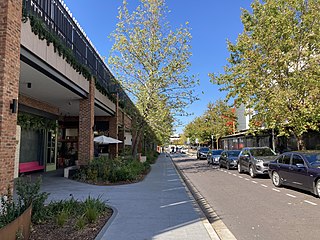
Woden Town Centre is the town centre of the district of Woden Valley in the Australian Capital Territory. It is located in the suburb of Phillip. The town centre has a variety of shops and amenities, including office blocks that house Australian departments, and shopping centres like Westfield Woden.
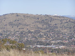
Mount Taylor is a prominent hill with an elevation of 856 metres (2,808 ft) AHD that is located between the Woden Valley, Weston Creek district and Tuggeranong Valley, in Canberra, within the Australian Capital Territory, Australia. Mount Taylor is part of the Canberra Nature Park and is surrounded by the suburbs of Kambah, Fisher, Waramanga, Chifley, Pearce, and Torrens. There are walking tracks to the peak. While there is no public road access to the peak there is a fire trail up the mountain from the end of Waldock St, Chifley where there is also a car park and picnic tables. The fire trail is normally closed to public vehicular access by locked gates, but the gates contain access points for walkers. The trail is especially popular with families and older walkers as it provides the easiest and most leisurely access to the peak. Originally a dirt road, it was partially sealed in 2009 on the steeper grades to make it safer for walkers and mountain bike riders.
Chifley is a suburb of Canberra, Australia, in the district of Woden Valley. The suburb's area is 1.6 square kilometres (0.62 sq mi).

Curtin is a suburb in Canberra, Australia, part of the Woden Valley district; its postcode is 2605.

Hughes is a suburb in the Canberra, Australia district of Woden. The postcode is 2605. The area of the suburb is 1.81 km2.

Farrer is a suburb in the Canberra, Australia district of Woden. The postcode is 2607.
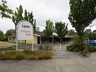
Lyons is a suburb in the Canberra, Australia district of Woden. The postcode is 2606.

Mawson is a suburb in the Canberra, Australia district of Woden Valley.

Phillip is a suburb of Canberra, Australia in the district of Woden Valley. It is located in the centre of the district and contains the district's main commercial centre, Woden Town Centre. Phillip had a residential population of 5,197 at the 2021 census. 67.0% of the population lived in flats. Many more flats are being planned or built.
Alfred Deakin High School is a government secondary school in Deakin, Australian Capital Territory, covering years 7 to 10 in the Territory's education system. It is named after the second Australian Prime Minister, Alfred Deakin.

Severe storms in Australia refers to the storms, including cyclones, which have caused severe damage in Australia.
Adelaide Avenue is a limited-access road in Canberra, Australian Capital Territory.

Yarra Glen is a major grade separated arterial road in Canberra. It is 3 km (1.9 mi) in length connects South Canberra to the Woden Valley district. It links at its northern end to Adelaide Avenue, and at its southern end to Melrose Drive and Yamba Drive via a large roundabout. It was designed to have no traffic lights nor cross roads on it.

Yamba Drive is a major arterial road in the southern suburbs of Canberra, the capital city of Australia. It is named after 'Yamba', a pastoral property established by the Eddison family in 1920 as part of the soldier settlement scheme which occupied the area prior to suburban development in the Woden Valley. The road forms part a major link between the Tuggeranong and Woden Valley districts, bypassing the Woden Town Centre and is an important access corridor for Canberra Hospital. Yamba Drive begins at a large roundabout north of the Woden Town Centre. It continues south-east past the Woden Cemetery and Canberra Hospital to a major junction with Hindmarsh Drive, before passing between the residential suburbs of O'Malley, Mawson, Issacs and Farrer before terminating between the Issacs and Farrer ridges in the Canberra Nature Park. Beyond this point, the route continues as Erindale Drive into the suburbs of the Tuggeranong District.

The 2024 Australian Capital Territory general election is scheduled to be held on 19 October 2024 to elect all 25 members of the unicameral ACT Legislative Assembly.