
Sweden had a very unusual start and finish to the year 2010, with two consecutive winter cold waves occurring in a single calendar year. Since both events were notable, both are covered in this article.
Sweden had a very unusual start and finish to the year 2010, with two consecutive winter cold waves occurring in a single calendar year. Since both events were notable, both are covered in this article.
January was in the southern part of the country the coldest for 23 years, the deep freeze of 1987. [1] Some cold weather had finished 2009 and was followed with solid freezing temperatures during the first week of January. The December means were not by any means extreme, but the cold would gradually build up. The intense cold set in between 7 January and 15 January, with Horn as far south as in northern Götaland recording an overnight low of −31.6 °C (−24.9 °F) and Hemavan in the north of the country recording −40.8 °C (−41.4 °F). [1] Relatively less extreme temperatures would follow during the second half of the month, until the final days of January saw another cold snap after some heavy snowfall on 27–28 January. [1] During the final three days of the month low temperatures fell below −20 °C (−4 °F) in most areas far south in the country. Linköping recorded −28.9 °C (−20.0 °F), which was the coldest temperature recorded on this location since the record-breaking 1942 cold wave. [1] The end result of January was that capital Stockholm that is inside an urban heat island did not record a single temperature above 0.0 °C (32.0 °F) all month. In Örebro the maximum temperature recorded was −0.6 °C (30.9 °F) and in Västerås −1 °C (30 °F), [2] which is very rare for an area so far south in Sweden. Remarkably, the far north of the country saw less severe January temperatures than during the 1961-1990 reference period.
February was colder than usual, although not matching the January extremes in the southerly parts of the country. The cold was shifted further north, with Nikkaluokta above the polar circle having a monthly mean of −19.9 °C (−3.8 °F) and an average low of −27.3 °C (−17.1 °F). [3] With means below Dalälven (the boundary between Svealand and Norrland) being between −2 °C (28 °F) and −7 °C (19 °F) in most cases the heavy snowfall was a larger issue. Westerlies mixed with the colder than usual air made snowfall abundant during the low-pressure systems' resurgence on the west coast. [4] Although no February precipitation records were broken, [5] an unusual amount of what fell came as snow in the southerly part of the country, where winter highs normally are above freezing. The frequent snowfall caused havoc for rail transport, with severe delays and cancellations of many lines. The night of 22 February was among the coldest of the entire cold wave, with Stockholm recording −21.0 °C (−5.8 °F) inside the urban heat island and −27.5 °C (−17.5 °F) being measured in Örebro. 24 February saw the coldest temperature of the winter being recorded in Naimakka in the far north with −42 °C (−44 °F). [6]
From March onwards the temperatures slowly returned to normal. March is a winter month in the northern parts of the country, but apart from a −33.3 °C (−27.9 °F) reading in Pajala in the far north, no particular extremes were being seen. Sweden was affected less by the intense 2010 Northern Hemisphere summer heat waves than Russia, Finland or Germany were, although some hot temperatures were recorded and Lund had a July mean of 20.9 °C (69.6 °F) and Stockholm had one of the hottest months in the country's history with 21.2 °C (70.2 °F). [7] Unlike many other heat waves, the effects were rather local and did not affect the whole country. Such were the swings that Stockholm's 2010 values were in some ways comparable to inland areas in southern Ontario in Canada, known for its very continental climates. The summer peaked with a 34.4 °C (93.9 °F) reading in Målilla on July 11. Afterwards, August and September cooled down fairly rapidly, but with October being unusually cold.

November 2010 was described as King Bore (very cold winter) moved south by SMHI, with tendencies of winter even in the deep south. [8] The nature of November in the south is low diurnal temperature variation and lack of extreme cold, but significant snowfall occurred on several occasions quite far south in the country, and Jönköping, Linköping, Uppsala and Örebro all recorded daily means below freezing. [9] All of those cities are located inland, and in coastal locations means were above the freezing point, albeit not by much. Stockholm and Gothenburg both recorded 7 days with highs below freezing, something that is highly unusual for the country's big cities in November. Even more remarkable were the five ice days measured in Malmö, with southern Scania often averaging means above freezing even in January. In the north of the country the cold was rather intense even by winter standards. Out of SMHI's 100 selected monthly stations, the −16.2 °C (2.8 °F) mean of Nikkaluokta was the lowest ever recorded for the month, and lower than its January normals. Nikkaluokta also saw a −36.6 °C (−33.9 °F) reading on 24 November, which was the lowest in the country for the month. [8] This, unlike the averages was not a national record. Pajala and Arjeplog were also notably new record lows for November. No such records were broken south or east of the mountain ranges and the surrounding highland forests, where Ulvsjö in Bräcke Municipality in Jämtland saw a new record cold November with a −8.4 °C (16.9 °F) mean. [10]

The most extreme cold of the year relative to the normals came in December. Although January 2010 had been slightly colder than what was recorded in the south of the country, December is normally a month that is above freezing during daytime in southern Sweden due to its seasonal lag that a maritime climate brings. Although the month started out quite mild, temperatures plummeted to extreme cold as winter solstice and Christmas neared. [11] Most of the month was solidly below freezing in the entire country, with a few bursts of mild air affecting the deep south. The cold just before Christmas was unprecedented this time of the year in many southern locations. Kalmar saw a record cold −25.6 °C (−14.1 °F) value, Kristianstad another record −24.6 °C (−12.3 °F) value, with Örebro nearly beating its December all-time record cold with −26.6 °C (−15.9 °F), the coldest value for 124 years. [11] During Christmas, the most extreme cold had swept north, with several coastal cities of Norrland recording temperatures around −30 °C (−22 °F). [11] This, albeit highly unusual, did not break any December records. Temperatures throughout the months in the northern parts of the country were quite far below normals, resulting in the cold wave being felt in the entire country. In the south, the New Year's Eve brought milder air, bringing temperatures just above freezing for that night. [11] This marked the end of the cold wave in the south, with January 2011 being a normal winter month. The cold returned to normal levels further north as well, although winter temperatures there are more extreme than a cold wave in the south regardless. The coldest temperature of the month and year was recorded in Nikkaluokta on 20 December, with −42.1 °C (−43.8 °F). [11]
The fallout of December were a lot of new all-time low monthly mean temperatures in southern Sweden. The most extreme new record was set in Arvika, Värmland, with a monthly mean of −14.6 °C (5.7 °F) and a low of −20.2 °C (−4.4 °F). [12] This was more than three degrees colder than the previous December record for the site and less than half a degree below the deep freeze of January 1987, in all possibly the coldest December month there since 1788. Among other new December record cold months were found in Örebro, Norrköping, Linköping, Gothenburg, Malmö, Kalmar, Växjö, Kristianstad, Halmstad, Varberg, Borås, Vänersborg, Helsingborg, Ljungby, Visby and many maritime coastal stations such as Falsterbo, Landsort and the extreme points of Öland. [12] The −5.3 °C (22.5 °F) reading of Helsingborg was also almost three degrees colder than the previous record.
The summer heat wave prevented all-time yearly cold records throughout the country in spite of the two cold waves. The nearest to a new all-time cold record was in Ljungby, which measured 5 °C (41 °F) as opposed to the 4.9 °C (40.8 °F) record of 1987. [13] Although the year was colder than normal throughout the country, it takes a cool summer for those records to be broken, as were in 1942, 1985 and 1987. In spite of this, it is extremely rare for inland locations in Götaland in the south to record yearly means below 5 °C (41 °F), as was done at some stations such as Jönköping, Vänersborg and Ulricehamn. The same was recorded in Örebro and Västerås further north, climates that most often are as mild as further south.
The year 2010 was a blip in a warming tendency of Swedish winters, the following winters were often delayed by mild autumns, and brief in nature with mild Februarys.
Norrköping had a record cold December, with a new all-time low for the month being set on December 23 with −24.7 °C (−12.5 °F). [12] Also during the January cold wave, Norrköping did not go above freezing all month. In total, Norrköping had 158 frost days during the year. [13]
| Climate data for Norrköping (2010 values only) | |||||||||||||
|---|---|---|---|---|---|---|---|---|---|---|---|---|---|
| Month | Jan | Feb | Mar | Apr | May | Jun | Jul | Aug | Sep | Oct | Nov | Dec | Year |
| Mean daily maximum °C (°F) | −5.1 (22.8) | −2.7 (27.1) | 3.5 (38.3) | 11.4 (52.5) | 15.6 (60.1) | 20.8 (69.4) | 25.4 (77.7) | 20.8 (69.4) | 15.7 (60.3) | 9.2 (48.6) | 2.2 (36.0) | −4.8 (23.4) | 9.3 (48.7) |
| Mean daily minimum °C (°F) | −11.4 (11.5) | −9.1 (15.6) | −4.1 (24.6) | 1.2 (34.2) | 6.1 (43.0) | 9.5 (49.1) | 14.9 (58.8) | 13.4 (56.1) | 8.2 (46.8) | 2.6 (36.7) | −2.0 (28.4) | −11.7 (10.9) | 1.4 (34.5) |
| Average precipitation mm (inches) | 41 (1.6) | 59 (2.3) | 21 (0.8) | 22 (0.9) | 67 (2.6) | 32 (1.3) | 82 (3.2) | 95 (3.7) | 41 (1.6) | 57 (2.2) | 93 (3.7) | 41 (1.6) | 651 (25.6) |
| Mean monthly sunshine hours | 36 | 30 | 161 | 191 | 215 | 298 | 285 | 150 | 150 | 118 | 53 | 37 | 1,724 |
| Source: SMHI Monthly Data 2002-2015 [14] | |||||||||||||
| Climate data for Norrköping (2002-2015 temperatures; 1961-1990 precipitation & sunshine) | |||||||||||||
|---|---|---|---|---|---|---|---|---|---|---|---|---|---|
| Month | Jan | Feb | Mar | Apr | May | Jun | Jul | Aug | Sep | Oct | Nov | Dec | Year |
| Mean daily maximum °C (°F) | 0.8 (33.4) | 1.2 (34.2) | 5.6 (42.1) | 12.0 (53.6) | 16.7 (62.1) | 20.4 (68.7) | 23.1 (73.6) | 21.8 (71.2) | 17.5 (63.5) | 10.7 (51.3) | 5.8 (42.4) | 2.5 (36.5) | 11.5 (52.7) |
| Mean daily minimum °C (°F) | −4.3 (24.3) | −4.4 (24.1) | −2.5 (27.5) | 1.4 (34.5) | 6.1 (43.0) | 10.0 (50.0) | 13.3 (55.9) | 12.4 (54.3) | 8.6 (47.5) | 3.8 (38.8) | 1.1 (34.0) | −2.3 (27.9) | 3.7 (38.7) |
| Average precipitation mm (inches) | 31.7 (1.25) | 23.1 (0.91) | 27.3 (1.07) | 29.7 (1.17) | 36.4 (1.43) | 49.7 (1.96) | 61.9 (2.44) | 59.0 (2.32) | 55.3 (2.18) | 47.3 (1.86) | 47.7 (1.88) | 38.9 (1.53) | 508.2 (20.01) |
| Mean monthly sunshine hours | 40 | 70 | 100 | 175 | 259 | 277 | 253 | 222 | 149 | 96 | 57 | 36 | 1,734 |
| Source 1: SMHI [15] | |||||||||||||
| Source 2: SMHI Monthly Data 2002-2015 [16] | |||||||||||||
Stockholm did not set any cold records, but still had a colder year than usual, with the entire January month being below freezing. 136 air frosts were recorded throughout the year. [13] In addition, Stockholm also had a very hot July, being most affected by the 2010 Northern Hemisphere summer heat waves than any other Swedish location. This moderated the yearly average, along with the urban heat island that always render milder overnight lows than in the rural Mälar valley.
| Climate data for Stockholm (2010 values only) | |||||||||||||
|---|---|---|---|---|---|---|---|---|---|---|---|---|---|
| Month | Jan | Feb | Mar | Apr | May | Jun | Jul | Aug | Sep | Oct | Nov | Dec | Year |
| Mean daily maximum °C (°F) | −4.8 (23.4) | −3.0 (26.6) | 3.0 (37.4) | 10.8 (51.4) | 16.4 (61.5) | 21.2 (70.2) | 26.5 (79.7) | 21.3 (70.3) | 15.5 (59.9) | 8.8 (47.8) | 2.2 (36.0) | −4.2 (24.4) | 9.4 (48.9) |
| Mean daily minimum °C (°F) | −9 (16) | −7.7 (18.1) | −3.1 (26.4) | 2.5 (36.5) | 7.3 (45.1) | 11.1 (52.0) | 17.2 (63.0) | 14.1 (57.4) | 9.3 (48.7) | 4.2 (39.6) | −1.5 (29.3) | −9.3 (15.3) | 2.9 (37.2) |
| Average precipitation mm (inches) | 26 (1.0) | 29 (1.1) | 22 (0.9) | 23 (0.9) | 31 (1.2) | 33 (1.3) | 74 (2.9) | 105 (4.1) | 73 (2.9) | 34 (1.3) | 54 (2.1) | 45 (1.8) | 549 (21.6) |
| Mean monthly sunshine hours | 38 | 37 | 165 | 201 | 247 | 326 | 302 | 172 | 162 | 130 | 54 | 30 | 1,864 |
| Source: SMHI average data 2002-2015 [17] | |||||||||||||
| Climate data for Stockholm, temperature 2002-2015; precipitation and sunshine 1961-1990 | |||||||||||||
|---|---|---|---|---|---|---|---|---|---|---|---|---|---|
| Month | Jan | Feb | Mar | Apr | May | Jun | Jul | Aug | Sep | Oct | Nov | Dec | Year |
| Mean daily maximum °C (°F) | 0.5 (32.9) | 0.8 (33.4) | 4.7 (40.5) | 11.3 (52.3) | 16.6 (61.9) | 20.7 (69.3) | 23.8 (74.8) | 22.2 (72.0) | 16.9 (62.4) | 10.1 (50.2) | 5.7 (42.3) | 2.4 (36.3) | 11.2 (52.2) |
| Mean daily minimum °C (°F) | −3.1 (26.4) | −3.3 (26.1) | −1.2 (29.8) | 2.8 (37.0) | 7.4 (45.3) | 11.4 (52.5) | 15.1 (59.2) | 14.3 (57.7) | 10.2 (50.4) | 5.2 (41.4) | 2.0 (35.6) | −1.2 (29.8) | 4.9 (40.8) |
| Average precipitation mm (inches) | 39 (1.5) | 27 (1.1) | 29 (1.1) | 29 (1.1) | 32 (1.3) | 55 (2.2) | 65 (2.6) | 59 (2.3) | 52 (2.0) | 49 (1.9) | 47 (1.9) | 45 (1.8) | 531 (20.9) |
| Mean monthly sunshine hours | 40 | 72 | 135 | 185 | 276 | 292 | 260 | 221 | 154 | 99 | 54 | 33 | 1,821 |
| Source 1: SMHI average data 2002-2015 [18] | |||||||||||||
| Source 2: SMHI [19] | |||||||||||||
Örebro had a record cold December, and the coldest temperature for decades set in January with −28.3 °C (−18.9 °F). Considering the airport's rural setting farther from Lake Hjälmaren at a slightly higher elevation, temperature extremes in the city proper may have been slightly less severe, although these differences would be marginal. In total, Örebro recorded 171 air frosts in 2010. [13]
| Climate data for Örebro Airport (2010 values only) | |||||||||||||
|---|---|---|---|---|---|---|---|---|---|---|---|---|---|
| Month | Jan | Feb | Mar | Apr | May | Jun | Jul | Aug | Sep | Oct | Nov | Dec | Year |
| Mean daily maximum °C (°F) | −6.5 (20.3) | −3.5 (25.7) | 2.8 (37.0) | 11.5 (52.7) | 16.5 (61.7) | 21.0 (69.8) | 24.6 (76.3) | 20.7 (69.3) | 15.9 (60.6) | 9.5 (49.1) | 1.2 (34.2) | −5.6 (21.9) | 9.0 (48.2) |
| Mean daily minimum °C (°F) | −13.6 (7.5) | −10.5 (13.1) | −4.8 (23.4) | 1.1 (34.0) | 5.7 (42.3) | 8.9 (48.0) | 13.8 (56.8) | 12.8 (55.0) | 6.5 (43.7) | 2.0 (35.6) | −3.4 (25.9) | −13.7 (7.3) | 0.4 (32.7) |
| Average precipitation mm (inches) | 31 (1.2) | 82 (3.2) | 25 (1.0) | 22 (0.9) | 115 (4.5) | 25 (1.0) | 166 (6.5) | 83 (3.3) | 42 (1.7) | 30 (1.2) | 88 (3.5) | 31 (1.2) | 740 (29.1) |
| Source: SMHI average data 2002-2015 [17] | |||||||||||||
| Climate data for Örebro Airport (2002-2015 temperatures and 1961-1990 precipitation normals) | |||||||||||||
|---|---|---|---|---|---|---|---|---|---|---|---|---|---|
| Month | Jan | Feb | Mar | Apr | May | Jun | Jul | Aug | Sep | Oct | Nov | Dec | Year |
| Mean daily maximum °C (°F) | 0.3 (32.5) | 0.7 (33.3) | 5.4 (41.7) | 12.1 (53.8) | 16.9 (62.4) | 20.6 (69.1) | 23.1 (73.6) | 21.8 (71.2) | 17.2 (63.0) | 10.3 (50.5) | 5.3 (41.5) | 1.9 (35.4) | 11.3 (52.3) |
| Mean daily minimum °C (°F) | −5.6 (21.9) | −5.4 (22.3) | −3.2 (26.2) | 1.0 (33.8) | 5.7 (42.3) | 9.4 (48.9) | 12.5 (54.5) | 11.2 (52.2) | 7.3 (45.1) | 2.7 (36.9) | 0.5 (32.9) | −3.6 (25.5) | 2.7 (36.9) |
| Average precipitation mm (inches) | 48.4 (1.91) | 34.9 (1.37) | 35.8 (1.41) | 40.1 (1.58) | 43.7 (1.72) | 55.5 (2.19) | 76.2 (3.00) | 74.3 (2.93) | 74.5 (2.93) | 62.3 (2.45) | 65.6 (2.58) | 50.1 (1.97) | 661.4 (26.04) |
| Source 1: SMHI Precipitation normals 1961-1990 [20] | |||||||||||||
| Source 2: SMHI average data 2002-2015 [18] | |||||||||||||
Hudiksvall that normally has a very mild climate considering its northerly latitude saw one of its coldest years on record. Hudiksvall was the northernmost part of the country that saw a record cold December, although nearby Delsbo had seen a much colder value 17 years before Hudiksvall's weather station opened in 1932. [12] Both cold waves also saw high snowfall. In total Hudiksvall had 179 frost days during 2010. [13]
| Climate data for Hudiksvall (2010 values only) | |||||||||||||
|---|---|---|---|---|---|---|---|---|---|---|---|---|---|
| Month | Jan | Feb | Mar | Apr | May | Jun | Jul | Aug | Sep | Oct | Nov | Dec | Year |
| Mean daily maximum °C (°F) | −6.4 (20.5) | −4.7 (23.5) | 2.7 (36.9) | 9.2 (48.6) | 15.0 (59.0) | 18.6 (65.5) | 24.2 (75.6) | 19.6 (67.3) | 15.8 (60.4) | 9.4 (48.9) | 0.0 (32.0) | −6.2 (20.8) | 8.1 (46.6) |
| Mean daily minimum °C (°F) | −12.7 (9.1) | −14.0 (6.8) | −5.0 (23.0) | −0.6 (30.9) | 4.6 (40.3) | 7.5 (45.5) | 13.7 (56.7) | 11.4 (52.5) | 5.6 (42.1) | 1.0 (33.8) | −6.1 (21.0) | −14.0 (6.8) | −0.7 (30.7) |
| Average precipitation mm (inches) | 49 (1.9) | 82 (3.2) | 14 (0.6) | 18 (0.7) | 42 (1.7) | 152 (6.0) | 42 (1.7) | 106 (4.2) | 39 (1.5) | 16 (0.6) | 68 (2.7) | 122 (4.8) | 750 (29.5) |
| Source: SMHI climate data 2002-2015 [21] | |||||||||||||
| Climate data for Hudiksvall (2002-2015 temperatures; 1961-1990 precipitation) | |||||||||||||
|---|---|---|---|---|---|---|---|---|---|---|---|---|---|
| Month | Jan | Feb | Mar | Apr | May | Jun | Jul | Aug | Sep | Oct | Nov | Dec | Year |
| Mean daily maximum °C (°F) | −0.8 (30.6) | 0.2 (32.4) | 4.9 (40.8) | 10.4 (50.7) | 14.9 (58.8) | 19.2 (66.6) | 22.5 (72.5) | 21.1 (70.0) | 16.7 (62.1) | 9.6 (49.3) | 4.0 (39.2) | 0.7 (33.3) | 10.2 (50.4) |
| Mean daily minimum °C (°F) | −7.5 (18.5) | −7.3 (18.9) | −4.3 (24.3) | −0.4 (31.3) | 4.2 (39.6) | 8.4 (47.1) | 12.2 (54.0) | 11.0 (51.8) | 6.5 (43.7) | 1.5 (34.7) | −1.7 (28.9) | −5.7 (21.7) | 1.4 (34.5) |
| Average precipitation mm (inches) | 50.2 (1.98) | 36.8 (1.45) | 38.9 (1.53) | 38.4 (1.51) | 38.4 (1.51) | 49.0 (1.93) | 63.2 (2.49) | 72.7 (2.86) | 69.8 (2.75) | 58.6 (2.31) | 63.1 (2.48) | 54.9 (2.16) | 635.9 (25.04) |
| Source 1: SMHI precipitation average 1961-1990 [22] | |||||||||||||
| Source 2: SMHI climate data 2002-2015 [23] | |||||||||||||
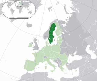
Sweden is a country in Northern Europe on the Scandinavian Peninsula. It borders Norway to the west ; Finland to the northeast; and the Baltic Sea and Gulf of Bothnia to the south and east. At 450,295 km2 (173,860 sq mi), Sweden is the largest country in Northern Europe, the fifth largest in Europe, and the 55th largest country in the world.

Winter is the coldest and darkest season of the year in temperate and polar climates. It occurs after autumn and before spring. The tilt of Earth's axis causes seasons; winter occurs when a hemisphere is oriented away from the Sun. Different cultures define different dates as the start of winter, and some use a definition based on weather.

Sveg is a locality and the seat of Härjedalen Municipality in Jämtland County, Sweden with 2,547 inhabitants in 2010.

Örebro is the sixth-largest city in Sweden, the seat of Örebro Municipality, and capital of Örebro County. It is situated by the Närke Plain, near the lake Hjälmaren, a few kilometers inland along the small river Svartån, and has a population of approximately 126,000 in the city proper. It is one of the largest inland hubs of the country, and a major logistic and commercial operating site.

Nyköping is a locality and the seat of Nyköping Municipality, Södermanland County, Sweden, with 32,759 inhabitants as of 2017. The city is also the capital of Södermanland County.
A cold wave is a weather phenomenon that is distinguished by a cooling of the air. Specifically, as used by the U.S. National Weather Service, a cold wave is a rapid fall in temperature within a 24-hour period requiring substantially increased protection to agriculture, industry, commerce, and social activities. The precise criteria for a cold wave are the rate at which the temperature falls, and the minimum to which it falls. This minimum temperature is dependent on the geographical region and time of year.
The cold wave of 1978 was a weather event that occurred in the Eastern United States. Beginning in December 1977 and lasting until March, it produced one of the coldest winters on record in all states east of the Rocky Mountains, except Maine.
The 1936 North American cold wave ranks among the most intense cold waves in the recorded history of North America. The Midwestern United States and the Canadian Prairies were hit the hardest. Only the Southwestern United States and California largely escaped its effects. The cold wave was related to a highly negative North Atlantic Oscillation event during that winter driving cold Arctic air into most of North America.

Nikkaluokta is a Swedish Sami village in Norrbotten County. The village belongs to Gällivare Municipality, bordering Kiruna Municipality, the closest urban area some 60 kilometers away. In its vicinity lie the areas of two Sami communities, Laevas and Girjas, who still herd semi-domesticated reindeer in the region.

Landsort is a Swedish village with a lighthouse on the island of Öja. The village has around 30 permanent residents.

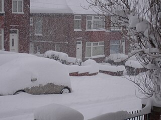
The winter of 2009–2010 in Europe was unusually cold. Globally, unusual weather patterns brought cold, moist air from the north. Weather systems were undergoing cyclogenesis from North American storms moving across the Atlantic Ocean to the west, and saw many parts of Europe experiencing heavy snowfall and record-low temperatures. This led to a number of deaths, widespread transport disruption, power failures and postponed sporting events.

The south of Sweden has a temperate climate, despite its northern latitude, with largely four distinct seasons and mild temperatures throughout the year. The winter in the far south is usually weak and is manifested only through some shorter periods with snow and sub-zero temperatures, autumn may well turn into spring there, without a distinct period of winter. The northern parts of the country have a subarctic climate while the central parts have a humid continental climate. The coastal south can be defined as having either a humid continental climate using the 0 °C isotherm, or an oceanic climate using the –3 °C isotherm.
The winter of 2010–2011 in Europe began with an unusually cold November caused by a cold weather cycle that started in southern Scandinavia and subsequently moved south and west over both Belgium and the Netherlands on 25 November and into the west of Scotland and north east England on 26 November. This was due to a low pressure zone in the Baltics, with a high pressure over Greenland on 24 November, and ended on 3 May 2011 in Poland.
The winter of 2010–11 was a weather event that brought heavy snowfalls, record low temperatures, travel chaos and school disruption to the islands of Great Britain and Ireland. It included the United Kingdom's coldest December since Met Office records began, with a mean temperature of −1 °C (30 °F), breaking the previous record of 0.1 °C (32.2 °F) in December 1981. It was also the second coldest December in the narrower Central England Temperature (CET) record series which began in 1659, falling 0.1 °C short of the all-time record set in 1890. Although data has never officially been compiled, December 2010 is thought to be colder than December 1890 over the United Kingdom as a whole, as Scotland was up to 2 °C warmer than England. Hence, it is thought to be the coldest December across Great Britain since before 1659.

The 2013 extreme weather events included several all-time temperature records in Northern and Southern Hemisphere. The February extent of snow cover in Eurasia and North America was above average, while the extent of Arctic ice in the same month was 4.5% below the 1981–2010 average. The Northern Hemisphere weather extremes have been linked to the melting of Arctic sea ice, which alters atmospheric circulation in a way that leads to more snow and ice.

The 1994 North American cold wave occurred over the midwestern and eastern regions of the United States and southern Canada in January 1994. The cold wave caused over 100 deaths in the United States. Two notable cold air events took place from January 18–19 and January 21–22. There were 67 minimum temperature records set on January 19. During this time, much of the United States experienced its coldest temperatures since a major storm on February 20, 1934.

The January–March 2014 North American cold wave was an extreme weather event that extended through the late winter months of the 2013–2014 winter season, and was also part of an unusually cold winter affecting parts of Canada and parts of the north-central and northeastern United States. The event occurred in early 2014 and was caused by a southward shift of the North Polar Vortex. Record-low temperatures also extended well into March.

The 2014–15 North American winter was frigid and prolifically wintry, especially across the eastern half of North America in the months of January–March. The season began early, with many places in North America experiencing their first wintry weather during mid-November. A period of below-average temperatures affected much of the contiguous United States, and several records were broken. A quasi-permanent phenomenon referred to as the polar vortex may have been partly responsible for the cold weather. Temperatures in much of the United States dropped 15 to 35 °F below average by November 19, following a southward "dip" of the polar vortex into the eastern two-thirds of the country. The effects of this dip were widespread, bringing about temperatures as low as 28 °F (−2 °C) in Pensacola, Florida. Following a significant snowstorm there, Buffalo, New York received several feet of snow from November 17–21. In addition, significant winter weather occurred throughout the season, including a major blizzard that struck the Northeastern United States at the end of January, another blizzard that affected much of the Northern United States days later in early February, and several significant snow events paired with very frigid temperatures for much of February.
The summer of 2014 in Sweden was unusually warm, especially in the northern parts of the country. July was the warmest ever month on record in the north-west.
The Spring 2013 United Kingdom cold wave was a period of unusually cold weather in the United Kingdom between 6 March and early April 2013. The cold wave consisted of very low temperatures and significant snowfall. Freezing temperatures worsened due to the significant overcast and cloud covered skies. Extensive snowfall occurred on 11 and 12 March in the South East, North and West of England and Wales. Most parts of England, north Wales and the Isle of Man also suffered heavy persistent snowfall on 22 and 23 March 2013.