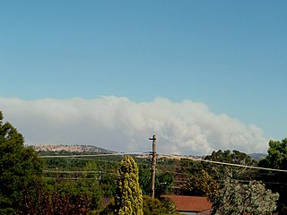
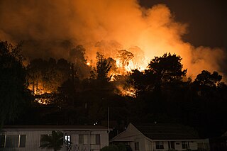
The Ash Wednesday bushfires, known in South Australia as Ash Wednesday II, were a series of bushfires that occurred in south-eastern Australia on 16 February 1983, which was Ash Wednesday in the Christian calendar. Within twelve hours, more than 180 fires fanned by winds of up to 110 km/h (68 mph) caused widespread destruction across the states of Victoria and South Australia. Years of severe drought and extreme weather combined to create one of Australia's worst fire days in a century. The fires became the deadliest bushfire in Australian history until the Black Saturday bushfires in 2009.

The Pulletop Bushfire, officially referred to as the "Wandoo fire", started on the 6 February 2006 in hot dry and windy weather conditions approximately 30 kilometres (19 mi) southeast of Wagga Wagga in the Australian state of New South Wales. The fire was thought to have been started by sparks from a tractor on a property at Pulletop which quickly got out of control. The New South Wales Rural Fire Service declared a bushfire emergency and the Hume Highway was closed late in the afternoon with fears that the fire would threaten the towns of Humula, Book Book, Livingstone and Kyeamba after 10 square kilometres (3.9 sq mi) of farmland was burnt. By 7 February 2006 milder conditions helped firefighters to control the fire burning in inaccessible country.

The 2006–07 Australian bushfire season was one of the most extensive bushfire seasons in Australia's history. Victoria experienced the longest continuously burning bushfire complex in Australia's history, with fires in the Victorian Alps and Gippsland burning over 1 million hectares of land over the course of 69 days. See Bushfires in Australia for an explanation of regional seasons.
The 2001 Warragamba bushfires occurred Christmas Day, 25 December 2001 in the small New South Wales town of Warragamba, leaving 30 homes and businesses destroyed.

Bushfires are frequent events during the warmer months of the year, due to Australia's mostly hot, dry climate. Each year, such fires impact extensive areas. On one hand, they can cause property damage and loss of human life. Certain native flora in Australia have evolved to rely on bushfires as a means of reproduction, and fire events are an interwoven and an essential part of the ecology of the continent. For thousands of years, Indigenous Australians have used fire to foster grasslands for hunting and to clear tracks through dense vegetation.

The Black Saturday bushfires were a series of bushfires that ignited or were burning across the Australian state of Victoria on and around Saturday, 7 February 2009 and were among Australia's all-time worst bushfire disasters. The fires occurred during extreme bushfire-weather conditions and resulted in Australia's highest ever loss of life from a bushfire; there were 173 direct fatalities, This figure was later increased to 180 after several people succumbed to their injuries. Many were left homeless as a result.

The 2009–10 Australian bushfire season was the bushfire season which occurred predominantly from June 2009 to May 2010. Increased attention has been given to this season as authorities and government attempt to preempt any future loss of life after the Black Saturday bushfires during the previous season, 2008–09. Long range weather observations predict very hot, dry and windy weather conditions during the summer months, leading to a high risk of bushfire occurrence.

The 2010–11 Australian bushfire season was notable for a relative lack of bushfires along Eastern Australia due to a very strong La Niña effect, which instead contributed to severe flooding, in particular the 2010–2011 Queensland floods and the 2011 Victorian floods. As a result of these weather patterns, most major fire events took place in Western Australia and South Australia. Some later significant fire activity occurred in Gippsland in eastern Victoria, an area which largely missed the rainfall that lead to the flooding in other parts of the state.

The 2012–13 Australian bushfire season had above average fire potential for most of the southern half of the continent from the east coast to the west. This is despite having extensive fire in parts of the country over the last 12 months. The reason for this prediction is the abundant grass growth spurred by two La Niña events over the last two years.

The 2013–14 Australian bushfire season was, at the time, the most destructive bushfire season in terms of property loss since the 2008–09 Australian bushfire season, with the loss of 371 houses and several hundred non-residential buildings as a result of wild fires between 1 June 2015 and 31 May 2016. The season also suffered 4 fatalities; 2 died in New South Wales, 1 in Western Australia and 1 in Victoria. One death was as a direct result of fire, 2 died due to unrelated health complications while fighting fires on their property, and a pilot contracted by the NSW Rural Fire Service died during an accident.
The 2014–15 Australian bushfire season was expected to have the potential for many fires in eastern Australia after lower than expected rainfall was received in many areas. Authorities released warnings in the early spring that the season could be particularly bad.

The 2015 Sampson Flat Fire was a bushfire in Australia in the state of South Australia, the area affected was predominantly the Northern Adelaide Hills and the outer Adelaide metropolitan area. The fire began on 2 January 2015 during a day of extreme heat and lasted until 9 January 2015.

The 2015–16 Australian bushfire season was the most destructive bushfire season in terms of property loss since the 2008–09 Australian bushfire season, with the loss of 408 houses and at least 500 non-residential buildings as a result of wild fires between 1 June 2015 and 31 May 2016. The season also suffered the most human fatalities since the 2008–09 Australian bushfire season; 6 died in Western Australia, 2 in South Australia and 1 in New South Wales. 8 deaths were as a direct result of fire, and a volunteer firefighter died due to unrelated health complications while on duty.
The 2015 Pinery bushfire was a catastrophic bushfire that burned from 25 November to 2 December 2015, and primarily affected the Lower Mid North and west Barossa Valley regions immediately north of Gawler in the Australian state of South Australia. At least 86,000 hectares of scrub and farmland in the council areas of Light, Wakefield, Clare and Gilbert Valleys, and Mallala were burned during its duration.
The 2014 Perth Hills Bushfire, sometimes referred to as the "Parkerville fire", was a bushfire that burned from 12 January to 1 February and affected the Mundaring municipality of the Perth Hills in the Australian state of Western Australia. During a major run of the fire on the afternoon and evening of 12 January, fifty-seven houses and numerous non-residential buildings were completely destroyed, and a further six houses were damaged in the suburbs of Mt. Helena, Stoneville, and Parkerville. Approximately 386 hectares of uncleared land and pasture—the majority on private property—were burned during the 21-day duration of the fire. None of the residential subdivisions impacted had been formally declared as being within a bushfire prone area.

The 2017 wildfire season involved wildfires on multiple continents. On Greenland, which is mostly covered by ice and permafrost, multiple fires occurred in melted peat bogs, described as "unusual, and possibly unprecedented". Popular media asked whether the wildfires were related to global warming. Research published by NASA states "climate change has increased fire risk in many regions", but caused "greater severity in the colder latitudes" where boreal and temperate forests exist, and scholars have described "a warm weather fluctuation that has become more frequent in recent decades" related to wildfires, without naming any particular event as being directly caused by global warming.
The 2017–18 Australian bushfire season was expected to have above normal bushfire risks with an elevated fire risk for the most of eastern and south Australian coastal areas. Australia had experienced its warmest winter on record and the ninth driest winter on record leaving dry fuel loads across much of southern Australia. Expected warmer weather over the summer period would also increase the risk. Bushfires were also expected to occur earlier, before the end of winter, as a result of the warm and dry winter. Both Queensland and north-eastern New South Wales experienced the wettest October since 1975 leading to a downgrade in bushfire risk.
The 2018–19 Australian bushfire season was predicted to be "fairly bleak" in parts of Australia, particularly in the east, by the Bushfire and Natural Hazards Cooperative Research Centre (CRC) chief executive Richard Thornton in September 2018. Large bushfires had already burned through southern New South Wales during winter. The outlook for Spring was of a higher likelihood of fires with a twice the normal chance of an El Nino for Summer. Many parts of eastern Australia including Queensland, New South Wales and Gippsland, in Victoria, were already in drought. Above normal fire was also predicted for large parts of southern Australia and eastern Australia by the Bushfire and Natural Hazards Cooperative Research Centre. The forecast noted that Queensland had recorded the ninth driest and fourth hottest period on record from April to November. New South Wales recorded the fourth hottest period and eighth driest on record while Victoria experiences the 13th driest and seventh hottest period on record. Authorities in New South Wales brought forward the start of the bushfire season for much of the state from October to the beginning of August.


